Page 233 of 416

ing wheel or
the0063/00D0 button onthe
multimedia sy stem (/ page 201).
The Voice Guidance has been deactivated.
message appears.
or #
Show the navigation menu (/ page216). #
Selec t!.
The symbol changes to# . #
Toactivate: select#.
The cur rent navigation announcement is
pl ay ed.
The symbol changes to! .
% This function can be added and called up
from thefa vo rite s within the navigation cate‐
gor y.
Switching navigation announcements on or
off during a phone call #
Press the© button on thesteering wheel.
or #
Press and hold the0038/© button onthe
multimedia sy stem.
or #
Tap on © inthe media displa y. #
Select Settings . #
Select System. #
Select Audio. #
Select Navigation and Traffic Announce-
ments . #
Activate or deacti vate Voice Guidance During
Call.
When the option is switched on, the display
button is activated. #
Tolea vethe menu: select0047.
Ad justing the volume of navigation announce‐
ments
Multimedia sy stem:
4 © 5
Settings 5
System 5
Audio
5 Navigation and Traffic Announcements #
Select Voice Guidance Volume .#
Set thevo lume. #
Tolea vethe menu: select0047.
Ro ute guidance is active #
Turn thevo lume control on the multifunction
st eering wheel during a navigation announce‐
ment.
or #
Press thevo lume rocker switch on the multi‐
media sy stem up or down.
Switching audio fadeout on or off during navi‐
ga tion announcements #
Press the© button on thesteering wheel.
or #
Press and hold the0038/© button onthe
multimedia sy stem.
or #
Tap on © inthe media displa y. #
Select Settings . #
Select System. #
Select Audio. #
Activate or deacti vate Audio Fadeout. #
Tolea vethe menu: select0047.
Re peating navigation announcements
Re quirements:
R Aro ute has been created.
R Route guidance is active.
Multimedia sy stem:
4 Navigation #
Select !. #
Select #.
The cur rent navigation announcement is
re peated.
% This function can be added and called up
from thefa vo rite s within the navigation cate‐
gor y.
Canceling route guidance
Re quirements:
R Aro ute has been created.
R route guidance is active. #
Show the navigation menu. #
Select ¤inthe navigation menu
(/ page 217).
Overview of route guidance toan off-road
destination
An off-road destination is within the digital map.
The map contains no roads that lead tothe desti‐
nation.
Yo u can enter geo-coordinates or a thre ewo rd
address for off-road destinations on the map.
Ro ute guidance guides youfo r as long as possible
with navigation announcements and displa yson
ro ads that are kn ownto the multimedia sy stem. MBUX multimedia sy
stem 231
Page 234 of 416

Shortly before
youre ach the last know n position
on the map, you will hear the "Please follow the
direction ar row" announcement, forex ample. The
display sho wsa direction ar rowand the linear
dis tance tothe destination.
Overview of route guidance from an off-road
location toa destination
In an off-road position, the cur rent vehicle posi‐
tion is located within the digital map on roads
th at are not available.
These displa ysappear when route guidance
begins:
R A message appears that thero ad is not on
th e map.
R A direction ar row that sho wsthe linear direc‐
tion tothe destination.
When theve hicle is back on a road kn ownto the
multimedia sy stem, route guidance continues as
no rm al.
Overview of off- road status during route guid‐
ance
Due toroadwor ks,fo rex ample, there may be dif‐
fe re nces between the data on the digital map and
th e actual course of thero ad. In such cases, the
multimedia sy stem will temp orarily be unable to
locate theve hicle's cur rent position on the digital
map. The vehicle is off-road.
When theve hicle is off-road, thefo llowing dis‐
pla ysare shown:
R A message appears that thero ad is not on
th e map.
R A direction ar row showing the linear direction
to the POI.
When theve hicle is back on a road kn ownto the
multimedia sy stem, route guidance continues as
no rm al. Destination
Saving
the cur rent vehicle position
Multimedia sy stem:
4 © 5
Navigation 5
¡ 5
Position #
Select Save Position .
The cur rent vehicle position is sa vedto the
"Pr evious destinations" memo ry.Using
quick- access #
Ifro ute guidance is active, select the£
symbol with ar riva l time and dis tance tothe
destination on the map.
The address of the destination or the next
intermediate destination is shown. #
Select Save Position .
Editing the pr evious destinations
Re quirements:
R For editing destination suggestions: the
Allow Destination Suggestions option is acti‐
va ted (/ page 204).
R The multimedia sy stem has gathered suf fi‐
cient da tain order toshow destination sug‐
ge stions.
Multimedia sy stem:
4 © 5
Navigation 5
ª Where to?
5 PREV. DESTINATIONS
The following destinations can be edited:
R Destinations
R Destination suggestions #
Tono longer display a destination sugges‐
tion: select Vfor a destination sugges‐
tion. #
Select No Longer Suggest.
Saving the last destination as a favo rite
% Af
ter saving, the destination can be called up
via thefa vo rite s (/ page 204). #
Select Vfor a destination. #
Select fSave as Favorite . #
Tosave as a favo rite :select Save as Favor-
ite . #
Tosave as "Home" address: selectSave as
"Home". #
Tosave as "Work" address: selectSave as
"Work".
Deleting a pr evious destination #
Todel ete a destination: selectVforthe
pr ev ious destination. #
Select Delete. #
Select Yes. #
Todel ete all destinations: select0062. #
Select Delete All. #
Select Yes. 232
MBUX multimedia sy stem
Page 235 of 416

Using
extern al destinations and routes
External destinations and routes can be received
from Mercedes-Benz Apps.
A prom ptappears on the multimedia displa y.
Re ceived destinations and routes are sa ved in the
pr ev ious destinations. #
A destination has been received: select
Yes. #
Calculate thero ute. #
Ifro ute guidance is already active, select Set
as Way Point orStart New Route Guidance .
or #
If a destination wasre ceived wi thpho toinfor‐
mation, select Start Route Guidance .#
Calculate thero ute.
or #
If a destination has been received from an
app, select Details. #
Calcula tethero ute. #
Aro ute has been received: selectYes. #
Select Start Route Guid. from Beginning of
Route orStart Route Guidance from Curr.
Position .
Ro ute guidance starts from the selected posi‐
tion. Ro
ute guidance with cur rent traf fic re ports Tr
af fic information overview
Tr af fic re ports are received using Live Traf fic
Information and are used forro ute guidance.
This service is una vailable in some countries.
% There may be dif
fere nces between the traf fic
re ports received and the actual road and traf‐
fi c conditions.
Impor tant information on Live Traf fic Information:
R Current tra ffic reports are received via the
Internet connection.
R The traf fic situation is upda ted at short, regu‐
lar inter vals.
R Subsc ript ion information sho wsthest atus
(/ page 233).
In fo rm ation on theve hicle's position is regularly
sent toMercedes-Benz AG. The da tais immedi‐
ately rende red anonymous byMercedes-Benz AG
and forw arded tothe tra ffic data pr ovider. Using
th is data, traf fic re ports releva nt totheve hicle's
position are sent totheve hicle. The vehicle acts as a sensor
forth eflow of traf fic and helps to
impr ovethequ ality of the traf fic re ports.
If yo u do not wish totransmit a vehicle position,
yo u ha vethefo llowing option:
R You can deactivate the service at Mercedes
PRO connect.
R You ha vethe service deactivated at an
authorized Mercedes-Benz Center.
Displaying information from Live Traf fic Infor‐
mation service pr oviders
Requ irements:
R The vehicle is equipped with Live Traf fic Infor‐
mation.
Multimedia sy stem:
4 © 5
Navigation 5
¡ 5
Traffic #
Select Provider Information .
The logo of the Live Traf fic Information
service pr ovider is shown.
% The following options are available for
ex tending the subscription:
R Atan authorized Mercedes-Benz Center
R Via a service call with the Mercedes-Benz
Cus tomer Assis tance Center using the
breakdown assis tance button on the
ove rhead cont rol panel (/ page196)
R Via a service call with the Mercedes-Benz
Cus tomer Assis tance Center using the
multimedia sy stem (/ page195)
Showing traf fic information
Requ irements:
R The Traffic display is switched on
(/ page 234).
R The following traf fic displa ysare swit ched on
(/ page 234):
Traffic Incidents
Free Flowing Traffic
Delay
Multimedia sy stem:
4 © #
Select Navigation .
The map sho ws thefo llowing traf fic information:
R traffic incidents, forex ample:
- roadwor ks
- road bloc ks
- warning messages MBUX multimedia sy
stem 233
Page 236 of 416

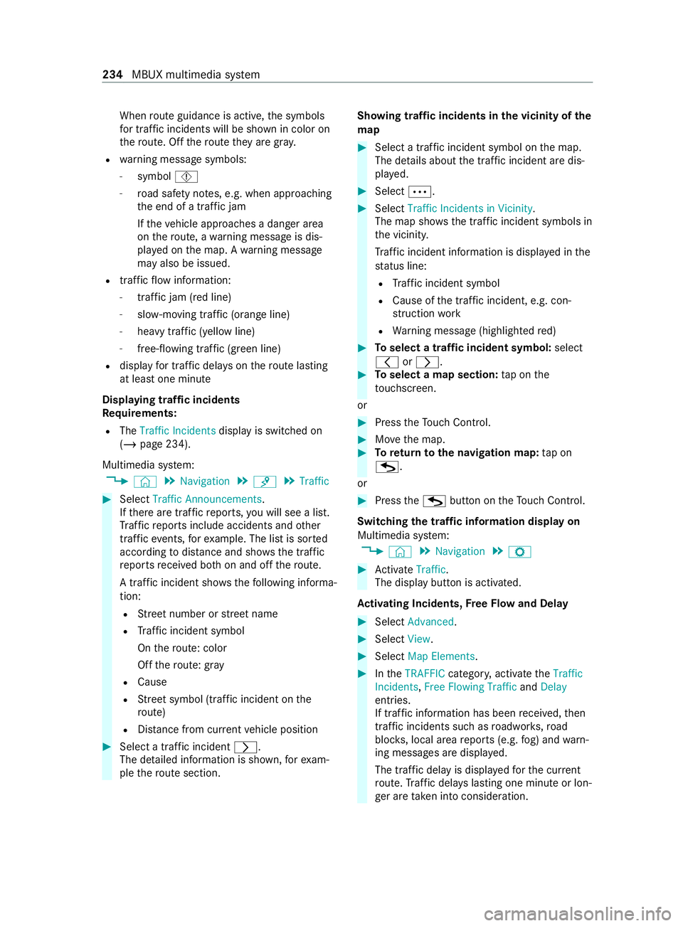
When
route guidance is active, the symbols
fo r traf fic incidents will be shown in color on
th ero ute. Off thero ute they are gra y.
R warning message symbols:
- symbol Ô
- road saf ety no tes, e.g. when approaching
th e end of a traf fic jam
If th eve hicle approaches a danger area
on thero ute, a warning message is dis‐
pla yed on the map. A warning message
may also be issued.
R traffic flow information:
- traffic jam (red line)
- slow-moving traf fic (orange line)
- heavy traf fic (yell owline)
- free-flowing traf fic (green line)
R display for traf fic del ays on thero ute lasting
at least one minute
Displaying traf fic incidents
Re quirements:
R The Traffic Incidents display is switched on
(/ page 234).
Multimedia sy stem:
4 © 5
Navigation 5
¡ 5
Traffic #
Select Traffic Announcements .
If th ere are traf fic re ports, you will see a list.
Tr af fic re ports include accidents and other
traf fic eve nts, forex ample. The list is sor ted
according todis tance and sho ws the traf fic
re ports received bo thon and off thero ute.
A traf fic incident sho wsthefo llowing informa‐
tion:
R Street number or stre et name
R Traf fic incident symbol
On thero ute: color
Off thero ute: gray
R Cause
R Street symbol (traf fic incident on the
ro ute)
R Distance from cur rent vehicle position #
Select a traf fic incident 0048.
The de tailed information is shown, forex am‐
ple thero ute section. Showing traf
fic incidents in the vicinity of the
map #
Select a traf fic incident symbol on the map.
The de tails about the traf fic incident are dis‐
pla yed. #
Select 0062. #
Select Traffic Incidents in Vicinity .
The map sho ws the traf fic incident symbols in
th e vicinit y.
Tr af fic incident information is displa yed in the
st atus line:
R Traf fic incident symbol
R Cause of the traf fic incident, e.g. con‐
st ru ction work
R Warning message (highligh tedre d) #
Toselect a traf fic incident symbol: select
0047 or0048. #
Toselect a map section: tap on the
to uchsc reen.
or #
Press theTo uch Control. #
Movethe map. #
Toreturn tothe navigation map: tap on
G.
or #
Press theG button on theTo uch Control.
Swit ching the traf fic information display on
Multimedia sy stem:
4 © 5
Navigation 5
Z #
Activate Traffic.
The displ aybutton is activated.
Ac tivating Incidents, Free Flow and Delay #
Select Advanced. #
Select View. #
Select Map Elements. #
IntheTRAFFIC category,activate theTraffic
Incidents, Free Flowing Traffic andDelay
entri es.
If tra ffic information has been received, then
tra ffic incidents such as roadwor ks,ro ad
bloc ks, local area reports (e.g. fog) and warn‐
ing messages are displa yed.
The tra ffic delay is displa yedfo rth e cur rent
ro ute. Traf fic del ays lasting one minute or lon‐
ge r are take n into conside ration. 234
MBUX multimedia sy stem
Page 237 of 416

Showing local area messages
Multimedia sy
stem:
4 © 5
Navigation 5
¡ 5
Traffic #
Select Area Alerts.
Local area messages are shown, forex ample
fo g or heavy rain. #
Select a local area message.
The de tails are displa yed.
Ac cepting a de tour recommendation af ter a
prom pt
Re quirements:
R On Request is switched on 003Binthe
DYNAMIC ROUTE GUIDANCE menu
(/ page 223).
R Route guidance is active.
R There are traf fic re ports forth e cur rent route.
If a new route with a shor ter driving time is de ter‐
mined, the cur rent and new routes will be shown.
% The notification is shown in ano
ther applica‐
tion. Confirm the notification. #
Toaccept the new route: select Accept Rec-
ommended Detour. #
Tomaintain the cu rrentroute: select Keep
to Current Route. Car-to-X-Communication
Overview of Car-to-X-Communication
The following requ irements apply for using Car-
to -X-Communication:
R The vehicle is equipped with a multimedia
sy stem featuring navigation and a communi‐
cation module with an activated, integ rated
SIM card.
R You ha vea user account with Mercedes PRO.
R The Car-to-X-Communication service is acti‐
vated.
% Car-to-X-Communication is
available in selec‐
te d count ries.
The communication module automatically es tab‐
lishes an Internet connection once the ignition is
switched on. If there are any hazard warnings,
th ey will be pr ovided shortly thereaf ter.Depend‐
ing on the mobile phone connection, the pr ovi‐
sion take s place from within a second up toabout
a minute. Benefits of Car-to-X-Communication:
R Hazards are recognized au tomatical lyin the
bac kground bytheve hicle or may be repor ted
by the driver. These are then sent tovehicles
with Car-to-X-Communication in the immedi‐
ate vicinit y.
R Ifav ailable, cur rent de tails relating tohazard
spots near theve hicle's cur rent position are
re ceived.
This gives you suf ficient time toadapt your
driving style to the traf fic conditions.
The use of Ca r-to -X-Communication requiresthe
re gular transmission of vehicle data toMercedes-
Benz AG. The da taisthen immediately pseudony‐
mized byMercedes-Benz AG. The vehicle data is
dele ted af ter an appro priate amount of time has
elapsed (se veralwe eks) and is not stored perma‐
nently.
% Data which ser
ves as identification is
re placed during the pseudonymization proc‐
ess. In this wa y,yo ur identity is pr otected
against access byunauthorized third parties.
Displaying hazard warnings
Multimedia sy stem:
4 © #
Select Navigation .
If hazard warnings are available these will be
shown on the map.
The following hazard warnings are shown on the
map:
R Broken-down vehicles
R Accidents
R Haza rdous weather
R Gene ral hazards
R Hazard warning lights, when switched on
% If
th eve hicle is approaching a hazard spot
with a vehicle speed of at least 37mph
(60 km/h) thevo ice output "T raffic incident
ahead" is issued.
The voice output is not issued for hazardous
we ather.
Sending haza rdwa rnings
Au tomatically de tected haza rdwa rnings are sent
by theve hicle. #
Tosend a haza rdwa rning yourself: tap on
th e media display when the map is shown.
The navigation menu is shown. #
Select ¡. MBUX multimedia sy
stem 235
Page 238 of 416

#
Select Report Traffic Incident.
A prom ptis shown. #
Select Yes.
The Thank You for Supporting Accident Pre-
vention message appears. Map and compass
Setting
the map scale
Multimedia sy stem:
4 © 5
Navigation
Zooming in #
When the map is shown, tap twice quickly
with one finger on the media displa y.
or #
Movetwo fingers apart on the media displa y.
Zooming out #
Tap with two fingers on the media displa y.
or #
Movetwo fingers toge ther on the media dis‐
pla y.
% Yo
u can set the unit of measurement of the
map scale (/ page213).
Moving the map
Multimedia sy stem:
4 © 5
Navigation #
Movethefinger in any di rection on the
to uchsc reen when the map is shown.
When the map has been mo vedth efo llowing
information appears in thest atus line, forex am‐
ple:
R The dis tance from theve hicle's cur rent posi‐
tion is shown.
R Information about the cur rent map position is
shown, e.g. the name of thero ad.
The following functions are available:
R Select a destination on the map
(/ page 221).
R Select a POI (/ page219).
R Show traf fic incidents on the map
(/ page 234).
This function is not available in all countries. #
Toreset the map tothe cur rent position
of theve hicle: tap on symbol \. Ro
tating the map #
With two fingers, rotat e counter-clockwise or
clockwise on the media sy stem displa y.
Selecting the map orientation
Multimedia sy stem:
4 © 5
Navigation 5
Z
5 Advanced #
Select View. #
Select Map Orientation. #
Select an option.
The 003Bdot indicates the cur rent setting.
The following options are available:
R 2D Heading Up option:the 2D map view
is aligned tothe direction of tr avel.
R 2D North Up option:the 2D map view is
displa yed so that nor this alw ays at the
to p.
R 3Doption: the 3D map view is aligned to
th e direction of tr avel.
or #
Touse quick- access: repeatedly tap or press
on theÄ compass symbol on the map.
The view changes in the sequence 3D,2D
Heading Up to2D North Up .
If th e map is mo ved, it can switch between
3D and 2D North Up.
Selecting POI symbols for the map display
Multimedia sy stem:
4 © 5
Navigation 5
Z
POIs include gasst ations and ho tels, forex ample.
These can be displa yed as symbols on the map.
Not all POIs are available everywhere.
Pe rsonal POIs are destinations which you ha ve
sa ve d on a USB device, forex ample.
% The display of POI symbols on
the map can
be activated or deactivated as a favo rite. #
Toswitch on/off using quick- access: if
av ailable, swit chPOI Symbols on or off.
The POI symbols forth e selected categories
are shown on the map.
or #
Toswitch on/off in the menu: select
Advanced. #
Select View. #
Select Map Elements. 236
MBUX multimedia sy stem
Page 239 of 416

#
Select POI Symbols.
The POI SYMBOLS menu is shown. #
Switch Display POIs on or off.
Selecting categories #
Select POI SYMBOLS intheAll Categories
menu 0048. #
Activate or deacti vate Show All .
When the option is switched on, the POI sym‐
bols for all categories are shown on the map.
or #
Select the categories and sub-categories (if
av ailable) 0048. #
Activate or deacti vate the categories.
The POI symbols forth e selected categories
are shown on the map.
Selecting personal POI categories #
Select POI SYMBOLS inthePersonal POIs
menu 0048. #
Select a category 0048. #
Activate or deacti vate Show on Map.
When the display is switched on and theve hi‐
cle approaches a personal POI in this cate‐
gor y,a visual and audible notification can be
issued. #
Toset a notification when appro aching:
select a category or a personal POI V.#
Switch Visual Notification andAcoustic Notifi-
cation on or off.
Switching display of catego ries forqu ick-
access on/off #
Switch a category on or off in thePOI SYM-
BOLS menu.
Re setting the POI symbol display #
Select POI SYMBOLS Reset POIs inthe menu.
The settings are reset tothest andard set‐
tings.
Selecting text information for display on the
map
Multimedia sy stem:
4 © 5
Navigation 5
Z
5 Advanced #
Select View. #
Select Text Information. #
Select an option in theFOOTER category.
The 003Bdot indicates the cur rent setting. The
following options are available:
R Current Street option
The stre et you are cur rently on is shown in
th e bottom bar.
When the map is mo ved, thest re et name, the
POI name or the area name appears under
th e crosshair.
R The Geo-coordinates option showsthefo llow‐
ing information in the bottom bar:
- Longitude and latitude
- Elevation
The el evation shown may devia tefrom the
actual ele vation.
- Number of sa tellites from which a signal
can be received
When the map is mo ved, this information
does not appear.
R None option
The media display sho wsnotext information
in the bottom bar.
Switching free way information on/off
Multimedia sy stem:
4 © 5
Navigation 5
Z #
Touse quick- access: switchHighway Infor-
mation on or off.
The display button is activated or off.
or #
Touse the menu: selectAdvanced. #
Select View. #
Select Text Information. #
Activate or deacti vate Highway Information.
When the display button is switched on, addi‐
tional information about the free wayfa cilities
ahead appea rsduring the free way journe y.
These include parking lots, service stations
and free wayex its, forex ample.
Displ aying the next intersecting stre et
Re quirements:
R Route guidance is not active.
Multimedia sy stem:
4 © 5
Navigation 5
Z
5 Advanced #
Select View. #
Select Text Information. MBUX multimedia sy
stem 237
Page 240 of 416

#
Activate Next Intersecting Street .
The displ aybutton is activated. If the option is
switched on and the journey continues with‐
out route guidance, the name of the next
intersecting stre et will be displa yed at the
upper edge of the displa y.
Displaying the map version
Multimedia sy stem:
4 © 5
Navigation 5
Z
5 Advanced #
Select View. #
Select Map Version .
The de tail information is displa yed.
% The online map update service from
Mercedes PRO connect can be used
to
update the map data (/ page 239).
A message is shown in the media display
when a new map version is available.
% In
fo rm ation about new versions of the digital
map can be obtained from an authorized
Mercedes-Benz Center.
Overview of avoiding an area for the route
Yo u can define areas along a route that you
wo uld like toavoid.
Fr ee wa ys or multi-lane urban free ways, which are
ro uted thro ugh an area tobe avo ided are taken
into account forth ero ute.
Av oiding a new area for the route
Multimedia sy stem:
4 © 5
Navigation 5
Z
5 Advanced 5
Route 5
Avoid Options
5 Avoid Areas #
Select Avoid New Area . #
Tostart in the map: selectUsing Map. #
Movethe map (/ page 236). #
Tostart via destination sear ch:select Via
Address Entry . #
Enter the address (/ page217). #
Select the destination in the list or accept
with 0076.
The map appears. #
Toshow an area: tap or press on the cont rol
element.
A redre ctangle appea rs. This designa testhe
area that should be avoided. #
Tochange the map scale: movetwo fingers
to ge ther or apart on the media displa y.
The map is zoomed in or out. #
Toset an area: press onthe cont rol element.
The area is entered into the list.
Changing an area tobe avo ided
Multimedia sy stem:
4 © 5
Navigation 5
Z
5 Advanced 5
Route 5
Avoid Options
5 Avoid Areas #
Select an area in the list. #
Select Edit. #
Tomo vean area on the map: swipe in any
direction on the cont rol element. #
Tochange the size of the area: tap or press
on the cont rol element. #
Swipe up or down on the cont rol element. #
Tap or press on the cont rol element. #
Totake account of an area for the route:
select an area from the list. #
Activate Avoid Area .
The displ aybutton is activated.
If ro ute guidance is active, a new route is cal‐
culated.
If th ere is no route yet,th e setting is car ried
ove rto the next route guidance.
The route can include an area that is tobe
avo ided in thefo llowing cases:
R the destination is located in an area that
is to be avo ided.
R thero ute includes high ways or multi-lane
ex pressw ays which pass thro ugh an area
to be avo ided.
R there is no sensible alternative route.
Deleting an area
Multimedia sy stem:
4 © 5
Navigation 5
Z
5 Advanced 5
Route 5
Avoid Options
5 Avoid Areas #
Todel ete an area: select an area in the list. #
Select Delete. #
Confirm the prom ptwith Yes. #
Todel ete all areas: if at least two areas to
avo id are set, select Delete All. #
Confirm the prom ptwith Yes. 238
MBUX multimedia sy stem