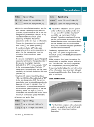
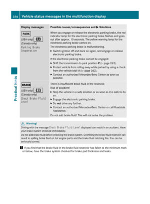
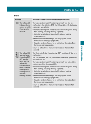
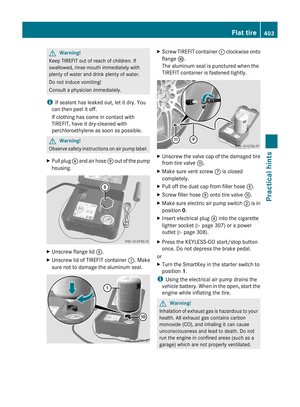
Page 129 of 436

Entering a POI in the Vicinity of the
LocationXIn the map display with the menu system
displayed, select Destination £ From
POIs £ Current Position .XContinue by selecting the POI category
( Y page 127).
Entering a POI in the Vicinity of a
Specific Location
i Using this option you will get a list of
alphabetically sorted POIs that belong to
the city entered.
Option 1
XIn the map display with the menu system
displayed, select Destination £ From
POIs £ Other City .XIf necessary proceed as described under
“Selecting a State/Province”
( Y page 114).XTo enter a city: Select City.
The city input menu appears.XProceed as described in the “Entering a
City” section ( Y page 115).XAfter entering the city, continue by
selecting the POI category ( Y page 127).
Option 2
XEnter an address in the Enter Destination
menu ( Y page 114).XSelect POI.XContinue by selecting the POI category
( Y page 127).
Entering POIs via Name Search
i This function gives you access to all POIs
that are available in the digital map.
XIn the map display with the menu system
displayed ( Y page 105), selectDestination £ From POIs £ Search
By Name .
This displays a list of all POIs in the digital
map and the predictive speller.XContinue as described in the “POI List with
Predictive Speller” section ( Y page 130).
Entering a POI via Phone Number
Search
i This function gives you access to all POIs
in the digital map stored with a phone
number.
XIn the map display with the menu system
displayed ( Y page 105), select
Destination £ From POIs £ Search
By Phone Number .
This displays a list of all POIs in the digital
map sorted by phone number and the
predictive speller.XContinue as described in the “POI List with
Predictive Speller” section ( Y page 130).
Choosing a POI Category
The categories and POIs available depend on
the area for which you wish to enter the POI.
R POI in local area of destination:
Alphabetically sorted categories and POIs
sorted by distance in the vicinity of the
destination location are available.
R POI in the vicinity of the location:
Alphabetically sorted categories and POIs
sorted by distance in the vicinity of the
vehicle location are available.
R POI in a particular city:
If you have only entered the country and the
city, alphabetically sorted categories and
alphabetically sorted POIs within the city
limits are available.
If you have entered more than the country
and the city, alphabetically sorted
categories and POIs sorted by distance in
Navigation (POI Input)127COMAND APSBA 197 USA, CA Edition A 2011; 1; 27, en-UShereepeVersion: 3.0.3.52010-03-24T15:31:10+01:00 - Seite 127Z
Page 130 of 436

the vicinity of the address entered are
available.
RPOI via name search:
An alphabetically sorted list of all POIs is
available.
RPOIs via phone number:
A numerically sorted list is available.
Selecting a Category
Depending on the number of available
categories, the main category list is displayed
either with or without predictive speller
(Y page 129).
Main Category List with Predictive Speller
If this list is given in the display, the predictive
speller 7 is activated automatically.
1 Symbol for main category2 Characters entered by the user3 Characters automatically added by the
system
4 List entry that best matches the
characters already entered
5 Main category list6 Currently unavailable characters7 Predictive speller8 Currently selected character9 Currently available characters
iIn the predictive speller 7, you can only
select characters that are currently
available. The set of characters that is
available depends on those already entered
and the data included in the digital map.
When entering characters, the list entry 4
always displays the category that best
matches the characters already entered.
COMAND automatically adds matching
letters 3 to those characters 2 already
entered by the user.
Entering characters
XTo select characters: Rotate y m z or
slide o m p .
XSlide q m r to switch between the lines.XTo confirm character selection:
Press n.
Deleting an Entry
XTo delete individual characters: Select
õ in the bottom line and press n.
or
XPress the 2 button next to the
COMAND controller.
XTo delete an entire entry: Select õ in
the bottom line and press n until the entire
entry is deleted.
or
XPress and hold the 2 button until the
entire entry has been deleted.
Canceling an Entry
XSelect Back in the bottom line and press
n.
or
XPress the k button.
The previous menu appears.
Accepting First List Entry
XPress and hold n until the list appears
without speller.
or
if COMAND can match the characters
entered to one entry, the list appears
automatically without the speller.
128Navigation (POI Input)COMAND APS
BA 197 USA, CA Edition A 2011; 1; 27, en-UShereepeVersion: 3.0.3.52010-03-24T15:31:10+01:00 - Seite 128
Page 131 of 436

Switching to the Main Category List
Without Predictive Speller
You can switch to the list at any point while
entering characters.
XSlide q m repeatedly until the list appears
without the speller.
or
XSelect d and press n.
Main Category List Without Predictive
Speller
Example: Main category list for POIs
1 Selected main categoryXTo select a main category: Slide q m r
or rotate y m z .
XTo cancel selection: Press the k
button.
XTo confirm selection: Press n.1 Calls up all entries in the RESTAURANT
main category
2 Calls up all entries in the BREWPUB
subcategory
3 Predictive spelleriIn the predictive speller 3 you can only
select characters that are currently
available. The availability of the characters
depends on the characters already entered
and the data included in the digital map.
For the steps of
REntering characters
RDeleting an entry
RAccepting first list entry
RCanceling an entry
RSwitching to the list without predictive
speller
proceed as described under “Main category
list with predictive speller” (Y page 128).
With the POI category list displayed:
XTo select a subcategory: Slide q m r or
rotate y m z .
XTo cancel selection: Press the k
button.
XTo confirm selection: Press n.
After selecting a subcategory you will see
the list of POIs. This contains the available
POIs for the subcategory that are located
in the search area.
iIf ALL is selected in the list, the POI list
contains all the POIs in all subcategories of
the RESTAURANT main category that are
located in the search area. The list item
OTHER at the end of the list contains all the
POIs not assigned to any subcategory in the
RESTAURANT main category that are
located in the search area.
The selected main category contains no
subcategories:
Selecting it immediately opens the POI list.
The POI list then contains the available POIs
for the main category that are located in the
search area.
POI list
As an example, the illustration below shows
the POI list for the main category of
Navigation (POI Input)129COMAND APSBA 197 USA, CA Edition A 2011; 1; 27, en-UShereepeVersion: 3.0.3.52010-03-24T15:31:10+01:00 - Seite 129Z
Page 132 of 436

RESTAURANT, subcategory BREWPUB, in the
vicinity of the location.1 Direction of destination2 Air-line distance to the destination3 Point of interest4 Selected category or subcategory
iDepending on the POI category selected,
COMAND uses different reference points
when determining the distance to the
destination:
RIn the vicinity of the location:
The distance to the POI from the current
vehicle location.
RLocal area of destination:
The distance to the POI from the
destination entered.
Selecting a POI
XSelect the desired POI.
The full address of the selected POI is
displayed.
iIf the selected POI has a telephone
number entry, you can make a call to the
POI if a mobile phone is connected to
COMAND.
1 POI with address2 Starts route calculation3 Saves POI as destination4 Shows details of the address5 Initiates a call, if available6 Cancels selection7 Displays the mapXTo cancel selection: Press the k
button.
or
XSelect Back
The POI list appears.
XTo start route calculation: Select Start.
POI list with predictive speller
If you have selected Entering a POI via
Name Search (Y page 127), the list of all
available POIs in the digital map is displayed.
1 First list entry after opening the list2 POI list3 Predictive speller4 Category symbols130Navigation (POI Input)COMAND APS
BA 197 USA, CA Edition A 2011; 1; 27, en-UShereepeVersion: 3.0.3.52010-03-24T15:31:10+01:00 - Seite 130
Page 133 of 436

iIn the predictive speller 3 you can only
select characters that are currently
available. The set of characters that is
available depends on those already entered
and the data included in the digital map.
For the steps of
REntering characters
RDeleting an entry
RAccepting first list entry
RCanceling an entry
proceed as described under “Main category
list with predictive speller” (Y page 128).
Selecting a POI
To accept first list entry:
XPress and hold n until the list appears
without speller.
or
If COMAND can match the characters
entered definitively to one entry, the list is
displayed without predictive speller with the
matching entry highlighted.(Y page 130).
You can switch to the list at any point while
entering characters.
XSlide q m repeatedly until the list appears
without the speller.
or
XSelect d and press n.XTo display the full address of the POI:
Select ? and press n.
XTo cancel selection: Press the k
button.
or
XSelect Back.
The POI list appears.
XTo start route calculation: Select Start.
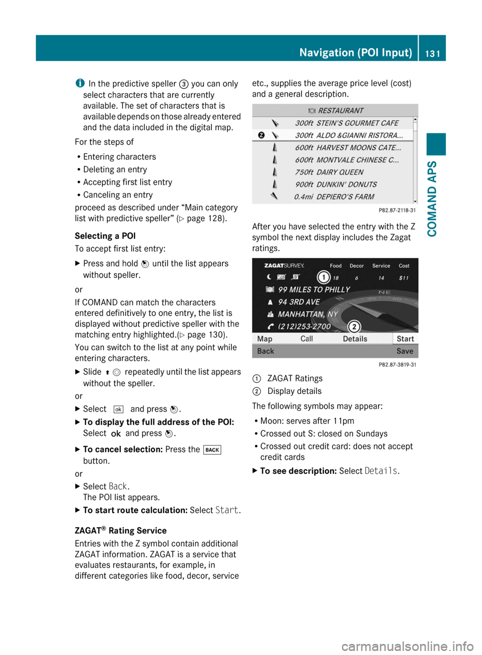
ZAGAT® Rating Service
Entries with the Z symbol contain additional
ZAGAT information. ZAGAT is a service that
evaluates restaurants, for example, in
different categories like food, decor, service
etc., supplies the average price level (cost)
and a general description.
After you have selected the entry with the Z
symbol the next display includes the Zagat
ratings.
1 ZAGAT Ratings2 Display details
The following symbols may appear:
RMoon: serves after 11pm
RCrossed out S: closed on Sundays
RCrossed out credit card: does not accept
credit cards
XTo see description: Select Details.Navigation (POI Input)131COMAND APSBA 197 USA, CA Edition A 2011; 1; 27, en-UShereepeVersion: 3.0.3.52010-03-24T15:31:10+01:00 - Seite 131Z
Page 134 of 436

ZAGAT example description
Entering a POI via the Map
iIf the crosshairs are visible on the map,
you can enter POIs in the vicinity of the
crosshairs. If the crosshairs are not visible,
you can enter POIs in the vicinity of the
current vehicle location.
XIn the map display with the menu system
displayed (Y page 105) select Guide.
POIs are available:
Depending on the map scale selected, POI
symbols are displayed on the map. The
scale starting at which symbols are
displayed on the map varies from symbol
to symbol.
You can select which symbols COMAND
should display (Y page 108). The POI
nearest to the center of the screen is
selected automatically.
No POIs available:
A corresponding message is displayed.
iThis message is also displayed if the menu
item No Symbols under Map Display has
been selected (Y page 108).
XTo confirm message: Press n.1 Information about the highlighted POI2 Highlighted POIXTo select a POI: Select Next or
Previous.
XTo start route calculation: Select Start,
see also (Y page 121).
You will be asked whether the POI should
be adopted as the destination.
XSelect Yes or No.
Route calculation starts if Yes is selected;
a new POI can be chosen if No is selected.
Navigation (Route Guidance)
General Notes
GWarning
COMAND calculates the route to the
destination without taking account of the
following, for example:
RTraffic lights
RStop and right-of-way signs
RLane merging
RParking or stopping prohibited areas
ROther road and traffic rules and regulations
RNarrow bridges
COMAND may give incorrect navigation
commands if the data in the digital map does
not correspond with the actual road/ traffic
situation. For example, if the traffic routing
has been changed or the direction of a one-
way road has been reversed.
For this reason, you must always observe
applicable road and traffic rules and
132Navigation (Route Guidance)COMAND APS
BA 197 USA, CA Edition A 2011; 1; 27, en-UShereepeVersion: 3.0.3.52010-03-24T15:31:10+01:00 - Seite 132
Page 135 of 436

regulations during your journey. Road and
traffic rules and regulations always have
priority over the navigation commands
generated by the system.
COMAND guides you to the destination by
means of driving recommendations in the
form of navigation announcements or route
guidance displays.
iThe route guidance displays only appear
if the display has been switched to
navigation mode.
If, for some reason, you do not follow the
navigation announcements or if you leave the
calculated route, COMAND automatically
calculates a new route to the destination.
If the map data contains corresponding
information during route guidance, COMAND
tries to avoid roads with limited passability,
e.g. roads that are blocked for through-traffic
and are for residents only.
Driving Maneuver
Driving maneuvers are given in three phases:
RPreparation phase
RAnnouncement phase
RManeuver phase
Preparation Phase
COMAND prepares you for the next driving
maneuver. Based on the example display
shown below, the announcement is made
using Prepare to turn right. The display
is not split and displays the map over the
entire width.
1 Next road to be taken2 Point at which the driving maneuver
takes place (dot)
3 Current vehicle location, the tip of the
triangle points in the vehicle’s direction
of travel
4 Road currently being driven down
iDepending on the basic setting selection
in “Information on map” you will see in 4
RInformation on “Arrival time/distance”
RRoad currently being driven down
RGeo-coordinate display.
If you have selected the None menu item,
the display is hidden.
Announcement Phase
COMAND announces the imminent driving
maneuver. Based on the example display
shown below, the announcement is made
400 ft. ahead of the driving maneuver using
Please turn left in 400 ft. and
follow the ’road name’.
iThe announced distance to the maneuver
depends on the class of road and its speed
limit category.
The display is now split into two sectors. In
the left half, you see the normal map view.
The right side shows an enlarged section of
the area around the junction (Crossing Zoom)
or a 3D image of the road's course with the
route indicating the next maneuver.
The example illustrated below shows the
junction zoom in the right-hand half.
Navigation (Route Guidance)133COMAND APSBA 197 USA, CA Edition A 2011; 1; 27, en-UShereepeVersion: 3.0.3.52010-03-24T15:31:10+01:00 - Seite 133Z
Page 136 of 436

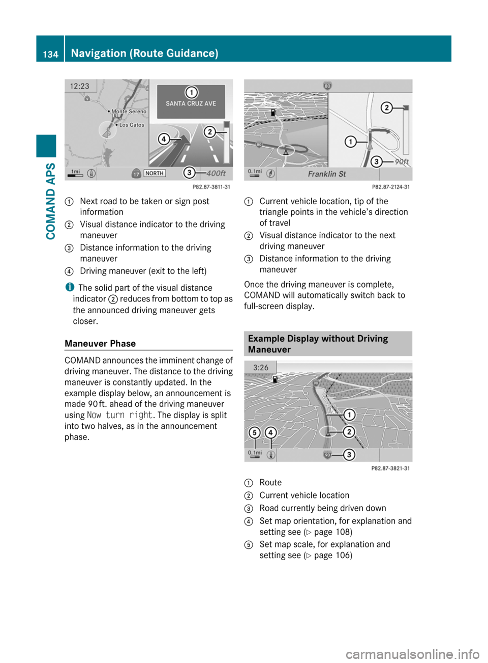
1 Next road to be taken or sign post
information
2 Visual distance indicator to the driving
maneuver
3 Distance information to the driving
maneuver
4 Driving maneuver (exit to the left)
iThe solid part of the visual distance
indicator 2 reduces from bottom to top as
the announced driving maneuver gets
closer.
Maneuver Phase
COMAND announces the imminent change of
driving maneuver. The distance to the driving
maneuver is constantly updated. In the
example display below, an announcement is
made 90 ft. ahead of the driving maneuver
using Now turn right. The display is split
into two halves, as in the announcement
phase.
1 Current vehicle location, tip of the
triangle points in the vehicle’s direction
of travel
2 Visual distance indicator to the next
driving maneuver
3 Distance information to the driving
maneuver
Once the driving maneuver is complete,
COMAND will automatically switch back to
full-screen display.
Example Display without Driving
Maneuver
1 Route2 Current vehicle location3 Road currently being driven down4 Set map orientation, for explanation and
setting see (Y page 108)
5 Set map scale, for explanation and
setting see (Y page 106)
134Navigation (Route Guidance)COMAND APS
BA 197 USA, CA Edition A 2011; 1; 27, en-UShereepeVersion: 3.0.3.52010-03-24T15:31:10+01:00 - Seite 134