2018 CHEVROLET CITY EXPRESS navigation
[x] Cancel search: navigationPage 45 of 74

Chevrolet City Express Infotainment System (GMNA-Localizing-U.S./Canada-
11683801) - 2018 - crc - 7/12/17
44 Navigation
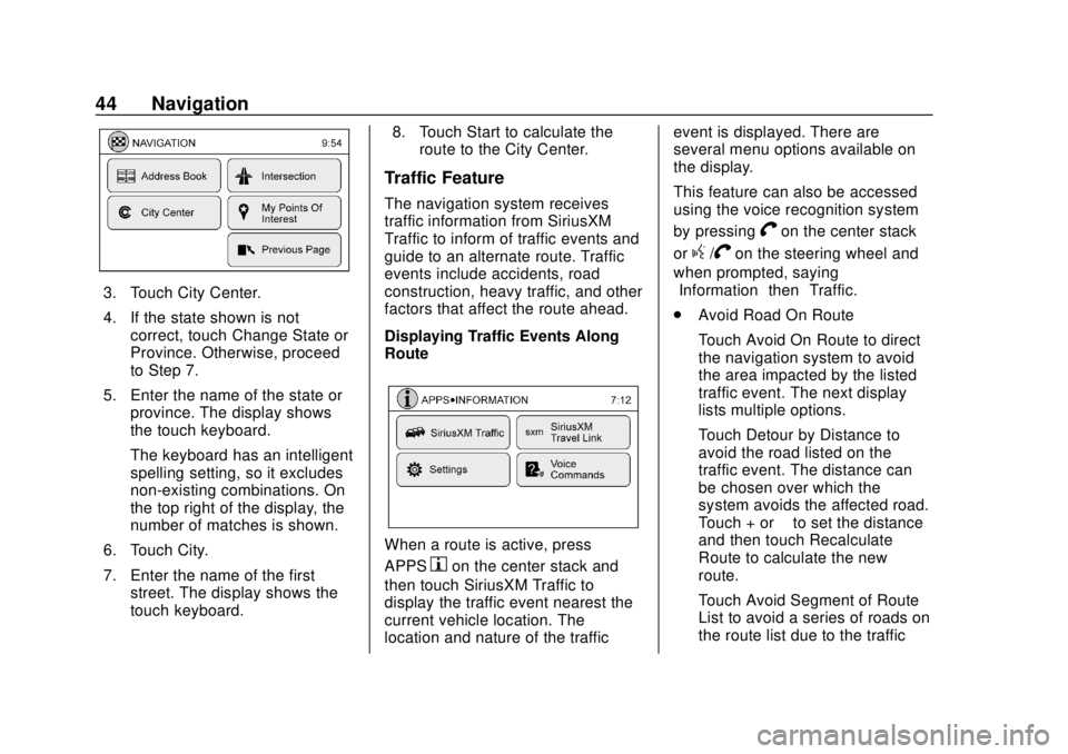
3. Touch City Center.
4. If the state shown is notcorrect, touch Change State or
Province. Otherwise, proceed
to Step 7.
5. Enter the name of the state or province. The display shows
the touch keyboard.
The keyboard has an intelligent
spelling setting, so it excludes
non-existing combinations. On
the top right of the display, the
number of matches is shown.
6. Touch City.
7. Enter the name of the first street. The display shows the
touch keyboard. 8. Touch Start to calculate the
route to the City Center.
Traffic Feature
The navigation system receives
traffic information from SiriusXM
Traffic to inform of traffic events and
guide to an alternate route. Traffic
events include accidents, road
construction, heavy traffic, and other
factors that affect the route ahead.
Displaying Traffic Events Along
Route
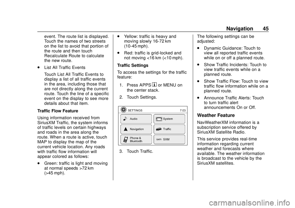
When a route is active, press
APPS
hon the center stack and
then touch SiriusXM Traffic to
display the traffic event nearest the
current vehicle location. The
location and nature of the traffic event is displayed. There are
several menu options available on
the display.
This feature can also be accessed
using the voice recognition system
by pressing
Von the center stack
or
g/Von the steering wheel and
when prompted, saying
”Information” then“Traffic.”
. Avoid Road On Route
Touch Avoid On Route to direct
the navigation system to avoid
the area impacted by the listed
traffic event. The next display
lists multiple options.
Touch Detour by Distance to
avoid the road listed on the
traffic event. The distance can
be chosen over which the
system avoids the affected road.
Touch + or −to set the distance
and then touch Recalculate
Route to calculate the new
route.
Touch Avoid Segment of Route
List to avoid a series of roads on
the route list due to the traffic
Page 46 of 74

Chevrolet City Express Infotainment System (GMNA-Localizing-U.S./Canada-
11683801) - 2018 - crc - 7/12/17
Navigation 45
event. The route list is displayed.
Touch the names of two streets
on the list to avoid that portion of
the route and then touch
Recalculate Route to calculate
the new route.
. List All Traffic Events
Touch List All Traffic Events to
display a list of all traffic events
in the area, including those that
are not directly along the current
route. Touch the line of a specific
event on the display to see more
details about that item.
Traffic Flow Feature
Using information received from
SiriusXM Traffic, the system informs
of traffic levels on certain highways
and roads in the area along the
route. When a route is active, touch
MAP to display the map of the
current vehicle location. Any roads
with traffic flow information will
appear colored as follows:
. Green: traffic is light and moving
at normal speeds >72 km
(>45 mph). .
Yellow: traffic is heavy and
moving slowly 16-72 km
(10-45 mph).
. Red: traffic is grid-locked and
not moving <16 km (<10 mph).
Traffic Settings
To access the settings for the traffic
feature:
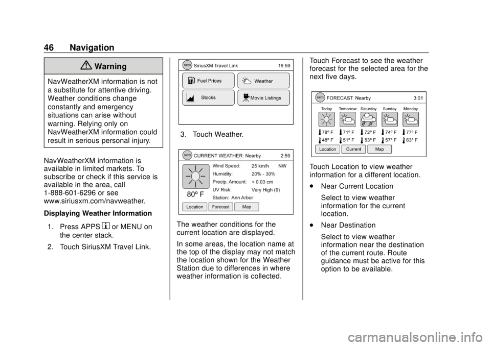
1. Press APPS
hor MENU on
the center stack.
2. Touch Settings.
3. Touch Traffic. The following settings can be
adjusted:
.
Dynamic Guidance: Touch to
view all reported traffic events
while on or off a planned route.
. Show Traffic Incidents: Touch to
view traffic events while on a
planned route.
. Show Traffic Flow: Touch to view
traffic flow information while on a
planned route.
. Announce Traffic Alerts: Touch
to turn traffic alert
announcements On or Off.
Weather Feature
NavWeatherXM information is a
subscription service offered by
SiriusXM Satellite Radio.
This service provides real-time
information regarding current
weather and forecasts where
available. The weather information
is broadcast to the vehicle by the
SiriusXM satellites.
Page 47 of 74

Chevrolet City Express Infotainment System (GMNA-Localizing-U.S./Canada-
11683801) - 2018 - crc - 7/12/17
46 Navigation
{Warning
NavWeatherXM information is not
a substitute for attentive driving.
Weather conditions change
constantly and emergency
situations can arise without
warning. Relying only on
NavWeatherXM information could
result in serious personal injury.
NavWeatherXM information is
available in limited markets. To
subscribe or check if this service is
available in the area, call
1-888-601-6296 or see
www.siriusxm.com/navweather.
Displaying Weather Information 1. Press APPS
hor MENU on
the center stack.
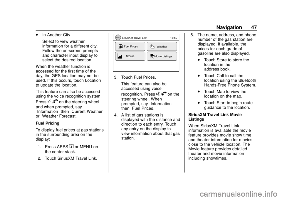
2. Touch SiriusXM Travel Link.
3. Touch Weather.
The weather conditions for the
current location are displayed.
In some areas, the location name at
the top of the display may not match
the location shown for the Weather
Station due to differences in where
weather information is collected. Touch Forecast to see the weather
forecast for the selected area for the
next five days.
Touch Location to view weather
information for a different location.
.
Near Current Location
Select to view weather
information for the current
location.
. Near Destination
Select to view weather
information near the destination
of the current route. Route
guidance must be active for this
option to be available.
Page 48 of 74

Chevrolet City Express Infotainment System (GMNA-Localizing-U.S./Canada-
11683801) - 2018 - crc - 7/12/17
Navigation 47
.In Another City
Select to view weather
information for a different city.
Follow the on-screen prompts
and character input display to
select the desired location.
When the weather function is
accessed for the first time of the
day, the GPS location may not be
used. If this occurs, touch Location
to update the location.
This feature can also be accessed
using the voice recognition system.
Press
g/Von the steering wheel
and when prompted, say
“Information” then“Current Weather”
or “Weather Forecast.”
Fuel Pricing
To display fuel prices at gas stations
in the surrounding area on the
display:
1. Press APPS
hor MENU on
the center stack.
2. Touch SiriusXM Travel Link.
3. Touch Fuel Prices. This feature can also be
accessed using voice
recognition. Press
g/Von the
steering wheel. When
prompted, say “Information”
then “Fuel Prices.”
4. A list of gas stations is displayed with the distance and
direction to each entry. Touch
any entry on the display to
view information about that gas
station. 5. The name, address, and phone
number of the gas station are
displayed. If available, the
prices for each grade of
gasoline are also displayed.
.Touch Store to store the
location in the
address book.
. Touch Call to call the
location using the Bluetooth
Hands-Free Phone System.
. Touch Map to view the
location on the map.
. Touch Start to begin route
guidance to the location.
SiriusXM Travel Link Movie
Listings
When SiriusXM Travel Link
information is available the movie
feature provides movie show time
and theater information for movies
close to the vehicle location. The
Movie feature provides detailed
theater and movie information
including showtimes.
Page 49 of 74

Chevrolet City Express Infotainment System (GMNA-Localizing-U.S./Canada-
11683801) - 2018 - crc - 7/12/17
48 Navigation
From the SiriusXM Travel Link
menu, touch SiriusXM Movie. The
system displays the Movie and
Theater search page.
To search movies:
.Touch Movie to choose a
movie name.
. Touch Theater to choose a
specific theater.
. Touch Date to choose which
date to search movies and/or
theaters.
. Touch Search to view a list of
movies or theaters.
When searching by movie, a list will
display movies to select. When a
movie is selected, a theater list will
appear with a direction arrow and
distance from the current vehicle
location. The direction and distance
will update every 10 seconds as the
vehicle is moving. The direction
arrow represents the location of the
theater from the current vehicle
location. The distance represents
the straight line distance between
the vehicle location and the theater. Movie details are available when a
movie is selected. The details
include Cast, Synopsis, and Theater
Information. Touch the appropriate
icon to display more information.
Cast and Synopsis:
.
Actors
. Show Times
. Rating (G, PG-13, R, etc.)
. Length of movie
Theater information includes
address, phone number, distance,
and amenities.
Troubleshooting
XM Travel Link services use the
SiriusXM Satellite Signal and GPS
Satellite Signal to provide this
feature.
When the vehicle is started, it can
take up to five minutes for the radio
to receive the Travel Link services.
Travel Link Messages
No GPS Signal : Move the vehicle
into a position that is visible to
the sky. Acquiring Signal :
Radio is
downloading the activation
information or not receiving a good
signal. Move the vehicle to an open
area and restart the vehicle.
No XM Signal : Reception is
blocked. Move the vehicle into an
open area.
Global Positioning
System (GPS)
This navigation system combines
the data obtained from the vehicle
and from GPS (Global Positioning
System) satellites to calculate the
current location of the vehicle. This
position is then displayed
throughout route guidance to a
destination.
Vehicle Positioning
At times, the position of the vehicle
on the map could be inaccurate due
to one or more of the following
reasons:
. The road system has changed.
Page 50 of 74

Chevrolet City Express Infotainment System (GMNA-Localizing-U.S./Canada-
11683801) - 2018 - crc - 7/12/17
Navigation 49
.The vehicle is driving on slippery
road surfaces such as sand,
gravel, or snow.
. The vehicle is traveling on
winding roads or long straight
roads.
. The vehicle is approaching a tall
building or a large vehicle.
. The surface streets run parallel
to a freeway.
. The vehicle has been transferred
by a vehicle carrier or a ferry.
. The current position calibration
is set incorrectly.
. The vehicle is traveling at high
speed.
. The vehicle changes directions
more than once, or the vehicle is
turning on a turn table in a
parking lot.
. The vehicle is entering and/or
exiting a parking lot, garage, or a
lot with a roof.
. The GPS signal is not received.
. A roof carrier is installed on the
vehicle. .
Tire chains have been installed.
. The tires are replaced or worn.
. The tire pressure for the tires is
incorrect.
. This is the first navigation use
after the map data is updated.
. The 12-volt battery is
disconnected for several days.
. The vehicle is driving in heavy
traffic where driving is at low
speeds, and the vehicle is
stopped and started repeatedly.
Problems with Route
Guidance
.
The navigation system may not
calculate a route if the current
vehicle location is too far away
from the destination. In this
case, divide your trip by
selecting one or two
intermediate destinations.
. To reach the destination, refer to
the map view. Always follow
actual roads and regulations and
drive safely. .
The suggested route may not be
the shortest, nor are other
circumstances such as traffic
jams considered unless the
SiriusXM Traffic is active.
. Because of the differences in
road conditions and
circumstances between the time
you use this system and the time
the information was produced for
the map data, there may be
discrepancies in roads and
regulations. In such cases,
follow the actual information
available.
. During route calculation, the
map will not scroll, however the
vehicle icon will move with the
actual vehicle’s movement.
. In some cases, after the
calculation is complete, the
calculated route may not be
immediately displayed.
. It may take more time to finish
drawing a route if the map is
being scrolled at the same time.
Page 51 of 74

Chevrolet City Express Infotainment System (GMNA-Localizing-U.S./Canada-
11683801) - 2018 - crc - 7/12/17
50 Navigation
.If waypoints are set, the system
calculates multiple routes
between waypoints
simultaneously, and the following
may result:
‐If one section between
waypoints cannot be
calculated, none of the route
will be displayed.
‐ The route may not connect
completely at some waypoints.
‐ The route may require a
U-turn close to some
waypoints.
. Route calculation may not be
completed in the following
cases:
‐There is no main road within a
range of 2.5 km (1.5 mi) from
the vehicle. A message will
appear on the display. Try
recalculating when the vehicle
is closer to a main road. ‐
The vehicle is too close to the
destination or there are no
roads to the destination.
A message will appear on the
display.
‐ It is impossible to reach the
destination or waypoints
because of traffic regulations.
‐ The only target route to the
destination or waypoints is
extremely complicated.
. The following may occur when
the route is displayed:
‐If a route is calculated on a
main road, the starting point of
the route may not exactly
match the current vehicle
location.
‐ The endpoint of the route may
not exactly match the
destination.
‐ If a route is calculated on a
main road, the system may
display a route from another
main road. This may be
because the position of the
vehicle icon is not accurate. In this case, park the vehicle in a
safe location and reset the
vehicle icon, or continue
driving to see if the position of
the vehicle icon is
automatically adjusted before
recalculating the route.
‐ In some cases, the system
shows an indirect route to the
destination or waypoints if you
set them from stored places
information. In order to correct,
be careful about the traffic
direction, especially when
lanes with different travel
directions are shown
separately, such as
interchanges and service
areas.
‐ Even if the freeway preference
is set to OFF, a route that uses
the freeway may be
suggested.
‐ Even if the preference is set to
OFF, a route that uses a ferry
line may be suggested.
Page 52 of 74

Chevrolet City Express Infotainment System (GMNA-Localizing-U.S./Canada-
11683801) - 2018 - crc - 7/12/17
Navigation 51
‐Ferry lines, excluding those
that are only for pedestrians,
bicycles, and motorcycles, are
stored in this system. Take
into consideration the travel
time required and operational
condition before deciding
whether to use the route.
If the System Needs
Service
If the navigation system needs
service and the steps listed here
have been followed but there are
still problems, see your dealer for
assistance.
Map Data Updates
The map data in the vehicle is the
most up-to-date information
available when the vehicle was
produced. The map data is updated
periodically, provided that the map
information has changed.
The SD card slot is on the front of
the unit. When this system is
purchased, an SD card with map
data is provided. The SD card slot can only read the
SD card with map data provided
specifically for use with the vehicle’s
navigation system. The system will
not read other SD cards.
For additional SD cards with map
data, contact your dealer.
Handling the SD Card
When handling the SD card, adhere
to the following instructions:
.
Handle the SD card with care.
Never touch the metal contacts.
. Do not use any conventional
cleaner, benzine, thinner,
or antistatic spray.
. Use a soft cloth to clean the
SD card.
. Never attempt to use an SD card
that has been cracked,
deformed, or repaired using
adhesive. Doing so may damage
the equipment.
. Do not try to bend the SD card.
Do not use any SD card that is
bent or cracked. .
Do not put on any sticker or
write anything on the SD card.
. Handle the SD card carefully to
avoid contamination or flaws.
Otherwise, the data may not be
read properly.
. Do not store the SD card in
locations exposed to direct
sunlight, or in high temperatures
or humidity.
. Always place the SD card in its
storage case when not in use.
Database Coverage
Explanations
Coverage areas vary with respect to
the level of map detail available for
any given area. Some areas feature
greater levels of detail than others.
If this happens, it does not mean
there is a problem with the system.
As the map data is updated, more
detail can become available for
areas that previously had limited
detail. See Map Data Updates 051.