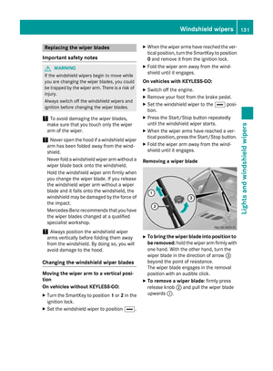
Page 345 of 614

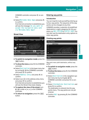
XTo create a new category:selectNewand
press Wto confirm.
XEnter the name of the category. Character
entry (
Ypage 301).
XSelect the ¬icon and press Wto con-
firm.
A list with icons appears. You can assign an
icon to the category.
XSelect a symbol by turning cVdthe
COMAND controller and press Wto con-
firm.
You have created a new category with a
name and icon. This category appears
when selecting the display on the map or
when selecting the destination.
XTo rename a category, to change an
icon: select Rename
orChange Iconand
press Wto confirm.
XProceed as described under "To create a
new category".
XTo delete a category: selectDeleteand
press Wto confirm.
A prompt appears asking whether the cat-
egory should be deleted.
iIf you delete a category, all points of inter-
est of this category are also deleted.
XSelect Yesand press Wto confirm.
If you select Yes
, the category will be
deleted.
If you select No
, the process will be can-
celed. Managing personal POIs
XCall up the "Personal POIs" menu
(
Ypage 341).
XSelect
Manage Categories for Per‐
sonal POIsin the menu and press Wto
confirm.
XSelect Not Classified,COMANDor your
own category and press Wto confirm.
XSelect a personal POI and press Wto con-
firm.
The personal point of interest is displayed.
For further information on managing personal
POI categories (
Ypage 344):
RRenaming
RChanging the category
RDeleting
Saving personal POIs
There are three ways to save personal points
of interest. You must insert an SD memory
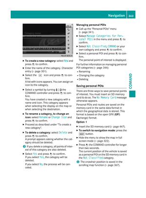
card to do so. The No
MemoryCardmessage
otherwise appears.
Personal POIs and routes are saved on the
memory card in the same data format in
which the geographical data is stored. This
format is based on the open GPX ( GPS
Exchange) format.
Option 1
XInsert the SD memory card (Ypage 447).
XTo switch to navigation mode: press the
Ø button.
XHide the menu to show the map in full
screen mode (
Ypage 322).
XPress Wthe COMAND controller for longer
than two seconds.
The current position of the vehicle is saved
as a personal POI on the SD memory card in
the Not Classified
category.
iThe crosshair position is saved in the
scrolling map function (
Ypage 367).
Navigation343
COMAND
Z
Page 346 of 614

Option 2
XInsert the SD memory card (Ypage 447).
XTo switch to navigation mode:press the
Ø button.
XTo show the menu: pressWthe COMAND
controller.
XSelect Positionin the navigation system
menu bar by turning cVdthe COMAND
controller and press Wto confirm.
XSelect SavePositionAsPersonalPOI
orSaveCrosshairPos.asPersonal
POI("Move map" function active) and press
W to confirm.
The list of personal categories appears.
XSelect a category and press Wto confirm.
XName for the personal point of interest.
Character entry (
Ypage 301).
Option 3
XInsert the SD memory card (Ypage 447).
XTo switch to navigation mode: press the
Ø button.
XCall up the address entry menu
(
Ypage 324).
XSelect Savefrom the address entry menu
and press Wto confirm.
XSelect Save As Personal POIand press
W to confirm.
XSelect a category.
XEnter the name.
The current address is saved as a personal
point of interest on the SD memory card.
Importing personal POIs via the online
function
You can import personal POIs (destinations,
routes) via the online function (
Ypage 424).
When importing, you can choose whether to
write files to the SD memory card or to file
them in the address book. The imported per- sonal POIs have their own icon and are filed in
the COMAND
category.
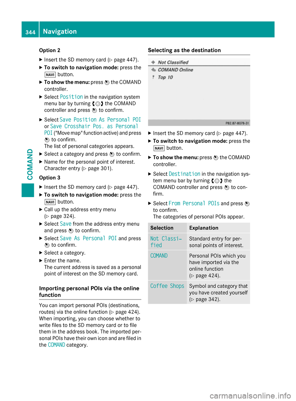
Selecting as the destination
XInsert the SD memory card (Ypage 447).
XTo switch to navigation mode: press the
Ø button.
XTo show the menu: pressWthe COMAND
controller.
XSelect Destinationin the navigation sys-
tem menu bar by turning cVdthe
COMAND controller and press Wto con-
firm.
XSelect FromPersonalPOIsand press W
to confirm.
The categories of personal POIs appear.
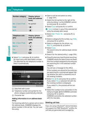
SelectionExplanation
Not Classi‐
fied
Standard entry for per-
sonal points of interest.
COMANDPersonal POIs which you
have imported via the
online function
(
Ypage 424).
CoffeeShopsSymbol and category that
you have created yourself
(
Ypage 342).
344Navigation
COMAND
Page 347 of 614

In the example, theCoffee Shopscategory
is selected.
The personal points of interest for this cate-
gory are shown.
XSelect a personal POI and press Wto con-
firm.
XTo rename a personal POI: selectRename
and press Wto confirm.
XTo change the category: selectChange
Categoryand press Wto confirm.
XTo change to the map: selectMapand
press Wto confirm.
The position of the personal point of inter-
est is shown in the map.
iA symbol is displayed according to the
"Displaying personal POIs on the map" set- ting (
Ypage 341).
XTo start route calculation: selectStart
and press Wto confirm.
If route guidance has been activated, a
prompt will appear asking whether you
wish to accept the personal point of inter-
est as the destination. If route guidance has not been activated,
route calculation for the personal point of
interest will start immediately.
XSelect
YesorNoand press Wto confirm.
If you select Yes
, the personal POI is accep-
ted as the destination.
If you select No
, the process will be can-
celed.
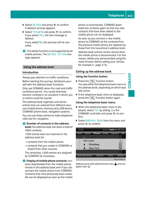
XTo make a call: selectCalland press Wto
confirm. COMAND switches to telephone
mode (
Ypage 390).
iCallis available if the personal POI has a
telephone number and a mobile phone is
connected to COMAND (
Ypage 383).
XTo delete a personal POI: selectDelete
and press Wto confirm.
A prompt appears asking whether you wish
to delete the point of interest.
XSelect YesorNoand press Wto confirm.
If you select Yes
, the personal POI is
deleted.
If you select No
, the process will be can-
celed.
Search & Send
Notes
iTo use Search & Send, your vehicle needs
to be equipped with mbrace, a navigation
system and a valid mbrace subscription.
Search & Send is a service assisting you in
entering destinations for the navigation sys-
tem. This mbrace service can send a destina- tion address directly from the Google Maps
®
website to the navigation system of your vehi-
cle.
Selecting and sending a destination
address
Please also refer to the notes about address
entry online: maps.google.com.
Navigation345
COMAND
Z
Page 348 of 614

XCallup the maps.google.com website and
enter the destination address inthe
addr ess entry field.
XClick the corresponding button to send the
destination address to the e-mail address
registered with mbrace.
XEnter the e-mail address you specified
when setting up your mbrace account into
the corresponding field in the "Send" dialog
window.
XClick "Se nd".
Calling up destination addresses
XPress the ïmbrace information button.
Downloading of the destination address to
the navigation system of your vehicle
begins.
iIf you have sent more than one destina-
tion addr ess to your vehicle's navigation
system, you willneed to call up the infor-
mation ind ividually for every address to be
down loaded.
XSelect Yeswhen the prompt for starting the
navigation system is shown. The window for starting the navigation system appears
(
Ypage 329).
XSe
lect Start.
or
XSe lect Noto store the downloaded desti-
nation inthe destination memory for later
use.
iThe destination addresses are downloa-
ded inthe same order as they are sent.
If you own several Mercedes-Benz vehicles
equipp ed with mbrace and a valid sub-
scriber account: each destination address
can bedownloaded byeach vehicle. This
requires each vehicle to beregistered with
an e-mail address inyour mbrace account.
Route guidance
Important notes
COMAND calculates the route to the destina-
tion without taking account of the following,
for example:
Rtraff iclights
Rstop and yield signs
Rmerging lanes
Rparking or stopping ina no parking /no
stopping zone
Rother road and traff icrules and regulations
Rnarrow bridges
COMAND may give differing navigation com-
man ds if the actual street/traff icsituation
does not correspond with the digital map's
data. For example, ifthe road layout or the
direction of a one-way street has been
changed.
For th isreason, you must always observe
road and traff icrules and regulations during
your journey. Road and traff icrules and reg-
ulations always have priority over the sys-
tem's driving recommendations.
Route guidance begins once a route has been
calculated (
Ypage 329).
COMAND guides you to your destination by
means of navigation announcements inthe
346Navigation
COMAND
Page 349 of 614

form of audible navigation announcements
and route guidance displays.
The route guidance displays can be seen if the
display is switched to navigation mode.
If you do not follow the navigation announce-
ments or if you leave the calculated route,
COMAND automatically calculates a new
route to the destination.
If the digital map contains the corresponding
information, the following applies:
Rduring route guidance, COMAND tries to
avoid roads with restricted access. Those
roads, for example, that are closed to
through-traffic.
Rroads that have time restrictions (e.g.
closed on Sundays and public holidays) areconsidered for route guidance on days
when they are open. For this purpose, the
relevant times must be correctly stored in
the database.
Displays during route guidance
Change of direction
Changes of direction have three phases:
Rpreparation phase
Rannouncement phase
Rchange-of-direction phase
Example: preparation phase
:
Next road
;Point at which the change of direction
takes place (light blue dot)
=Current vehicle position (the tip of the tri-angle indicates the vehicle’s direction of
travel)
?Current road
Display ?depends on the setting selected
for "Map information in the display"
(
Ypage 370).
COMAND prepares you for the upcoming
change of direction. Based on the example
display below, the change of direction is
announced by the Prepare to turn right
message. You see the full-screen map.
Example: announcement phase
:
Next road
;Change of direction (turn right here)
=Graphic representation of the distance to
the next change of direction
?Distance to the next change of direction
ARoute (highlighted in blue, shown in both
the left and right displays)
BPoint at which the change of direction
takes place (light blue dot, shown in both
the left and right displays)
iThe filled-in section of visual display for
distance =gets shorter the nearer you get
to the announced change of direction.
COMAND announces the imminent change of
direction. Based on the example display
below, the change of direction is announced
beforehand by the message: Please turn
right in 500 ft. and follow the
.
Navigation347
COMAND
Z
Page 350 of 614

The distance announced before the next
change of direction depends on the type of
road and its permissible maximum speed.
The display is now split into two sectors. In
the left half, you see the normal map view.
The right-hand half shows:
Ran enlarged section of the area around the
intersection (crossing zoom) or
Ra 3D image of the road's course with the
route indicating the next change of direc-
tion
Example: change-of-direction phase
:
Current vehicle position (the tip of the tri-
angle indicates the vehicle’s direction of
travel)
;Graphic representation of the distance to
the next change of direction
=Distance to the next change of direction
COMAND announces the imminent change of
direction.
Based on the example display below, the
change of direction is announced 150 ft
before the change of direction with the Now
turn rightmessage.
The display is split into two halves, as in the
announcement phase.
Once the change of direction is completed,
COMAND automatically switches back to full-
screen display. Example of a display without changes of
direction
:Route (highlighted in blue)
;Current vehicle position
=Current road
?Map orientation selected
AMap scale selected
Lane recommendations
Example: lane recommendations
:
Point of the next change of direction
;Point of the change of direction after next
=Next change of direction (in this case, turn
off to the right)
?Graphic representation of the distance to
the next change of direction
ADistance to the next change of direction
BPossible lane (light blue)
CRecommended lane (dark blue)
DLane not recommended (gray)
ECurrent vehicle position, the tip of the tri- angle indicating the vehicle’s direction of
travel
348Navigation
COMAND
Page 351 of 614

On multi-lane roads, COMAND can display
lane recommendations for the next change of
direction. The corresponding data must be
available in the digital map.
COMAND displays lane recommendationC
based on the next two changes of direction.
The number of lanes applies to the point at
which the next change of direction is
required.
iThe multifunction display also shows lane
recommendations.
Only the recommended lanes are displayed here, see the separate vehicle Operator's
Manual.
Display and description of lane recom-
mendations
LaneDay
modeNight
mode
Recommended lane
In this lane, you will
be able to complete
the next two
changes of direction
without changing
lanes.Dark
blueLight
blue
Possible lane
In this lane, you will
only be able to com-
plete the next
change of direction
without changing
lanes.Light
blueDark
blue
Lane not recom-
mended
In this lane, you will
not be able to com-
plete the next
change of direction
without changing
lanes.Light
brown or
light grayGray
iThe colors used in the lane recommenda-
tion display vary depending on whether day
or night mode is switched on.
HOV or carpool lanes
:HOV symbol on the road sign
;HOV symbol on the car pool lane
A route may be calculated taking the use of
HOV or carpool lanes into account. You can
use HOV or carpool lanes depending on the
number of persons in the vehicle as well as
the local and time limitation conditions.
iThis information is stored in the map data.
iYou can enter the number of people in the
vehicle (
Ypage 323). In this section, you
can also find more information on HOV or
carpool lanes.
If the system guides you to or from a carpool
lane, COMAND provides you with visual and
acoustic driving instructions.
Navigation announcements
Repeating navigation announcements
Navigation announcements are intended to
direct you while driving without diverting your
attention from the road and driving. Please
always use this feature instead of consulting
the map display for directions. The symbols or
the map display could distract you from traffic
conditions and driving.
If you have missed an announcement, you can
call up the current announcement at any
time.
Navigation349
COMAND
Z
Page 352 of 614

XTo show the menu:pressWthe COMAND
controller.
XSelect RPTin the navigation system menu
bar by turning cVdthe COMAND control-
ler and press Wto confirm.
Switching navigation announcements
on/off
XTo switch off: press the8button dur-
ing an announcement.
You will briefly see the message: The
driving instructions have been
muted.
XTo switch on:pressWthe COMAND con-
troller.
XSelect RPTin the navigation system menu
bar by turning cVdthe COMAND control-
ler and press Wto confirm.
iCOMAND automatically switches the nav-
igation announcements back on when:
Ryou have a new route calculated
Ryou switch COMAND on again or start the engine
Switching announcements and audio
fadeout on/off
XSelect Naviin the main function bar by
sliding ZVand turning cVdthe COMAND
controller and press Wto confirm.
XSelect Announcementsand press Wto
confirm.
A menu appears.
You can activate/deactivate the following
functions:
RAnnounce Street Names
Street names are announced during
route guidance.
RAudible Info During Phone Call
During a phone call, navigation
announcements and traffic reports are
audible in the background.
RAudio Fadeout
The volume of an active audio or video
source is automatically reduced during a navigation announcement.
RGas on Reserve
Once you have reached reserve fuel
level, you will see a prompt asking
whether you wish to start the search for a
gas station (
Ypage 336).
XSelect the function and press Wto confirm.
Switch the function on Oor off ª.
Setting the volume manually
XAdjust the volume using the qcontrol
knob during a navigation announcement.
or
XSelect RPTin the map view with the menu
shown and adjust the volume using the q
control knob.
Announce Street Names
If the function is switched on, the name of the
street which you are turning into is
announced.
Announcements are not made in the chosen
language in all countries. They are made when
relevant street names for the selected lan-
guage are available in the database.
XTo switch to navigation mode: press the
Ø button.
XTo show the menu: pressWthe COMAND
controller.
XSelect Naviin the main function bar by
sliding ZVthe COMAND controller and
press Wto confirm.
XSelect AnnounceStreetNamesand press
W to confirm.
The function is switched on Oor off ª,
depending on the previous status.
350Navigation
COMAND