Page 73 of 84
Navigation 83
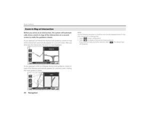
Other Functions
3
Select (quick POI selection).
4
Select the item that you want to edit.(Following procedure show how to change the category from
ATM to SUBARU dealership on Quick POI for example.)
5
Select (automotive).
6
Select (SUBARU dealership).
Page 74 of 84
84 NavigationOther Functions
ATM bookmarked as to Quick POI.
Selecting [Default] returns the Q-POI SELECTION items to their
default settings.
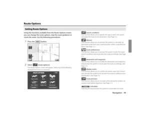
SUBARU dealership search■SUBARU dealership search from POI1
Press the button and select (point of inter-
est).
2
Press the (category).
3
Press the (automotive).
Page 75 of 84
Navigation 85
Other Functions
4
Select (SUBARU dealer-
ship) from the list.
NOTE
•Displayed information about a specific facility might not include recent
changes. It is recommended that you check the location or business days/
hours of a desired point of interest before departure.5
The system refine the destination search only for SUB-
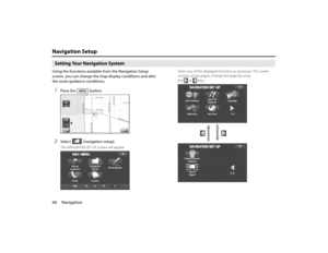
ARU dealership.■Displaying SUBARU dealership on map
1
Touch the current map screen.
2
Select (points of interest).
3
Select (list categories).If (SUBARU DEALER) has been registered
as a quick POI on the screen shown above, turn it on and then
proceed to step 6.
Page 76 of 84
86 NavigationOther Functions4
Select (automotive).
5
Select (SUBARU dealer-
ship) and press (show).The POI marker of SUBARU dealership will appear.
6
Select the SUBARU dealership marker by moving the
cross hair over it.
7
Select (info).
8
The information of SUBARU dealership will be displayed.
Page 77 of 84
Navigation 87
Version and InitializationVersionUse this function to check the version of the DVD-ROM disc
you are presently using.1
Press the button.
2
Select (version).
3
The version of the DVD-ROM disc will be displayed on
the screen.
Page 78 of 84
88 NavigationVersion and InitializationInitialization of the navigation settingsThe settings of the navigation system can be initialized. When
initialized, data such as memory points, travel history and
telephone numbers are all deleted. Data once deleted cannot
be restored.1
Press the button.
2
Select (version).
3
Select .
4
Select .
Page 79 of 84
Navigation 89Version and Initialization
5
Select .
6
The navigation system is restarted automatically.All of the settings are initialized.
Page 80 of 84

90 NavigationGeneral Information■Accuracy of vehicle positionArea in which GPS signals cannot be receivedBecause the radiowave signals from the GPS satellites travel primarily
by line of sight, the navigation system might not be able to receive
the signals in the areas described below.(If the GPS mark does not
appear on the map screen, it means that the GPS radiowave signals
are not being properly received.)
(1) Inside a tunnel
(2) Inside a building
(3) Under a three-dimensional road system such as for high speed
roads
(4) On boulevards lined with trees
(5) Between buildings
(6) Under a cliff or in a cave
•If the GPS antenna or its surroundings are blocked by an obstacle
(including cargo), it might not be possible for the system to
receive the GPS radiowave signals.
•If multiple paths are created due to the reflection from buildings,
a large measurement error could occur, causing the vehicle's
mark to deviate from its actual position.
Deviation of the vehicle's position markThe vehicle's position mark could deviate from its actual position
when the vehicle is being driven under the conditions listed below or
due to conditions of the GPS satellites.
If the vehicle travels on a road whose actual shape differs from that in
the map data, the vehicle's mark could deviate from the actual posi-tion. The correct position will eventually appear on the screen
through the correction function. If the screen does not show the cor-
rect position for an excessively long time, correct the current position
or make an automatic correction.
(1) The vehicle's mark could appear on a parallel road.
(2) When the road splits into a narrow Y, the vehicle's mark could
appear on the other fork of the Y.
(3) When the vehicle makes a right or left turn, the vehicle's mark
could appear on one street ahead or behind.
(4) If the vehicle is transported by means other than the vehicle's
own power, such as on a ferryboat, the vehicle's mark will
remain in the position it was before the transport until the sys-
tem can calculate the position through the GPS.
(5) When the vehicle is driven on a steep incline, the vehicle's mark
could deviate from its actual position.
(6) If there are continuous gradual curves in the same direction, the
vehicle's mark could deviate from its actual position.
(7) If the vehicle is driven in a zigzag pattern, such as through fre-
quent lane changes, the vehicle's mark could deviate from its
actual position.
(8) If the vehicle is placed on a turntable, such as in a parking area,
and turned with the ignition OFF, the vehicle's mark could devi-
ate from its actual orientation. The vehicle's mark could also
deviate even after the vehicle has exited the parking area.
(9) The vehicle's mark could deviate from its actual position if the
vehicle is driven using tire chains or snow tires on a snow-cov-
ered road or on a mountainous road.


.
4
Select the item that you want to edit.(Following procedure show how to change the category from
ATM to SUBARU dealership on Quick POI f")
![SUBARU FORESTER 2010 SH / 3.G Navigation Manual 84 NavigationOther Functions
ATM bookmarked as to Quick POI.
Selecting [Default] returns the Q-POI SELECTION items to their
default settings.
SUBARU dealership search■SUBARU dealership search from](/manual-img/17/7206/w960_7206-73.png "SUBARU FORESTER 2010 SH / 3.G Navigation Manual 84 NavigationOther Functions
ATM bookmarked as to Quick POI.
Selecting [Default] returns the Q-POI SELECTION items to their
default settings.
SUBARU dealership search■SUBARU dealership search from")
 from the list.
NOTE
•Displayed information about a specific facility might not include recent
changes. It is recommended that you check")
.
5
Select (SUBARU dealer-
ship) and press (show).The POI marker of SUBARU dealership will appear.
6
Select the SUBARU dealership marker by moving the")
.
3
The version of the DVD-ROM")

