Page 94 of 250
93
uu Entering a Destination u Previous Destination
Navigation
Previous Destination
H HOME u Navi u MENU u Previous Destination
Select an address from a list of your 50 most recent destinations to use as the
destinati
on. The list is displayed with the most recent destination at the top.
1.Select a destination from the list.
2. Set the route to your destination.
2 Calculating the Route P. 98
1 Previous Destination
If Previous Destination is grayed out, there are no
previous destinations entered.
Your home addresses and addresses stored in your
address book are not added to the list of previous
destinations.
You can delete unwanted prev ious destinations from
the list. 2 Previous Destination P. 36
Select Delete All to delete all previous destinations.
Page 95 of 250

94
uu Entering a Destination u Intersection
Navigation
Intersection
H HOME u Navi u MENU u More Search Methods u Intersection
Select the intersection of two streets as th e destination. The state
or province for
your current location is displayed at the left side of the screen (e.g., CALIFORNIA).
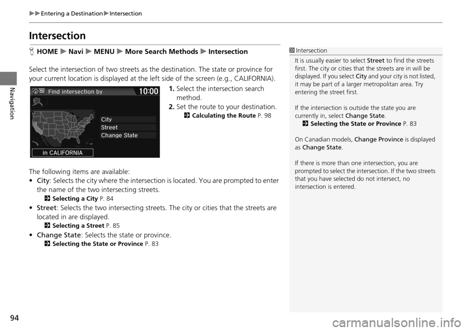
1.Select the intersection search
method
.
2. Set t he route to your destination.
2Calculating the Route P. 98
The following items are available:
• City : Se
lects the city where the intersection is located. You are prompted to enter
the name of the two in tersecting streets.
2Selecting a City P. 84
• Street : Selects the two intersecting streets. The city or cities that the streets are
located in are displayed.
2 Selecting a Street P. 85
• Change State : Selects the state or province.
2Selecting the State or Province P. 83
1 Intersection
It is usually easier to select Street to find the streets
first. The city or cities that the streets are in will be
displayed. If you select City and your city is not listed,
it may be part of a larg er metropolitan area. Try
entering the street first.
If the intersection is outside the state you are
currently in, select Change State.
2 Selecting the State or Province P. 83
On Canadian models, Change Province is displayed
as Change State .
If there is more than one intersection, you are
prompted to select the intersection. If the two streets
that you have selected do not intersect, no
intersection is entered.
Page 96 of 250
95
uu Entering a Destination u Coordinate
Navigation
Coordinate
H HOME u Navi u MENU u More Search Methods u Coordinate
Specify a location using latitude and longitude map coordinates. 1.Enter the latitude. Select
OK.
2. Enter the longitude. Select OK.
3. Scroll the map to position
the
cursor over your desired
destination, adjusting the map
scale as necessary.
u If the address is not the desire d
location, scroll to another
location and try again.
4. Select an icon fr om
the right side
of the screen to display the route
calculation menu.
2 Calculating the Route P. 98
5. Select Set as Destination .
1Coordinate
Latitude and longitude must be entered up to the
seconds’ value.
Place/landmark icons are displayed at 1/8 mile (200 m)
or less. Roads are displayed at 1/4 mile (400 m) or less.
If you select multiple icon s within the cursor radius,
you are prompted to select one of the items from a
list.
2 Selecting a Destination on the Map P. 121
Page 97 of 250
96
uu Entering a Destination u Map Input
Navigation
Map Input
H HOME u Navi u MENU u More Search Methods u Map Input
Scroll and select an icon on the map screen as the
destination.
You are prompted to define the map area to display.
1.Select an item.
The following item
s are available:
• Current Position : You
r current position is centered on the map.
• State : You are prompted to select
the state or province.
2Selecting the State or Province P. 83
• City : You are prompted to enter the city name.
2Selecting a City P. 84
Page 98 of 250
97
uu Entering a Destination u Map Input
Navigation
2. Scroll the map to position the
cursor over your desired
destination, adjusting the map
scale as necessary.
u If the address is not the desired
location, scroll the map to
another location and try again.
3. Select an icon fr om
the right side
of the screen to display the route
calculation menu.
2 Calculating the Route P. 98
4. Select Set as Destination .
1Map Input
Place/landmark icons are displayed at 1/8 mile (200 m)
or less. Roads are displayed at 1/4 mile (400 m) or less.
If you select multiple icon s within the cursor radius,
you are prompted to select one of the items from a
list.
2 Selecting a Destination on the Map P. 121
Page 99 of 250

98
Navigation
Calculating the Route
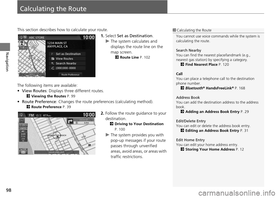
This section describes how to calculate your route.1.Select Set a
s Destination.
u The system calculates and
di
splays the route line on the
map screen.
2 Route Line P. 102
The following items are available:
• View Routes: Displays three different routes.
2 Viewing the Routes P. 99
• Route Preference : Changes the route preferences (calculating method).
2Route Preference P. 39
2. Follow the route guidance to your
destination.
2 Driving to Your Destination
P. 100
u The system provides you with
pop-up messages if your route
passes through unverified
areas, avoid areas, or areas with
traffic restrictions.
1Calculating the Route
You cannot use voice commands while the system is
calculating the route.
Search Nearby
You can find the nearest place/landmark (e.g.,
nearest gas station) by specifying a category. 2 Find Nearest Place P. 120
Call
You can place a telephone call to the destination
phone number.
2 Bluetooth ® HandsFreeLink ® P. 168
Address Book
You can add the destinati on address to the address
book. 2 Adding an Address Book Entry P. 29
Edit/Delete Entry
You can edit or delete the address book entry.
2 Editing an Address Book Entry P. 31
Edit Home Entry
You can edit your home address entry. 2 Storing Your Home Address P. 12
Page 100 of 250
99
uu Calculating the Route u Viewing the Routes
Navigation
Viewing the Routes
View three different routes to your destination.
1.Select a route on the list.
u The travel distance and
estimated t
ravel time is
displayed for each route.
u The syste m calculat
es and
displays the route line on the
map screen.
2 Route Line P. 102
2. Select OK.
1Viewing the Routes
It is not unusual for some ca lculated route options to
be identical.
Page 101 of 250

100
Navigation
Driving to Your Destination
This section describes how to follow the route guidance to your destination, receive
traffic information, and choose the icons displayed on the map screen.
Viewing the Route
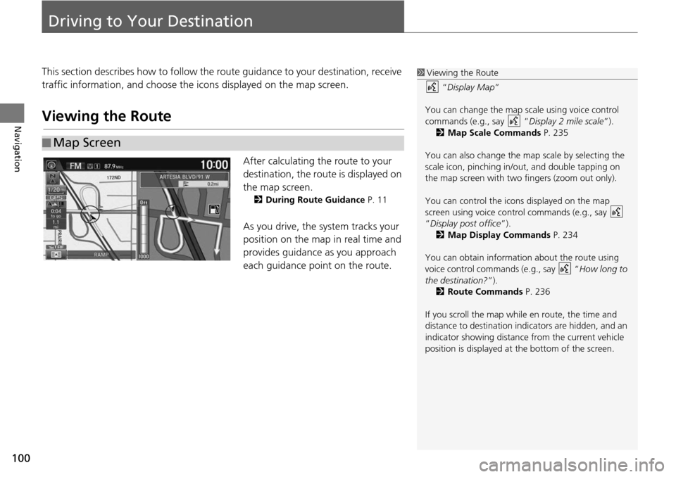
After calculating the route to your
destination, the route is displayed on
the map screen.
2During Route Guidance P. 11
As you drive, the system tracks your
position on the map in real time and
provides guidance as you approach
each guidance point on the route.
■Map Screen
1
Viewing the Route
“Display Map ”
You can change the map scale using voice control
commands (e.g., say “ Display 2 mile scale”).
2 Map Scale Commands P. 235
You can also change the ma p scale by selecting the
scale icon, pinching in/out, and double tapping on
the map screen with two fingers (zoom out only).
You can control the icons displayed on the map
screen using voice control commands (e.g., say
“Display post office ”).
2 Map Display Commands P. 234
You can obtain information about the route using
voice control commands (e.g., say “ How long to
the destination?”). 2 Route Commands P. 236
If you scroll the map whil e en route, the time and
distance to destination indi cators are hidden, and an
indicator showing distance from the current vehicle
position is displayed at the bottom of the screen.