Page 119 of 252
118
Map Menu
Weather Information
Navigation
HENTER button (on map)
Weather Info.
Radar Map
View a weather radar image map di
splaying rain and snow systems.
Scroll the map to view weather information, adjust
ing the map scale
as necessary.
■Radar Map
1Radar MapYou can change the map scale to 50, 150, or 350 miles. Moving the cursor does not
display the detailed
information.A visual guide helps y
ou see a weather radar
image map. 2AcuraLink Real-Time Weather™
P. 15
QRG
Page 120 of 252

119
Map Menu
Traffic Rerouting™
Traffic Rerouting™When driving to your destination, the sy
stem automatically searches for a faster
route based on traffic flow information and traffic incidents. 2AcuraLink Real-Time Traffic™
P. 15
2Traffic Rerouting
P. 52
HENTER button (on map)
Traffic Incidents
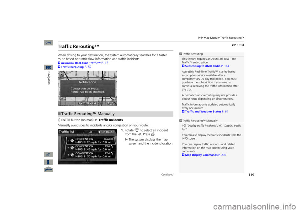
Manually avoid specific incidents and/or congestion on your route:
1.Rotate
i
to select an incident
from the list. Press
u
.
The system displays the map screen and the incident location.
1Traffic ReroutingThis feature requires an AcuraLink Real-Time Traffic™ subscription. 2Subscribing to XM® Radio
P. 144
AcuraLink Real-Time Traffic™ is a fee-based subscription service available after a complimentary 90-day tr
ial period. You must
purchase the subscription if you want to continue receiving the traffic information after the trial. Automatic traffic rerout
ing may not provide a
detour route dependi
ng on circumstances.
Traffic information is
updated automatically
every one minute. 2Traffic and Weather Status
P. 64
■Traffic Rerouting™ Manually
1Traffic Rerouting™ Manuallyd
“Display traffic incidents”
, d
“Display traffic
list” You can also display the tr
affic incidents from the
INFO screen.You can display traffic
incidents and related
information on the map screen using voice commands. 2Map Display Commands
P. 236
Continued
QRG
Navigation
Page 121 of 252
120
Map Menu
Traffic Rerouting™
Navigation
2.Press
u
to select
TRAFFIC
DETAIL
.
3.Rotate
i
to select
Avoid
.
Repeat step 1 to 3 as necessary.
4.Move
r to select
REROUTE
.
The system recalculates a detour route that avoids the traffic incidents.
1Traffic Rerouting™ ManuallyYou can choose to avoid up to 10 traffic incidents. It is not alwa
ys possible for the system
to calculate a route that avoids all traffic incidents or specific traf
fic incidents you select.
The “On Route” tab on the Traffic List screen is only available duri
ng route guidance.
You cannot select an inci
dent to avoid from the
“All” tab. You can also detour ar
ound a traffic incident
manually if you encounter an unexpected obstacle or do not have
an AcuraLink Real-Time
Traffic™ subscription. 2Taking a Detour
P. 122
QRG
Press
u
.
Page 122 of 252

121
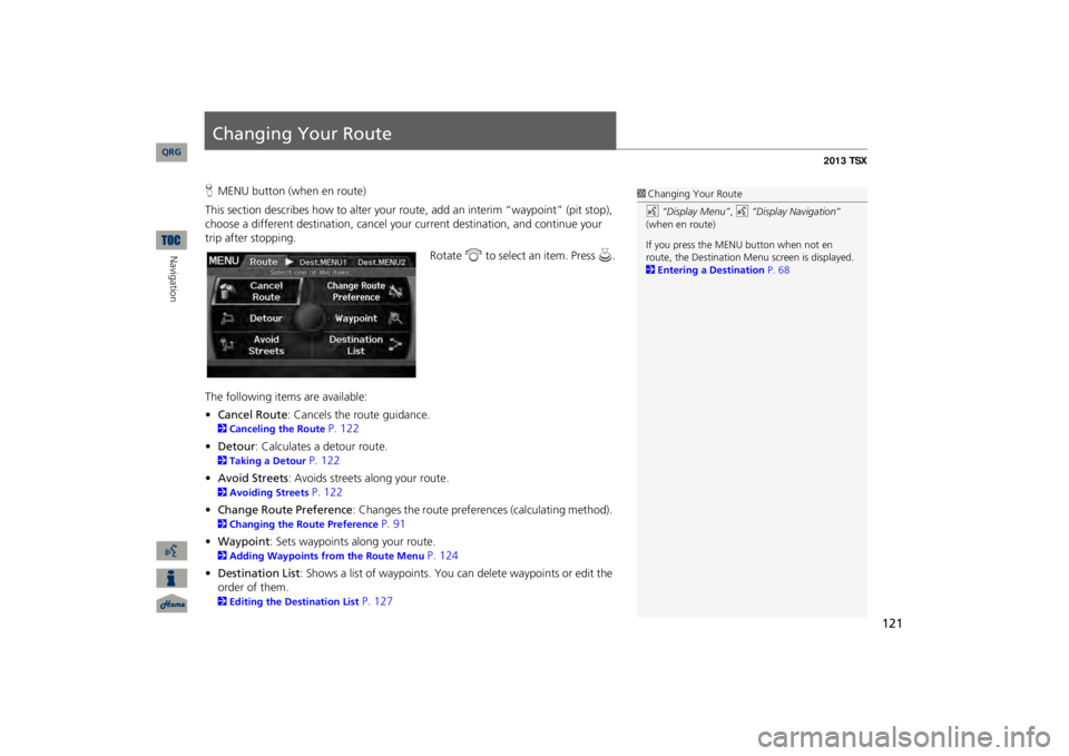
Changing Your RouteHMENU button (when en route)This section describes how to alter your r
oute, add an interim “waypoint” (pit stop),
choose a different destination, cancel your
current destination, and continue your
trip after stopping.
Rotate
i
to select an item. Press
u
.
The following items are available: •Cancel Route
: Cancels the route guidance.
2Canceling the Route
P. 122
•Detour
: Calculates a detour route.
2Taking a Detour
P. 122
•Avoid Streets
: Avoids streets along your route.
2Avoiding Streets
P. 122
•Change Route Preference
: Changes the route preferences (calculating method).
2Changing the Route Preference
P. 91
•Waypoint
: Sets waypoints along your route.
2Adding Waypoints from the Route Menu
P. 124
•Destination List
: Shows a list of waypoints. You
can delete waypoints or edit the
order of them. 2Editing the Destination List
P. 127
1Changing Your Routed
“Display Menu”
, d
“Display Navigation”
(when en route) If you press the MENU button when not en route, the Destination Me
nu screen is displayed.
2Entering a Destination
P. 68
QRG
Navigation
Page 123 of 252

122
Changing Your Route
Canceling the Route
Navigation
Canceling the RouteHMENU button (when en route)
Cancel Route
Cancel the route guidance and remove th
e destination and all waypoints from the
destination list. The system th
en returns to the map screen.
Taking a DetourHMENU button (when en route)
Detour
Calculate a detour route manu
ally. The system attempts to calculate a new route by
avoiding the next 5 miles (while on a freeway
) or 1 mile (while on a surface street).
Avoiding StreetsHMENU button (when en route)
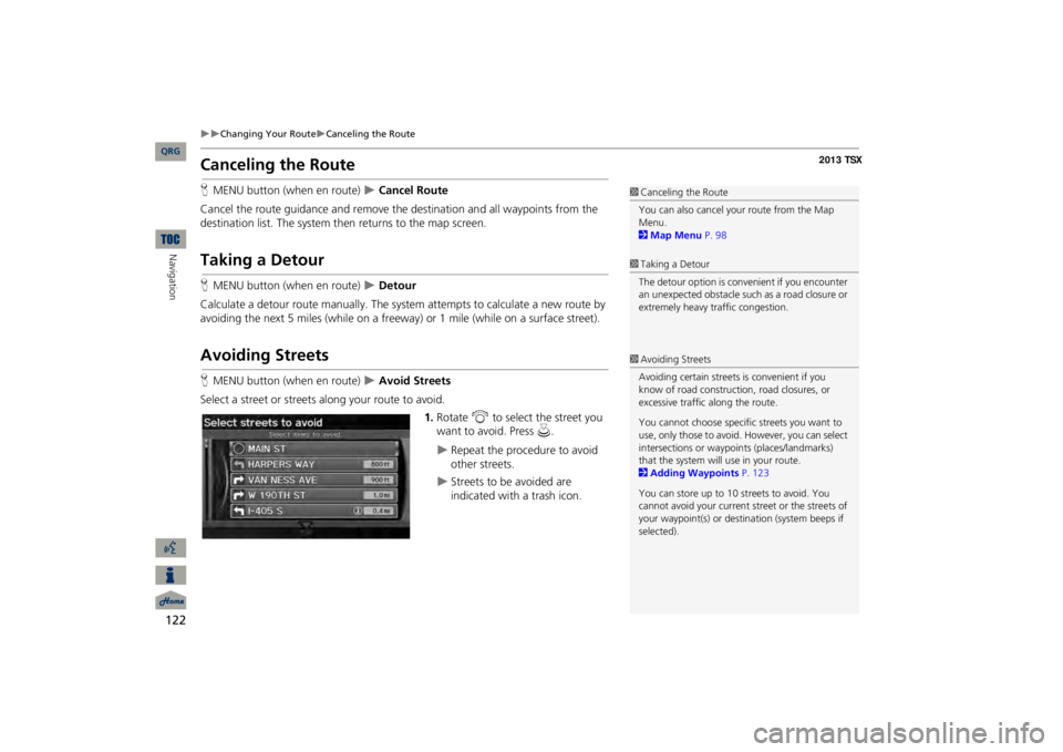
Avoid Streets
Select a street or streets
along your route to avoid.
1.Rotate
i
to select the street you
want to avoid. Press
u
.
Repeat the procedure to avoid other streets.
Streets to be avoided are indicated with a trash icon.
1Canceling the RouteYou can also cancel your route from the Map Menu. 2Map Menu
P. 98
1Taking a DetourThe detour option is conv
enient if you encounter
an unexpected obstacle such as a road closure or extremely heavy tr
affic congestion.
1Avoiding StreetsAvoiding certain streets
is convenient if you
know of road construction, road closures, or excessive traffic
along the route.
You cannot choose specific streets you want to use, only those to avoid.
However, you can select
intersections or waypoi
nts (places/landmarks)
that the system will use in your route.2Adding Waypoints
P. 123
You can store up to 10 streets to avoid. You cannot avoid your current st
reet or the streets of
your waypoint(s) or dest
ination (system beeps if
selected).
QRG
Page 124 of 252
123
Changing Your Route
Adding Waypoints
2.Move
r to select
OK
.
The system calculates a
Adding WaypointsAdd up to four waypoints (pit stops) along the route to your destination.
Waypoints are displayed on the map screen as small, numbered red flags. The route follows
the waypoints in
the order they are listed in the Destination List.
1Adding WaypointsWaypoints allow you to stop for gas or food, for example, and then continue on to your destination. Press the MAP/GUIDE button to return to the map screen without adding a waypoint at any time. The search corridor used
for adding waypoints
can be adjusted. 2Edit Waypoint Search Area
P. 55
You can delete waypoints
or edit the order of
waypoints in the destination list. 2Editing the Destination List
P. 127
QRG
Navigation
new route.
Page 125 of 252
124
Changing Your Route
Adding Waypoints
Navigation
HMENU button (when en route)
Waypoint
1.Rotate
i
to select a search
method and location to add a waypoint. Press
u
.
The following options are available: •SEARCH AROUND:
Searches in a spiral pattern around the location you select.
•SEARCH ALONG
: Searches within a “corridor” on either side of the locations
you select.
2.Rotate
i
to select a waypoint
category (e.g.,
GAS STATION
).
Press
u
.
■Adding Waypoints from the Route Menu
1Adding WaypointsSearch method
“Search around” method“Search along” method
QRG
Page 126 of 252
125
Changing Your Route
Adding Waypoints
3.Rotate
i
to select a place.
The waypoint is added to the Destination List.
4.Move
r to select
OK
.
The route is automatically recalculated and displayed on the map screen.
QRG
Navigation
Press
u
.