Page 1 of 174
Thank you for purchasing an NISSAN automo-
bile. This user’s manual is for the navigation
system only . This manual contains operating
instructions for the NISSAN Navigation System
offered in the NISSAN 350Z.
Please read this manual carefully to ensure safe
operation of the navigation system.
�Please read your vehicle’s owner’s manual
first.
�Do not remove this manual from the vehicle
when selling this vehicle. The next user of
this navigation system may need the
manual.
�Because of possible specification changes,
sections of this manual may not apply to
your vehicle.
�All information, specifications and illustra-
tions in this manual are those in effect at the
time of printing. NISSAN reserves the right
to change specifications or design at any
time without notice.
Page 6 of 174
HOW TO USE THIS
MANU AL
This manual uses special words and icons, or-
ganized by function. Please refer to the follow-
ing items and familiarize yourself with them.
FOR SAFE OPERATION
WARNING
This is used to indicate the presence
of a hazard that could cause death or
serious personal injury . T o avoid or
reduce the risk, the procedures must
be followed precisely .
CAUTION
This is used to indicate the presence
of a hazard that could cause minor or
moderate personal injury or damage
to your vehicle. T o avoid or reduce
the risk, the procedures must be fol-
lowed carefully .
NOTE:
This indicates an item to help you under-
stand the maximum performance of your
vehicle. If ignored, it may lead to a mal-
function or poor performance.
REFERENCE SYMBOLS
INFO:
This indicates information necessary for effi-
cient use of your vehicle or accessories.DESTbutton
This is a button on the control panel.
Viewkey
This is a select key on the screen. By se-
lecting this key you can proceed to the
next function.
SAFETY NOTE
This system is primarily designed to help you
reach your destination, and also performs other
functions as outlined in this manual. However ,
you, the driver , must use the system safely and
properly . Information concerning road condi-
tions, traffic signs and the availability of ser-
vices may not always be up-to-date.The sys-
tem is not a substitute for safe, proper ,
and legal driving.
Before using the navigation system, please
read the following safety information. Always
use the system as outlined in this manual.
INTRODUCTION
1-2
Page 7 of 174
WARNING
�When the driver operates the navi-
gation system or uses the joystick
(screen function), first park the ve-
hicle in a safe place and set the
parking brake. Using the system
while driving can distract the
driver and may result in a serious
accident. Destinations cannot be
set while the vehicle is in motion.
�Do not rely on voice guidance
alone. Always be sure that all driv-
ing maneuvers may be made le-
gally and safely to avoid an acci-
dent.
�Do not disassemble or modify this
system. If you do, it may result inaccidents, fire, or electrical
shock.
�Do not use this system if you no-
tice any malfunction such as a fro-
zen screen or lack of sound. Con-
tinued use of the system may re-
sult in accidents, fire, or electrical
shock.
�If you notice any foreign object in
the system hardware or spilled
liquid, or notice smoke or a smell
coming from it, stop using the sys-
tem immediately and contact your
nearest NISSAN dealer . Ignoring
such conditions may lead to acci-
dents, fire, or electrical shock.
NOTE:
Some states/provinces may have laws
limiting the use of video screens whiledriving. Use this system only where le-
gal.
LASER PRODUCT
This navigation system is certified as a Class
I laser product.
The navigation system complies with DHHS
Laser-Radiator Standards, 21 CFR Chapter 1
subchapter J.
INTRODUCTION
1-3
Page 9 of 174
2 HOW DOES THE NISSAN NAVIGATION SYSTEM WORK?
Wha t is a naviga tion system?..................... 2-2
About the naviga tion system ................ 2-2
Wha t is GPS (Global Positioning
System)? .................................................... 2-2
Accuracy of positioning.......................... 2-2
Positioning adjustment........................... 2-3
Receiving signals from GPS sa tellites ... 2-3
Displa y of GPS informa tion ................... 2-3
Det ailed map coverage areas (MCA) for the
naviga tion system ....................................... 2-4
When a gra y road is displa yed on the
map ....................................................... 2-4
Page 10 of 174
WHA T IS A NA VIGA TION
SYSTEM?
ABOUT THE NAVIGATION SYS-
TEM
This navigation system combines the data ob-
tained from the vehicle (by gyro sensor) and
from GPS (Global Positioning System) satel-
lites to calculate the current location of the ve-
hicle. This position is then displayed on the
screen, allowing route guidance to a destina-
tion.
WHA T IS GPS (GLOBAL PO-
SITIONING SYSTEM)?
GPS is a system developed and operated by the
U.S. Government, covering the entire planet.
This navigation system receives three or more
different radio signals from NAVST AR (GPS
satellites), orbiting the earth 13,049 miles
(21,000 km) above ground. The data from dif-
ferent sets of signals will be trigonometrically
calculated to obtain the position of the vehicle.INFO:
The tracking center in the U.S. controls signals
transmitted from GPS satellites. This control
sometimes results in reduced accuracy or no
signal received at all in accordance with gov-
ernment requirements.
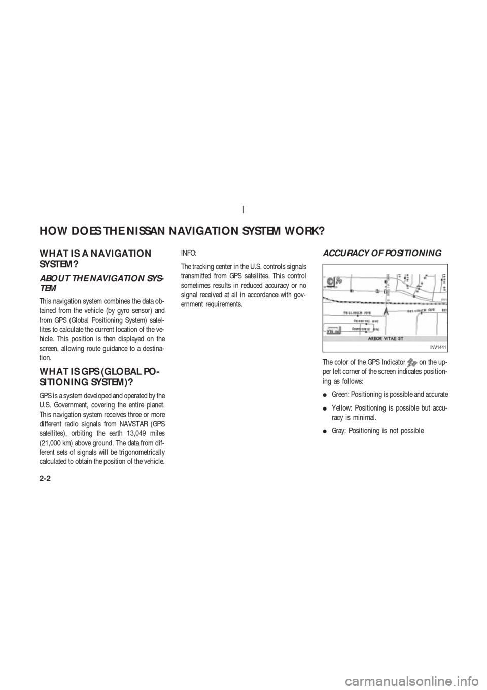
ACCURACY OF POSITIONING
The color of the GPS Indicatoron the up-
per left corner of the screen indicates position-
ing as follows:
�Green: Positioning is possible and accurate
�Y ellow: Positioning is possible but accu-
racy is minimal.
�Gray: Positioning is not possible
INV1441
HOW DOES THE NISSAN NAVIGATION SYSTEM WORK?
2-2
Page 11 of 174
INFO:
For approximately 3 or 4 minutes after system
startup, the GPS indicator
remains gray ,
even if accurate positioning is possible.
POSITIONING ADJUSTMENT
When the system judges that the vehicle po-
sition information is not accurate based on ve-
hicle speed and gyro sensor data calculations,
the system will adjust the vehicle position in-
formation using GPS signals.
RECEIVING SIGNALS FROM
GPS SATELLITES
Sometimes, satellite reception is weak. The fol-
lowing are places where signals tend to be
weak:
�Inside tunnels and parking lots in structures
�Areas with numerous tall buildings
�Under multi-layered highways
�In a dense forestVehicles in these areas may not receive GPS
signals (Indicator color: gray).
INFO:
The antenna for GPS is located in the instru-
ment panel.Do not place any objects, es-
pecially mobile phones or transceivers,
on the instrument panel. Because the
strength of the GPS signal is approximately
one billionth of that of TV waves, phones and
transceivers will decrease the strength or may
totally disrupt the signals.
DISPLAY OF GPS INFORMA-
TION
This system displays GPS information.
Please refer to “GPS information display” on
page 11-13.NOTE:
Directional guidance provided by the
navigation system does not take carpool
lane driving into consideration, espe-
cially when carpool lanes are separated
from other road lanes.
HOW DOES THE NISSAN NAVIGATION SYSTEM WORK?
2-3
Page 12 of 174
DET AILED MAP CO VERAGE
AREAS (MCA) FOR THE
NA VIGA TION SYSTEM
This system is designed to help you reach your
destination, and also performs other functions
as outlined in this manual. However , you, the
driver , must use the system safely and prop-
erly . Information concerning road conditions,
traffic signs and the availability of services may
not always be up-to-date. The system is not a
substitute for safe, proper , and legal driving.
Map data covers select metropolitan areas in
the United States.
Map data is available on map DVD-ROM. For
information about map DVD-ROMs, contact a
NISSAN dealer or call the NISSAN Navigation
System help desk at 1-800-NISSAN-1 (1-800-
647-7261) for U.S., and at 1-800-777-0325 for
CANADA.
Map data includes 2 types of areas: “Detailed
coverage areas” providing all detailed roaddata and other areas showing “Main roads
only”.
NOTE:
Detailed map data is not available in
many areas and is generally limited to
select major metropolitan areas.
For information on which metropolitan areas
are in detailed coverage areas, please refer to
the NISSAN Navigation System Software Book-
let (included). When you purchase an updated
map DVD-ROM, a new software booklet will be
provided.
WHEN A GRAY ROAD IS DIS-
PLAYED ON THE MAP
�Route calculation may not be possible when
a destination or the current vehicle location
is near a gray road.
�When setting a destination, the road near
the cross cursor blinks. For gray roads,
however , the road may not blink.�When you are driving on a gray road after
the vehicle has deviated from the suggested
route during route guidance, automatic re-
routing may not start immediately .
�Route guidance (enlarged view and voice
guidance) may not be done at the intersec-
tion where the road your vehicle is driving
on and a gray road intersect.
�POI information and street names near gray
roads are not contained in the map data.
HOW DOES THE NISSAN NAVIGATION SYSTEM WORK?
2-4
Page 13 of 174
3 WHAT FEATURES ARE AVAILABLE ON THE NISSAN
NAVIGATION SYSTEM?
Route guidance ............................................ 3-2
Point of interest (POI) directory ................ 3-2
Address book............................................... 3-2
Avoid area .................................................... 3-2
Automa tic re-route ...................................... 3-3
Detour .......................................................... 3-3
Birdview
TM................................................... 3-3
Voice guidance ............................................ 3-3
Short menus ................................................ 3-4