Page 65 of 116
GMC Infotainment System (U.S./Canada 2.6) (GMNA-Localizing-U.S./Canada-
13583174) - 2020 - CRC - 4/15/19
64 Navigation
Enter the POI information into the
text file in the following format:
.Longitude coordinate, Latitude
coordinate, “Name of POI,”
“Additional information,” “Phone
number.”
Example: 7.0350000,
50.6318040, “Michaels Home,”
“123 Maple Lane,”
“02379234567.”
. The GPS coordinates must be
expressed in decimal degrees
and can be taken from a
geographical map. The
additional information and phone
number strings are optional.
. The POI name and the
additional information string may
not exceed 60 characters.
. POI information for each
destination address must be
entered in a single separate line.
Storing the POI on a USB Device
In the root directory of a USB
device, create a folder name
“myPOIs.” For example, “F:\”is the
root directory of the USB device. In the
“myPOIs” folder, store the text
file with your POIs, for example,
“F:\myPOIs\TomsPOIs.csv.”
Downloading the POI to the
Infotainment System
Connect the USB device containing
the POI information to the USB port
of the infotainment system.
A message displays prompting
whether or not to download the POI
information from the USB device. All
POIs found are saved even if they
are in multiple folders.
Subfolders can also be created to
organize the POIs into categories,
for example, “F:\myPOIs
\Restaurants\TomsPOIs.csv.”
If the message is dismissed or
ignored, no POI information is
downloaded. This prompt will not
reoccur for the current ignition cycle.
When the system is finished
downloading, a pop-up displays
asking to specify a category for the
new POIs, if desired. Importing and Overwriting
Categories
When POIs are found on a media
device, the date of the file is
examined and compared to the date
for the files already in the system.
If the file being downloaded is
newer than the one in the system,
that particular category of POIs is
overwritten. Any other POIs that had
previously been saved in other
categories are not affected.
Address Book Download
If an Address Book is found on the
connected USB device, the same
alert is used to indicate that
locations have been found and they
can be downloaded. If there is
already content in the vehicle
Address Book, the system prompts
if the stored content should be
overwritten. Touch Save to overwrite
the existing Address Book
information. Touch Cancel to abort
the import of information.
Page 66 of 116
GMC Infotainment System (U.S./Canada 2.6) (GMNA-Localizing-U.S./Canada-
13583174) - 2020 - CRC - 4/15/19
Navigation 65
Browsing Downloaded POIs
Access the downloaded POIs by
selecting the My POIs list item in the
POIs list.
Editing My POIs
Downloaded POIs can be edited at
a category level. These POIs can
either be deleted as an entire
category or reassigned as another
category. To edit the categories:
.Touch the edit icon at the main
category view to edit the POIs.
The edit icon will display next to
each category name. There is
no POI browsing in this mode;
only edit functions are available.
. Once an action such as deleting
or reassigning has been
selected, the changes are saved
immediately. Changing POI Categories
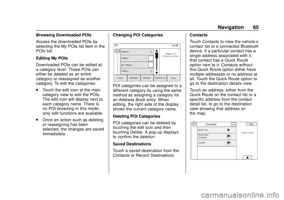
POI categories can be assigned to a
different category by using the same
method as assigning a category for
an Address Book entry. When
editing, the right side of the display
shows the current category name.
Deleting POI Categories
POI categories can be deleted by
touching the edit icon and then
touching Delete. A pop-up displays
to confirm the deletion.
Saved Destinations
Touch a saved destination from the
Contacts or Recent Destinations. Contacts
Touch Contacts to view the vehicle’
s
contact list or a connected Bluetooth
device. If a particular contact has a
single address associated with it,
that contact has a Quick Route
option next to it. Contacts without
this Quick Route option either have
multiple addresses or no address at
all. Touch the Quick Route option to
go to the destination details view.
Touch an address, either from the
Quick Route on the contact list or a
specific address from the contact
detail list, to go to the destination
view showing that address on
the map.
Page 67 of 116
GMC Infotainment System (U.S./Canada 2.6) (GMNA-Localizing-U.S./Canada-
13583174) - 2020 - CRC - 4/15/19
66 Navigation
Trips from Contacts can be saved
and recalled. The order is based on
when the trip was last used. When
the trips are saved, they are given a
default title of the final destination
name. If there are no saved trips,
this list item is hidden.
Adding a New Contact
When creating a new contact, the
navigation system automatically
saves all data from the selected
location into a new contact.
The information saved will store as:
.Location Name saved as
First Name
. Phone Number saved as Work
. Address saved as Work
. POI Information saved as Notes
. Category saved in Category
Field
After touching Create New Contact,
the newly created contact is then
displayed. Favorite Destinations
.
Destinations can be saved as
Favorites for recall later.
Depending on the favorite, when
an address or POI favorite is
recalled, the Destination Details
view is shown.
. When a favorite address is being
routed, it is shown active. Touch
on the active favorite to suspend
that route.
. Save locations as Favorites for
recall later in the Destination
Details view.
. Save trips from the
Address Book.
Storing Favorites from the Contact
Details List
A contact name or any of the
contact’ s information such as phone
number, e-mail address, or address
from Contact Details can be stored
as a Favorite.
. Drag
lup to display the
Favorites. .
Touch a preset to store a favorite
contact on the Contact Details
List. The contact name and all
contact information can be
saved.
. Touch and hold to store as a
favorite. The favorite label will be
the name of the contact.
. Touch the saved favorite to
display the destination view.
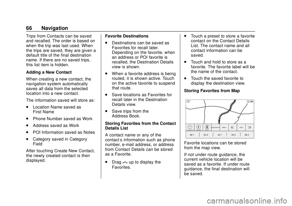
Storing Favorites from Map
Favorite locations can be stored
from the map view.
If not under route guidance, the
current vehicle location will be
saved as a favorite. If under route
guidance, the final destination will
be saved.
Page 68 of 116
GMC Infotainment System (U.S./Canada 2.6) (GMNA-Localizing-U.S./Canada-
13583174) - 2020 - CRC - 4/15/19
Navigation 67
Draglup to display the Favorites.
Touch and hold a preset to store a
favorite location from the map view.
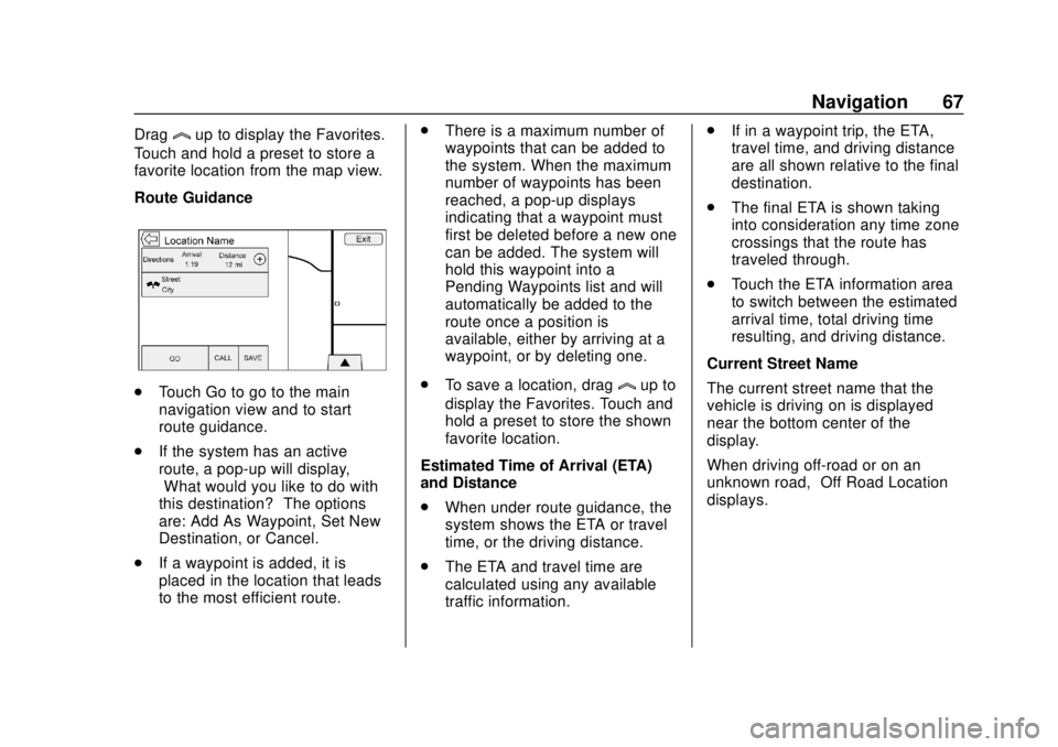
Route Guidance
. Touch Go to go to the main
navigation view and to start
route guidance.
. If the system has an active
route, a pop-up will display,
“What would you like to do with
this destination?” The options
are: Add As Waypoint, Set New
Destination, or Cancel.
. If a waypoint is added, it is
placed in the location that leads
to the most efficient route. .
There is a maximum number of
waypoints that can be added to
the system. When the maximum
number of waypoints has been
reached, a pop-up displays
indicating that a waypoint must
first be deleted before a new one
can be added. The system will
hold this waypoint into a
Pending Waypoints list and will
automatically be added to the
route once a position is
available, either by arriving at a
waypoint, or by deleting one.
. To save a location, draglup to
display the Favorites. Touch and
hold a preset to store the shown
favorite location.
Estimated Time of Arrival (ETA)
and Distance
. When under route guidance, the
system shows the ETA or travel
time, or the driving distance.
. The ETA and travel time are
calculated using any available
traffic information. .
If in a waypoint trip, the ETA,
travel time, and driving distance
are all shown relative to the final
destination.
. The final ETA is shown taking
into consideration any time zone
crossings that the route has
traveled through.
. Touch the ETA information area
to switch between the estimated
arrival time, total driving time
resulting, and driving distance.
Current Street Name
The current street name that the
vehicle is driving on is displayed
near the bottom center of the
display.
When driving off-road or on an
unknown road, “Off Road Location”
displays.
Page 69 of 116
GMC Infotainment System (U.S./Canada 2.6) (GMNA-Localizing-U.S./Canada-
13583174) - 2020 - CRC - 4/15/19
68 Navigation
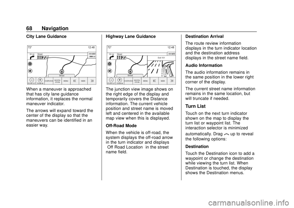
City Lane Guidance
When a maneuver is approached
that has city lane guidance
information, it replaces the normal
maneuver indicator.
The arrows will expand toward the
center of the display so that the
maneuvers can be identified in an
easier way.Highway Lane GuidanceThe junction view image shows on
the right edge of the display and
temporarily covers the Distance
information. The current vehicle
position and street name is moved
left and centered in the available
map view when this is displayed.
Off-Road Mode
When the vehicle is off-road, the
system displays the off-road arrow
in the turn indicator and displays
“Off Road Location”
in the street
name field. Destination Arrival
The route review information
displays in the turn indicator location
and the destination address
displays in the street name field.
Audio Information
The audio information remains in
the same position in the lower right
corner of the display.
The current street name information
remains in the same location, but
will truncate if needed.
Turn List
Touch on the next turn indicator
shown on the map to display the
turn list or waypoint list. The
interaction selector is minimized
automatically. Drag
lup to reveal
the following options:
Destination
Touch the Destination icon to add a
waypoint or change the destination
while viewing the turn list. When
Destination is touched, the display
shows the Destination menus.
Page 70 of 116
GMC Infotainment System (U.S./Canada 2.6) (GMNA-Localizing-U.S./Canada-
13583174) - 2020 - CRC - 4/15/19
Navigation 69
End Guidance
Touch End Guidance to suspend the
current route in the turn list. When
End Guidance is touched, the turn
list is exited, and the display returns
to the main map view.
Avoid Areas
Touch Avoid Areas to select the
highway name that is to be avoided.
The system shows a pop-up asking
how many miles or if the entire road
should be avoided.
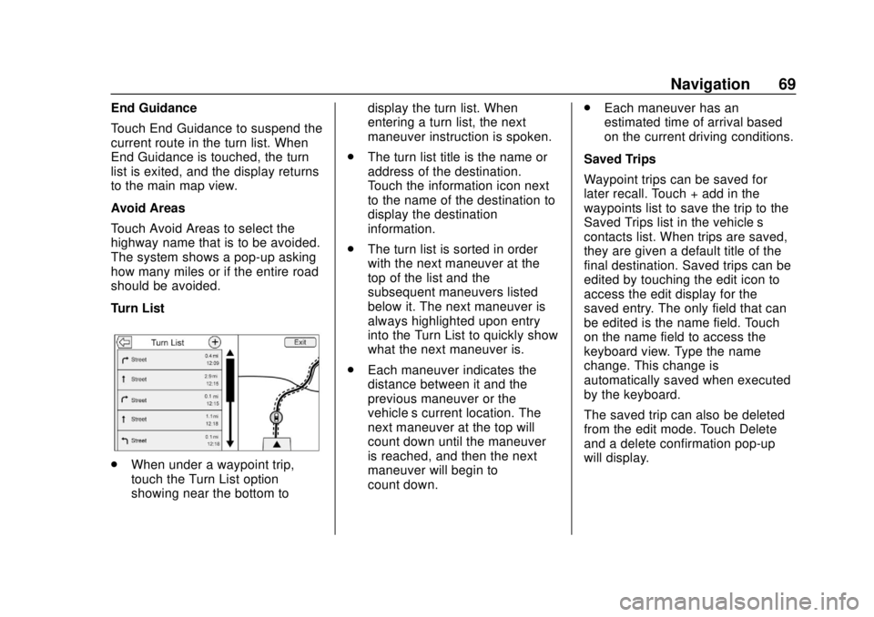
Turn List
.When under a waypoint trip,
touch the Turn List option
showing near the bottom to display the turn list. When
entering a turn list, the next
maneuver instruction is spoken.
. The turn list title is the name or
address of the destination.
Touch the information icon next
to the name of the destination to
display the destination
information.
. The turn list is sorted in order
with the next maneuver at the
top of the list and the
subsequent maneuvers listed
below it. The next maneuver is
always highlighted upon entry
into the Turn List to quickly show
what the next maneuver is.
. Each maneuver indicates the
distance between it and the
previous maneuver or the
vehicle’s current location. The
next maneuver at the top will
count down until the maneuver
is reached, and then the next
maneuver will begin to
count down. .
Each maneuver has an
estimated time of arrival based
on the current driving conditions.
Saved Trips
Waypoint trips can be saved for
later recall. Touch + add in the
waypoints list to save the trip to the
Saved Trips list in the vehicle’ s
contacts list. When trips are saved,
they are given a default title of the
final destination. Saved trips can be
edited by touching the edit icon to
access the edit display for the
saved entry. The only field that can
be edited is the name field. Touch
on the name field to access the
keyboard view. Type the name
change. This change is
automatically saved when executed
by the keyboard.
The saved trip can also be deleted
from the edit mode. Touch Delete
and a delete confirmation pop-up
will display.
Page 71 of 116
GMC Infotainment System (U.S./Canada 2.6) (GMNA-Localizing-U.S./Canada-
13583174) - 2020 - CRC - 4/15/19
70 Navigation
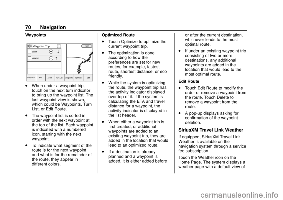
Waypoints
.When under a waypoint trip,
touch on the next turn indicator
to bring up the waypoint list. The
last waypoint view is shown,
which could be Waypoints, Turn
List, or Edit Route.
. The waypoint list is sorted in
order with the next waypoint at
the top of the list. Each waypoint
is indicated with a numbered
icon, starting with the next
waypoint.
. To indicate what segment of the
route is for the next waypoint,
and what is for the remainder of
the route, they appear in
different colors. Optimized Route
.
Touch Optimize to optimize the
current waypoint trip.
. The optimization is done
according to how the
preferences are set for new
routes, for example, fastest
route, shortest distance, or eco
friendly.
. While the system is optimizing
the route, the waypoint trip has
the activity indicator displayed
over top of it. If the system is
calculating the ETA and travel
distance for a waypoint, the
activity indicator is displayed in
the list header.
. When either a waypoint trip is
first created, or additional
waypoints are added to an
existing waypoint trip, they are
added in the location that would
lead to an optimized route.
. If a destination is already
planned and a waypoint is
added, it is either added before or after the current destination,
whichever leads to the most
optimal route.
. If under an existing waypoint trip
consisting of two or more
destinations, any additional
waypoints are added in the
location that would lead to the
most optimal route.
Edit Route
. Touch Edit Route to modify the
order or remove a waypoint from
the route. Touch Delete to
remove a waypoint from the
route.
. A pop-up displays asking for
confirmation of the waypoint
deletion.
SiriusXM Travel Link Weather
If equipped, SiriusXM Travel Link
Weather is available on the
navigation system through a service
fee subscription.
Touch the Weather icon on the
Home Page. The system displays a
weather page with a default view of
Page 72 of 116
GMC Infotainment System (U.S./Canada 2.6) (GMNA-Localizing-U.S./Canada-
13583174) - 2020 - CRC - 4/15/19
Navigation 71
the hourly forecast. The other
available views appear near the
bottom of the display.
These weather option displays are:
.Hourly: The Hourly Forecast
view shows the current day’s
forecast split into 3-hour
increments.
. 5-day: The 5-day view shows
the current day’s forecast as well
as the next four days.
. On Route: The On Route view
shows the forecasted weather
for the route. This feature is only
available while under route
guidance.
. Location: The Location view is
where the city can be selected to
receive and display
weather data.
. Map: The Map view shows three
levels of zoom on the left side of
the map. These zoom views are
Near, Mid, and Far. Touch any
one to change the zoom level.
. Menu Allow approximately 15 minutes for
the current weather in the area to
display.
Weather Screen Not Under
Guidance
The weather application uses the
navigation system to provide the
appropriate information for the
guidance route. When not under
guidance, it defaults to the current
location.
City and State/Province :
The city
and state/province are displayed for
the view currently shown. The
default is the current city and state/
province that the vehicle is in. Forecast Information
.
The map can be panned to
another location. The forecast
information is updated to the
new location.
. The city and state/province
update to reflect the current
location.
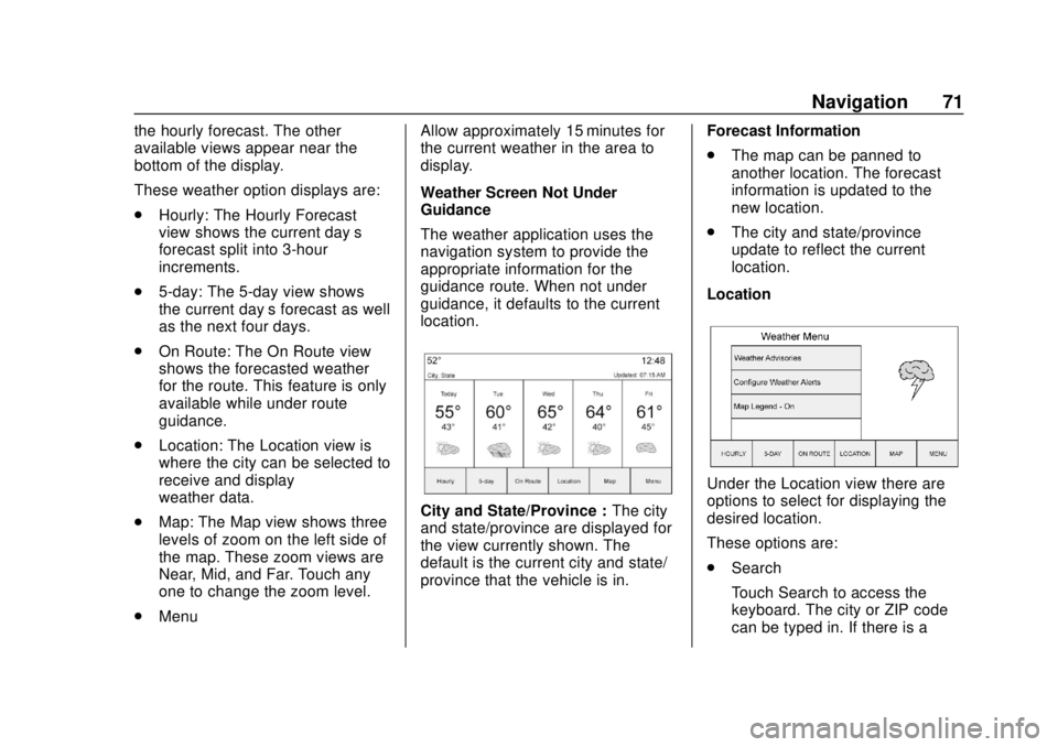
Location
Under the Location view there are
options to select for displaying the
desired location.
These options are:
. Search
Touch Search to access the
keyboard. The city or ZIP code
can be typed in. If there is a
 1
1 2
2 3
3 4
4 5
5 6
6 7
7 8
8 9
9 10
10 11
11 12
12 13
13 14
14 15
15 16
16 17
17 18
18 19
19 20
20 21
21 22
22 23
23 24
24 25
25 26
26 27
27 28
28 29
29 30
30 31
31 32
32 33
33 34
34 35
35 36
36 37
37 38
38 39
39 40
40 41
41 42
42 43
43 44
44 45
45 46
46 47
47 48
48 49
49 50
50 51
51 52
52 53
53 54
54 55
55 56
56 57
57 58
58 59
59 60
60 61
61 62
62 63
63 64
64 65
65 66
66 67
67 68
68 69
69 70
70 71
71 72
72 73
73 74
74 75
75 76
76 77
77 78
78 79
79 80
80 81
81 82
82 83
83 84
84 85
85 86
86 87
87 88
88 89
89 90
90 91
91 92
92 93
93 94
94 95
95 96
96 97
97 98
98 99
99 100
100 101
101 102
102 103
103 104
104 105
105 106
106 107
107 108
108 109
109 110
110 111
111 112
112 113
113 114
114 115
115


