Page 60 of 275

3-4Navigation
by searching for a route that avoids those areas.“Storing avoid area” (page 3-61)
*11Stored location (orange):
Displays the locations that are stored in the
Address Book. Icons can be changed according
to personal preferences.
“Storing location” (page 3-58)
*12Vehicle icon:
Indicates the current vehicle location and the
direction of travel.
*13Starting point:
Displays the vehicle location, with which the route
is set, as the starting point.
*14Suggested route:
Appears in bold yellow during route guidance.
*15Traffic indicator:
Displays the reception condition of the traffic
information transmitted from the provider.
Green: Reception is good.
Gray: Reception is poor.
No mark: Subscription to NavTraffic service is not
detected.
*16Arrow:
Indicates the distance to the next guide point and
the turning direction at that guide point.
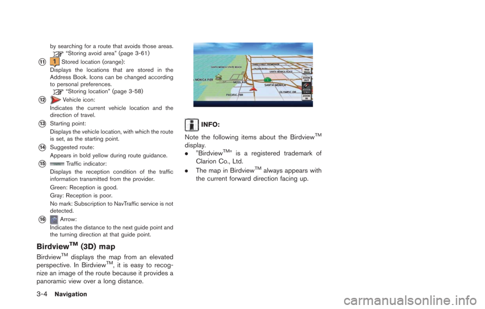
BirdviewTM(3D) map
BirdviewTMdisplays the map from an elevated
perspective. In BirdviewTM, it is easy to recog-
nize an image of the route because it provides a
panoramic view over a long distance.
INFO:
Note the following items about the Birdview
TM
display.
. "BirdviewTM" is a registered trademark of
Clarion Co., Ltd.
. The map in Birdview
TMalways appears with
the current forward direction facing up.
Page 61 of 275
DISPLAYING CURRENT VEHICLE
LOCATION
Operating with control panel
The basic map screen displays the current
location (the position where the vehicle mark is
located) . Push theMAPbutton to display the
current location on the map while on any screen.
Operating with touch panel opera-
tion
After moving the map, touch [BACK] on the map
screen to display the current location map
screen.
MOVING MAP
The operations for moving across the map are
different between the 2D and BirdviewTMmaps.
2D map
Navigation3-5
Page 62 of 275
3-6Navigation
1. Touch the screen. The cross pointer isdisplayed, and the position touched is set
as the center of the screen.
2. Touch the direction to move to. The mapcontinues to scroll while the screen is
touched.
INFO:
While driving, scrolling on the map is limited to a
specified distance. Fine-tuning the cursor position:
1. Touch [Slow]. The 8-directional key is
displayed.
2. Touch the 8-directional key to adjust thecross pointer position.
INFO:
. When [Cancel] is touched, display of the 8-
directional key will be turned off and the
system will switch to normal map scrolling
operation.
. Fine-tuning the cursor position is not pos-
sible while driving.
BirdviewTM(3D) map
1. Touch the screen. The cross pointer and 8-
directional key are displayed.
Page 63 of 275
![NISSAN LEAF 2013 1.G Navigation Manual 2. Touch the direction to move to. The mapcontinues to scroll while the screen is
touched.
3. Touch []or[] to change the direction of
the map.
: Rotates the map clockwise.
: Rotates the map counterclo NISSAN LEAF 2013 1.G Navigation Manual 2. Touch the direction to move to. The mapcontinues to scroll while the screen is
touched.
3. Touch []or[] to change the direction of
the map.
: Rotates the map clockwise.
: Rotates the map counterclo](/manual-img/5/324/w960_324-62.png)
2. Touch the direction to move to. The mapcontinues to scroll while the screen is
touched.
3. Touch []or[] to change the direction of
the map.
: Rotates the map clockwise.
: Rotates the map counterclockwise.
INFO:
While driving, scrolling on the map is limited to a
specified distance.
CHANGING SCALE OF MAP
1. Touch [ZOOM IN] or [ZOOM OUT] to change the scale.
INFO:
Free zoom:
The scale can be changed in smaller steps when
[ZOOM IN] or [ZOOM OUT] is touched and held
than when either key is briefly touched.
If briefly touched, the operation returns to
normal.
Map scale
Any required map scale (map coverage) be-
tween 400 miles (640 km) and 1/32 mile (50 m)
can be selected. Scale level for 2D map and Birdview
TMmap
(3D) display:
Normal Map US Units Metric Units
320 miles 640 km
80 miles 160 km
32 miles 64 km8 miles 16 km
5 miles 10 km
2 miles 4 km
1 mile 2 km
1/2 mile 1 km
1/4 mile 500 m
1/8 mile 200 m
1/16 mile 100 m
Shows build- ing footprint graphics 1/32 mile 50 m
1/64 mile 25 m
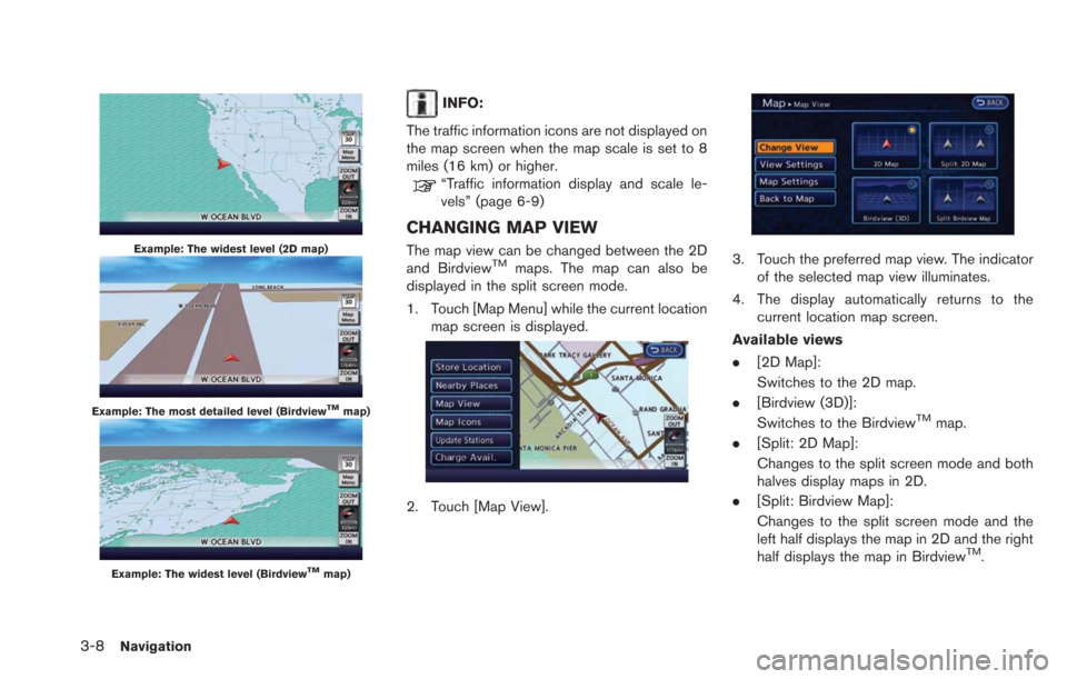
Example: The most detailed level (2D map)
Navigation3-7
Page 64 of 275

3-8Navigation
Example: The widest level (2D map)
Example: The most detailed level (BirdviewTMmap)
Example: The widest level (BirdviewTMmap)
INFO:
The traffic information icons are not displayed on
the map screen when the map scale is set to 8
miles (16 km) or higher.
“Traffic information display and scale le-
vels” (page 6-9)
CHANGING MAP VIEW
The map view can be changed between the 2D
and BirdviewTMmaps. The map can also be
displayed in the split screen mode.
1. Touch [Map Menu] while the current location
map screen is displayed.
2. Touch [Map View].
3. Touch the preferred map view. The indicatorof the selected map view illuminates.
4. The display automatically returns to the current location map screen.
Available views
. [2D Map]:
Switches to the 2D map.
. [Birdview (3D)]:
Switches to the Birdview
TMmap.
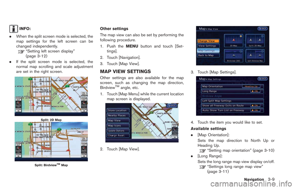
. [Split: 2D Map]:
Changes to the split screen mode and both
halves display maps in 2D.
. [Split: Birdview Map]:
Changes to the split screen mode and the
left half displays the map in 2D and the right
half displays the map in Birdview
TM.
Page 65 of 275

INFO:
. When the split screen mode is selected, the
map settings for the left screen can be
changed independently.
“Setting left screen display”
(page 3-12)
. If the split screen mode is selected, the
normal map scrolling and scale adjustment
are set in the right screen.
Split: 2D Map
Split: BirdviewTMMap
Other settings
The map view can also be set by performing the
following procedure.
1. Push the MENUbutton and touch [Set-
tings].
2. Touch [Navigation].
3. Touch [Map View].
MAP VIEW SETTINGS
Other settings are also available for the map
screen, such as changing the map direction,
Birdview
TMangle, etc.
1. Touch [Map Menu] while the current location map screen is displayed.
2. Touch [Map View].
3. Touch [Map Settings].
4. Touch the item you would like to set.
Available settings
.[Map Orientation]:
Sets the map direction to North Up or
Heading Up.
“Setting map orientation” (page 3-10)
. [Long Range]:
Sets the long range map view display on/off.
“Settings long range map view”
(page 3-11)
Navigation3-9
Page 66 of 275
![NISSAN LEAF 2013 1.G Navigation Manual 3-10Navigation
.[Birdview Angle]:
Changes the BirdviewTMangle.“Changing BirdviewTMangle”
(page 3-11)
. [Left Split Map Settings]:
Sets the map settings for the left screen of
the split map.
“Set NISSAN LEAF 2013 1.G Navigation Manual 3-10Navigation
.[Birdview Angle]:
Changes the BirdviewTMangle.“Changing BirdviewTMangle”
(page 3-11)
. [Left Split Map Settings]:
Sets the map settings for the left screen of
the split map.
“Set](/manual-img/5/324/w960_324-65.png)
3-10Navigation
.[Birdview Angle]:
Changes the BirdviewTMangle.“Changing BirdviewTMangle”
(page 3-11)
. [Left Split Map Settings]:
Sets the map settings for the left screen of
the split map.
“Setting left screen display”
(page 3-12)
. [Show all Freeway Exits on Route]:
Sets the display of the freeway exit informa-
tion on/off.
“Show exit information on freeways”
(page 3-44)
. [Auto. Show Turn List on Freeway]:
The turn list can be set on or off to be
displayed automatically while driving on a
freeway.
Other settings:
The orientation of the map can also be set by
performing the following procedure.
1. Push the MENUbutton and touch [Set-
tings].
2. Touch [Navigation].
3. Touch [Map View].
4. Touch [Map Settings].
Setting map orientation
The map direction (orientation) can also be
changed in the 2D map. These settings are
available only in the 2D map or 2D/2D split map.
1. Touch [Map Orientation].
2. Touch the preferred map orientation. The indicator of the selected map orientation
illuminates.
3. Push the MAPbutton to return to the
current location map screen. Available map orientations
.
[North Up]:
The top of the map remains oriented to the
north.
. [Heading Up]:
The top of the map follows the traveling
direction.
INFO:
The direction of the map can also be changed by
touching the icon on the map. The method for
changing the direction of the map by touching
an icon can only be used when the current
location map is displayed.
If the map orientation is switched, the icon
displayed in the lower right corner is also
switched.
: North Up
: Heading Up
Page 67 of 275
North Up
Heading Up
Settings long range map view
The position of the vehicle icon can be changed
to view a wider area in the direction that the
vehicle is traveling. If this function is activated,
the vehicle icon is located slightly lower than the
center of the screen.
1. Touch [Long Range]. The indicator illumi-nates when the item is set.
2. Push the MAPbutton to return to the
current location map screen.
Long Range Map View
INFO:
[Long Range] is displayed only when [Heading
Up] is selected.
Changing BirdviewTMangle
The BirdviewTMangle can be changed. This
setting is available only in the BirdviewTMmap or
2D/BirdviewTMsplit map.
1. Touch [Birdview Angle].
Navigation3-11