2013 MERCEDES-BENZ SL-CLASS ROADSTER navigation
[x] Cancel search: navigationPage 349 of 572
X
Select Never, When Off-Road or When
Route Guidance Inactive and press W
to confirm.
The selected setting is accepted.
Switching additional information on/off
Switching the topographical map on/off
X To show the menu: press
W the COMAND
controller.
X Select Navi in the main function bar by
sliding ZV and
turning cVd the COMAND
controller and press W to confirm.
X Select Map Settings and press W to
confirm.
The map settings menu appears.
X Select Topographic Map and press W to
confirm.
Depending on the previous status, switch
the option on O or off ª.
The topographical map uses different colors
to depict elevation. The color key generally
reflects the topography's dominant
vegetation or the ground's perceived color
when seen from the air, for example:
R green (grass) for lowland
R yellow, brown (woodland) for hills
R gray (stone) and white (snow) for
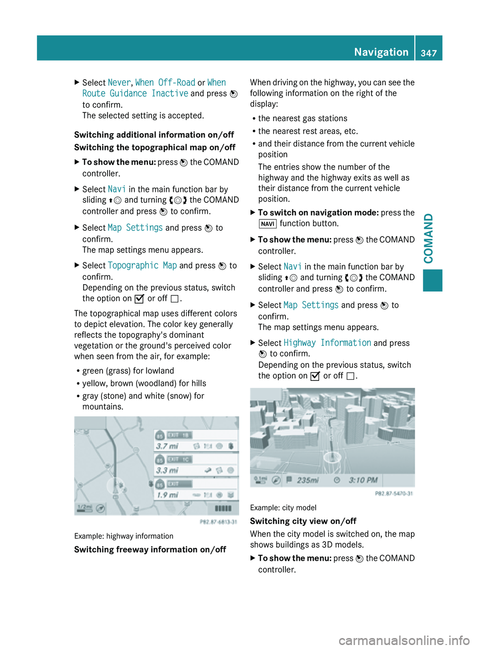
mountains. Example: highway information
Switching freeway information on/off When driving on the highway, you can see the
following information on the right of the
display:
R
the nearest gas stations
R the nearest rest areas, etc.
R and their
distance from the current vehicle
position
The entries show the number of the
highway and the highway exits as well as
their distance from the current vehicle
position.
X To switch on navigation mode: press
the
Ø function button.
X To show the menu:
press W
the COMAND
controller.
X Select Navi in the main function bar by
sliding ZV and
turning cVd the COMAND
controller and press W to confirm.
X Select Map Settings and press W to
confirm.
The map settings menu appears.
X Select Highway Information and press
W to confirm.
Depending on the previous status, switch
the option on O or off ª. Example: city model
Switching city view on/off
When
the
city model is switched on, the map
shows buildings as 3D models.
X To show the menu: press W
the COMAND
controller. Navigation
347
COMAND Z
Page 350 of 572
X
Select Navi in the main function bar by
sliding ZV and
turning cVd the COMAND
controller and press W to confirm.
X Select Map Settings and press W to
confirm.
The map settings menu appears.
X Select City (3D)
and press W to confirm.
Depending on the previous status, switch
the option on O or off ª.
i The city model is only shown for "Bird's-
eye view" or "3D map".
It is
available in the 0.05 mi and 0.1 mi map
scales.
The data required for displaying buildings
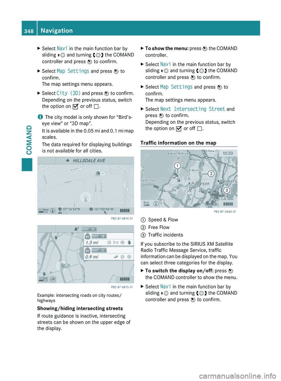
is not available for all cities. Example: intersecting roads on city routes/
highways
Showing/hiding intersecting streets
If route guidance is inactive, intersecting
streets can be shown on the upper edge of
the display. X
To show the menu: press W
the COMAND
controller.
X Select Navi in the main function bar by
sliding ZV and
turning cVd the COMAND
controller and press W to confirm.
X Select Map Settings and press W to
confirm.
The map settings menu appears.
X Select Next Intersecting Street and
press W to confirm.
Depending on the previous status, switch
the option on O or off ª.
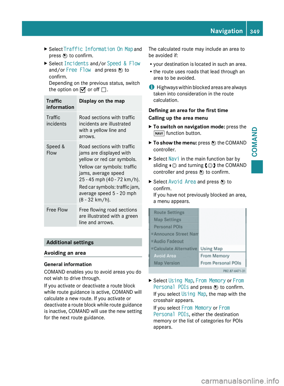
Traffic information on the map :
Speed & Flow
; Free Flow
= Traffic incidents
If you subscribe to the SIRIUS XM Satellite
Radio Traffic Message Service, traffic
information can
be displayed on the map. You
can select three categories for the display.
X To switch the display on/off: press W
the COMAND
controller to show the menu.
X Select Navi in the main function bar by
sliding ZV and
turning cVd the COMAND
controller and press W to confirm. 348
Navigation
COMAND
Page 351 of 572
X
Select Traffic Information On Map and
press W to confirm.
X Select Incidents and/or Speed & Flow
and/or Free Flow and press W to
confirm.
Depending on the previous status, switch
the option on O or off ª.Traffic
information Display on the map
Traffic
incidents Road sections with traffic
incidents are illustrated
with a yellow line and
arrows.
Speed &
Flow Road sections with traffic
jams are displayed with
yellow or red car symbols.
Yellow car symbols: traffic
jams, average speed
25
-
45 mph (40 - 72 km/h).
Red car symbols: traffic jam,
average speed 5 - 20 mph
(8 - 32 km/h). Free Flow Free flowing road sections
are illustrated with a green
line and arrows.
Additional settings
Avoiding an area General information
COMAND enables you to avoid areas you do
not wish to drive through.
If you activate or deactivate a route block
while route guidance is active, COMAND will
calculate a new route. If you activate or
deactivate
a
route block while route guidance
is inactive, COMAND will use the new setting
for the next route guidance. The calculated route may include an area to
be avoided if:
R
your destination
is located in such an area.
R the route uses roads that lead through an
area to be avoided.
i Highways within blocked areas are always
taken into consideration in the route
calculation.
Defining an area for the first time
Calling up the area menu
X To switch on navigation mode: press
the
Ø function button.
X To show the menu:
press W
the COMAND
controller.
X Select Navi in the main function bar by
sliding ZV and
turning cVd the COMAND
controller and press W to confirm.
X Select Avoid Area and press W to
confirm.
If you
have not previously blocked an area,
a menu appears. X
Select Using Map , From Memory or From
Personal POIs and press W to confirm.
If you select Using Map, the map with the
crosshair appears.
If you select From Memory or From
Personal POIs, either the destination
memory or the list of categories for POIs
appears. Navigation
349
COMAND Z
Page 352 of 572
R
Destination memory ( Y page 304)
R List of categories for personal POIs
(Y page 319)
X Select the desired destination or personal
POI and press W to confirm.
X When the destination address is displayed,
select Continue and press W to confirm.
The map appears.
The crosshair marks the center of the area
that is to be avoided.
X To scroll the map: slide XVY, ZVÆ or
aVb the COMAND controller.
X To set the map scale: as
soon as you turn
cVd the COMAND controller, the scale bar
appears. Turning clockwise zooms out from
the map; turning counter-clockwise zooms
in.
X Turn cVd until the desired scale is set.
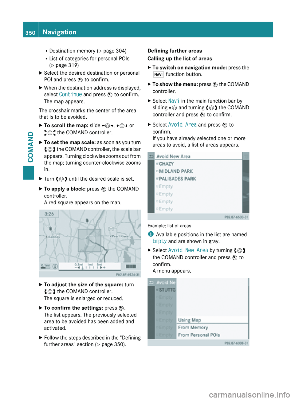
X To apply a block: press W the COMAND
controller.
A red square appears on the map. X
To adjust the size of the square: turn
cVd the COMAND controller.
The square is enlarged or reduced.
X To confirm the settings: press W.
The list appears. The previously selected
area to be avoided has been added and
activated.
X Follow the steps described in the "Defining
further areas" section ( Y page 350).Defining further areas
Calling up the list of areas
X
To switch on navigation mode: press
the
Ø function button.
X To show the menu:
press W
the COMAND
controller.
X Select Navi in the main function bar by
sliding ZV and
turning cVd the COMAND
controller and press W to confirm.
X Select Avoid Area and press W to
confirm.
If you have already selected one or more
areas to avoid, a list of areas appears. Example: list of areas
i
Available positions in the list are named
Empty and are shown in gray.
X Select Avoid New Area by turning cVd
the COMAND controller and press W to
confirm.
A menu appears. 350
Navigation
COMAND
Page 353 of 572
X
Select Using Map , From Memory or From
Personal POIs and press W to confirm.
If you select Using Map, the map with the
crosshair appears.
If you select From memory or From
Personal POIs, either the destination
memory or the list of categories for POIs
appears.
R Destination memory ( Y page 304)
R List of categories for personal POIs
(Y page 319)
X Select the desired destination or personal
POI and press W to confirm.
X When the destination address is displayed,
select Continue and press W to confirm.
The map appears.
X To avoid a new area: call up
the area menu
again ( Y page 349).
Switching an avoided area on/off
X Call up the area list ( Y page 350).
X Select an entry in the list by turning cVd
the COMAND controller and press W to
confirm.
The avoided area is switched on O or off
ª depending on the previous status.
Displaying and changing an avoided area
X Call up the area list ( Y page 350).
X Select an entry in the list by turning cVd
the COMAND controller.
X Slide VY the COMAND controller and
press W to confirm.
X Select Display /
Change and press W to
confirm.
The area to be avoided is indicated in the
map.
X To change the location of the area: slide
XVY, ZVÆ or aVb the COMAND
controller.
The area is moved on the map. X
To adjust the size of the area: turn
cVd the COMAND controller.
The area is enlarged or reduced.
X To confirm the change: press W the
COMAND controller.
The list
appears and the change is entered.
Deleting a set area
X Call up the area list ( Y page 350).
X Select an entry in the list by turning cVd
the COMAND controller.
X Slide VY the COMAND controller and
press W to confirm.
X Select Delete and press W to confirm.
A query appears asking whether the entry
should be deleted.
X Select Yes or No.
If you select Yes, the entry is deleted.
If you select No, the process will be
canceled.
SIRIUS XM service Displaying SIRIUS XM service information
You can display the SIRIUS XM service
information.
X
To show the menu: press W
the COMAND
controller.
X Select Navi in the main function bar by
sliding ZV and
turning cVd the COMAND
controller and press W to confirm.
X Select SIRIUS Service and press W to
confirm.
The window
on the right half of the display
shows the telephone number of the
provider (SIRIUS XM) and the serial number
of your service module.
Registering for the SIRIUS XM traffic
report service
X Call the traffic report provider's phone
number shown on the screen.
i You can also have the satellite service
activated online. To do so, visit the SIRIUS Navigation
351
COMAND Z
Page 354 of 572
XM Radio website at
http://www.sirius.com (USA) or
http://www.siriuscanada.com
(Canada).
Once the connection has been established:
X Follow the instructions of the operator.
The activation process may take up to ten
minutes.
If registration is not included when
purchasing the system, your credit card
details will be required to activate your
account.
Compass function In the compass view, you can see the current
direction of travel, the current height above
sea level and the coordinates of the vehicle
position, for example.
X
To switch on navigation mode: press the
Ø function button.
X To show the menu:
press W
the COMAND
controller.
X Select Position in the navigation system
menu bar by sliding VÆ and turning cVd
the COMAND controller and press W to
confirm.
X Select Compass and press W to confirm. Example: compass
:
Current direction of travel
; Current height above average sea level
(rounded) =
Current vehicle position: longitude
coordinates
? Number of GPS satellites currently being
used
A Current vehicle position: latitude
coordinates
B Currently set steering angle of the front
wheels
i To display current elevation ;, the
system must
be able to receive at least four
satellites. Steering angle B can be a
maximum of 35° in both directions.
X To exit the display: confirm Back by
pressing W or
press the % back button.
Showing the map data version X
To show the map data menu: press W
the COMAND controller.
X Select Navi in the main function bar by
sliding ZV and
turning cVd the COMAND
controller and press W to confirm.
X Select Map Version and press W to
confirm.
The map data version number is shown.
Information about new versions of the
digital map can be obtained from an
authorized Mercedes-Benz Center. 352
Navigation
COMAND
Page 355 of 572
Updating the digital map
Introduction
The digital maps generated by the map
software become outdated in the same way
as conventional road maps. Optimal route
guidance can only be provided by
the
navigation
system in conjunction with the
most up-to-date map software.
Information about new versions of the digital
map can be obtained from an authorized
Mercedes-Benz Center. You can have the
digital map updated there with a DVD, or you
can update it yourself.
Updating process G
WARNING
Never leave the engine running in an enclosed
space. The exhaust gases contain carbon
monoxide. Inhaling
exhaust gases constitutes
a health hazard and could lead to loss of
consciousness or even death.
i The update process can take a long time
(over an hour), depending on the size of the
digital map. During this time, you will only
be able to switch on radio mode and to
accept incoming calls. The update will be
completed more quickly if the vehicle is
stationary.
If you start the update with the engine
switched off and the starter battery has
insufficient power, COMAND may
automatically switch off. This protects the
battery. If this occurs, restart the update
with the engine running.
X Insert the DVD:
R
in the single DVD drive (Y page 421)
R in the DVD changer (
Y page 421)
COMAND checks whether the digital map
on the DVD is compatible with the
navigation system and system software.
A prompt then appears asking if you want
to install the database. Versions of the
database currently installed and the database that is to be installed are
displayed.
X Select Yes or No and press W to confirm.
After selecting Yes, an activation code
must be
entered when installing a database
for the first time. You will receive the
activation code when you buy the
navigation DVD.
If you select No, the process will be
canceled.
X Enter the activation code.
After entering the activation code
correctly, COMAND starts updating the
digital map. Once the update is finished,
you will see a message.
X To confirm the message: press W the
COMAND controller.
X Take the DVD out of the slot.
While the update is running, you will see a
message to this effect and a progress bar.
The navigation system is not operational
until the update is complete.
i You cannot eject the DVD during the
update. If you switch off COMAND during
the update, the update is interrupted. It
then continues from where it was
interrupted when the system is restarted.
COMAND may
prompt you to change the DVD
during the update.
X Press the V (for DVD changer) or
8 (for single DVD drive) load/eject
button.
X Take the DVD out of the slot.
X Insert the requested DVD.
Once the update has been successfully
completed, you will see a message to this
effect.
X To confirm the message: press W the
COMAND controller.
X Take the DVD out of the slot.
The update is complete.
If the
update is not successfully completed,
you will see a message that the map update
is not possible. Navigation
353
COMAND Z
Page 356 of 572

X
To confirm the message: press W the
COMAND controller.
X Take the DVD out of the slot.354
NavigationCOMAND