I34706
*2
*5*2
*5
*6*1
*3*4
*7
05±1450
± DIAGNOSTICSNAVIGATION SYSTEM
AVENSIS REPAIR MANUAL (RM1018E)
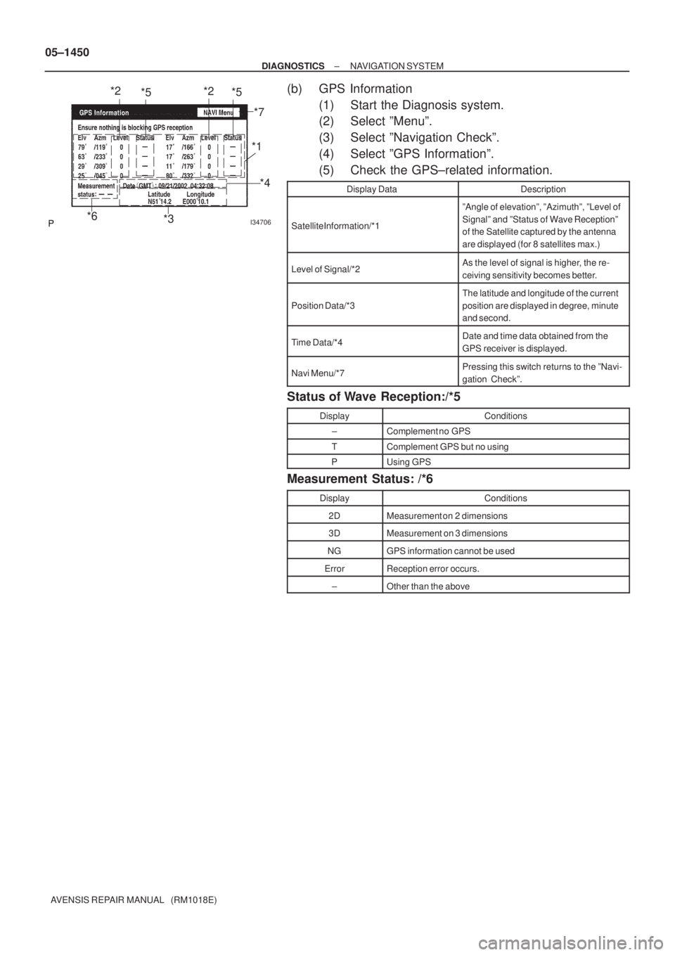
(b) GPS Information
(1) Start the Diagnosis system.
(2) Select ºMenuº.
(3) Select ºNavigation Checkº.
(4) Select ºGPS Informationº.
(5) Check the GPS±related information.
Display DataDescription
Satellite Information/*1
ºAngle of elevationº, ºAzimuthº, ºLevel of
Signalº and ºStatus of Wave Receptionº
of the Satellite captured by the antenna
are displayed (for 8 satellites max.)
Level of Signal/*2As the level of signal is higher, the re-
ceiving sensitivity becomes better.
Position Data/*3
The latitude and longitude of the current
position are displayed in degree, minute
and second.
Time Data/*4Date and time data obtained from the
GPS receiver is displayed.
Navi Menu/*7Pressing this switch returns to the ºNavi-
gation Checkº.
Status of Wave Reception:/*5
DisplayConditions
±Complement no GPS
TComplement GPS but no using
PUsing GPS
Measurement Status: /*6
DisplayConditions
2DMeasurement on 2 dimensions
3DMeasurement on 3 dimensions
NGGPS information cannot be used
ErrorReception error occurs.
±Other than the above