2014 MITSUBISHI MIRAGE warning
[x] Cancel search: warningPage 1 of 135

1
Thank you for purchasing Mitsubishi Multi Entertainment System (MMES).
Please read this owner’s manual thoroughly before operating MMES.
After reading this manual, be sure to keep it handy for future reference.
Contents
Introduction ......................................................................................................................................... 5
Navigation ........................................................................................................................................... 9
1. WARNINGS AND SAFETY INFORMATION ......................................................................................................................................10
2. GETTING STARTED ..........................................................................................................................................................................10
Navigation menu .................................................................................................................................................................................11
Buttons and other controls on the screen ...........................................................................................................................................15
Map screen .........................................................................................................................................................................................19
Operation Regulations ........................................................................................................................................................................28
3. ON-ROAD NAVIGATION ....................................................................................................................................................................29
Selecting the destination of a route ....................................................................................................................................................29
Viewing the entire route on the map ...................................................................................................................................................51
Checking route parameters and accessing route related functions ....................................................................................................51
Modifying the route .............................................................................................................................................................................52
Saving a location as a Favorite destination .........................................................................................................................................56
Saving a map location as an alert point ..............................................................................................................................................57
Editing an alert point ...........................................................................................................................................................................57
Watching the simulation of the route ...................................................................................................................................................58
4. OFF-ROAD NAVIGATION ..................................................................................................................................................................59
Selecting the destination of the route .................................................................................................................................................59
Navigating in off-road mode ................................................................................................................................................................59
5. REFERENCE GUIDE .........................................................................................................................................................................60
Concepts .............................................................................................................................................................................................60
205-0010-00_QY-7375M-A_EN.indb 1205-0010-00_QY-7375M-A_EN.indb 13/12/2013 9:57:13 AM3/12/2013 9:57:13 AM
Page 8 of 135

8
Important Points
on Safety for the
Customer
This product features a number of pictorial
indications as well as points concerning
handling so that you can use the product
correctly and in a safe manner, as well as
prevent injury or damage to yourself, other
users, or property.
WARNINGThis indicates details
regarding handling of the
product that if ignored, could
be expected to result in death
or serious injury.
CAUTIONThis indicates details
regarding handling of the
product that if ignored, could
be expected to result in
personal injury or property
loss.
WARNING
The driver should not pay close
attention to the images on the
screen while driving.
This may prevent the driver looking
where they are going, and cause an
accident.
The driver should not perform
complicated operations while
driving.
Performing complicated operations while
driving may prevent the driver looking
where they are going, and cause an
accident.
Therefore stop the vehicle in a safe
location before performing such
operations.
Do not use during malfunctions,
such as when the screen does not
light up or no sound is audible.
This may lead to accident, fire, or electric
shock.
Do not place anything on the
open display.
This may lead to accident, fire, electric
shock, or malfunction.
Ensure water or other foreign
objects do not enter the product.
This may lead to smoking, fire, electric
shock, or malfunction.
WARNING
Do not insert foreign objects into
the disc slot or card slot.
This may lead to fire, electric shock, or
malfunction.
Always obey all actual traffic
regulations, even when following
route guidance from this
navigation system.
Due to changes in traffic rules, this
data may differ from the actual traffic
regulations.
Always obey the actual traffic regulations.
In the event of abnormalities
occurring when foreign objects
or water enter the product,
resulting in smoke or a strange
smell, immediately stop using
the product, and consult with
your dealer.
Continuing to use the product may result
in accident, fire, or electric shock.
Do not disassemble or modify
the product.
This may lead to malfunction, fire, or
electric shock.
During thunderstorms, do not
touch the antenna or the front
panel.
This may lead to electrical shock from
lightning.
205-0010-00_QY-7375M-A_EN.indb 8205-0010-00_QY-7375M-A_EN.indb 83/12/2013 9:57:13 AM3/12/2013 9:57:13 AM
Page 10 of 135

10
1. WARNINGS
AND SAFETY
INFORMATION
The navigation system helps you find your
way to your destination with a connected
GPS receiver. MMES does not transmit your
position; others cannot track you.
If you accept it when first using the
application, MMES collects usage information
and GPS logs that may be used for improving
the application and the quality and coverage
of maps. The data is processed anonymously;
no one will be able to track any personal
information. If you change your mind later,
you can enable or disable the log collection in
Settings (page 74).
It is important that you look at the display only
when it is safe to do so. If you are the driver of
the vehicle, we recommend that you operate
MMES before you start your journey. Plan the
route before your departure and stop if you
need to change the route. Some operations
are restricted while driving for safety.
You must obey the traffic signs and follow
the road geometry. If you deviate from the
recommended route, MMES changes the
instructions accordingly.
2. GETTING
STARTED
MMES is optimized for in-car use. You can
use it easily by tapping the screen buttons and
the map with your fingertips.
When using the navigation software for
the first time, an initial setup process starts
automatically. Do as follows:
1. Select the language and voice used for
voice guidance messages. Later you can
alter your selection via the Sound and
Warnings settings (page 66).
2. If needed, modify the settings. Later you
can alter your selection via the Regional
settings (page 73).
3. If needed, modify the default route
planning options. Later you can alter your
selection via the Route settings (page 68).
4. The initial setup is now complete. The
Configuration wizard can be restarted
later from the Settings menu (page 64).
After the initial setup process, the Navigation
menu appears and you can start using MMES.
205-0010-00_QY-7375M-A_EN.indb 10205-0010-00_QY-7375M-A_EN.indb 103/12/2013 9:57:14 AM3/12/2013 9:57:14 AM
Page 51 of 135

51
6. The Destination menu appears and you
can select the destination of the route the
same way as described in the previous
sections.
7. When the new destination is selected, the
list returns.
8. To add more destinations, tap where
you want to insert the new route point in
the list, and repeat the above procedure.
Viewing the entire route
on the map
It is easy to get a map overview of the active
route. Do as follows:
1. If you are on the Map screen, tap
to return to the
Navigation menu.
2. In the Navigation menu, tap
.
3. Tap
. The active route
is displayed in its full length on the map
together with additional information and
controls.
Checking route
parameters and accessing
route related functions
You can check different parameters of the
route recommended by MMES.
1. If you are on the Map screen, tap
to return to the
Navigation menu.
2. In the Navigation menu, tap
.
3. The following pieces of information are
displayed:
The name and/or address of the
destination.
Warning icons (if any). They provide
extra information about your route
(e.g. unpaved roads or toll roads to be
taken).
The total time of the route.
The total length of the route.
The route planning method (e.g. Fast).
205-0010-00_QY-7375M-A_EN.indb 51205-0010-00_QY-7375M-A_EN.indb 513/12/2013 9:57:22 AM3/12/2013 9:57:22 AM
Page 53 of 135

53
3. If you already have a route, tap
. If you are starting a
new route, tap
.
4. The first line is the start of the route,
normally the current position. Tap
(blue) and confirm your action at the
warning message.
5. The Destination menu appears and you
can select the start point of the route the
same way you select a destination.
6. When the new start point is set, tap
.
7. The map returns with a transparent
Vehimarker (showing that there is no
GPS reception). If an active route already
existed, it is now recalculated starting
from the selected location.
8. To return to normal navigation, tap
.
qEditing the list of
destinations (Edit Route)
You can edit the route by modifying the list
of destinations. You can add or remove
destinations, modify the start position or
reorder the list.
1. If you are on the Map screen, tap
to return to the
Navigation menu.
2. In the Navigation menu, tap
.
3. Tap
.
4. You have the following options:
to add a new destination.
to delete a destination.
(blue) to modify the start
point of the route.
205-0010-00_QY-7375M-A_EN.indb 53205-0010-00_QY-7375M-A_EN.indb 533/12/2013 9:57:22 AM3/12/2013 9:57:22 AM
Page 61 of 135

61
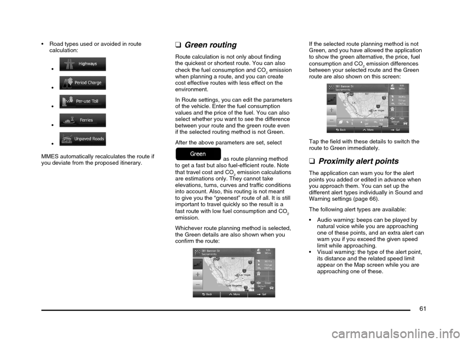
Road types used or avoided in route
calculation:
MMES automatically recalculates the route if
you deviate from the proposed itinerary.
qGreen routing
Route calculation is not only about finding
the quickest or shortest route. You can also
check the fuel consumption and CO
2 emission
when planning a route, and you can create
cost effective routes with less effect on the
environment.
In Route settings, you can edit the parameters
of the vehicle. Enter the fuel consumption
values and the price of the fuel. You can also
select whether you want to see the difference
between your route and the green route even
if the selected routing method is not Green.
After the above parameters are set, select
as route planning method
to get a fast but also fuel-efficient route. Note
that travel cost and CO
2 emission calculations
are estimations only. They cannot take
elevations, turns, curves and traffic conditions
into account. Also, this routing is not meant
to give you the “greenest” route of all. It is still
important to travel quickly so the result is a
fast route with low fuel consumption and CO
2
emission.
Whichever route planning method is selected,
the Green details are also shown when you
confirm the route:
If the selected route planning method is not
Green, and you have allowed the application
to show the green alternative, the price, fuel
consumption and CO
2 emission differences
between your selected route and the Green
route are also shown on this screen:
Tap the field with these details to switch the
route to Green immediately.
qProximity alert points
The application can warn you for the alert
points you added or edited in advance when
you approach them. You can set up the
different alert types individually in Sound and
Warning settings (page 66).
The following alert types are available:
Audio warning: beeps can be played by
natural voice while you are approaching
one of these points, and an extra alert can
warn you if you exceed the given speed
limit while approaching.
Visual warning: the type of the alert point,
its distance and the related speed limit
appear on the Map screen while you are
approaching one of these.
205-0010-00_QY-7375M-A_EN.indb 61205-0010-00_QY-7375M-A_EN.indb 613/12/2013 9:57:23 AM3/12/2013 9:57:23 AM
Page 62 of 135

62
For some of the alert points, the enforced or
expected speed limit is available. For these
points, the audio alert can be different if you
are below or above the given speed limit.
Only when speeding: The audio alert is
only played when you exceed the given
speed limit.
When approaching: The audio alert is
always played when approaching one of
these alert points. In order to draw your
attention, the alert is different when you
exceed the speed limit.
qSpeed limit warning
Maps may contain information about the
speed limits of the road segments. MMES is
able to warn you if you exceed the current
limit. This information may not be available for
your region, or may not be fully correct for all
roads in the map.
Speed warning can be fine-tuned in Sound
and Warning settings (page 66).
You can set the relative speed above which
the application initiates the warning.
The following alert types are available:
Audio warning: you receive a verbal
warning when you exceed the speed limit
with the given percentage.
Visual warning: the current speed limit is
shown on the map when you exceed it
(for example:
).
You can also choose to see the speed limit
sign on the map all the time.
Note:
The speed limit warning is an auxiliary function.
Check the speed in the vehicle’s speedometer
and observe the legal speed.
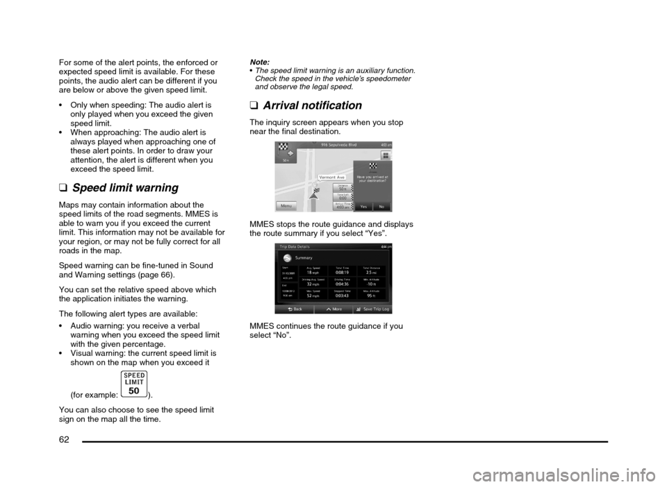
qArrival notification
The inquiry screen appears when you stop
near the final destination.
MMES stops the route guidance and displays
the route summary if you select “Yes”.
MMES continues the route guidance if you
select “No”.
205-0010-00_QY-7375M-A_EN.indb 62205-0010-00_QY-7375M-A_EN.indb 623/12/2013 9:57:24 AM3/12/2013 9:57:24 AM
Page 63 of 135

63
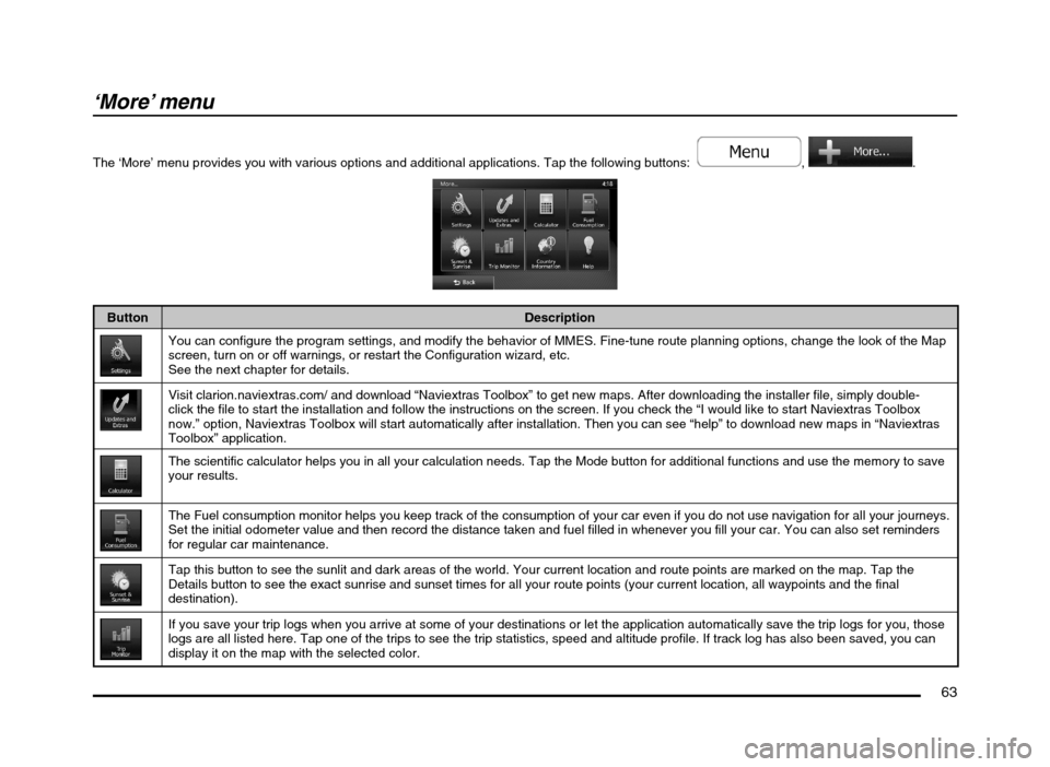
‘More’ menu
The ‘More’ menu provides you with various options and additional applications. Tap the following buttons: , .
Button Description
You can configure the program settings, and modify the behavior of MMES. Fine-tune route planning options, change the look of the Map
screen, turn on or off warnings, or restart the Configuration wizard, etc.
See the next chapter for details.
Visit clarion.naviextras.com/ and download “Naviextras Toolbox” to get new maps. After downloading the installer file, simply double-
click the file to start the installation and follow the instructions on the screen. If you check the “I would like to start Naviextras Toolbox
now.” option, Naviextras Toolbox will start automatically after installation. Then you can see “help” to download new maps in “Naviextras
Toolbox” application.
The scientific calculator helps you in all your calculation needs. Tap the Mode button for additional functions and use the memory to save
your results.
The Fuel consumption monitor helps you keep track of the consumption of your car even if you do not use navigation for all your journeys.
Set the initial odometer value and then record the distance taken and fuel filled in whenever you fill your car. You can also set reminders
for regular car maintenance.
Tap this button to see the sunlit and dark areas of the world. Your current location and route points are marked on the map. Tap the
Details button to see the exact sunrise and sunset times for all your route points (your current location, all waypoints and the final
destination).
If you save your trip logs when you arrive at some of your destinations or let the application automatically save the trip logs for you, those
logs are all listed here. Tap one of the trips to see the trip statistics, speed and altitude profile. If track log has also been saved, you can
display it on the map with the selected color.
205-0010-00_QY-7375M-A_EN.indb 63205-0010-00_QY-7375M-A_EN.indb 633/12/2013 9:57:24 AM3/12/2013 9:57:24 AM