2013 NISSAN LEAF light
[x] Cancel search: lightPage 55 of 275
![NISSAN LEAF 2013 1.G Navigation Manual 2. The system displays a message screen andannounces the contents of the message to
recommend battery charging. Check the
message displayed on the screen.
Touch [Nearby Charging Station] to search
all NISSAN LEAF 2013 1.G Navigation Manual 2. The system displays a message screen andannounces the contents of the message to
recommend battery charging. Check the
message displayed on the screen.
Touch [Nearby Charging Station] to search
all](/manual-img/5/324/w960_324-54.png)
2. The system displays a message screen andannounces the contents of the message to
recommend battery charging. Check the
message displayed on the screen.
Touch [Nearby Charging Station] to search
all charging stations that are located near
the current vehicle position.
“Finding charging station” (page 3-25)
3. Touch [BACK] or push the MAPbutton to
return to the current location map screen.
INFO:
. The charge recommendation guidance can
be set to off.
“Setting messages that are displayed
on screen” (page 2-16)
. When the route is changed to avoid a traffic
jam or the possible driving distance indi-
cated in the meter is changed, the charge
recommendation guidance is displayed again.
Low Battery
When the Low battery charge warning lightand the master warning light (yellow)illuminate, the system displays a message on
the navigation screen that notices the driver that
the Li-ion battery charge is low.
1. The notification is displayed on the upper left
side of the screen. Touch [Show] to display
the detailed information screen.
2. The system displays a message screen andannounces the contents of the message to
warn that the Li-ion battery charge is low.
Check the message displayed on the
screen.
Touch [Nearby Charging Station] to search
all charging stations that are located near
the current vehicle position.
“Finding charging station” (page 3-25)
3. Touch [BACK] or push the MAPbutton to
return to the vehicle location screen.
INFO:
. The Low Battery message display can be
set to off.
“Setting messages that are displayed
on screen” (page 2-16)
. When the Li-ion battery charge is low, the
system automatically obtains charging sta-
tion information.
Limited Power Notice
When the power limitation indicatorand the
master warning light (yellow)illuminate, the
system displays a message on the navigation
screen that notices the driver that power output
is restricted for various reasons. See LEAF
Owner’s Manual for details of the indicator/
Unique EV functions2-17
Page 56 of 275
![NISSAN LEAF 2013 1.G Navigation Manual 2-18Unique EV functions
warning lights.
1. The notification is displayed on the upper leftside of the screen. Touch [Show] to display
the detailed information screen.
2. The system displays a message NISSAN LEAF 2013 1.G Navigation Manual 2-18Unique EV functions
warning lights.
1. The notification is displayed on the upper leftside of the screen. Touch [Show] to display
the detailed information screen.
2. The system displays a message](/manual-img/5/324/w960_324-55.png)
2-18Unique EV functions
warning lights.
1. The notification is displayed on the upper leftside of the screen. Touch [Show] to display
the detailed information screen.
2. The system displays a message screen and
announces the contents of the message to
warn that power output is restricted and
inform the driver of the reason for this
occurrence and what action is to be taken.
INFO:
The Limited Power Notice display can be set to
off.
“Setting messages that are displayed on
screen” (page 2-16)
Page 67 of 275

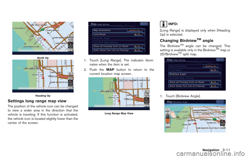
North Up
Heading Up
Settings long range map view
The position of the vehicle icon can be changed
to view a wider area in the direction that the
vehicle is traveling. If this function is activated,
the vehicle icon is located slightly lower than the
center of the screen.
1. Touch [Long Range]. The indicator illumi-nates when the item is set.
2. Push the MAPbutton to return to the
current location map screen.
Long Range Map View
INFO:
[Long Range] is displayed only when [Heading
Up] is selected.
Changing BirdviewTMangle
The BirdviewTMangle can be changed. This
setting is available only in the BirdviewTMmap or
2D/BirdviewTMsplit map.
1. Touch [Birdview Angle].
Navigation3-11
Page 68 of 275
![NISSAN LEAF 2013 1.G Navigation Manual 3-12Navigation
2. Adjust the BirdviewTMangle by touching
[Raise] or [Lower].
3. Push the MAPbutton to return to the
current location map screen.
Setting left screen display
When the split screen is di NISSAN LEAF 2013 1.G Navigation Manual 3-12Navigation
2. Adjust the BirdviewTMangle by touching
[Raise] or [Lower].
3. Push the MAPbutton to return to the
current location map screen.
Setting left screen display
When the split screen is di](/manual-img/5/324/w960_324-67.png)
3-12Navigation
2. Adjust the BirdviewTMangle by touching
[Raise] or [Lower].
3. Push the MAPbutton to return to the
current location map screen.
Setting left screen display
When the split screen is displayed, the map
settings of the left screen can be changed.
1. Touch [Left Split Map Settings].
2. Touch the preferred map setting. 3. Push the
MAPbutton to return to the
current location map screen.
Available settings
. [Map Orientation]:
The map direction can be selected as
follows.
— [North Up]:
The top of the map remains oriented to
the north.
— [Heading Up]: The top of the map follows the direction
in which the vehicle is traveling.
. [Long Range]:
Positions the vehicle icon slightly lower than
the center of the screen. This offers a wider
view in the traveling direction.
. [Map Scale]:
Displays a scale on the left side of the
screen. Use this to change the scale of a
map.
INFO:
. The settings of the right screen are the same
as the settings of the full screen map.
. The scale of the map can also be changed
by touching [ZOOM OUT] or [ZOOM IN].
LOOKING AT INFORMATION ON
MAP
Icons can be displayed on the map, and
information about destinations and landmarks
can be displayed.
Displaying map icons
The map icons can be displayed or hidden by
type.
1. Touch [Map Menu] while the current location
map screen is displayed.
2. Touch [Map Icons].
Page 73 of 275

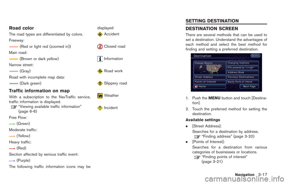
Road color
The road types are differentiated by colors.
Freeway:
(Red or light red (zoomed in))
Main road:
(Brown or dark yellow)
Narrow street:
(Gray)
Road with incomplete map data:
(Dark green)
Traffic information on map
With a subscription to the NavTraffic service,
traffic information is displayed.
“Viewing available traffic information”
(page 6-6)
Free Flow:
(Green)
Moderate traffic:
(Yellow)
Heavy traffic:
(Red)
Section affected by serious traffic event:
(Purple)
The following traffic information icons may be displayed
Accident
Closed road
Information
Road work
Slippery road
Weather
Incident
DESTINATION SCREEN
There are several methods that can be used to
set a destination. Understand the advantages of
each method and select the best method for
finding and setting a preferred destination.
1. Push the
MENUbutton and touch [Destina-
tion].
2. Touch the preferred method for setting the destination.
Available settings
. [Street Address]:
Searches for a destination by address.
“Finding address” (page 3-20)
. [Points of Interest]:
Searches for a destination from various
categories of businesses or locations.
“Finding points of interest”
(page 3-21)
Navigation3-17
SETTING DESTINATION
Page 129 of 275
![NISSAN LEAF 2013 1.G Navigation Manual .[Reset All Navigation Settings to Default]:
Reset all of the settings to default.
“Resetting all navigation settings to
default” (page 3-76)
SPEED LIMIT INDICATION ON MAP
Turn the [Speed Limit In NISSAN LEAF 2013 1.G Navigation Manual .[Reset All Navigation Settings to Default]:
Reset all of the settings to default.
“Resetting all navigation settings to
default” (page 3-76)
SPEED LIMIT INDICATION ON MAP
Turn the [Speed Limit In](/manual-img/5/324/w960_324-128.png)
.[Reset All Navigation Settings to Default]:
Reset all of the settings to default.
“Resetting all navigation settings to
default” (page 3-76)
SPEED LIMIT INDICATION ON MAP
Turn the [Speed Limit Indication on Map] display
on or off. The indicator light illuminates when the
speed limit display function is set to on.
1. Touch [Speed Limit Indication on Map] to
toggle the function between on and off. The
indicator light illuminates when the speed
limit display function is set to on.
OTHER NAVIGATION SETTINGS
1. Push the MENUbutton and touch [Set-
tings].
2. Touch [Navigation].
3. Touch [Others].
4. Touch the item you would like to set.
Available settings
. [Audio Display on Map]:
Allows the audio information to be displayed
at all times.
“Displaying audio information on map
screen” (page 3-73)
. [Map Scrolling Information]:
Sets the system so that when the map
scrolls the information about the location
aligned at the center of the cross pointer is
displayed.
“Map scrolling information”
(page 3-13) .
[Customize Nearby Places]:
Set the category of frequently visited nearby
places.
“Customizing Nearby Places”
(page 3-74)
. [Keyboard Type]:
Switches the keyboard layout for the char-
acter input screen.
“Settings keyboard layout of character
input screen” (page 3-74)
. [North Up when Zoomed Out]:
When this setting is ON, the orientation of
the map is automatically changed to North
Up when the widest map scale is selected.
The orientation is changed to North Up even
when Heading Up is set.
. [Adjust Current Location]:
Corrects the position of the current location.
“Adjusting current vehicle location”
(page 3-75)
Displaying audio information on
map screen
The operating status of audio functions can be
displayed on the map screen.
1. Touch [Others].
Navigation3-73
Page 136 of 275

4-2Audio system
RADIO
Push the power switch to the "ACC" or "ON"
position and push the radio band select button
to turn on the radio. If you listen to the radio with
the READY to drive indicator light is OFF, the
power switch should be pushed to the "ACC"
position.
Radio reception is affected by station signal
strength, distance from radio transmitter, build-
ings, bridges, mountains and other external
influences. Intermittent changes in reception
quality normally are caused by these external
influences.
Using a cellular phone in or near the
vehicle may influence radio reception
quality.
Radio reception
Your NISSAN radio system is equipped with
state-of-the-art electronic circuits to enhance
radio reception. These circuits are designed to
extend reception range, and to enhance the
quality of that reception.
However there are some general characteristics
of both FM and AM radio signals that can affect
radio reception quality in a moving vehicle, even
when the finest equipment is used. These
characteristics are completely normal in a given
reception area, and do not indicate any mal-function in your NISSAN radio system.
Reception conditions will constantly change
because of vehicle movement. Buildings, terrain,
signal distance and interference from other
vehicles can work against ideal reception.
Described below are some of the factors that
can affect your radio reception.
Some cellular phones or other devices may
cause interference or a buzzing noise to come
from the audio system speakers. Storing the
device in a different location may reduce or
eliminate the noise.
While charging the vehicle, radio programs may
not be tuned in to because the reception of the
radio becomes weak.
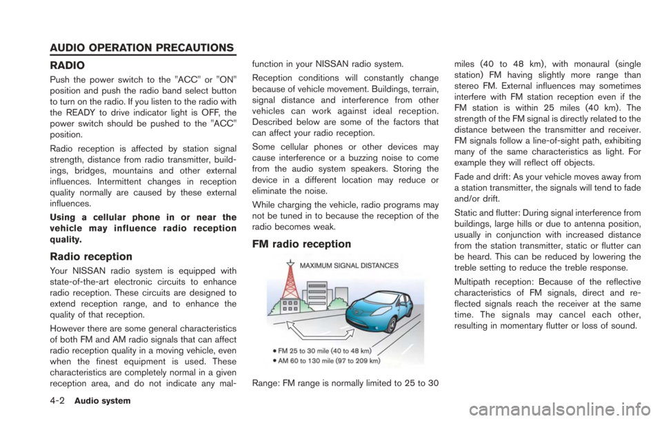
FM radio reception
Range: FM range is normally limited to 25 to 30
miles (40 to 48 km) , with monaural (single
station) FM having slightly more range than
stereo FM. External influences may sometimes
interfere with FM station reception even if the
FM station is within 25 miles (40 km). The
strength of the FM signal is directly related to the
distance between the transmitter and receiver.
FM signals follow a line-of-sight path, exhibiting
many of the same characteristics as light. For
example they will reflect off objects.
Fade and drift: As your vehicle moves away from
a station transmitter, the signals will tend to fade
and/or drift.
Static and flutter: During signal interference from
buildings, large hills or due to antenna position,
usually in conjunction with increased distance
from the station transmitter, static or flutter can
be heard. This can be reduced by lowering the
treble setting to reduce the treble response.
Multipath reception: Because of the reflective
characteristics of FM signals, direct and re-
flected signals reach the receiver at the same
time. The signals may cancel each other,
resulting in momentary flutter or loss of sound.
AUDIO OPERATION PRECAUTIONS
Page 137 of 275

AM radio reception
AM signals, because of their low frequency, can
bend around objects and skip along the ground.
In addition, the signals can bounce off the
ionosphere and be bent back to earth. Because
of these characteristics, AM signals are also
subject to interference as they travel from
transmitter to receiver.
Fading: Occurs while the vehicle is passing
through freeway underpasses or in areas with
many tall buildings. It can also occur for several
seconds during ionospheric turbulence even in
areas where no obstacles exist.
Static: Caused by thunderstorms, electrical
power lines, electric signs and even traffic lights.
Satellite radio reception
When the satellite radio is used for the first time
or the battery has been replaced, the satellite
radio may not work properly. This is not a
malfunction. Wait more than 10 minutes with the
satellite radio ON and the vehicle outside of any
metal or large building for the satellite radio to
receive all of the necessary data.
The satellite radio mode requires an active
SiriusXM Satellite Radio subscription. The sa-
tellite radio is not available in Alaska, Hawaii and
Guam.
The satellite radio performance may be affectedif cargo carried on the roof blocks the satellite
radio signal.
If possible, do not put cargo near the satellite
antenna.
A build up of ice on the satellite radio antenna
can affect satellite radio performance. Remove
the ice to restore satellite radio reception.
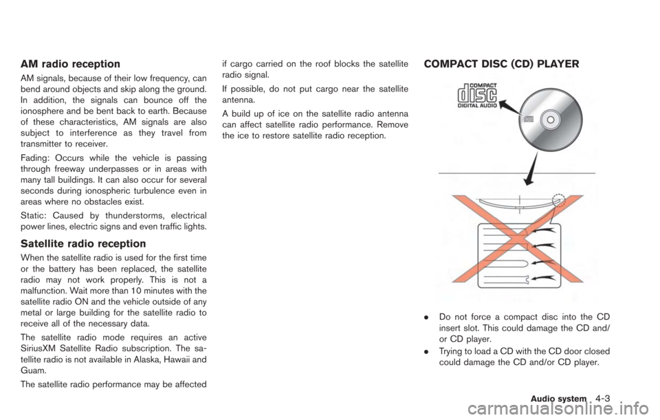
COMPACT DISC (CD) PLAYER
.
Do not force a compact disc into the CD
insert slot. This could damage the CD and/
or CD player.
. Trying to load a CD with the CD door closed
could damage the CD and/or CD player.
Audio system4-3