2012 MERCEDES-BENZ CLS-Class display
[x] Cancel search: displayPage 89 of 234

X
Sel ect Swap in
the menu byturni ngcVd
the COMAND controllera nd pre ssW to
confi rm.
De letin gthe route
X Sel ect Delete in
the menu byturning
cVd theCOMAND controller and press
W toconfi rm.
Ap rompt appears asking whethe rthe route
should bedeleted.
X Select Yes or
No and
press Wtoconfirm .
If you select Yes ,
the route willbedeleted.
If you select No ,
the process willbe
canceled.
Scanning thememory The
SDmemory cardisinserted.
X Select Memory in
the Routes menu
(Y page 85)byturning cVdtheCOMAND
cont roller andpress Wtoconfirm .
The route memory isdispla yed. Off-r
oadand off-ma p
Import antsafety note G
WARNING
The COMAND navigation systemmaydirect
you tooff-road routesthatyour vehicle may
not becapable oftraversing throughwithout
damaging yourtires, wheels orvehicle. Itis
the driver's soleresponsibility todetermine
the suitabili tyof the route. Off-roadroutes
may beofvarying condition sand their appropriateness
foruse may beaffected by
various factorssuchastime ofday, time of
year andimmediate weathercondition sthat
cannot bejudged ortaken intoconsideration
by the COMAND system.
Route guidance toadestination thatis
not onadigitized road COMAND
canguide youtodestinations
which arewithin thearea covered bythe
digital map,butwhich arenot themselves
recorded onthe map.
These destinations areknown asoff-r oad
destinations, whichyoucan enter using the
map, forexample. Inthese cases, COMAND
guides youforaslong aspossible with
navigation announcemen tsand displa yson
roads known tothe system. Example:
routeguidance toan off-road destination
: Off-r oaddestination
; Off-r oadroute section (dashed blue)
= Current vehicleposition (thetipofthe
triangle indicates thevehicle’s direction
of travel)
? Off-r oad(ifavaila ble)
If the vehicle reaches anarea which isnot part
of the digital map,thedispla yappea rsas a
split-screen view.Onthe right-hand side,an
arrow appearswhich points tooff-r oad
destination :.Youwill hear the
announc ement:"Please followthearrow on
the display" .Asthe vehicle approachesthe
destination, theArea ofdestination reached message
appears. Route
guidance
87Navigation Z
Page 93 of 234
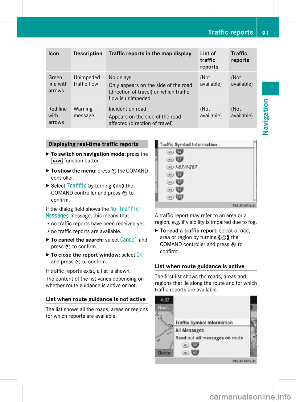
Icon Descr
iption Tr
affic rep ortsin thema pdis pla y List
of
tr af fic
rep orts Tr
affic
rep orts Gree
n
lin ewit h
arr ows Un
impe ded
tr aff icflo w No
delays
On lyappear son theside oftheroad
(dir ection oftravel) onwhic htraff ic
flo wisunim peded (Not
availab le) (Not
availab le) Red
line
wit h
arr ows Warn
ing
mes sage In
cid enton road
Ap pear son theside ofther oad
affect ed(direction oftravel) (Not
availa ble) (Not
availa ble) Displaying
real-timetraffic repor ts
X To switch onnavigation mode:pressthe
Ø functionbutton .
X To show themenu: pressWthe COMAND
cont roller.
X Select Traffic by
turnin gcVd the
COMAND controller andpress Wto
conf irm.
If the dialog fieldshows theNoTraffic Messages message,
thismeans that:
R no traffic reports havebeen received yet.
R no traffic reports areavaila ble.
X To cancel thesearch: selectCancel and
press Wtoconf irm.
X To close thereport window: selectOK and
press Wtoconf irm.
If traffic reports exist,alist isshown.
The cont entofthe listvaries depending on
whether routeguidance isactive ornot .
List when routeguidance isnot active The
listshows allthe roads, areasorregions
for which reports areavaila ble. A
traffic report mayrefer toan area ora
region, e.g.ifvisibility isimpaired duetofog.
X To read atraffic report :select aroad,
area orregion byturnin gcVd the
COMAND controller andpress Wto
conf irm.
List when routeguidance isactive The
first listshows theroads, areasand
regions thatliealong theroute andforwhich
traffic reports areavaila ble. Tr
affic repor ts
91Navigation Z
Page 100 of 234
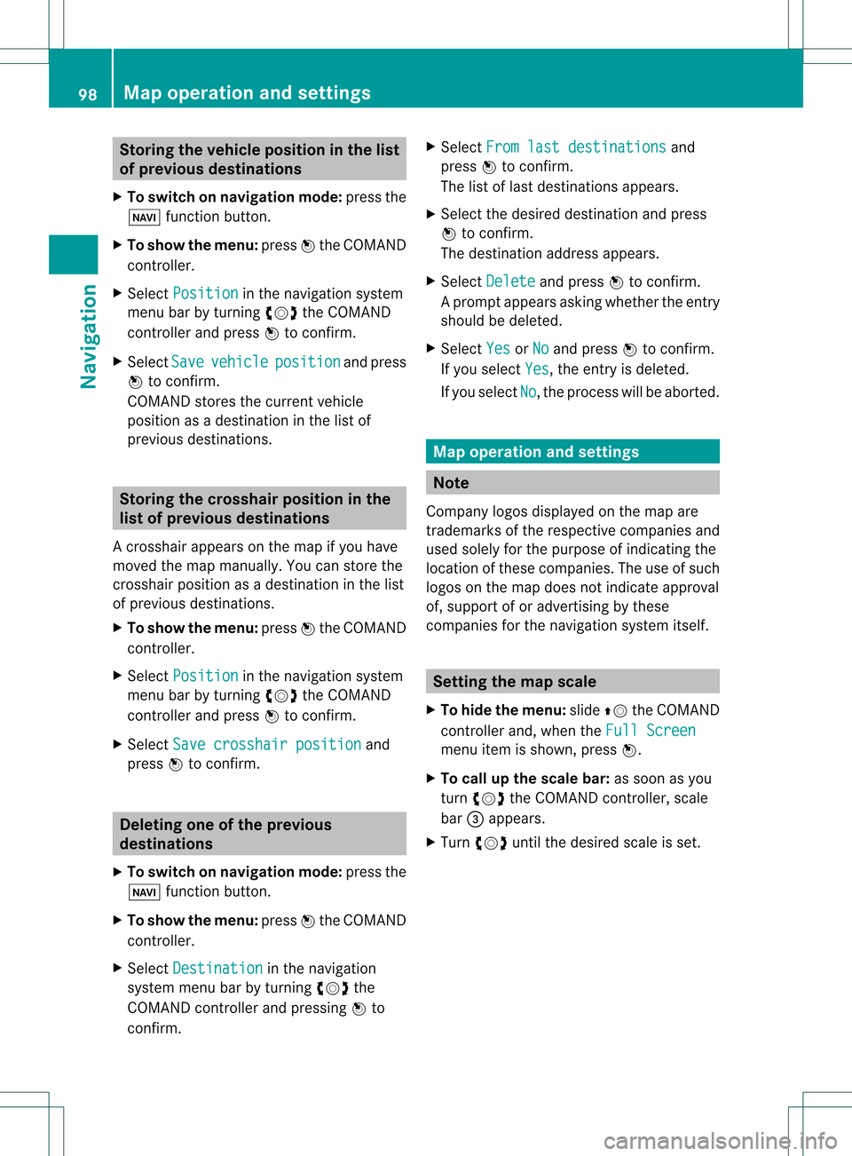
Storing
thevehicle position inthe list
of previous destinations
X To switch onnavigation mode:pressthe
Ø functionbutton.
X To show themenu: pressWthe COMAND
cont roller.
X Select Position in
the navigation system
menu barbyturnin gcVd theCOMAND
cont roller andpress Wtoconf irm.
X Select Save vehicle position and
press
W toconf irm.
COMAND storesthecurrent vehicle
position asadestination inthe listof
previous destinations . Storing
thecrosshair positioninthe
list ofprevious destinations
Ac rossha irapp ears onthe map ifyou have
moved themap manua lly.Y ou can store the
crosshair positionasadestinat ioninthe list
of previous destinations.
X To show themenu: pressWthe COMAND
cont roller.
X Select Position in
the navigation system
menu barbyturnin gcVd theCOMAND
cont roller andpress Wtoconf irm.
X Select Savecrosshair position and
press Wtoconf irm. Dele
ting oneofthe previous
destinat ions
X To switch onnavigation mode:pressthe
Ø functionbutton .
X To show themenu: pressWthe COMAND
cont roller.
X Select Destination in
the navigation
system menubarbyturnin gcVd the
COMAND controller andpressing Wto
conf irm. X
Select Fromlastdestinations and
press Wtoconf irm.
The listoflast destination sappears.
X Select thedesired destinationandpress
W tocon firm.
The destin ationaddress appears.
X Select Delete and
press Wtocon firm.
Ap rompt appears asking whethe rthe entr y
should bedeleted.
X Select Yes or
No and
press Wtoconfirm .
If you select Yes ,
the entr yis deleted.
If you select No ,
the process willbeaborted. Map
operation andsettings Note
Company logosdisplayedonthe map are
trademarks ofthe respective companies and
used solely forthe purpose ofindicating the
location ofthese companies. Theuseofsuch
logos onthe map does notindicate approval
of, support ofor advertising bythese
companies forthe navigation systemitself. Setting
themap scale
X To hide themenu: slideZVtheCOMAND
cont roller and,when theFull Screen menu
itemisshown, pressW.
X To call upthe scale bar:assoon asyou
turn cVd theCOMAND controller, scale
bar =appea rs.
X Turn cVd untilthedesired scaleisset. 98
Map
operat ionand settingsNavigat ion
Page 101 of 234
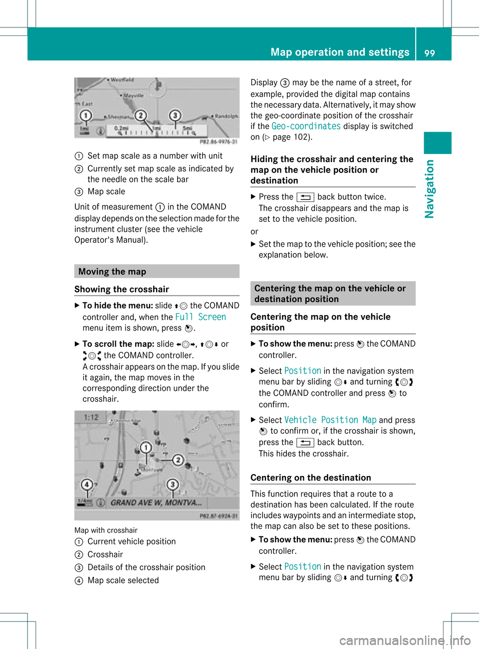
:
Set map scaleas anumb erwith uni t
; Currentl yset map scaleas ind icated by
the need leon the scaleba r
= Mapsca le
Unit ofmea sureme nt: inthe COMAND
di spl aydepends onthe selecti onmad efor the
instr umentclu ster (seethe vehicle
Ope rator'sManua l). Mov
ingthe map
Sho wing the crossh air X
To hide themen u:slide ZV theCOMAND
control lera nd, when the FullScr een menu
itemi sshown, pressW.
X To scroll themap :slide XVY, ZVÆor
aVb theCOMAND controller.
Ac rossha irapp ears onthe map. Ifyou slide
it aga in,the map moves inthe
correspo ndingdirection under the
crossha ir. Map
withcrossha ir
: Current vehicl eposi tion
; Cross hair
= Detail sof the crossha irposi tion
? Map scale selected Displ
ay= may bethe name ofastreet, for
exampl e,provid edthe digitalmap contains
the necessary data.Alter natively, itmay show
the geo- coor dinat eposit ionofthe crosshair
if the Geo- coordinates display
isswitc hed
on (Ypage 102).
Hid ing thecrossh airand center ingthe
ma ponthe vehicle position or
destina tion X
Press the% backbutton twice.
The cross hairdisappears andthemap is
set tothe vehicle position .
or
X Set themap tothe vehicle position ;see the
explanat ionbelow. Centering
themap onthe vehicle or
destina tionposition
Centering themap onthe vehicle
position X
To show themenu: pressWthe COMAND
con troller.
X Select Positio n in
the navigation system
menu barbysliding VÆandturningcVd
the COMAND controller andpress Wto
con firm.
X Select Vehicle PositionMap and
press
W tocon firm or,ifthe cross hairisshown,
press the% backbutton .
This hides thecross hair.
Centering onthe destina tion This
function requires thataroute toa
destin ationhasbeen calculated. Ifthe route
includes waypoints andanintermediate stop,
the map canalso beset tothese position s.
X To show themenu: pressWthe COMAND
con troller.
X Select Positio n in
the navigation system
menu barbysliding VÆandturningcVd Map
opera tionandsettings
99Navigation Z
Page 103 of 234
COMA
NDcontrol ler and pressW to
co nfirm .
A # dot indicat esthene wset ting.
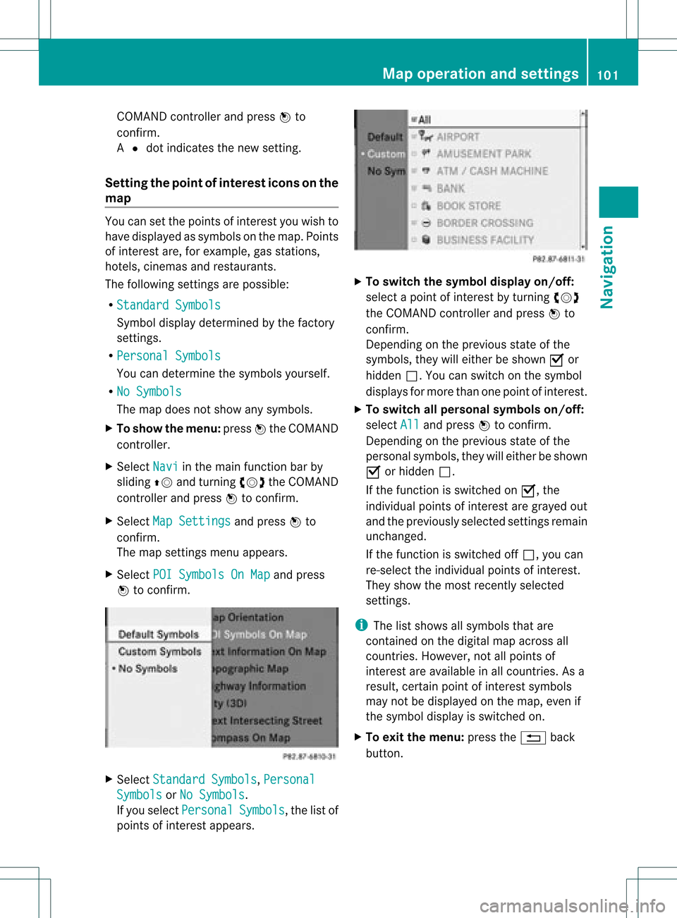
Set tingth epoin tofinterest iconsonthe
map You
cansetthe point sof int erest youwish to
have displayed assymbols onthe map. Points
of interest are,forexample, gasstations,
hotels, cinemasand restaurants.
The following settings arepossible:
R Standar dSymbols Symbol
displaydeterminedbythe factory
sett ings.
R Persona lSymbols You
candeterm inethe symbols yourself.
R No Symbols The
map does notshow anysymbols.
X To show themenu: pressWthe COMAND
con troller.
X Select Navi in
the main function barby
sliding ZVandturningcVd theCOMAND
con troller andpress Wtocon firm.
X Select MapSetting s and
press Wto
con firm.
The map settings menu appears.
X Select POISymbols OnMap and
press
W tocon firm. X
Select Standar dSymbols ,
Persona l Symbols or
No Symbols .
If you select Persona l Symbols ,
the listof
point sof interest appears. X
To switch thesymbol displayon/off:
select apoint ofinterest byturn ingcVd
the COMAND controller andpress Wto
con firm.
Depen dingonthe previous stateof the
symbols, theywilleither beshown Oor
hidden ª.Youcan switch onthe symbol
display sfor more thanonepoint ofinteres t.
X To switch allpersonal symbolson/off:
select All and
press Wtoconf irm.
Dependin gon the previous stateofthe
personal symbols, theywilleither beshown
O orhidden ª.
If the funct ionisswitched onO, the
individual pointsofinteres tare gray edout
and theprevi ouslysele cted settings remain
unchange d.
If the function isswi tched offª, you can
re-sele ctthe indivi dualpoints ofinterest.
They show themost recently selected
settings.
i The listshow sall symb olsthat are
contained onthe digitalmap across all
countries. However,not allpoints of
interest areavailable inall countries. Asa
resu lt,certain pointofinterest symbols
may notbedisp layed on the map, evenif
the symb oldisp layisswi tched on.
X To exitthe menu: pressthe% back
button. Map
operation andsetting s
101Navigatio n Z
Page 104 of 234
Map
information inthe display During
routeguidance, youcan have map
informati onshow natthe bottom edgeofthe
displa y.
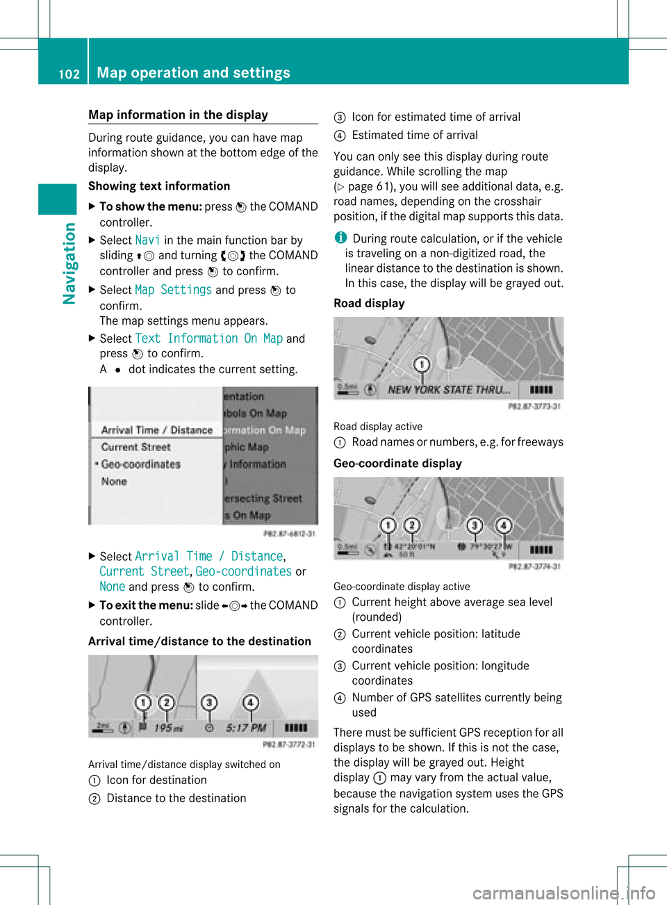
Showing textinformat ion
X To show themenu: pressWthe COMAND
cont roller.
X Select Navi in
the main functionbar by
sliding ZVandturning cVdtheCOMAND
cont roller andpress Wtoconfirm .
X Select MapSettings and
press Wto
confirm .
The map settin gsmenu appears.
X Select TextInformation OnMap and
press Wtoconfirm .
A # dot indicates thecurrent setting. X
Select Arrival Time/Distance ,
Current Street ,
Geo-coordinates or
None and
press Wtoconfirm .
X To exit themenu: slideXVY theCOMAND
cont roller.
Arrival time/distance tothe destination Arrival
time/distanc edisplay switched on
: Icon fordestination
; Distanc eto the destination =
Icon forestimated timeofarrival
? Estimated timeofarrival
You canonly seethis displa yduring route
guida nce.While scrolling themap
(Y page 61),youwillsee additional data,e.g.
road names, depending onthe crosshair
position, ifthe digital mapsupports thisdata.
i During routecalculation, orifthe vehicle
is traveling onanon- digitized road,the
linear distance tothe destination isshown.
In this case, thedispla ywill begrayed out.
Road display Road
display active
: Road names ornumbers, e.g.forfreeways
Geo-coo rdinatedisplay Geo-coordinate
displayactive
: Current heightaboveaverage sealevel
(rounded)
; Current vehicleposition: latitude
coordinates
= Current vehicleposition: longitude
coordinates
? Number ofGPS satellites currentlybeing
used
There mustbesufficient GPSreception forall
displa ystobe shown. Ifthis isnot thecase,
the displa ywill begrayed out.Height
displa y: may varyfrom theactual value,
because thenavigation systemusestheGPS
signals forthe calculation. 102
Map
operat ionand settingsNavigat ion
Page 105 of 234
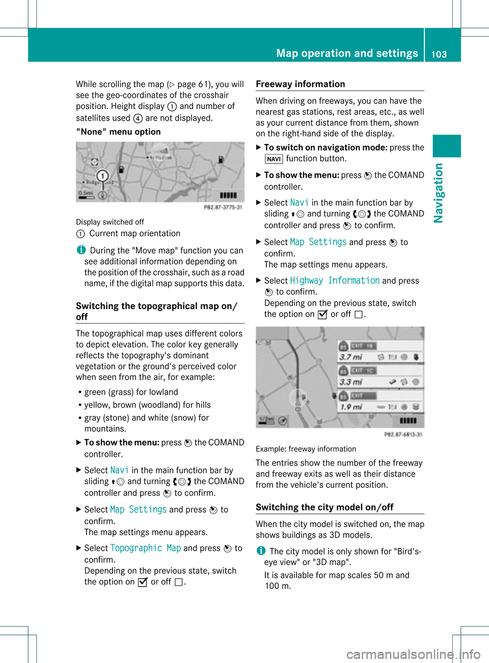
While
scrollin gthe map (Ypage 61),youwill
see thegeo-c oordinat esofthe cross hair
position .Height display :and number of
satellites used?are not displayed.
"None" menuoption Display
switchedoff
: Current maporient ation
i Durin gthe "Move map"function youcan
see additional information depending on
the position ofthe cross hair,such asaroad
name, ifthe digital mapsupports thisdata.
Switching thetopogr aphical map on/
off The
topogr aphical mapuses differen tcolors
to depict elevation. Thecolor keygenerally
reflect sthe topography's dominant
vegetation orthe ground's perceived color
when seenfromtheair,forexample:
R green (grass) forlowland
R yellow ,brown (woodland) forhills
R gray (stone) andwhite (snow) for
mountains.
X To show themenu: pressWthe COMAND
cont roller.
X Select Navi in
the main functionbar by
sliding ZVandturnin gcVd theCOMAND
cont roller andpress Wtoconf irm.
X Select MapSettings and
press Wto
conf irm.
The map settings menu appears.
X Select Topographic Map and
press Wto
conf irm.
Dependin gon the previous state,switch
the option onO oroff ª. Freeway
information When
driving onfreeways, youcan have the
nearest gasstation s,rest areas, etc.,as well
as your current distance fromthem, shown
on the right- hand sideofthe display .
X To switch onnavigation mode:pressthe
Ø functionbutton .
X To show themenu: pressWthe COMAND
cont roller.
X Select Navi in
the main functionbar by
sliding ZVandturnin gcVd theCOMAND
cont roller andpress Wtoconf irm.
X Select MapSettings and
press Wto
conf irm.
The map settings menu appears.
X Select Highway Information and
press
W toconf irm.
Dependin gon the previous state,switch
the option onO oroff ª. Example:
freewayinformation
The entriesshow thenumber ofthe freeway
and freeway exitsaswell astheir distance
from thevehicle's currentposition.
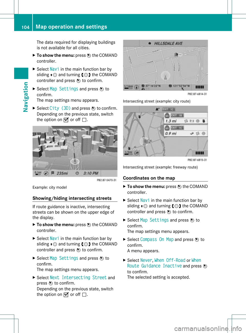
Switching thecity model on/off When
thecity model isswitched on,the map
shows buildingsas3D models.
i The citymodel isonly shown for"Bird's-
eye view" or"3D map".
It is availa bleformap scales 50ma nd
100 m. Map
operatio nand settin gs
103Navi gation Z
Page 106 of 234
The
data required fordisplay ingbuildings
is not availab lefor allcities.
X To show themenu: pressWthe COMAND
cont roller.
X Select Navi in
the main functionbar by
sliding ZVandturnin gcVd theCOMAND
cont roller andpress Wtoconf irm.
X Select MapSettings and
press Wto
conf irm.
The map settings menu appears.
X Select City (3D) and
press Wtoconf irm.
Dependin gon the previous state,switch
the option onO oroff ª. Example:
citymodel
Showing/hiding intersectingstreets If
route guidance isinact ive,inter secting
street scan beshown onthe upper edgeof
the display .
X To show themenu: pressWthe COMAND
cont roller.
X Select Navi in
the main functionbar by
sliding ZVandturnin gcVd theCOMAND
cont roller andpress Wtoconf irm.
X Select MapSettings and
press Wto
conf irm.
The map settings menu appears.
X Select NextIntersecti ngStreet and
press Wtoconf irm.
Dependin gon the previous state,switch
the option onO oroff ª. Int
ersect ingstreet (example: cityroute) Int
ersect ingstreet (example: freewayroute)
Coordinates onthe map X
To show themenu: pressWthe COMAND
cont roller.
X Select Navi in
the main functionbar by
sliding ZVandturnin gcVd theCOMAND
cont roller andpress Wtoconf irm.
X Select MapSettings and
press Wto
conf irm.
The map settings menu appears.
X Select Compass OnMap and
press Wto
conf irm.
Am enu appears.
X Select Never ,
When Off-Roa d or
When Route
Guidanc eInactiv e and
press W
to con firm.
The select edsett ingisaccept ed. 104
Map
opera tionandsettingsNavigation