2012 MERCEDES-BENZ CLS-Class display
[x] Cancel search: displayPage 67 of 234

Selec
tion Step
From
POIs X
Ent erapoint of
interest
(Y page 66). From
Personal POIs X
Ent era
destination from
the personal
points ofinterest
(Y page 75). Using
Map X
Ent era
destination using
the map
(Y page 61). Using
Geo- Coordinates X
Ent era
destination using
the geo-
coordinates
(Y page 62). When
theentr yis complete, theway point
appea rs. X
To accept thewaypoint: confirmOK by
pressing W.
X To display thedetails: selectDetails by
turnin gcVd theCOMAND controller and
press Wtoconf irm.
X To make acall: select Call with
the
COMAND controller andpress Wto
conf irm. COMAND switchestotelephone
mode (Ypage 122). i
This menu itemisavaila bleifthe way point
has atelephone numberandamobile
phone isconn ected toCOMAND
(Y page 116).
X To call upthe map :select Map with
the
COMAND controller andpress Wto
conf irm.
X You canmove themap andselect the
destination.
X To store thewaypoint inthe destination
memory :select Presets with
the
COMAND controller andpress Wto
conf irm.
When youhave accepted theway point, itis
entered inthe way point menu. Theexample
shows themenu withtwoentered waypoints. Waypoi
ntmenu withtwowayp oints
Editing waypoints You
can:
R change waypoints
R change thesequence inthe way point menu
R delete waypoints
To change thesequence, bothwaypoints
must beentered.
X To change waypoints: selectthesymbol
for way point 1or 2in the way point menu
by turnin gcVd theCOMAND controller
and press Wtoconf irm.
X Select Edit and
press Wtoconf irm.
X Use oneofthe destination entryoptions
offered. Des
tinat ionentry
65Navigat ion Z
Page 71 of 234

Point
ofinter estsearch nearthecurrent position
(example)
i The point ofinter estsearch iscanc eled
when 50points ofinter esthave been
found.
COMAND searcheswithinaradius of
approximately 60mi.
If COMAND failstofind apoint ofinter est
within thisradius, itexten dsits search
range toapproximately 125mi.
If COMAND findsonepoint ofinter est
within thisradius, itfinishes thesearch.
Onc ethe search iscompleted, thepoint of
inter estlistisdisplay ed. Point
ofinterest list
Introdu ction The
point ofinter estlistdisplay sthe search
results forthe selection made. Point
ofinter estlist(example) An
entrycont ains thefollowing information:
R an arrow thatshows thelinear direction to
the point ofinter est
R the linear distanc eto the point ofinter est
R the name ofthe point ofinter est
i The arrow andlinear distanc eto the
destinat ionare not visible ifyou have
ent ered apoint ofinter estwithin aspecific
city.
The arrow isalso notshown whenapoint
of inter estinthe vicinit yof the destinat ion
has been entered.
Dependin gon the point ofinter est
selected, COMAND usesdifferent
referen cepoints indetermin ingthe linear
distanc eto the destinat ion:
R vicinit yof curren tposition: thelinear
distanc eis the distanc eof the point of
inter estfrom thecurren tvehicle
position.
R vicinit yof destinat ion:thelinear distanc e
is the distanc efrom thedestinat ion
ent ered tothe point ofinter est.
Selecting apoint ofint eres t The
exam plehas been selectedin thepoin t
of interes tcate gor yBAR &RES TAURANT .
X Sel ect thepoin tof intere stinthepoin tof
int ere stlist byturnin gcVd theCOMA ND
co ntroll erand pres sW toconfirm .
The comple teaddre ssofthepoin tof
int erest selectedisshown . Enter
ingapoint ofint eres t
69Navi gatio n Z
Page 72 of 234

:
Point ofinter estwith address
; Tostart route calculation
= Tostore anaddress inthe destinat ion
memory
? Todisplay details
A Tomake acall (when availabl e)
B Tocanc elselection
C Toshow anaddress onthe map
X To star trout ecalculation: selectStart and
press Wtoconf irm.
X To store anadd ress inthe destinat ion
memor y:select Save and
press Wto
conf irm. Youcannow select storage
options (Ypage 96).
X To show thedeta iledview: select
Details and
press Wtoconf irm.
X To mak eacall: select Call and
press W
to conf irm. COMAND switchesto
telephone mode(Ypage 122).
i This menu itemisavailabl eif the point of
inter esthas atelephone numberanda
mobile phoneisconn ected toCOMAND
(Y page 116).
X To call upthe map :select Map and
press
W toconf irm.
X You canmove themap andselect the
destinat ion(Ypage 61).
ZAGAT ®
survey service En
tries withtheZicon containadditional
ZAGAT information.ZAGAT ratesrestaurant s,for
inst ance, inregard tothe quality ofthe
food, furnishin g,service, andprovides an
average pricinglevelaswell asageneral
descript ion. X
Select theentrywith theZicon byturn ing
cVd theCOMAND controller andpress
W toconf irm.
The ZAGAT evaluations appear. 1
ZAGAT ratings
2 Todisplay details
X To show adescri ption: selec tDet ails and
pres sW tocon firm. ZAGA
Texam pledesc ription 70
Enter
ingapoint ofint eres tNavi gatio n
Page 73 of 234
Point
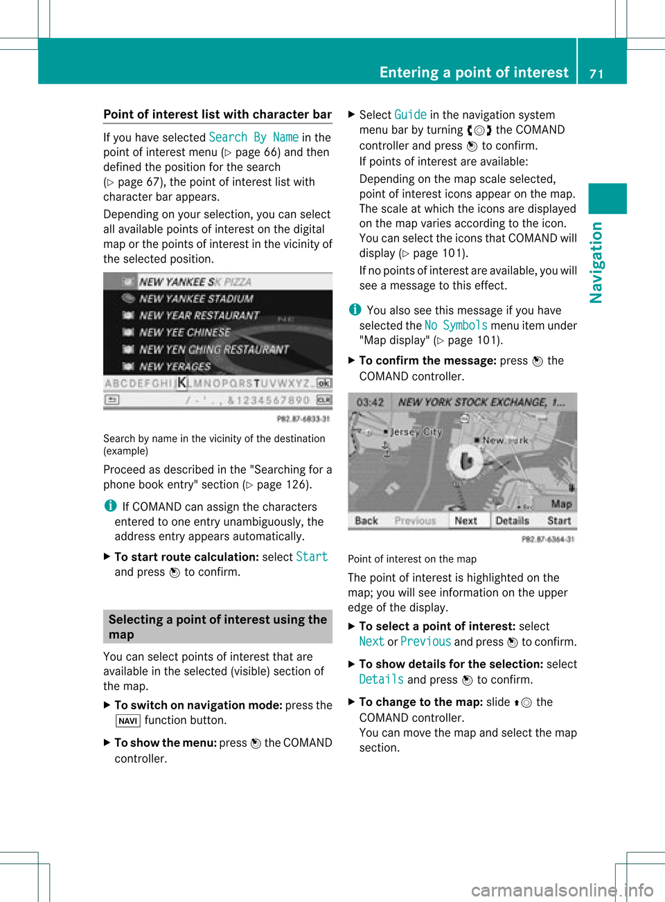
ofinterest listwith charact erbar If
you have selected SearchByName in
the
point ofinterest menu(Ypage 66)and then
defined theposition forthe search
(Y page 67),thepoint ofinterest listwith
character barappears.
Depending onyour selection, youcan select
all availa blepoints ofinterest onthe digital
map orthe points ofinterest inthe vicinity of
the selected position. Search
byname inthe vicinity ofthe destination
(example)
Proceed asdescribed inthe "Searching fora
phone bookentry"section (Ypage 126).
i IfCOMAND canassign thecharacters
entered toone entryunambiguou sly,the
address entryappears automatically.
X To star troute calculation: selectStart and
press Wtoconf irm. Selec
tingapoint ofint eres tusing the
map
You canselect points ofinter estthat are
available inthe selected (visible)sectionof
the map.
X To switch onnavigat ionmode: pressthe
Ø function button .
X To show themenu: pressWthe COMAND
con troller. X
Select Guide in
the navigation system
menu barbyturn ingcVd theCOMAND
con troller andpress Wtocon firm.
If points ofinter estare available:
Depen dingonthe map scale selected,
point ofinter esticons appear onthe map.
The scale atwhich theicons aredisplayed
on the map varies accordin gto the icon.
You canselect theicons thatCOMAND will
display (Ypage 101).
If no points ofinter estare available, youwill
see amessage tothis effec t.
i You also seethis message ifyou have
selected theNo Symbols menu
itemunder
"Map display" (Ypage 101).
X To confirm themessage: pressWthe
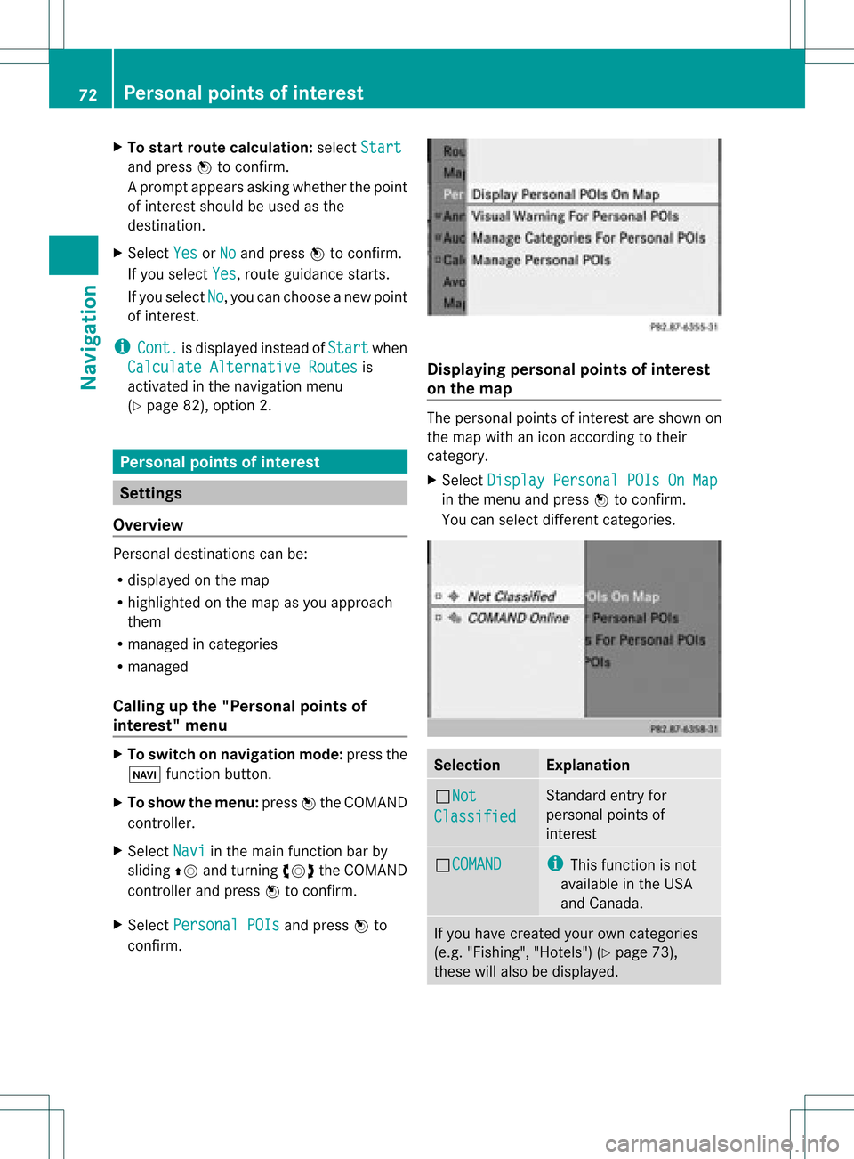
COMAND controller. Point
ofinter estonthe map
The point ofinter estishighlighted onthe
map; youwillsee infor mation onthe upper
edge ofthe display.
X To select apoint ofint erest :selec t
Nex t or
Pre vious and
pres sW tocon firm.
X To show details fortheselecti on:selec t
Det ails and
pres sW tocon firm.
X To chan getothema p:slide ZVthe
COMA NDcontroller .
You canmov eth emap andselec tthe map
section. Entering
apoint ofint eres t
71Navi gatio n Z
Page 74 of 234
X
To start route calculati on:sel ect Start and
pressW toconfi rm.
Ap rompt appears asking whethe rthe point
of interest shouldbeused asthe
destination.
X Select Yes or
No and
press Wtoconfirm .
If you select Yes ,
route guidancestarts.
If you select No ,
you can choose anew point
of interest .
i Cont. is
displa yedinstead ofStart when
Calculate Alternative Routes is
activated inthe navigation menu
(Y page 82),option 2. Personal
pointsofinterest Settings
Overview Personal
destinations canbe:
R displa yedonthe map
R highlighted onthe map asyou approach
them
R managed incategories
R managed
Calling upthe "Personal pointsof
interest" menu X
To switch onnavigation mode:pressthe
Ø functionbutton.
X To show themenu: pressWthe COMAND
cont roller.
X Select Navi in
the main functionbar by
sliding ZVandturning cVdtheCOMAND
cont roller andpress Wtoconfirm .
X Select Personal POIs and
press Wto
confirm . Displaying
personalpointsofinterest
on the map The
personal pointsofinterest areshown on
the map withanicon according totheir
category.
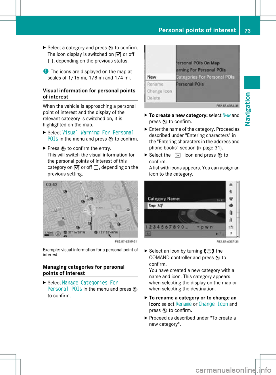
X Select Display Personal POIsOnMap in
the menu andpress Wtoconfirm .
You canselect different categories. Selec
tion Explanation
ªNot
Classified Standard
entryfor
personal pointsof
interest ªCOMAND i
This funct ionisnot
availa bleinthe USA
and Canada . If
you have created yourowncategories
(e.g. "Fishing", "Hotels")(Ypage 73),
these willalso bedispla yed. 72
Personal
pointsofinterestNavigat ion
Page 75 of 234
X
Sel ect acate goryand pressW toconfi rm.
The icond isplay isswitc hedonO oroff
ª, depen dingonthe prev ious status.
i The iconsare displayed onthe map at
scales of1/ 16 mi, 1/8mi and 1/4mi.
Visu alinfor mation forpersonal points
of inter est When
thevehic leisapproac hingaperso nal
point ofinterest andthedisplay ofthe
relev antcategory isswitc hedon,itis
highligh tedonthe map.
X Selec tVisu alWarn ingForPersonal POIs in
the men uand press Wtocon firm .
X Press Wtocon firm theentry.
This willswitc hthe visual inform ation for
the perso nalpoint sof interest ofthis
cat egory onO oroff ª, depen dingonthe
prev ious setting. Ex
ample: visualinform ation foraperso nalpoint of
int erest
Man aging categories forpersonal
point sof inter est X
Selec tMana geCate goriesFor Pers
onal POIs in
the men uand press W
to con firm . X
To crea tean ew category :selec tNew and
pres sW tocon firm.
X En ter thenam eof thecat egor y.Proc eedas
desc ribed under "Entering char acters" in
th e"En tering char acters intheaddres sand
phon ebook s"sec tion(Ypage 31).
X Select the¬ iconandpress Wto
con firm.
Al ist with iconsappears. Youcanassign an
icon tothe category. X
Selec tan icon byturnin gcVd the
COMA NDcontroller andpress Wto
con firm .
You have created anew category witha
name andicon.This category appears
when selecting thedispla yon the map or
when selecting thedestination.
X To rename acategory ortochange an
icon: select Rename or
Change Icon and
press Wtoconfirm .
X Proceed asdescribed under"Tocreate a
new category". Personal
pointsofinterest
73Navigation Z
Page 77 of 234
Selec
tingasthe destination
X Insert theSDmemory card(Ypage 157).
X To switch onnavigation mode:pressthe
Ø functionbutton.
X To show themenu: pressWthe COMAND
cont roller.
X Select Destination in
the navigation
system menubarbyturnin gcVd the
COMAND controller andpress Wto
conf irm.
X Select FromPersonal POIs and
press
W toconf irm.
Al ist with thecategorie sfor perso nal
point sof interest appears. X
Selec tan ent ryand press Wtocon firm . Selection Expla
nation Not
Clas
sified St
andard entryfor
perso nalpoint sof
int erest . COMA
ND This
function isnot
available inthe USA and
Canada. Coff
ee Shop
s Ico
nand category that
you have created yourself
(Y page 73). In
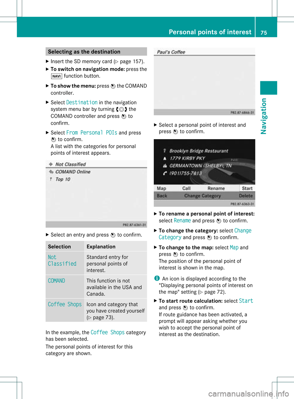
the exam ple,theCoff eeShop s cat
egory
has been selected.
The perso nalpoint sof interest forthis
cat egory areshown . X
Selec tapersonal pointofinterest and
press Wtocon firm. X
To renam eapers onal point ofinter est:
select Rename and
press Wtocon firm.
X To change thecategor y:select Change Catego
ry and
press Wtocon firm.
X To change tothe map:select Map and
press Wtocon firm.
The position ofthe person alpoint of
int erest isshown inthe map.
i Anicon isdisplayed accordingtothe
"Displaying personalpoint sof interest on
the map" setting(Ypage 72).
X To star trout ecalculat ion:select Start and
press Wtocon firm.
If route guidance hasbeen activated, a
prompt willappear askingwhether you
wish toaccept theperson alpoint of
int erest asthe destin ation. Personal
pointsofinter est
75Navigat ion Z
Page 79 of 234
X
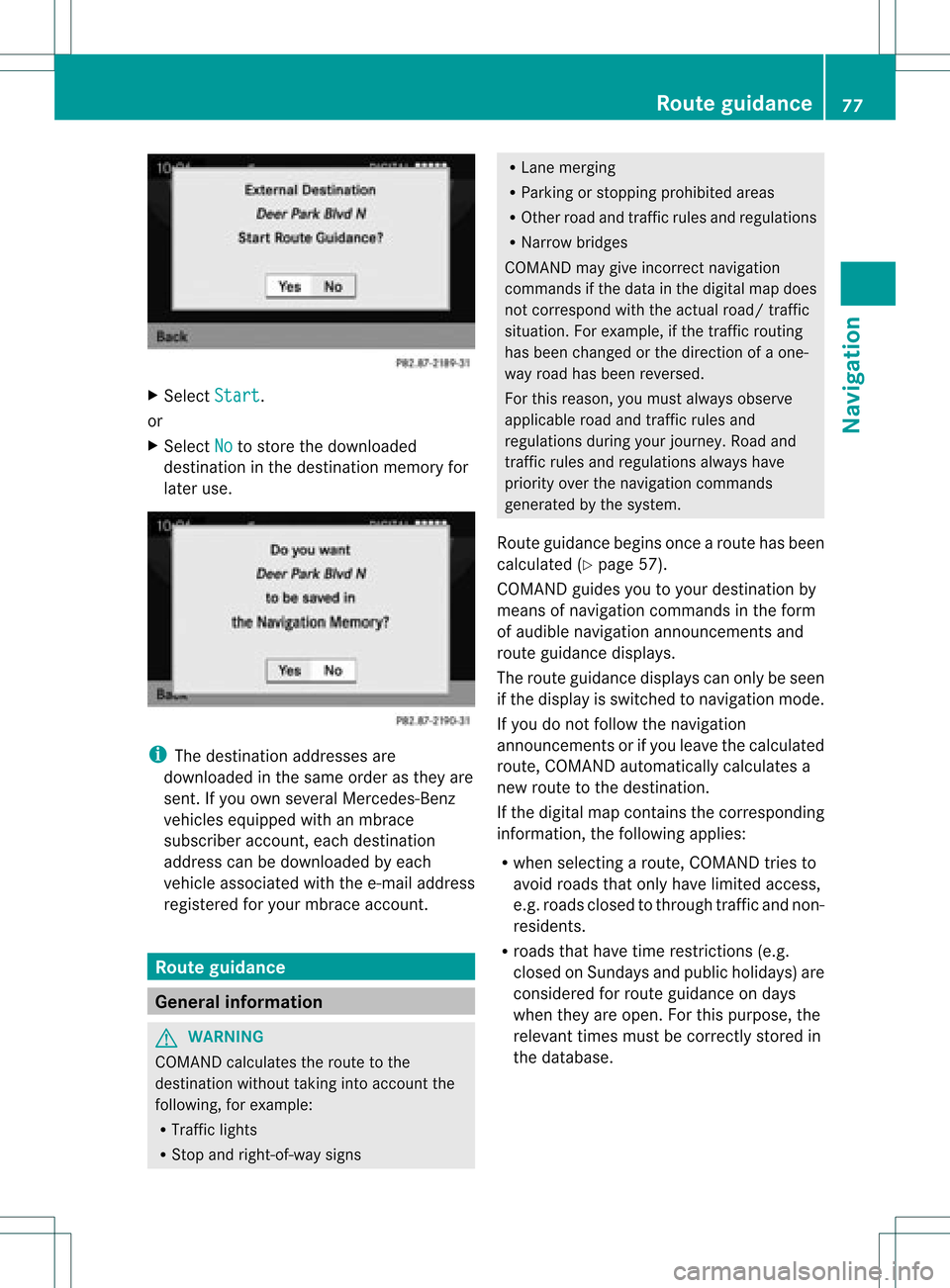
Sel ect Start .
or
X Sel ect No to
store thedow nloaded
de stina tioninthe destina tionmemo ryfor
la ter use. i
The destina tionaddre sse sare
dow nloaded inthe same orderas they are
sent. Ifyo uow ns everal Mercedes- Benz
vehicles equipped withanmbrace
subscriber account,each destin ation
address canbedownloaded byeach
vehicle associated withthee-mail address
register edfor your mbrace account. Rout
eguida nce General
information G
WARN
ING
COMAND calculates theroute tothe
destin ationwithout takinginto accoun tthe
following, forexample:
R Traffic lights
R Stop and right- of-way signs R
Lane mergin g
R Parkin gor stoppin gprohibited areas
R Other roadandtrafficrules andregulations
R Narrow bridges
COMAND maygiveincor rectnavigation
comm andsifthe data inthe digital mapdoes
not corr espond withtheactual road/traffic
situation .For example, ifthe traff icroutin g
has been changed orthe direct ionofaone-
way road hasbeen revers ed.
For this reason, youmust alway sobserve
applicable roadandtrafficrules and
regulations duringyourjourn ey.Road and
traff icrules andregulations alwayshave
priority overthenavigation commands
generat edbythe system.
Route guidance beginsoncear oute hasbeen
calculated (Ypage 57).
COMAND guidesyoutoyour destination by
means ofnavigation commandsinthe form
of audib lenavigation announcementsand
route guidance displays.
The route guidance displayscan only beseen
if the display isswitched tonavigation mode.
If you donot follow thenavigation
announc ementsor ifyou leave thecalculated
route, COMAND automatically calculatesa
new route tothe destination .
If the digital mapcontains thecorrespon ding
inform ation,thefollowing applies:
R when selecting aroute, COMAND triesto
avoid roads thatonly have limited access,
e.g. roads closed tothrough trafficandnon-
residents.
R roads thathave timerestriction s(e.g.
closed onSundays andpublic holiday s)are
considered forroute guidance ondays
when theyareopen. Forthis purpose, the
relevant timesmustbecorrec tlystored in
the database. Rout
eguidance
77Navigation Z