Page 129 of 187
128 Navigation*
Destination entry
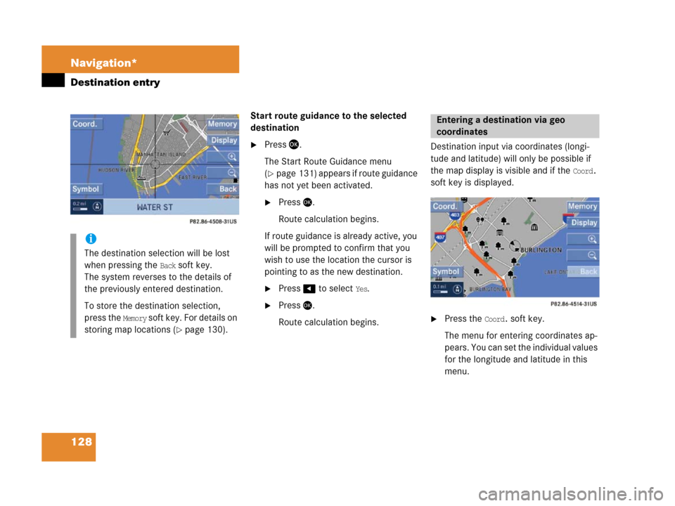
Start route guidance to the selected
destination
�Press '.
The Start Route Guidance menu
(
�page 131) appears if route guidance
has not yet been activated.
�Press'.
Route calculation begins.
If route guidance is already active, you
will be prompted to confirm that you
wish to use the location the cursor is
pointing to as the new destination.
�Press# to select Yes.
�Press'.
Route calculation begins.Destination input via coordinates (longi-
tude and latitude) will only be possible if
the map display is visible and if the
Coord.
soft key is displayed.
�Press the Coord. soft key.
The menu for entering coordinates ap-
p e a r s . Y o u c a n s e t t h e i n d i v i d u a l v a l u e s
for the longitude and latitude in this
menu.
i
The destination selection will be lost
when pressing the
Back soft key.
The system reverses to the details of
the previously entered destination.
To store the destination selection,
press the
Memory soft key. For details on
storing map locations (
�page 130).
Entering a destination via geo
coordinates
Page 130 of 187
129 Navigation*
Destination entry
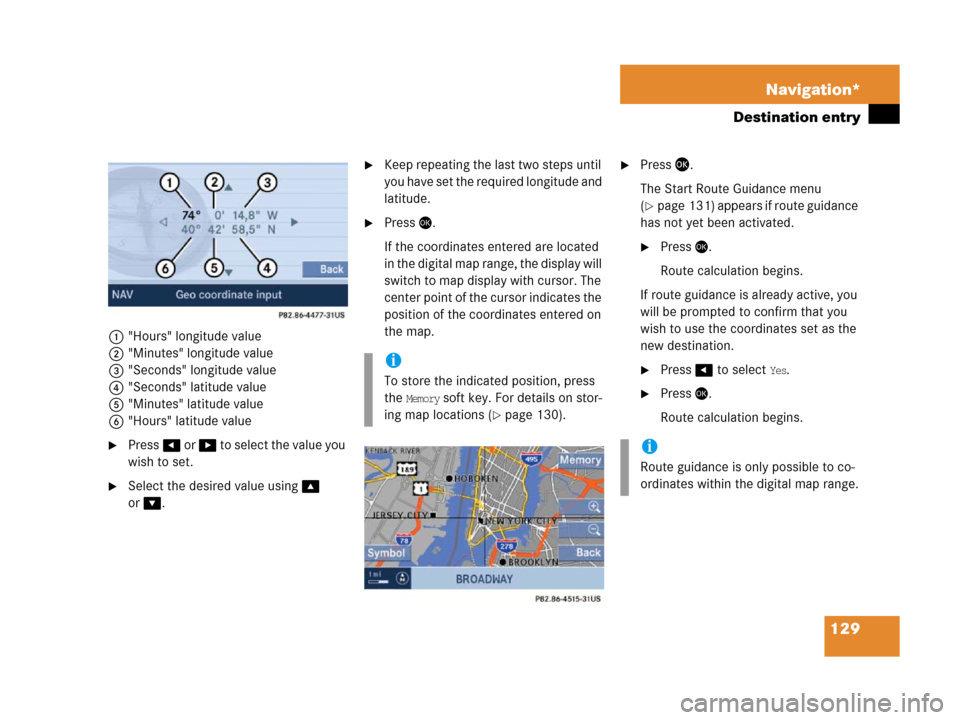
1"Hours" longitude value
2"Minutes" longitude value
3"Seconds" longitude value
4"Seconds" latitude value
5"Minutes" latitude value
6"Hours" latitude value
�Press# or $ to selec t the va lue you
wish to set.
�Select the desired value using%
or
&.
�Keep repeating the last two steps until
you have set the required longitude and
latitude.
�Press'.
If the coordinates entered are located
in the digital map range, the display will
switch to map display with cursor. The
center point of the cursor indicates the
position of the coordinates entered on
the map.
�Press '.
The Start Route Guidance menu
(
�page 131) appears if route guidance
has not yet been activated.
�Press'.
Route calculation begins.
If route guidance is already active, you
will be prompted to confirm that you
wish to use the coordinates set as the
new destination.
�Press# to select Yes.
�Press'.
Route calculation begins.
i
To store the indicated position, press
the
Memory soft key. For details on stor-
ing map locations (
�page 130).
i
Route guidance is only possible to co-
ordinates within the digital map range.
Page 131 of 187
130 Navigation*
Destination entry
You can store the current vehicle position
or a location selected via the map as an en-
try in the Last Destinations memory.
Therein such entries are marked with
(
�page 151).
If you wish to store such entries for later
retrieval or repeat usage, you can save
them in the Destination memory
(
�page 152).
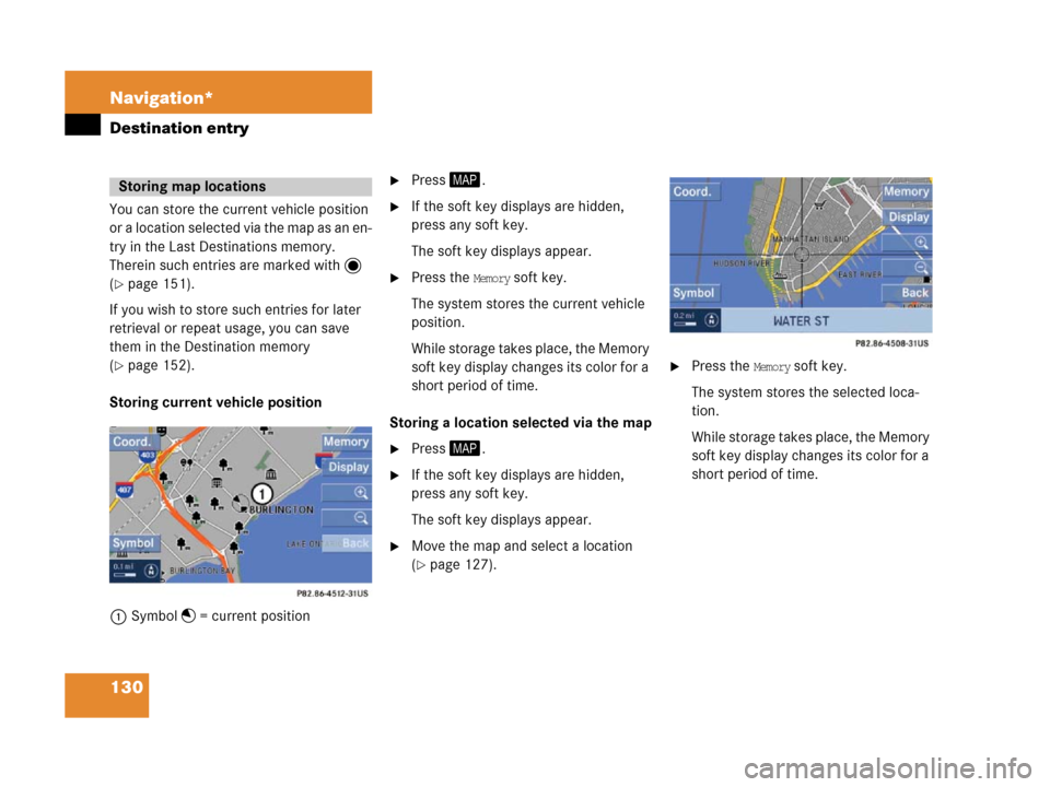
Storing current vehicle position
1Symbol = current position
�Press5.
�If the soft key displays are hidden,
press any soft key.
The soft key displays appear.
�Press the Memory soft key.
The system stores the current vehicle
position.
While storage takes place, the Memory
soft key display changes its color for a
short period of time.
Storing a location selected via the map
�Press5.
�If the soft key displays are hidden,
press any soft key.
The soft key displays appear.
�Move the map and select a location
(
�page 127).
.
�Press the Memory soft key.
The system stores the selected loca-
tion.
While storage takes place, the Memory
soft key display changes its color for a
short period of time.
Storing map locations
Page 132 of 187
131 Navigation*
Route guidance
� Route guidance
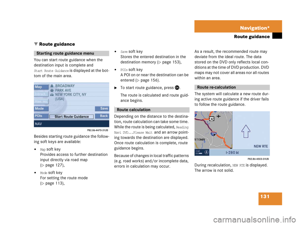
You can start route guidance when the
destination input is complete and
Start Route Guidance is displayed at the bot-
tom of the main area.
Besides starting route guidance the follow-
ing soft keys are available:
�Map soft key
Provides access to further destination
input directly via road map
(
�page 127),
�Mode soft key
For setting the route mode
(
�page 113),
�Save soft key
Stores the entered destination in the
destination memory (
�page 153),
�POIs soft key
A POI on or near the destination can be
entered (
�page 156).
�To start route guidance, press '.
The route is calculated and route guid-
ance begins.
a
Depending on the distance to the destina-
tion, route calculation can take some time.
While the route is being calculated,
Reading
Navi DVD...Please Wait
and an arrow point-
ing towards the destination are displayed.
Once route calculation is complete, route
guidance begins.
Because of changes in local traffic patterns
(e.g. road works) and/or incomplete data,
errors in calculation may occur.As a result, the recommended route may
deviate from the ideal route. The data
stored on the DVD only reflects local con-
ditions at the time of DVD production. DVD
maps may not cover all areas nor all routes
within an area.
The system will calculate a new route dur-
ing active route guidance if the driver fails
to follow the route guidance.
During recalculation,
NEW RTE is displayed.
The arrow is not solid.
Starting route guidance menu
Route calculation
Route re-calculation
Page 133 of 187
132 Navigation*
Route guidance
After route calculation, the system assists
r o u t e g u i d a n c e u s i n g p i c t o r i a l d i s p l a y s a n d
navigation announcements.
Repeating a current navigation an-
nouncement
If a navigation announcement is not readily
understood, it can be repeated at any time.
�Press 9.
The current navigation announcement
is repeated.
Switching navigation announcements
ON/OFF
Switching OFF:
�During a navigation announcement,
press (.
For a short period of time, the message
Voice announcements muted is displayed.
Further route guidance takes place
only via the symbols in the display.
If a new route guidance cycle is started,
the announcements are automatically
switched ON again.
Switching ON manually:
�Press 9.The navigation displays are visible only
with activated route guidance.
�To switch to the navigation display
from another display, e.g. from CD
mode, press4 or 5.
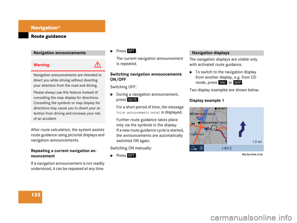
Two display examples are shown below.
Display example 1
Navigation announcements
WarningG
Navigation announcements are intended to
direct you while driving without diverting
your attention from the road and driving.
Please always use this feature instead of
consulting the map display for directions.
Consulting the symbols or map display for
directions may cause you to divert your at-
tention from driving and increase your risk
of an accident.
Navigation displays
Page 134 of 187
133 Navigation*
Route guidance
The road currently travelled on is indicated
in the status bar at the bottom, in this ex-
ample
I-80 E (Interstate 80 East).
The information 1.2 mi on the very right in-
dicates the distance to the next driving ma-
neuver.
The circle shows the current vehicle lo-
cation. The arrow in the circle designates
the current driving direction.
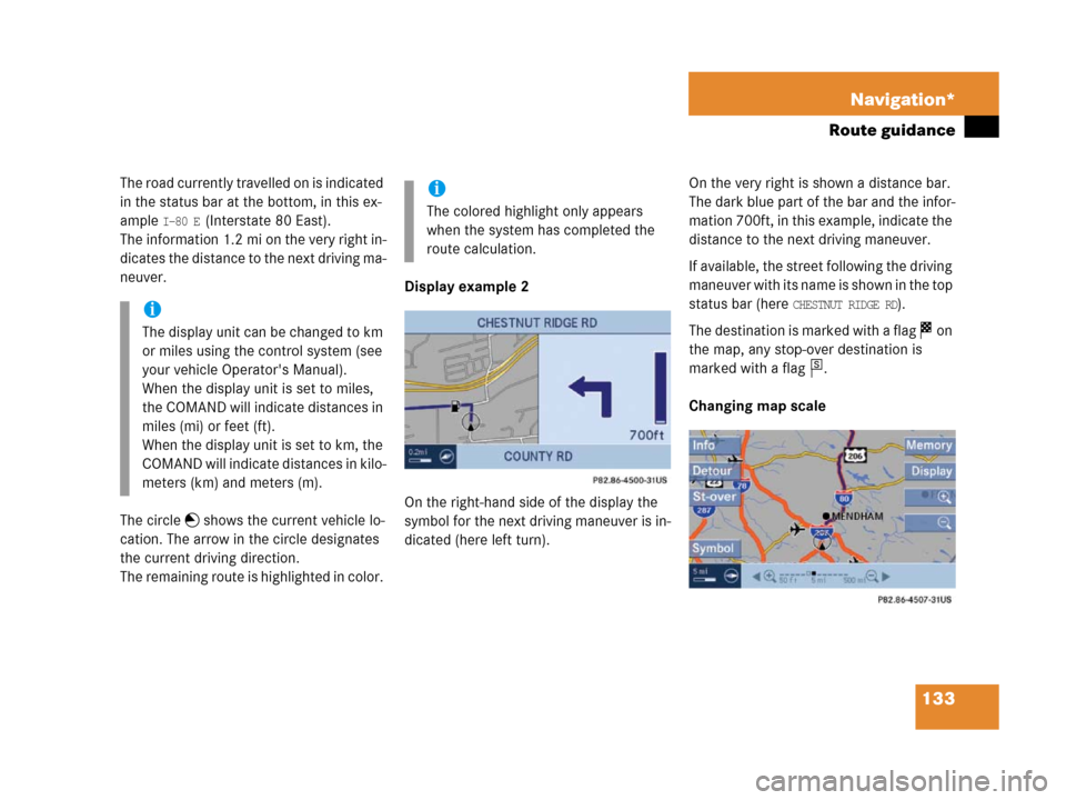
The remaining route is highlighted in color. Display example 2
On the right-hand side of the display the
symbol for the next driving maneuver is in-
dicated (here left turn).On the very right is shown a distance bar.
The dark blue part of the bar and the infor-
mation 700ft, in this example, indicate the
distance to the next driving maneuver.
If available, the street following the driving
m a n e u v e r w i t h i t s n a m e i s s h o w n i n t h e t o p
status bar (here
CHESTNUT RIDGE RD).
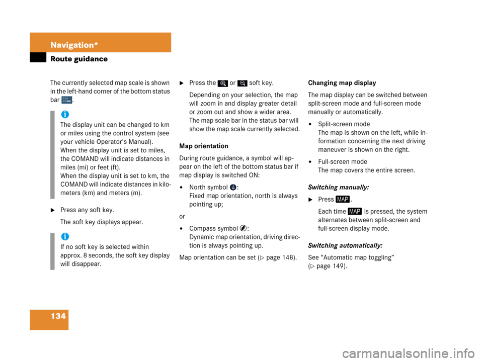
The destination is marked with a flag on
the map, any stop-over destination is
marked with a flag .
Changing map scalei
The display unit can be changed to km
or miles using the control system (see
your vehicle Operator's Manual).
When the display unit is set to miles,
the COMAND will indicate distances in
miles (mi) or feet (ft).
When the display unit is set to km, the
COMAND will indicate distances in kilo-
meters (km) and meters (m).
i
The colored highlight only appears
when the system has completed the
route calculation.
s
Page 135 of 187
134 Navigation*
Route guidance
The currently selected map scale is shown
in the left-hand corner of the bottom status
bar .
�Press any soft key.
The soft key displays appear.
�Press the or soft key.
Depending on your selection, the map
will zoom in and display greater detail
or zoom out and show a wider area.
The m ap sc ale bar in t he stat us ba r will
show the map scale currently selected.
Map orientation
During route guidance, a symbol will ap-
pear on the left of the bottom status bar if
map display is switched ON:
�North symbol :
Fixed map orientation, north is always
pointing up;
or
�Compass symbol :
Dynamic map orientation, driving direc-
tion is always pointing up.
Map orientation can be set (
�page 148).Changing map display
The map display can be switched between
split-screen mode and full-screen mode
manually or automatically.
�Split-screen mode
The map is shown on the left, while in-
formation concerning the next driving
maneuver is shown on the right.
�Full-screen mode
The map covers the entire screen.
Switching manually:
�Press5.
Each time 5 is pressed, the system
alternates between split-screen and
full-screen display mode.
Switching automatically:
See “Automatic map toggling”
(
�page 149).
i
The display unit can be changed to km
or miles using the control system (see
your vehicle Operator's Manual).
When the display unit is set to miles,
the COMAND will indicate distances in
miles (mi) or feet (ft).
When the display unit is set to km, the
COMAND will indicate distances in kilo-
meters (km) and meters (m).
i
If no soft key is selected within
approx. 8 seconds, the soft key display
will disappear.
Page 136 of 187
135 Navigation*
Route guidance
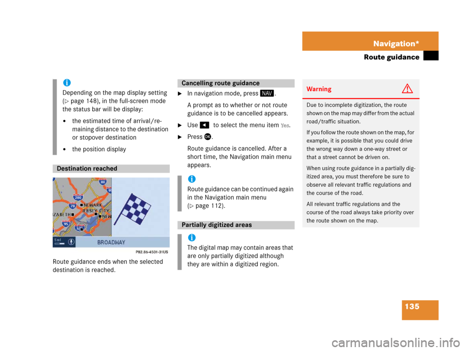
.
Route guidance ends when the selected
destination is reached.
�In navigation mode, press 4.
A prompt as to whether or not route
guidance is to be cancelled appears.
�Use #7to select the menu item Yes.
�Press '.
Route guidance is cancelled. After a
short time, the Navigation main menu
appears.
i
Depending on the map display setting
(
�page 148), in the full-screen mode
the status bar will be display:
�the estimated time of arrival/re-
maining distance to the destination
or stopover destination
�the position display
Destination reached
Cancelling route guidance
i
Route guidance can be continued again
in the Navigation main menu
(
�page 112).
Partially digitized areas
i
The digital map may contain areas that
are only partially digitized although
they are within a digitized region.
WarningG
Due to incomplete digitization, the route
s h o w n o n t h e m a p m a y d i f f e r f r o m t h e a c t u a l
road/traffic situation.
If you follow the route shown on the map, for
example, it is possible that you could drive
the wrong way down a one-way street or
that a street cannot be driven on.
When using route guidance in a partially dig-
itized area, you must therefore be sure to
observe all relevant traffic regulations and
the course of the road.
All relevant traffic regulations and the
course of the road always take priority over
the route shown on the map.