Page 147 of 225

139 Navigation
Destination input
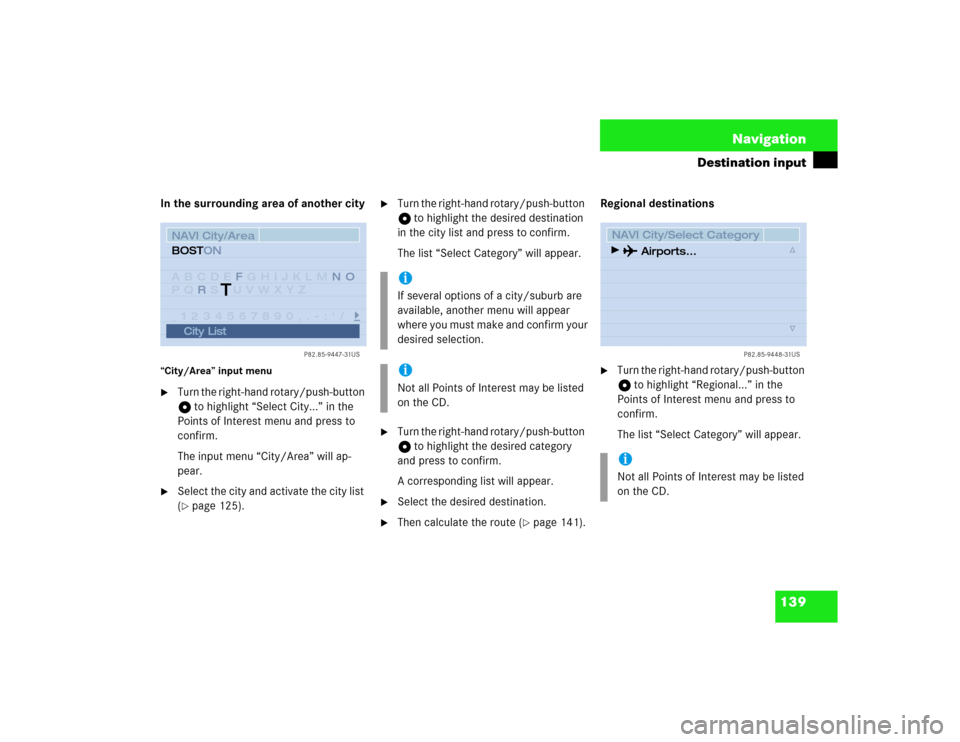
In the surrounding area of another city“City/Area” input menu�
Turn the right-hand rotary/push-button
v to highlight “Select City...” in the
Points of Interest menu and press to
confirm.
The input menu “City/Area” will ap-
pear.
�
Select the city and activate the city list
(�page 125).
�
Turn the right-hand rotary/push-button
v to highlight the desired destination
in the city list and press to confirm.
The list “Select Category” will appear.
�
Turn the right-hand rotary/push-button
v to highlight the desired category
and press to confirm.
A corresponding list will appear.
�
Select the desired destination.
�
Then calculate the route (
�page 141).Regional destinations
�
Turn the right-hand rotary/push-button
v to highlight “Regional...” in the
Points of Interest menu and press to
confirm.
The list “Select Category” will appear.
P82.85-9447-31US
NAVI City/AreaABCDE GHIJKLM
PQ S UVWXYZ
_1234567890,.�:‘/FNO
R BOSTON
City List
T
iIf several options of a city/suburb are
available, another menu will appear
where you must make and confirm your
desired selection.iNot all Points of Interest may be listed
on the CD.
iNot all Points of Interest may be listed
on the CD.
P82.85-9448-31US
NAVI City/Select Category
Airports...
Page 148 of 225
140 NavigationDestination input�
Turn the right-hand rotary/push-button
v to highlight the desired category
and press to confirm.
An input menu, e.g. “Airport” will ap-
pear.
�
Select an entry (
�page 124) and then
activate the list.Activating the list
�
Press the right-hand rotary/push-
button v longer than 2 seconds.
or
�
Turn the right-hand rotary/push-button
v to highlight “List” and press to con-
firm.
The list will appear.
�
Turn the right-hand rotary/push-button
v to highlight the desired entry and
press to confirm.
�
Then calculate the route (
�page 141).
P82.85-9449-31US
NAVI AirportABCDEFGHIJKLMNO
PQRSTUVWXYZ
1234567890,.�:‘/ _ JOHN F KENNEDY INT’LAIRPORT
List
P82.85-9450-31US
NAVI Airport ListJOHN F KENNEDY INT’L AIR
JOHN F KENNEDY INT’L�JFK EX
JOHN F KENNEDY INT’L�VAN
KUPPER AIRPORT (51, SOHO)
LA GUARDIA AIRPORT
Page 149 of 225

141 Navigation
Destination input
This function allows you to display up to 12
destinations you last selected.
1Destination selected last
�
Turn the right-hand rotary/push-button
v to highlight “Last destinations...” in
the main destination input menu and
press to confirm.
The list “Last destinations...” will ap-
pear.
�
Turn the right-hand rotary/push-button
v to highlight the desired destination
and press to confirm.
�
Then calculate the route.First select the calculation mode and then
calculate your route.
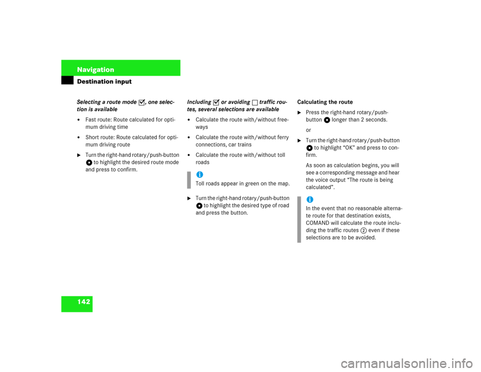
Selecting calculation mode
COMAND calculates the route either as
the Fast Route or Short Route 1 whereby
traffic routes 2 can be included or avoi-
ded (with several selections).
1Route types
2Traffic routes
3Calculates route
Selecting the last destinations
P82.85-9451-31US
NAVI Last Destinations
NORTH ADAMS, NORTH
NORTHBROOK, WILWAU
DEERFIELD, CHICORY
MMM, NORTHBROOK
1
Calculating a route
P82.85-9452-31US
NAVI Route Mode
Fast Route
Short Route
Freeway
Ferry
Toll
OK
12
3
Page 150 of 225

142 NavigationDestination inputSelecting a route mode P, one selec-
tion is available�
Fast route: Route calculated for opti-
mum driving time
�
Short route: Route calculated for opti-
mum driving route
�
Turn the right-hand rotary/push-button
v to highlight the desired route mode
and press to confirm.Including P or avoiding Q traffic rou-
tes, several selections are available
�
Calculate the route with/without free-
ways
�
Calculate the route with/without ferry
connections, car trains
�
Calculate the route with/without toll
roads
�
Turn the right-hand rotary/push-button
v to highlight the desired type of road
and press the button.Calculating the route
�
Press the right-hand rotary/push-
button v longer than 2 seconds.
or
�
Turn the right-hand rotary/push-button
v to highlight “OK” and press to con-
firm.
As soon as calculation begins, you will
see a corresponding message and hear
the voice output “The route is being
calculated”.
iToll roads appear in green on the map.
iIn the event that no reasonable alterna-
te route for that destination exists,
COMAND will calculate the route inclu-
ding the traffic routes 2 even if these
selections are to be avoided.
Page 151 of 225
143 Navigation
Destination input
4Calculation method
5Destination
Cancel route calculation�
Turn the right-hand rotary/push-button
v to highlight “Cancel” and press to
confirm.
The main destination input menu will
appear.During the calculation, the symbol display
will appear after a few seconds.
6Arrow indicating the direction to the
destination (as the crow flies)
7Calculation of route
8Distance to the destination (as the
crow flies)The route will be calculated. COMAND
identifies the road you are travelling on.
Position 6 now indicates the driving di-
rection.
You will e.g. hear the voice output “Please,
make the next right turn”.NAVIFast Route to Destination:
NEW YORK
CENTRAL PARK WEST 100
is being calculated
P82.85-9453-31US
Cancel
4
5
P82.85-9454-31US
DIRECTION TO DESTN.
Map
Stop
Mix
CALC.
ROUTE
2.9 mi
6
7
8
P82.85-9455-31US
3.4 mi
Map
Stop
Mix
BATTERY PARK / STATE ST
0.1 mi
Page 155 of 225

147 Navigation
Route guidance
Once you have calculated the route, you
can request destination and route informa-
tion.�
Press ..
The selection menu “Destination Info”
will appear.
“Destination Info” selection menu 1Estimated time of arrival at destination
and (in brackets) estimated time nee-
ded for the journey to the destination
2Current distance to destination
3Displays route list
4Requests route mode
5Displays location map
6Activates route map
7Displays current destination
8Displays stop-over
�
Turn the right-hand rotary/push-button
v to highlight 3 to 8 and press to
confirm.
Route guidance is switched off
The last destination driven to will appear in
line 1.
Requesting destination and route in-
formation
P82.85-9456-31US
NAVI Destination InfoETA: 10:42 AM (8 min)
Distance: 1.3 miRoute List
Location Map
Current Destn.
Options
Route map
Stop
1
2
4
5
6
7
8
3
iIf the vehicle drives on a road which is
not digitized, 1 and 2 will appear in
gray and display the last available infor-
mation. The message “Off Road: dest.
info not up-to-date” appears underne-
ath.
Page 156 of 225

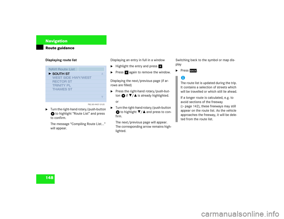
148 NavigationRoute guidanceDisplaying route list�
Turn the right-hand rotary/push-button
v to highlight “Route List” and press
to confirm.
The message “Compiling Route List...”
will appear.Displaying an entry in full in a window
�
Highlight the entry and press u.
�
Press u again to remove the window.
Displaying the next/previous page (if ar-
rows are filled)
�
Press the right-hand rotary/push-but-
ton v if ?/= is already highlighted.
or
�
Turn the right-hand rotary/push-button
v to highlight ?/= and press to con-
firm.
The next/previous page will appear.
The corresponding arrow remains high-
lighted.Switching back to the symbol or map dis-
play
�
Press *.
P82.85-9457-31US
NAVI Route ListSOUTH ST
WEST SIDE HWY/WEST
RECTOR ST
TRINITY PL
THAMES ST
iThe route list is updated during the trip.
It contains a selection of streets which
will be travelled or which still lie ahead.
If a longer route is calculated, e.g. to
avoid sections of the freeway
(�page 142), these freeways may still
appear on the route list. As the vehicle
approaches the freeway, it will be dele-
ted from the route list.
Page 157 of 225
149 Navigation
Route guidance
Requesting route mode�
Turn the right-hand rotary/push-button
v in the selection menu “Destination
Info” to highlight “Options” and press
to confirm.
The settings for the current route are
displayed. Switching back to the symbol or map dis-
play
�
Press * or wait approximately 15
seconds. Activating the location map
If route guidance is active
�
Turn the right-hand rotary/push-button
v in the selection menu “Destination
Info” to highlight “Location Map” and
press to confirm.
The location map faces north (North-
up).
P82.85-9458-31US
NAVI Route Mode� Short Route
� No Freeway, with Toll,
with Ferry
� No Blocking �
iSelecting calculation mode
(�page 141)
Selecting a detour during destination
guidance (
�page 162)
Marking a way point (
�page 160)