2002 LINCOLN BLACKWOOD change time
[x] Cancel search: change timePage 3 of 48

HOW DOES THE NAVIGATION SYSTEM WORK?
The navigation system is a tool to assist the driver in daily traffic. The
system allows you to enter the destination and activate ªGuidanceº, and
the system provides guidance advice through both audio and visual
advice.
Determination of the vehicle position
The movement of the vehicle is measured by sensors which are
integrated into the navigation system. The distance driven is recorded by
an electronic signal from the speedometer and the rotary movements of
turns by the gyroscope (a rotary measurement system). The information
from these sensors is, however, not always exact as the values can be
affected by tire slippage, varying tire pressure due to changes in
temperature, etc.
Data from the sensors, in conjunction with positional information
received from the global positioning system is transmitted to the
navigation computer. The resultant calculated position is then compared
against the road network data stored on the CD-ROM in order to display
the current vehicle position.
GPS (global positioning system)
The global positioning system is based on the reception of navigation
signals from a total of 24 GPS satellites at a height of 20 920 km
(13 000 miles).
Signals from at least four satellites must be received to determine the
vehicle position with sufficient accuracy. The GPS receiver can handle up
to eight satellite signals simultaneously. This allows an accuracy of
approximately 100 m (328 ft), which is further improved by other
sensors so that a final accuracy of approximately6mto18m
(20 ft to 60 ft) can be reached.
When the vehicle is parked for a long period of time, the satellites
change their orbital positions. Therefore, when the ignition is turned on
again it can take a few minutes before the navigation system can pick up
enough satellites and evaluate the received signals.
²Sufficient reception is indicated by the green symbol that appears in
the system's display. If the satellite symbol remains red, the GPS
reception is not sufficient.
Introduction
3
Page 19 of 48

GUIDANCE SCREEN
Once you select ªGuidanceº, either
the guidance screen or the map will
appear. If you are on a digitized
road, the guidance screen will
appear. Otherwise, the map will
appear.
In case you entered a new
destination address, it may take
some time before the first guidance
advice is shown. The navigation system plans the route. During route
planning and hourglass appears in the status line. The following is the
information offered by the guidance screen:
1. Current vehicle position: Road name, city name and county name if
stored in the database.
2. Visual guidance advice: Diagram of the next intersection or turn. In
addition, direction changes are announced by voice messages.
3. GPS reception status: When the GPS receiver receives valid data, the
color of the satellite icon changes from red to green.
4. Next maneuver. The next road you have to turn onto.
5. Distance to the next direction change.*
6. Function opens a pull down list with three options: ªReturnº (for Start
Menu) or ªMapº (for route map) or ªInfoº (for Route Information Menu)
7. Target direction arrow. Shows the ªas the crow fliesº direction to the
selected destination.
8. Distance to the destination.* (real driving distance once a route is
planned).
9. Status line.
* The measuring units are dependent on the system settings. Refer to
theSystem settingssection.
Guidance
19
Page 22 of 48

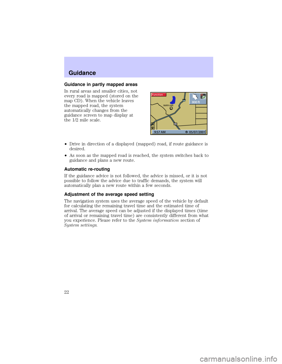
Guidance in partly mapped areas
In rural areas and smaller cities, not
every road is mapped (stored on the
map CD). When the vehicle leaves
the mapped road, the system
automatically changes from the
guidance screen to map display at
the 1/2 mile scale.
²Drive in direction of a displayed (mapped) road, if route guidance is
desired.
²As soon as the mapped road is reached, the system switches back to
guidance and plans a new route.
Automatic re-routing
If the guidance advice is not followed, the advice is missed, or it is not
possible to follow the advice due to traffic demands, the system will
automatically plan a new route within a few seconds.
Adjustment of the average speed setting
The navigation system uses the average speed of the vehicle by default
for calculating the remaining travel time and the estimated time of
arrival. The average speed can be adjusted if the displayed times (time
of arrival or remaining travel time) are consistently different from what
you experience. Please refer to theSystem informationsection of
System settings.
Guidance
22
Page 23 of 48

ALTERNATIVE ROUTE / DETOUR
The navigation system can calculate
an alternative route only during
guidance for an adjustable distance,
e.g.1-10km(1-6miles).
This function can be used to get
around traffic jams or if you do not
agree with the current route
planning of the navigation system.
The alternative route is calculated
from the current vehicle position for
the selected distance.
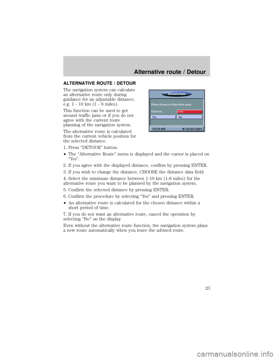
1. Press ªDETOURº button.
²The ªAlternative Routeº menu is displayed and the cursor is placed on
ªYesº.
2. If you agree with the displayed distance, confirm by pressing ENTER.
3. If you wish to change the distance, CHOOSE the distance data field.
4. Select the minimum distance between 1-10 km (1-6 miles) for the
alternative route you want to be planned by the navigation system.
5. Confirm the selected distance by pressing ENTER.
6. Confirm the procedure by selecting ªYesº and pressing ENTER.
²An alternative route is calculated for the chosen distance within a
short period of time.
7. If you do not want an alternative route, cancel the operation by
selecting ªNoº on the display.
Even without the alternative route function, the navigation system plans
a new route automatically when you leave the advised route.
Alternative route / Detour
23
Page 32 of 48

Screen config.
A variety of color combinations along with information shown in the
satus line of the screen can be selected.
²Select ªScreen config.º from the Settings menu.
²The ªScreen Settingsº menu is displayed.
The following options are available:
Day color / Night color
Select one out of six color combinations for day or nighttime display.
²Optimized daytime contrast is provided by the options blue, green and
red. This color combination is active when the headlights are off.
²The options dark blue, dark green and dark red provide optimized
nighttime contrast. This color combination is active when the
headlights are turned on.
Map Color
Select one of the three options for Map color:
Automatic switching:The Map color changes automatically when the
headlights are switched on.
Always day color:The Map color remains in day mode independent of
headlight activation.
Always night color:The Map color remains in night mode independent
of headlight deactivation.
Status line left/Status line right
Select the kind of information shown in the lower left corner of the
screen:
²None:Status line left switched off.
²Clock:Time display.
²Date:Date display.
²Remaining travel time:Estimated time remaining until you arrive at
the next via point or the destination address (if o via points were
entered) as calculated by the navigation system.
System settings
32
Page 43 of 48

Symptoms Possible Cause/Remedy
Color of the satellite icon on the
GPS logo is constantly red.²Drive outdoors, if you are in a
garage or a tunnel.
Display shows9NO CD9or
9WRONG CD9.²Make sure that an appropriate
CD is inserted correctly in the CD
player.
Current time in the status line is
wrong.²Adjust the time zone in the
9System Settings9menu, option
9Date / Clock9.
Not possible to store address in
the address book.Address book is full.
²Delete one or more entries no
longer used.
Entered relocation intersection is
not accepted during vehicle
position input.Not all intersections entered by
the9keyboard9are suitable for
relocation.
²Select an intersection displayed
in the list.
Guidance is not precise. An inaccuracy of 30 m (100 ft) is
within the limit.
Displayed vehicle position by the
navigation system does not
correspond with actual vehicle
position.Bad GPS reception for a longer
period of time.
²If necessary, wait a few minutes.
The system automatically corrects
the position as soon as sufficient
GPS reception is resumed.
Guidance advice does not
correspond with actual traffic
situation.It is possible that the vehicle
position calculated by the system
is currently wrong. The roads may
be changed and do not correspond
with the information stored on the
map CD.
Troubleshooting
43