Page 313 of 566

Re
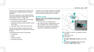
peati ngnavig atio nanno unceme nts
Re quirement s:
R Aro utehas already been creat ed.
R Routeguidan ceisact ive.
Mult imed iasystem:
4 Navigation #
Select !Voice Guidance . #
Select #Voice Guidance .
The current navig ation anno uncement is
re peat ed.
% Youcan add andcallupthis func tion asa
fa vo rite und erRepeat VoiceGuidan ce.
Cancel ingrout eguidanc e
Re quirement s:
R Aro utehas already been creat ed.
R Routeguidan ceisact ive.
Mult imed iasystem:
4 Navigation #
Select %Cancel RouteGuidance . Ov
ervie wof routeguidanc eto an off-r oad
des tinatio n
An off-r oad destinatio nis wit hin thedigit almap.
The map contains noroads that lead tothedes‐
tinat ion.
Yo ucan enterge o-coor dinatesorath re ewo rd
addr essforof f-r oad destinations onthemap.
Ro uteguidan ceguides youfo ras long aspossi ‐
ble withna vig ation announcements anddisplays
on roads that arekn ow nto themultimedia sys‐
te m.
Shor tlybef oreyo ure ac hth elas tkn ow npo sitio n
on themap, youwill hear the"Please follo wthe
dir ect ion arrow "ann oun cem ent.The displ ay
sho wsadir ect ion arrow and thelinear distance
to thedes tinat ion.
Ov ervie wof routeguidanc efrom anoff-r oad
loc ation toades tinatio n
Of f-road position: thecur rent vehicle position is
locat edwithin thedigit almap onroads that are
no tav ailable.
When routeguidan cebegin sth efo llo wing dis‐
pla ysappear :
R The Road NotMapped messageis sho wn. R
Adir ect ion arro w sho wing thelinear direc‐
tion tothePOI.
When theve hicle isbac kon aro ad know nto the
multime diasystem, routeguidan cecontinue sas
no rm al.
Ov ervie wof off-ro ad status during rout e
guidanc e
Due toroadw orks ,fo rex am ple, ther ema ybe dif‐
fe re nces betwee nth edat aon thedigit almap
and theactual courseofthero ad. Insuc hcas es,
th emultimedia system will temp orarily be
unable tolocat eth eve hicle's current positio non
th edigit almap. Thevehicle isoff-r oad.
When theve hicle isoff-r oad, thefo llo wing dis‐
pla ysaresho wn:
R theRoad NotMapped message
R adir ect ion arrow showing thelinear direct ion
to thePOI
When theve hicle isbac kon aro ad know nto the
multime diasystem, routeguidan cecontinue sas
no rm al. Mult
imed iasystem 31
1
Page 314 of 566

Des
tinat ion Sa
ving thecur rent vehicl eposi tion
Mul timedi asy stem:
4 Navigation #
Ifth emap isdispla yedin full screen mode,
pr ess thecent ralcon trol elemen t.
The map menuappear s. #
Selec t1 onthemap menu (/page31 5).
Th ecur rent vehicle position issave dto the
"Pr evious destination s"memo ry.
St oring ama pposit ion
Multi media system:
4 Navigation
The map isin full-scr eenmode. #
Select "movemap" inmap menu 2
(/ page31 5). #
Select apos ition on themap.
If multiple entries areav ailable fora map
posi tion, alis tapp ears. #
Highl ightanentr y. #
Select ¥ Store in"Previ ousDesti na-
tions ".
The map position issave dto the"Pr evious
des tination s"memo ry.
Edit ingthepr ev ious destina tions
Multime diasystem:
4 Navigation
5 ¬ Previous andOther Destination s
5 Previous Destination s #
Highlight oneofthepr ev ious destination s. #
Tosave asafa vo rite :sel ect ¥ SaveMy
Fav orite.
The favo rite sar edispla yed. #
Movethefa vo rite to thedesir edposition .
If afa vo rite has already been added atthis
posit ion,itwill beove rwritt en. #
Tosave as"Home "addr ess:sele ct¥
Save as"Home ". #
Tosave as"W ork" addr ess:sele ct¥
Save as"Wo rk". #
Todel eteasing leor all des tina tions :
selec t¥ Deleteor Dele teAll.
A pr om ptappear s. #
Select Yes. #
Todispl aydes tina tioninf ormatio n:sel ect
¥ Details.
Usi ngextern al des tinatio ns
Ext ernal destinatio nscan berecei vedfrom the
fo llo wing sources:
R Mer cedes -Benz Apps
R Doo r-to -doo rna vig ation with Com panionapp
(US A)
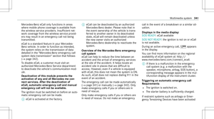
% Recei veddes tinations aresa ve din thepr ev i‐
ous destination s.
A pr om ptappear son themedia display. #
Ades tination hasbeen receiv edwit hou t
pict ureinf orma tion :selec tYes . #
Ifro uteguidan ceisno tact ive, sele ctStart
Rout eGuidan ce.
The routeto thedes tinat ioniscalculat ed.
The map showsthero ute. Ro uteguidan ce
th en begins. 31
2
Multimedia system
Page 315 of 566

or
#
Ifro uteguidan ceisact ive, sele ctStart New
Rout eGuidan ceorSet asNex tWay Point.
St art New RouteGuidan ce:th ere cei veddes‐
tin ation addressissetas ane wdes tination.
The prev ious destination sand intermediat e
des tination sar edele ted. Ro uteguidan ceto
th ene wdes tinat ionbegins.
Set asNext WayPoint :th ere cei veddes tina‐
tion addr essissetas thene xt int ermediat e
des tinat ion.Routeguidan cebegin s. #
Ades tination hasbeen receiv edwit hpic‐
tu re informa tion: select Start Route Guid-
ance .
Ro uteguidan cestar ts. Ro
uteguidanc ewith current traf fic re por ts Tr
af fic inf orma tion overview
Tr af fic re por tsarere cei vedusing LiveTr af fic
Inf ormation andareused forro uteguidan ce.
This serviceis una vailable insome countries. Ther
ema ybe differe nces betwee nth etraf fic
re por tsrecei vedand theactual road and traffic
condi tions.
Im por tant informa tionon LiveTr af fic Inf orma‐
tion:
R Current traffic repor tsarere cei vedvia the
Int erne tconnection.
R The traf fic situ ation isup datedat shor t,re gu‐
lar interva ls.
R The subsc ript ion informatio nsho wsthest a‐
tus (/ page31 3).
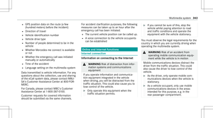
In fo rm atio non theve hicle's position isregular ly
sent toDai mle rAG .The data isimmed iatelyre n‐
de redanon ymous byDai mle rAG and forw arded
to thetra ffic dat apr ov ider .Usin gth is dat a,traf‐
fi c re por tsreleva nt totheve hicle's position are
sent totheve hicle. Thevehicle actsasasensor
fo rth eflow oftraf fic and helpstoimprove the
qu alit yof thetraf fic re por ts.
If yo udo notwish totrans mityo ur vehicle posi‐
tion, youcan have this ser vice deact ivat ed atan
aut hor ized Mercedes -Benz Cent er. Displa
yingsubscr iption informa tion
Re quirement s:
R The vehicle iseq uipped withLiv eTr af fic
Inf ormation.
Multime diasystem:
4 Navigation 5
Z Option s
The subscr iption expir ation dateis aut omatic ally
displa yed:
R one mont hbef oreth eex pir ation date.
R one week bef oreth eex pir ation date.
R ontheex pir ation date. #
Todispl aymanu ally:select LiveTraffic Sub-
scription Info.
Depending onthest atus ,on eof thefo llo wing
mess ages appear s:
R theper iod ofvalidity forth esubscr iption
is displa yed.
R thesubscr iption hasexpir ed.
% The subscr iption canbeextende d:
R atan author ized Mercedes-B enzCent er Multimedia
system 31
3
Page 316 of 566

R
viaanMB Infocall totheMer cedes- Benz
Cus tomer Assis tance Center
Di spl aying thetraf fic ma p
Re quirement s:
R ForLiv eTr af fic Inf ormati on:theve hicle is
eq uipped withacommunication modulefea‐
tur ing anact ivat ed, integratedSIM card.
R When theve hicle isstar ted, thecomm unica‐
tion module automaticall yes tablishes an
Int erne tcon nection .Tr af fic inf ormati onis
mad eav ailable shortly af te rw ards.
Mult imed iasystem:
4 Navigation 5
Z Option s
5 Map Menu #
Alternativ ely:ifth emap isdispla yedin full
scr een mode, press theTo uc hCon trol, the
contr oller or theto uc hpad.
The map menuappear s. #
Activate0073 º.
The traf fic map showsthefo llo wing informatio n,
fo rex am ple:
R Traf fic inci dents ,fo rex am ple: -
Roadw orks
- Road bloc ks
- Warning mess ages
The symbols fortr af fic inci dents aredis‐
pl ay ed incolor (onthero ute) or gra y(of fth e
ro ute).
R Traf fic flow informatio n:
- Traf fic jam (red line)
- Slow-mo ving traf fic (or ang eline)
- Hea vytraf fic (yel lo w line)
- Free-f lowing traffic (gr een line)
R Disp lay fo rtr af fic del ayson thero utelas ting
at leas ton emin ute
R Warning mess agesymbols :
- Symbo lÔ
- Addition alroad safetyno teswhen
appr oaching atraf fic inci dent, e.g.the
end ofatra ffic jam
If th eve hicle approaches adang erarea
on thero ute, awa rning mess ageis dis‐ pla
yedon themap. Awa rning mess age
ma yalso beissued (/page31 5).
Dis playin gtraf fic incid ents
Mult imed iasystem:
4 Navigation 5
Z Option s
5 Map Conten t #
Activate0073 TrafficInci dents .
Ro adw orks ,ro ad bloc ks,local area repor ts
(e.g. fog) and warning mess ages aredis‐
pla yed.
Ac tiv atin gfree flowan dtraf fic dis pla y #
Activate0073 FreeFlo wing Tra fficand Traffic
Del ays.
% Thetraf fic del ayisdispla yedfo rth ecur rent
ro ute. Traf fic del ayslas ting oneminut eor
long erareta ke nint oconsi deratio n.
Di spl aying details #
Displa ysthetraf fic map (/page 314). #
Movesth emap (/page31 6). 31
4
Multimedia system
Page 317 of 566

#
When atra ffic repor tsymbol isunder the
cr oss hair,pr ess onthecent ralcon trol ele‐
men t.
The traffic re por tde tails aredispla yed.
or #
Press onthecent ralcon trol elemen t. #
Selec tInf ormat iononTraff icReport s.
The map showsthetraf fic re por tsymbols in
th evicinit y.
Tr af fic re por tinf ormation isdispla yedin the
st atus line:
R Traf fic re por tsymbol
R Reason forth etraf fic re por t,e.g. traffic
con gestion
R Warning mess age(highligh tedin red) #
Toselect atraf fic re por tsymb ol:sel ect
Next orPre vious. #
Press onthecent ralcon trol elemen t.
The traffic re por tde tails aredispla yed. Issuing
hazardwa rnings
Multime diasystem:
4 Navigation 5
Z Option s
5 Announc ement s #
Activate0073 Annou nceTrafficWa rnings .
Wa rning mess ages areissued andtailbac ks
whic hpose arisk areannounced. Map
andcom pass Map
andcom pass overview 1
Savesth ecur rent vehicle position
2 Movesth emap
3 Select sth emap orient ation andmap view
4 Select sth efunc tion depending ontheeq uip‐
ment :
• Sends ahazar dwa rning viaCar -to-X . Multim
ediasystem 31
5
Page 318 of 566

•
Fil ters thedispla yof POIs inthevicinit y
accor dingtoPOI categor y
5 Switc hesthedispla yof per sonal POIsym‐
bols onthemap onoroff
6 Switc hesone ofthefo llo wing displa yson or
of fdepending ontheeq uipment :
• We ather informat ion
• Sat ellit emap
• Traf fic inci dents
7 Switches thetra ffic map displa yon oroff
The map andsatellit eimag esaresho wninglobe
pr oject ion.This allowsfora re alis ticmap displa y
in all map scales. Themap uses elevatio nmod el‐
ing .
Dep endingonthemap data,im por tant buildi ngs
in ma nyciti esaredep icted realis ticallyon the
map insmal lmap scale s(e.g. 1/32 mi(20 m),
1/1 6mi (50 m)). Other buildings aresho wnas
model s.
% Youcan setth eunit ofmeasur ementofthe
map scale (/page28 4). If
online information isavailable, fuelprice sand
th eav ailabilit yof par kingspac esinpar king
ga rage aredispla yed, forex am ple.
% Requiremen ts:
R Mer cedes meconnectis available.
R Youha ve auser accoun tfo rth e
Mer cedes meportal.
R The service hasbeen activat ed atan
aut hor ized Mercedes -Benz Cent er.
Fu rther information canbefound at:ht tp :/ /
www .merced es.me
% The onlineinf ormat ionisno tav ailable inall
coun tries.
If Dis play inCOMA NDisact ivat ed inTraf fic Sign
Assi st(/ pag e23 1), speed limitsandovertak‐
ing restrictions aredispl ayed on themap.
% Com panylogos displayedon themap are
tra demar ksofthere spectiv ecom panies and
used solely forth epur pose ofindicat ingthe
locat ionsofthese com panies. Theuseof
suc hlogos onthemap does notindicat e
appr oval of, suppo rtof or adv ertising by th
ese com panies forth ena vig ation system
itself.
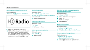
Se tting thema pscale
Re quirement s:
R The map issho wn.
Multime diasystem:
4 Navigation
% Youcan setth eunit ofmeasur ementofthe
map scale (/page28 4).
Mo ving thema p
Multi media system:
4 Navigation 5
Z Option s
5 Map Menu #
Alternativ ely,if th emap isdispla yedin full
scr een mode, press thecent ralcon trol ele‐
men t.
The map menuappear s. #
Selec t"Mo vemap" inmap menu 2
(/ page31 5). 31
6
Multimedia system
Page 319 of 566

Selec
tingthema por ientat ion
Multi media system:
4 Navigation 5
Z Option s
5 Map Menu #
Alternativ ely,if th emap isdispla yedin full
scr een mode, press thecent ralcon trol ele‐
men t.
The map menuappear s. #
Inmap menu3 ,selec tN, 2D or
3D( /pag e31 5).
R N:the2D map viewisdispla yedso that
no rth is alw aysat theto p.
R 2D: the2D map viewisaligned tothe
dir ect ion oftra vel.
R 3D: the3D map viewisaligned tothe
dir ect ion oftrav el.
Selecting POIsymbols
Multimedia system:
4 Navigation 5
Z Option s
5 Map Conten t #
Select POISymbols.
The 003Bdo tindicat esthecur rent setting. Stand
arddispl ayssymbols ofpredef ined cat‐
egor iesonthemap.
User Definedallo wsyouto per sonall yselect
th esymbols forth eav ailable categor ies.
Non eswit ches thedispla yof f. #
Select ase tting. #
User Defined:select categor ies.
The POIsymbols oftheselect edcategor ies
ar edispla yed0073 ornotdispla yed0053.
Selecting thedisp layof text inf ormat ionin
th ema p
Multi media system:
4 Navigation 5
Z Option s
5 Text Information #
Select text informati on.
Cu rrent Streetsho wsthest re et youar ecur ‐
re ntly drivi ng on atthebo ttom ofthedispla y.
When themap ismo ved, thefo llo wing infor‐
matio nappear sunder thecr osshair :
R Street nam e
R POI nam e
R Area nam e Ge
o-co ordinates displ aysth efo llo wing infor‐
matio n:
R Lon gitude andlatitude
R Elevatio n
Th eelev atio nsho wnmayde viat efrom
th eactual elevatio n.
R Numb erofsatellit es from whic hasign al
can berecei ved
When themap ismo ved, this inf ormatio n
does notappear .
Climate Controldispla ysthecur rent clima te
contr olsettings.
None switches thedispla yof f.
Displa yingthene xt int ersectin gst re et
Re quirement s:
R Routeguidan ceisno tact ive.
Mult imed iasystem:
4 Navigation 5
Z Option s #
Activate0073 NextInter secting Street.
Th enam eof thene xt int ersect ingstre et will
be displa yedat theupper edgeof thedispla y. Multimedia
system 317
Page 320 of 566

Disp
laying thema pve rsion
Multime diasystem:
4 Navigation 5
Z Option s #
Select MapVersion . #
Select Details.
% Information aboutnewversions ofthedigit al
map canbeobt ained from anaut hor ized
Mer cedes- BenzCenter.
Ov ervie wof avo iding anarea
Yo ucan define areas alon garo uteth at you
wo uld liketo avoid.
The routecan include anarea that isto be avoi‐
ded inthefo llo wing situat ions:
R thedes tinat ionislocat edinan area that isto
be avo ided
R iffree wa ys areloc ated within thear ea that is
to be avoided
Fr ee wa ys arealw aysta ke nint oacco untfor
th ero ute.
R ther eis no sensible alternativ ero ute Av
oiding ane warea
Mult imedia system:
4 Navigation 5
À Route andPosition
5 Avoid Option s5
Areas #
Select AvoidNewArea. #
Tosear chforan area viathe map: select
Usi ngMa p. #
Movethemap.
or #
Tosear chforan area usi ng anaddr ess:
sel ect Add ressEntry . #
Entertheaddr ess. #
Select SelectDestination.
The map appear s.
Changing anarea
Multimedia system:
4 Navigation 5
À Route andPosition
5 Avoid Option s5
Areas #
Highlight anarea inthelis t. #
Select ¥Edit. Mo
ving thear ea on thema p #
Swipe inanydir ect ion ontheTo uc hCon trol
or touc hpad.
or #
Slid eth econ troller inanydir ect ion.
Changing thesize ofthear ea #
Tostar t:press theTo uc hCon trol, theto uc h‐
pad orthecon troller . #
Tochang e:swi peup ordown ontheTo uc h
Con trol or theto uc hpad.
or #
Slid eth econ troller upordown. #
Tosto p:press theTo uc hCon trol, theto uc h‐
pad orthecon troller .
Ta king thear ea forthe rout eint oacc ount #
Avoid 0073anarea inthelis t.
If ro uteguidan ceisact ive, ane wrouteis cal‐
culat ed.
If th er eis no routeye t,th ese tting iscar ried
ove rto thene xt routeguidan ce. 31
8
Multimedia system