Page 200 of 244

9-18
000EDetailed Guidance View: You can set to display detailed
information on the Map screen, such as moving directions
and lane change.
000ESpeed Limits: Sets whether or not to display the speed limits
on the screen.
Map Auto-scale Settings
You can set the scales for each vehicle speed zone.
0000
A
For example, when you select “100 m” for the “21–50 km/h”
zone and “200 m” for the “51–80 km/h” zone, the unit interval
for the map scale on the navigation screen becomes 100
m when the vehicle speed is 50 km/h and 200 m when the
vehicle speed is 51 km/h.
Return to Map: Set Time
You can set the system to automatically display the map screen
after a specified period of time when switched to the Radio/Media
mode screen while using the navigation.
> See “Return to Map: Set
Time.”
0000
A
This function works while driving once a destination has been
set.
0000
A
This feature is not available on the phone projection screen.
Auto Re-center Map
You can set the system to automatically display the current
position when the specified period of time elapses after changing
to another position on the map.
000DDisplay Traffic: Displays nearby traffic information on the
map.
000D3D Buildings: Displays major buildings on the map in
three dimensions.
000DAuto-scale: Automatically changes the scale of the map.
000E POI Display: You can specify the icon type to display nearby
places on the map.
0000
A
Touch
on the right side of Gas/LPG Station to select display
options for fuel prices.
000DGas and LPG stations on the Map screen will also show their
fuel prices if they are lower than the set price.
000DSelect Display Fuel Price Info on Map to view
recommended fuel prices based on the prices offered in
the area.
000DFuel prices on the map may differ from actual ones.
Information
You can specify the information to display on the navigation map
screen while driving.
000E Route Guide Line: Used to display the route guide line in
different colors depending on the traffic conditions. To display
the route color with a fixed one, uncheck Show Traffic Colors
on Route and select a color.
000EVehicle Symbol: You can specify the icon type to display your
current location on the map.
000EUnit: You can set the distance unit of the navigation map to
Kilometers (km) or Miles (mi) (if equipped).
000EShow Vehicle Speed: Displays the vehicle speed on the map.
Page 201 of 244

9-19
Show Route Overview While Stopped.
You can set to display the route overview from the start point to
the destination when the vehicle is stationary.
Others
You can configure navigation options, e.g., turning on or off fuel
prices, exporting or importing places from and to Address Book.
0000
A
The screen may differ depending on the vehicle model and
specifications.
Previous Destinations Settings
You can set to automatically save the previous destination and
display the previous destinations when the navigation system
starts.
000ESave Previous Destinations: The previous destination is
automatically saved.
000EShow Previous Destinations after Navigation Start-
Up: When the navigation system starts, the list of recent
destinations appear on a pop-up window.
Guidance
You can configure the navigation guidance settings.
0000A
The screen may differ depending on the vehicle model and
specifications.
Show Guidance Distance
You can configure settings for displaying the distance to the
destination during guidance.
000EInterval Distance: Displays the distance as the one between
different zones.
000ECumulative Distance: Displays the distance as the one
between the current position and target position.
Border Crossing Info.
You can set whether or not to display the border crossing
information on the screen.
Page 202 of 244

9-20
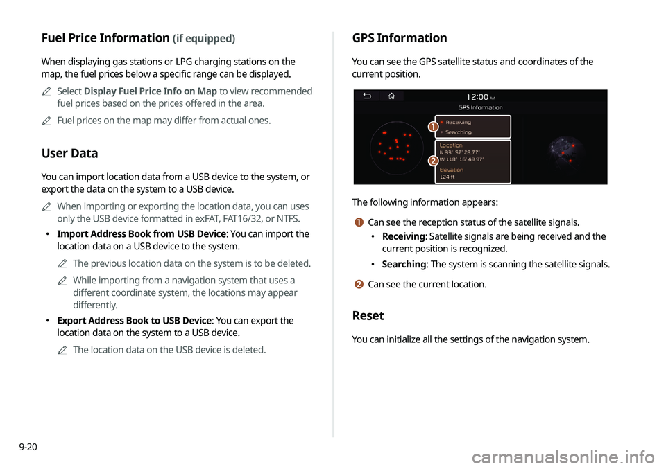
GPS Information
You can see the GPS satellite status and coordinates of the
current position.
\037
\036
The following information appears:
a Can see the reception status of the satellite signals.
000EReceiving: Satellite signals are being received and the
current position is recognized.
000ESearching: The system is scanning the satellite signals.
b Can see the current location.
Reset
You can initialize all the settings of the navigation system.
Fuel Price Information (if equipped)
When displaying gas stations or LPG charging stations on the
map, the fuel prices below a specific range can be displayed.
0000
A
Select Display Fuel Price Info on Map to view recommended
fuel prices based on the prices offered in the area.
0000
A
Fuel prices on the map may differ from actual ones.
User Data
You can import location data from a USB device to the system, or
export the data on the system to a USB device.
0000
A
When importing or exporting the location data, you can uses
only the USB device formatted in exFAT, FAT16/32, or NTFS.
000EImport Address Book from USB Device: You can import the
location data on a USB device to the system.
0000
A
The previous location data on the system is to be deleted.
0000
A
While importing from a navigation system that uses a
different coordinate system, the locations may appear
differently.
000EExport Address Book to USB Device: You can export the
location data on the system to a USB device.
0000
A
The location data on the USB device is deleted.
Page 210 of 244
9-28
Storage
You can check the storage space of the system memory where
voice memos can be saved.
User's Manual on Web (QR Code)
You can access the online user’s manual of the system by
scanning the QR code with your smartphone.
Reset
You can initialize all system settings including general settings
and navigation settings.
\334Caution
000EWhen initialization is performed, all user data in the system
including the location data is deleted.
000EWhen phone projection is active, you cannot reset the system
settings. To reset the settings, remove the USB cable from
your system.
System Info
You can check the system storage space. You can also use your
smartphone to access the online user’s manual of the system, or
initialize all system settings to default values.
0000A
The screen may differ depending on the vehicle model and
specifications.
Page 214 of 244
9-32
Updating the system software
and map
You can update the navigation map and infotainment system.
Please visit your local dealership to update your system.0000
A
Any changes made after the update file is created are not
reflected in the map. As a result, certain roads, buildings, and
speed limits on the map may not be up to date.
0000
A
Depending on the total data amount, an update may take
several minutes.
0000
A
Do not turn off the system or remove the storage device while
the update is in progress. When power supply is cut off or the
storage device is removed from the system, it may damage
the data or cause a system malfunction.
Page 222 of 244

10-8
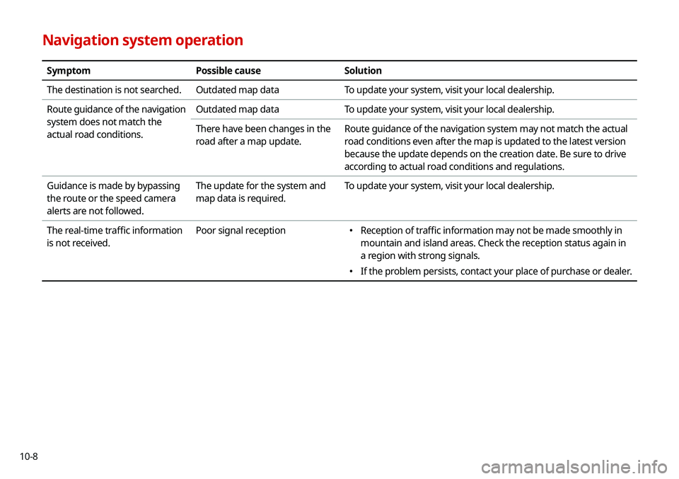
Navigation system operation
SymptomPossible causeSolution
The destination is not searched. Outdated map dataTo update your system, visit your local dealership.
Route guidance of the navigation
system does not match the
actual road conditions. Outdated map data
To update your system, visit your local dealership.
There have been changes in the
road after a map update. Route guidance of the navigation system may not match the actual
road conditions even after the map is updated to the latest version
because the update depends on the creation date. Be sure to drive
according to actual road conditions and regulations.
Guidance is made by bypassing
the route or the speed camera
alerts are not followed. The update for the system and
map data is required.
To update your system, visit your local dealership.
The real-time traffic information
is not received. Poor signal reception
000E
Reception of traffic information may not be made smoothly in
mountain and island areas. Check the reception status again in
a region with strong signals.
000EIf the problem persists, contact your place of purchase or dealer.
Page 223 of 244
10-9
System status indicator icons
You can see the system status by checking the status indicator
icons at the top right of the system screen.
Different status indicator icons appear when each function is
performed. The meanings of the icons are as follows:
Mute/memo recording
Navigation sound muted
Radio/Media sound muted
All sound outputs muted
Recording a voice memo
Bluetooth/call
Connecting a phone via Bluetooth
Connecting an audio device via Bluetooth
Connecting a phone and an audio device via Bluetooth
Making a call via a Bluetooth phone
Bluetooth phone’s microphone off
Downloading the contact and list of recent calls from
the connected Bluetooth phone
Page 225 of 244

10-11
Bluetooth
QWhich functions can I use via Bluetooth?
AYou can use the hands-free call function with a mobile
phone connected. You can also play music after
connecting an audio device such as MP3 player or mobile
phone.
> See “Making a call via Bluetooth .“, “Listening to music
via Bluetooth.”
QHow can I register a Bluetooth device?
AOn the All Menus screen, touch Setup >
Device
Connections >
Bluetooth >
Bluetooth Connections >
Add New. From the Bluetooth device to be connected,
search for the vehicle system and register it. Use the
Bluetooth device to enter or approve the authentication
number displayed on the system. Then the device is
added to the list of Bluetooth devices in the system and
automatically connected to the system.
> See “ Connecting
a Bluetooth device.”
FAQ
Navigation
QHow can I update the map?
AYou can download the latest map data to a USB device
and use the device to update the map.
> See “ Updating the
system software and map.”
QGuidance is made by bypassing the route or the speed
camera alerts are late.
ASelect another route after setting the route options.
On the map screen, touch Menu >
Route >
Route
Options to change the settings and resume navigation.
> See “ Changing the route search criteria.”
When the system is not updated, update the software
and map and then perform search again.
> See “Updating
the system software and map.”