2018 MERCEDES-BENZ AMG GT ROADSTER navigation system
[x] Cancel search: navigation systemPage 76 of 174

In the display, you will then see theRoad NotMappedmessage, an arrow and the distance to
the destination. The direction arrow shows the
compass heading to the destination.
As soon as the system can assign the vehicle
position to the map again, route guidance con-
tinues in the usual way.
Real-time traffic reports
Prerequisites
This function is currently not available for Can-
ada.
In order to receive real-time traffic reports via
satellite radio, you need to subscribe to SIRIUS
XM Satellite Radio Traffic Message Service.
Further information on satellite radio
(
Ypage 131).
The multimedia system can receive traffic
reports via satellite radio and take account of
these for route guidance in the navigation sys-
tem. Received traffic reports are displayed on
the map either as text or as symbols.
Real-time traffic reports on the map
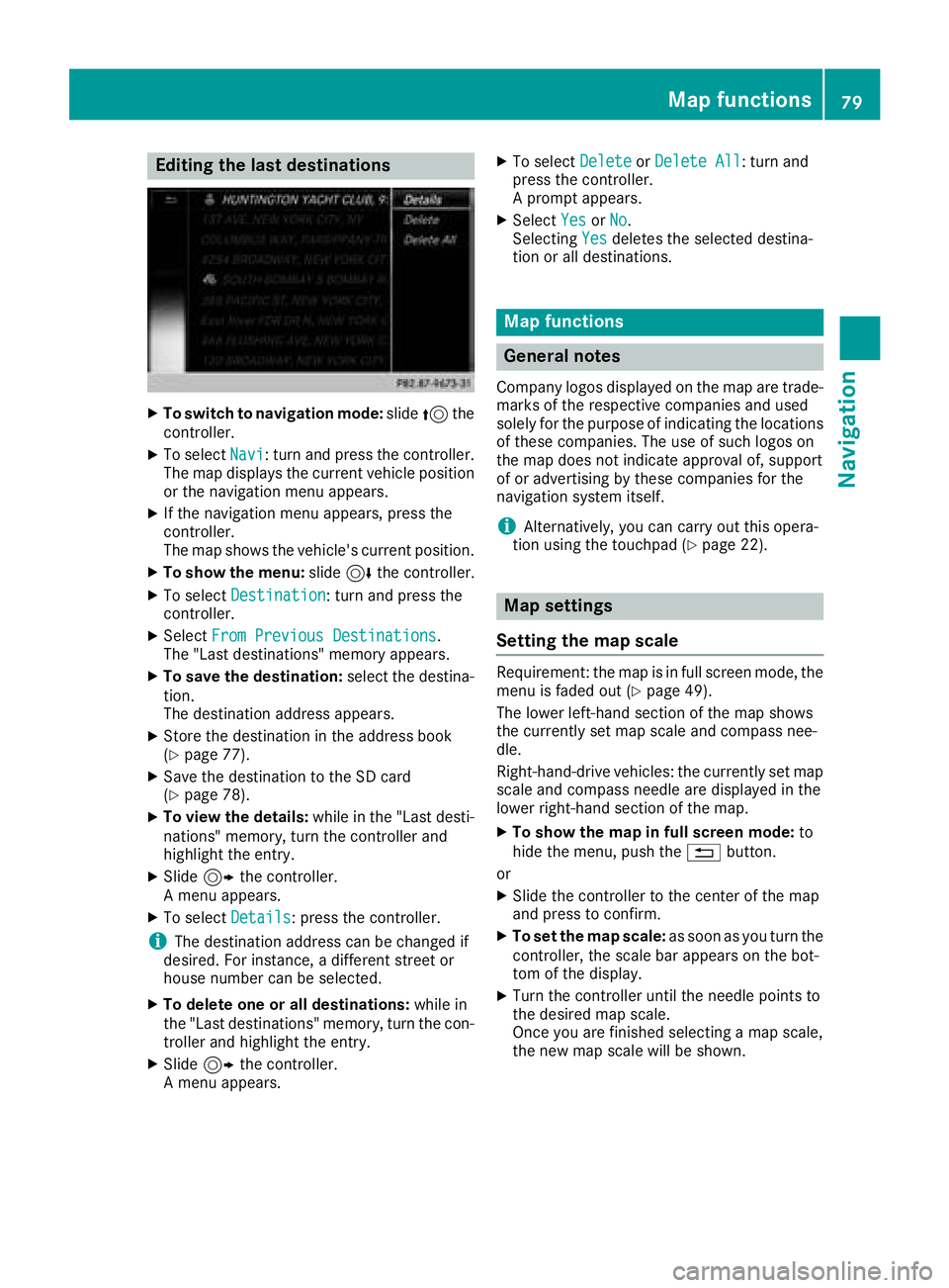
The multimedia system can show certain traffic
incidents on the map with symbols (type of inci-
dent) and colored lines (extent). Traffic reports
are shown on the map at scales of 1/32 mi to
20 mi.
When :is displayed, traffic reports can be
received or traffic reports are available. If it is
not displayed, no reception is possible.
XTo hide the menu: slide5and press the
controller.
The map can be seen in the full-screen dis-
play.
XTo set the map scale: turn the controller
until the desired map scale is selected.
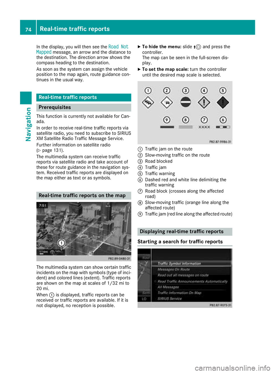
:Traffic jam on the route
;Slow-moving traffic on the route
=Road blocked
?Traffic jam
ATraffic warning
BDashed red and white line delimiting the
traffic warning
CRoad block (crosses along the affected
road)
DSlow-moving traffic (orange line along the
affected route)
ETraffic jam (red line along the affected route)
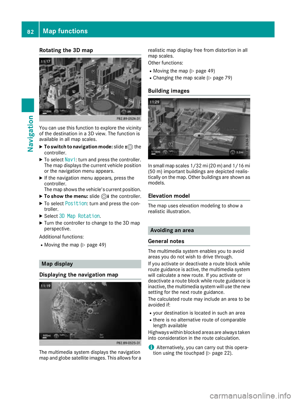
Displaying real-time traffic reports
Starting a search for traffic reports
74Real-time traffic reports
Navigation
Page 79 of 174

You can start the text reader function manually
or set it to automatic.
Starting the text reader function man-
ually
XTo switch to navigation mode:slide5the
controller.
XTo select Navi: turn and press the controller.
The map displays the current vehicle position
or the navigation menu appears.
XIf the navigation menu appears, press the
controller.
The map shows the vehicle's current position.
XTo show the menu: slide6the controller.
XTo select Traffic: turn and press the con-
troller.
XSelect ReadOutAllMessagesonRoute.
The multimedia system reads out the reports in sequential order.
If there are no reports for the route, the Read
Out All Messages on Routemenu item is
gray and cannot be selected.
XTo cancel the read-aloud function: select
Cancel Read-Aloud Function
.
The multimedia system reads the current
report aloud and then exits the read-aloud
function.
Automatic text reader function
XTo switch to navigation mode: slide5the
controller.
XTo select Navi: turn and press the controller.
The map displays the current vehicle position
or the navigation menu appears.
XIf the navigation menu appears, press the
controller.
The map shows the vehicle's current position.
XTo show the menu: slide6the controller.
XTo select Traffic: turn and press the con-
troller.
XSelect Read Traffic AnnouncementsAutomatically.
Depending on the previous state, switch the
option on Oor off ª.
Recalculating the route dynamically
TheDynamicTrafficRouteroute type takes
into account all of the traffic reports it receives for the current route when calculating the route
(
Ypage 50).
If you have selected Dynamic Traffic Route
as the route type, the multimedia system guides
you to your destination along the updated route.
Storing destinations
General notes
If a route to a destination has been calculated,
the multimedia system saves the destination to
the last destinations memory. If the memory is
full, the multimedia system overwrites the old-
est destination. When you save the current vehi-
cle position or a crosshair position, this position
is stored in the "Last destinations" memory.
You can save destinations permanently in the
address book and on an SD card. For example,
you can save a destination as your home
address immediately after entering the address
(
Ypage 53).
Requirements: the SD card has the FAT data
system format (e.g. FAT32).
Storing the destination in the address
book
The example shows an intermediate destina-
tion.
XTo select Save: turn and press the controller.
A menu appears.
XNew contact: selectAs New Contact.
If the address book already contains con-
tacts, the entry Add
toContactis also avail-
able.
XSelect Not Classified,Homeor Work.
An input menu shows the destination
address.
Storing destinations77
Navigation
Z
Page 81 of 174

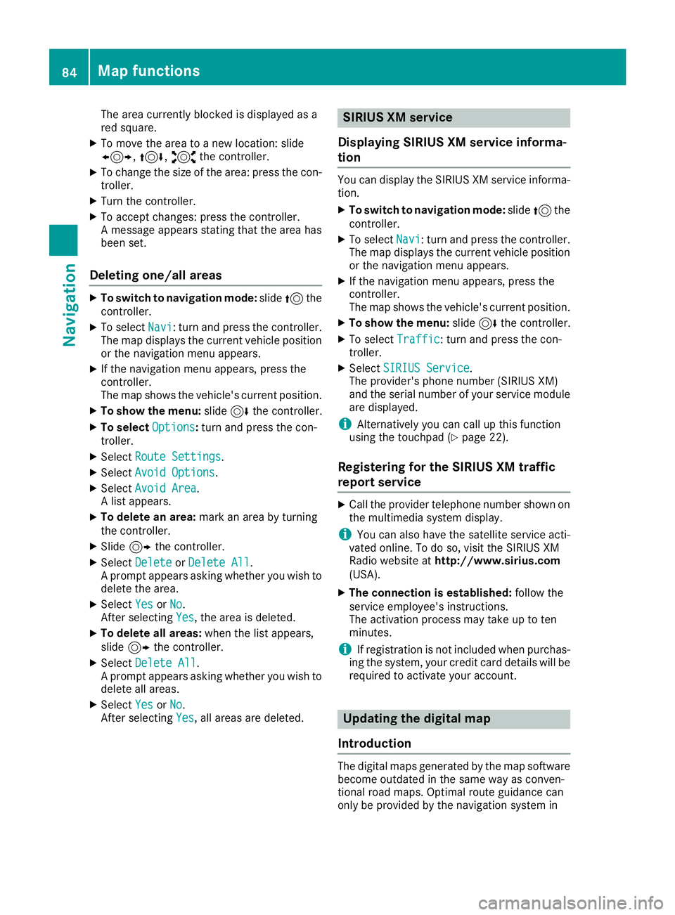
Editing the last destinations
XTo switch to navigation mode:slide5the
controller.
XTo select Navi: turn and press the controller.
The map displays the current vehicle position
or the navigation menu appears.
XIf the navigation menu appears, press the
controller.
The map shows the vehicle's current position.
XTo show the menu: slide6the controller.
XTo select Destination: turn and press the
controller.
XSelect From Previous Destinations.
The "Last destinations" memory appears.
XTo save the destination: select the destina-
tion.
The destination address appears.
XStore the destination in the address book
(Ypage 77).
XSave the destination to the SD card
(Ypage 78).
XTo view the details: while in the "Last desti-
nations" memory, turn the controller and
highlight the entry.
XSlide 9the controller.
A menu appears.
XTo select Details: press the controller.
iThe destination address can be changed if
desired. For instance, a different street or
house number can be selected.
XTo delete one or all destinations: while in
the "Last destinations" memory, turn the con-
troller and highlight the entry.
XSlide 9the controller.
A menu appears.
XTo select DeleteorDelete All: turn and
press the controller.
A prompt appears.
XSelect YesorNo.
Selecting Yesdeletes the selected destina-
tion or all destinations.
Map functions
General notes
Company logos displayed on the map are trade- marks of the respective companies and used
solely for the purpose of indicating the locations
of these companies. The use of such logos on
the map does not indicate approval of, support
of or advertising by these companies for the
navigation system itself.
iAlternatively, you can carry out this opera-
tion using the touchpad (Ypage 22).
Map settings
Setting the map scale
Requirement: the map is in full screen mode, the
menu is faded out (Ypage 49).
The lower left-hand section of the map shows
the currently set map scale and compass nee-
dle.
Right-hand-drive vehicles: the currently set map
scale and compass needle are displayed in the
lower right-hand section of the map.
XTo show the map in full screen mode: to
hide the menu, push the %button.
or
XSlide the controller to the center of the map
and press to confirm.
XTo set the map scale: as soon as you turn the
controller, the scale bar appears on the bot-
tom of the display.
XTurn the controller until the needle points to
the desired map scale.
Once you are finished selecting a map scale,
the new map scale will be shown.
Map functions79
Navigation
Z
Page 84 of 174

Rotating the 3D map
You can use this function to explore the vicinity
of the destination in a 3D view. The function is
available in all map scales.
XTo switch to navigation mode:slide5the
controller.
XTo select Navi: turn and press the controller.
The map displays the current vehicle position
or the navigation menu appears.
XIf the navigation menu appears, press the
controller.
The map shows the vehicle's current position.
XTo show the menu: slide6the controller.
XTo select Position: turn and press the con-
troller.
XSelect 3D Map Rotation.
XTurn the controller to change to the 3D map
perspective.
Additional functions:
RMoving the map (Ypage 49)
Map display
Displaying the navigation map
The multimedia system displays the navigation
map and globe satellite images. This allows for a realistic map display free from distortion in all
map scales.
Other functions:
RMoving the map (Ypage 49)
RChanging the map scale (Ypage 79)
Building images
In small map scales 1/32 mi (20
m) and1/16 mi
(5 0m) importan t buildings are depicted realis-
tically on the map. Other buildings are shown as
models.
Elevation model
The map uses elevation modeling to show a
realistic illustration.
Avoiding an area
General notes
The multimedia system enables you to avoid
areas you do not wish to drive through.
If you activate or deactivate a route block while
route guidance is active, the multimedia system
will calculate a new route. If you activate or
deactivate a route block while route guidance is
inactive, the multimedia system will use the new
setting for the next route guidance.
The calculated route may include an area to be
avoided if:
Ryour destination is located in such an area
Rthere is no alternative route of comparable
length available
Highways within blocked areas are always taken
into consideration in the route calculation.
iAlternatively, you can carry out this opera-
tion using the touchpad (Ypage 22).
82Map functions
Navigation
Page 86 of 174

The area currently blocked is displayed as a
red square.
XTo move the area to a new location: slide
1,4,2the controller.
XTo change the size of the area: press the con-
troller.
XTurn the controller.
XTo accept changes: press the controller.
A message appears stating that the area has
been set.
Deleting one/all areas
XTo switch to navigation mode: slide5the
controller.
XTo select Navi: turn and press the controller.
The map displays the current vehicle position
or the navigation menu appears.
XIf the navigation menu appears, press the
controller.
The map shows the vehicle's current position.
XTo show the menu: slide6the controller.
XTo select Options:turn and press the con-
troller.
XSelect Route Settings.
XSelectAvoid Options.
XSelectAvoid Area.
A list appears.
XTo delete an area: mark an area by turning
the controller.
XSlide 9the controller.
XSelect DeleteorDelete All.
A prompt appears asking whether you wish to
delete the area.
XSelect YesorNo.
After selecting Yes, the area is deleted.
XTo delete all areas: when the list appears,
slide 9 the controller.
XSelect Delete All.
A prompt appears asking whether you wish to
delete all areas.
XSelect YesorNo.
After selecting Yes, all areas are deleted.
SIRIUS XM service
Displaying SIRIUS XM service informa-
tion
You can display the SIRIUS XM service informa-
tion.
XTo switch to navigation mode: slide5the
controller.
XTo select Navi: turn and press the controller.
The map displays the current vehicle position
or the navigation menu appears.
XIf the navigation menu appears, press the
controller.
The map shows the vehicle's current position.
XTo show the menu: slide6the controller.
XTo select Traffic: turn and press the con-
troller.
XSelect SIRIUS Service.
The provider's phone number (SIRIUS XM)
and the serial number of your service module
are displayed.
iAlternatively you can call up this function
using the touchpad (Ypage 22).
Registering for the SIRIUS XM traffic
report service
XCall the provider telephone number shown on
the multimedia system display.
iYou can also have the satellite service acti-
vated online. To do so, visit the SIRIUS XM
Radio website at http://www.sirius.com
(USA).
XThe connection is established: follow the
service employee's instructions.
The activation process may take up to ten
minutes.
iIf registration is not included when purchas-
ing the system, your credit card details will be
required to activate your account.
Updating the digital map
Introduction
The digital maps generated by the map software
become outdated in the same way as conven-
tional road maps. Optimal route guidance can
only be provided by the navigation system in
84Map functions
Navigation
Page 87 of 174

conjunction with the most up-to-date map soft-
ware.
Information about new versions of the digital
map can be obtained from an authorized
Mercedes-Benz Center. You can have the digital
map updated there using a data medium, or you
can update it yourself.
Carrying out a manual update
You can carry out the update yourself.
The update process may take some time (up to
45 minutes), depending on the size of the digital
map. The update will be completed more quickly
if the vehicle is stationary. If you begin the
update while the vehicle is stationary and the
starter battery has insufficient power, the mul-
timedia system may switch off automatically.
This protects the battery. In order to prevent
this, a suitable power supply to the vehicle must
be maintained.
Navigation functions
Calling up the navigation system
menu
XTo switch to navigation mode:slide5the
controller.
XTo select Navi: turn and press the controller.
The navigation menu appears or the map dis-
plays the current vehicle position.
XIf the map appears, slide 5the controller.
XPress the controller.
The navigation menu appears.
XTo return to the map: turn the controller
until Navigation
appears and then press the
controller.
Calling up the online map display
Requirement for online map display (USA):
mbrace must be activated for Internet access
(
Ypage 118).
Requirement for the online map display (Can-
ada): a mobile phone is connected to the multi-
media system via Bluetooth
®(Ypage 90) or
USB (Ypage 151).
XCall up the navigation menu (Ypage 85).
XTurn the controller until Online Map Dis‐playis brought to the front.
XPress the controller.
The online connection is established. Once
the connection is established, the Google
Maps™ map shows the vicinity of the current
vehicle position.
iAlternatively you can call up this function
using the touchpad (Ypage 22).
XTo exit the online map display: press the %
button.
Calling up the compass display
XCall up the navigation menu (Ypage 85).
XTurn the controller until Compassis brought to
the front.
XPress the controller.
The compass display provides the following
information:
RThe current direction of travel with bearing
(360 degree format) and compass direction
RLongitude and latitude coordinates in
degrees, minutes and seconds
RHeight (rounded off) above sea level
RNumber of GPS satellites from which a sig- nal can be received
iAlternatively you can call up this function
using the touchpad (Ypage 22).
XTo exit the compass display: press the %
button.
Navigation functions85
Navigation
Z
Page 88 of 174

Drive information
XCall up thenavigation men u (Ypage 85).
XTurnth econtroller until DriveInformationis brought to th efront.
XPress th econtroller .
The Starting Drive Information.
Please Wait.. .messageappears .
You will then see map swit hth ecurren tvehi-
cl eposition and th evicinit yof th edestination
in differen tscales ,these are automatically
displaye don eafter another.
If mbrace is activated fo rInternet access
(
Ypage 118), additional information can be
displayed, e.g. weather at th edestination .
iAlternatively you can cal lup this function
usin gth etouchpad (Ypage 22).
XTo exit Drive Information :press th econtroller .
XPress the% button.
Route flight
XCall up th enavigation men u (Ypage 85).
XTurnth econtroller until Route Flightis
brought to th efront.
XPress th econtroller .
iAlternatively you can cal lup this function
usin gth etouchpad (Ypage 22).
XSelectÌ.
The rout ewill be flown alon gfrom ahelicopter
perspective .
XTo stop rout eflight :selec tË.
XTo exit th erout eflight :press th econtroller .
XPress the% button.
Infoon navigation
XCall up th enavigation men u (Ypage 85).
XTurnth econtroller until Infoon Naviga ‐tionis brought to th efront.
XPress th econtroller .
The Digital Operator's Manual is opene dat
th esection on navigation .
iAlternatively you can cal lup this function
usin gth etouchpad (Ypage 22).
Problemswit hth enavigation syste m
ProblemPossible causes/consequences an dMSolutions
The multimedia syste m
doe sno tresume rout e
guidanc eafter th ejour-
ne yhas bee ninterrup-
ted.Rout eguidanc eis canceled if you interrupt th ejourney fo rmore than
tw ohours.
"Interruptin gth ejourney" refers to stoppin gth evehicle.
"Continuing rout eguidance" refers to switchin gth emultimedia sys-
te m bac kon and drivin gon .
XContinue rout eguidanc e (Ypage 71) .
86Problems with the navigation system
Navigation
Page 89 of 174

ProblemPossible causes/consequences andMSolutions
The multimedia system
is unable to determine
the vehicle's position.The multimedia system must identify the vehicle’s position again after
it has been transported.
Example:
RAfter transporting the vehicle by ferry
RAfter transporting the vehicle by motorail
XStart the vehicle and pull away.
The multimedia system calculates the vehicle's position. Depending
on the driving situation, this may take some time.
Route guidance may be restricted during the determination of the
vehicle's position.
When positioning is complete, route guidance is resumed with nav-
igation announcements and route guidance displays.
ProblemPossible causes/consequences andMSolutions
TheNavigationUnavailable Pleaserefer to the Opera‐tor's Manual.mes-
sage appears.
The multimedia system has an integrated hard drive on which the
digital map is stored.
To protect the integrated hard drive against damage, the multimedia
system deactivates it at very high and low temperatures. The naviga-
tion system will then be temporarily unavailable.
XLet the vehicle and the multimedia system heat up or cool down to a normal temperature.
XTo hide the message: switch the multimedia system off and then
on again.
ProblemPossible causes/consequences and MSolutions
A message informs you
that the data medium
containing the digital
map is incompatible with
the vehicle software.The data medium containing the digital map cannot be used for the
update.
XTo confirm the message: press the controller.
XRemove the data medium.
XHave the system database checked at an authorized Mercedes-
Benz Center.
ProblemPossible causes/consequences andMSolutions
The map software
update has failed.The data medium is dirty.
XClean the data medium.
XRestart the update.
The data medium is scratched.
XConsult an authorized Mercedes-Benz Center.
Problems with the navigation system87
Navigation
Z