2017 NISSAN MAXIMA navigation
[x] Cancel search: navigationPage 98 of 243
![NISSAN MAXIMA 2017 A36 / 8.G Nissan Connect Navigation Manual 5. Information
INFO:
. You can also connect to the NissanCon-
nect
SMServices Interactive Voice Menu by
touching the Voice Menu button
*1on the
map.
. After selecting [Connect to Voice Menu], it
may t NISSAN MAXIMA 2017 A36 / 8.G Nissan Connect Navigation Manual 5. Information
INFO:
. You can also connect to the NissanCon-
nect
SMServices Interactive Voice Menu by
touching the Voice Menu button
*1on the
map.
. After selecting [Connect to Voice Menu], it
may t](/manual-img/5/539/w960_539-97.png)
5. Information
INFO:
. You can also connect to the NissanCon-
nect
SMServices Interactive Voice Menu by
touching the Voice Menu button
*1on the
map.
. After selecting [Connect to Voice Menu], it
may take some time until the system initiates
connection, depending on the technical
environment and whether the TCU (Tele-
matics Control Unit) is being used by other
services.
. To avoid disconnecting the line, do not turn
off the engine or the hybrid system.
Setting route to a searched destination
Use Connected Search to find destinations via
the internet and set a route to them directly from
your navigation system.
1. Touch [Info] on the Launch Bar.
2. Touch [NissanConnect Services].
3. Touch [Connected Search]. A keyboard is
displayed.
4. Enter the keyword and touch [Search]. The system will connect to the Internet and the
search results will be displayed.
5. Touch a preferred destination from the list and touch [Start] to start the route guidance.
INFO:
The Connected Search can also be set by
touching [Navi] on the Launch Bar and then
touching [Connected Search].
Message Box
The text messages from the NissanConnectSM
Data Center that were previously received to are
displayed.
1. Touch [Info] on the Launch Bar.
2. Touch [NissanConnect Services]. 3. Touch [Message Box].
4. A history list is displayed. Highlight the
information.
Viewing information feeds
Contents of the various NissanConnectSMSer-
vices information can be downloaded.
1. Touch [Info] on the Launch Bar.
2. Touch [NissanConnect Services].
3. Touch [All Information Feeds]. A list screen is displayed.
4. Touch a preferred folder. A list of information feeds is displayed. The content is announced
by the system (Text-to-Speech) while the
vehicle is being driven, or if parked, you can
read the content on the display.
INFO:
. Touch [Stop] during communication with the
NissanConnect
SMServices Data Center to
cancel the connection.
. A message is displayed when the commu-
nication is disconnected while downloading
information due to a poor communication
status. Select [Yes] to restart the download.
5-14
Page 99 of 243
.Laws in some jurisdictions may restrict the
use of “Text-to-Speech.” Check local reg-
ulations before using this feature.
. Some terminology such as personal names,
place names, special terms, symbols, etc.
may not be announced correctly. This is not a
malfunction.
. The system will pause announcements when
interrupted by the voice guidance given by
the navigation system. When the voice
guidance finishes, the system will restart
the announcement.
. The volume can be adjusted when the
system announces the information.
“Volume and Beeps settings”
(page 2-20)
. The selected content is read out while the
vehicle is being driven, or if parked, you can
read the content on the display.
. Content settings can be made using the
NissanConnect
SMServices website. For
more details, refer to the NissanConnectSM
Services website or contact the NissanCon-
nectSMServices support line.
NissanConnectSMServices website:
For U.S.
www.nissanusa.com/connect For Canada
www.nissan.ca/nissanconnect (English)
www.nissan.ca/nissanconnect/fr (French)
NissanConnect
SMServices support
line:
1-855-426-6628
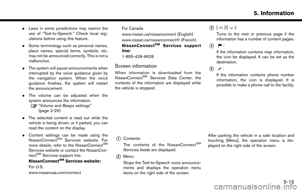
Screen information
When information is downloaded from the
NissanConnectSMServices Data Center, the
contents of the information are displayed while
the vehicle is stopped.
*1Contents:
The contents of the NissanConnectSM
Services feeds are displayed.
*2Menu:
Stops the Text-to-Speech voice announce-
ments and displays the operation menu
items on the right side of the screen.
*3[]/[]:
Turns to the next or previous page if the
information has a number of content pages.
*4:
If the information contains map information,
the icon be displayed. It can be set as the
destination.
*5:
If the information contains phone number
information, the icon is displayed. It is
possible to make a phone call to the facility.
After parking the vehicle in a safe location and
touching [Menu], the operation menu is dis-
played on the right side of the screen.
5. Information
5-15
Page 103 of 243
SiriusXM TRAVEL LINK (for U.S.
and Canada)
SiriusXM Travel Link information is a subscription
service offered by SiriusXM Satellite Radio. It is
necessary to subscribe to use the SiriusXM
Travel Link information.
This service provides real-time information re-
garding current weather, fuel prices, sports
scores, stock tickers and movie times where
available. The SiriusXM Travel Link is broadcast
to the vehicle by SiriusXM Satellite Radio.
The service enables you to view the following
information on the navigation system:
*Current information around the destination
*Detailed information and forecasts of an area of
interest
*Countrywide and local maps with the current
weather, temperature, warnings and road condi-
tion information
*List of warning/watches events detected
around the current location
*Pop-up messages on the navigation screen with
voice announcements when warnings and
watches are detected around the current loca-
tion
SXM service menus can be accessed from theinformation screen.
“Information menu” (page 5-2)
WARNING
SiriusXM Travel Link information is not a
substitute for attentive driving. Weather
conditions change constantly and emer-
gency situations can arise without warn-
ing. Relying only on SiriusXM Travel Link
information could result in serious per-
sonal injury.
VIEWING SiriusXM TRAVEL LINK
SiriusXM Satellite Radio and SiriusXM Travel
Link subscriptions are sold separately or as a
package, and are continuous until you call
SiriusXM to cancel. See SiriusXM Customer
Agreement for complete terms at www.siriusxm.
com (for U.S.) or www.siriusxm.ca (for Canada) .
SiriusXM Travel Link is available in select
markets.
For more information, refer to the SiriusXM
website or call Listener Care.
SiriusXM website:
For U.S.
www.siriusxm.com/travellink
For Canada www.siriusxm.ca/siriusxm-traffic-services/
siriusxm-travel-link (English)
www.siriusxm.ca/fr/services-siriusxm-
traffic/siriusxm-travel-link (French)
Listener Care:
For U.S.
1-877-447-0011
For Canada
1-877-438-9677
INFO:
. If a contract is not completed for the
SiriusXM Travel Link information service, a
message appears and it will not be possible
to check the information on the traffic
information system.
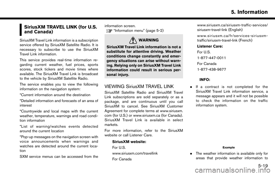
Example
.The weather information is available only for
areas that provide weather information to
5. Information
5-19
Page 109 of 243
6 Navigation
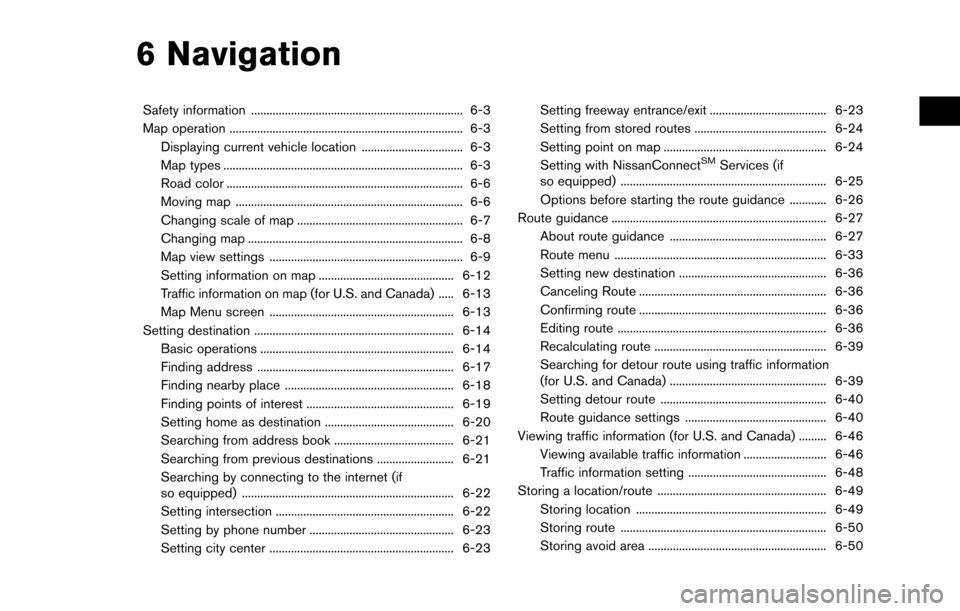
Safety information ..................................................................... 6-3
Map operation ........................................................................\
.... 6-3Displaying current vehicle location ................................. 6-3
Map types ........................................................................\
...... 6-3
Road color ........................................................................\
..... 6-6
Moving map ........................................................................\
.. 6-6
Changing scale of map ...................................................... 6-7
Changing map ...................................................................... 6-8
Map view settings ............................................................... 6-9
Setting information on map ............................................ 6-12
Traffic information on map (for U.S. and Canada) ..... 6-13
Map Menu screen ............................................................ 6-13
Setting destination ................................................................. 6-14 Basic operations ............................................................... 6-14
Finding address ................................................................ 6-17
Finding nearby place ....................................................... 6-18
Finding points of interest ................................................ 6-19
Setting home as destination .......................................... 6-20
Searching from address book ....................................... 6-21
Searching from previous destinations ......................... 6-21
Searching by connecting to the internet (if
so equipped) ..................................................................... 6-22
Setting intersection .......................................................... 6-22
Setting by phone number ............................................... 6-23
Setting city center ............................................................ 6-23 Setting freeway entrance/exit ...................................... 6-23
Setting from stored routes ........................................... 6-24
Setting point on map ..................................................... 6-24
Setting with NissanConnect
SMServices (if
so equipped) ................................................................... 6-25
Options before starting the route guidance ............ 6-26
Route guidance ...................................................................... 6-27
About route guidance ................................................... 6-27
Route menu ..................................................................... 6-33
Setting new destination ................................................ 6-36
Canceling Route ............................................................. 6-36
Confirming route ............................................................. 6-36
Editing route .................................................................... 6-36
Recalculating route ........................................................ 6-39
Searching for detour route using traffic information
(for U.S. and Canada) ................................................... 6-39
Setting detour route ...................................................... 6-40
Route guidance settings .............................................. 6-40
Viewing traffic information (for U.S. and Canada) ......... 6-46
Viewing available traffic information ........................... 6-46
Traffic information setting ............................................. 6-48
Storing a location/route ....................................................... 6-49 Storing location .............................................................. 6-49
Storing route ................................................................... 6-50
Storing avoid area .......................................................... 6-50
Page 110 of 243
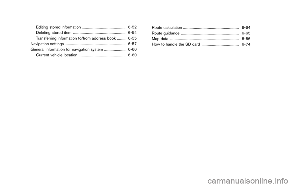
Editing stored information .............................................. 6-52
Deleting stored item ........................................................ 6-54
Transferring information to/from address book ......... 6-55
Navigation settings ................................................................ 6-57
General information for navigation system ....................... 6-60 Current vehicle location .................................................. 6-60 Route calculation ............................................................ 6-64
Route guidance .............................................................. 6-65
Map data ........................................................................\
.. 6-66
How to handle the SD card ........................................ 6-74
Page 111 of 243
SAFETY INFORMATION
The navigation system is primarily designed to
help you reach your destination. However, you,
the driver, must use the system safely and
properly. Information concerning road condi-
tions, traffic signs and the availability of services
may not always be up to date. The system is not a
substitute for safe, proper, and legal driving.
WARNING
Do not rely on route guidance alone.
Always be sure that all driving maneu-
vers are legal and safe in order to avoid
accidents.
MAP OPERATION
DISPLAYING CURRENT VEHICLE
LOCATION
Push
Page 112 of 243
6. Navigation
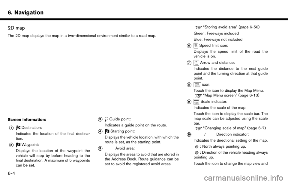
2D map
The 2D map displays the map in a two-dimensional environment similar to a road map.
Screen information:
*1Destination:
Indicates the location of the final destina-
tion.
*2Waypoint:
Displays the location of the waypoint the
vehicle will stop by before heading to the
final destination. A maximum of 5 waypoints
can be set.
*3Guide point:
Indicates a guide point on the route.
*4Starting point:
Displays the vehicle location, with which the
route is set, as the starting point.
*5Avoid area:
Displays the areas to avoid that are stored in
the Address Book. Route guidance can be
set to avoid the registered avoid areas.
“Storing avoid area” (page 6-50)
Green: Freeways included
Blue: Freeways not included
*6Speed limit icon:
Displays the speed limit of the road the
vehicle is on.
*7Arrow and distance:
Indicates the distance to the next guide
point and the turning direction at that guide
point.
*8icon:
Touch the icon to display the Map Menu.
“Map Menu screen” (page 6-13)
*9Scale indicator:
Indicates the scale of the map.
Touch the icon to display the scale bar. The
map scale can be adjusted using the scale
bar.
“Changing scale of map” (page 6-7)
*10/Direction indicator:
Indicates the directional setting of the map.
: North always pointing up.
: Direction of the vehicle heading always
pointing up.
Touch the icon to change the map view and
6-4
Page 113 of 243
the map orientation.“Changing map view and map orienta-
tion” (page 6-8)
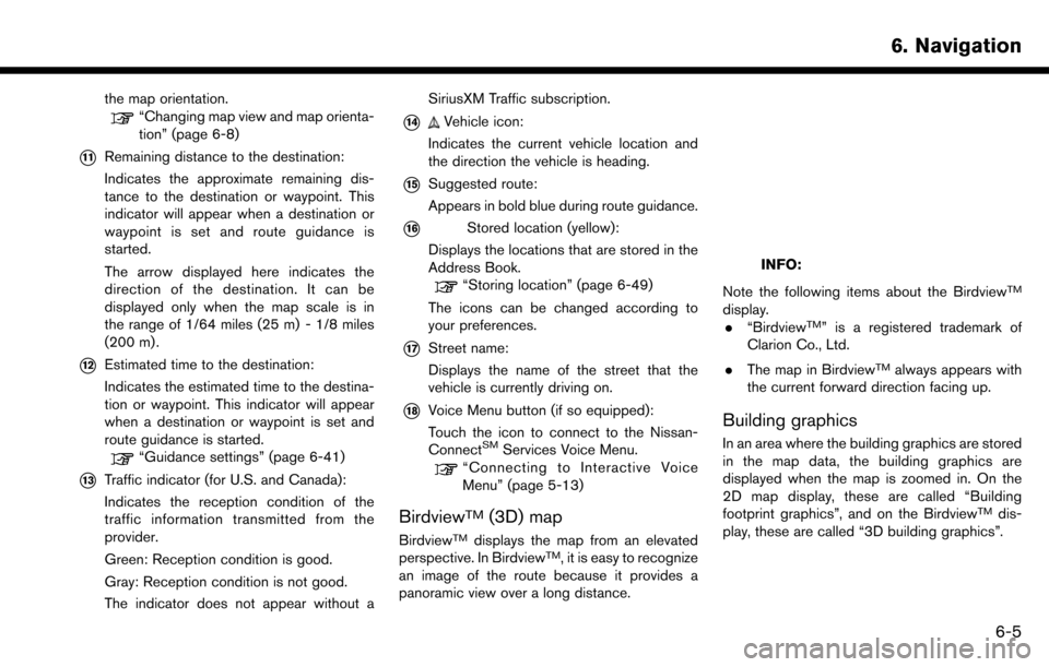
*11Remaining distance to the destination:
Indicates the approximate remaining dis-
tance to the destination or waypoint. This
indicator will appear when a destination or
waypoint is set and route guidance is
started.
The arrow displayed here indicates the
direction of the destination. It can be
displayed only when the map scale is in
the range of 1/64 miles (25 m) - 1/8 miles
(200 m) .
*12Estimated time to the destination:
Indicates the estimated time to the destina-
tion or waypoint. This indicator will appear
when a destination or waypoint is set and
route guidance is started.
“Guidance settings” (page 6-41)
*13Traffic indicator (for U.S. and Canada):
Indicates the reception condition of the
traffic information transmitted from the
provider.
Green: Reception condition is good.
Gray: Reception condition is not good.
The indicator does not appear without aSiriusXM Traffic subscription.
*14Vehicle icon:
Indicates the current vehicle location and
the direction the vehicle is heading.
*15Suggested route:
Appears in bold blue during route guidance.
*16Stored location (yellow):
Displays the locations that are stored in the
Address Book.
“Storing location” (page 6-49)
The icons can be changed according to
your preferences.
*17Street name:
Displays the name of the street that the
vehicle is currently driving on.
*18Voice Menu button (if so equipped):
Touch the icon to connect to the Nissan-
Connect
SMServices Voice Menu.“Connecting to Interactive Voice
Menu” (page 5-13)
BirdviewTM(3D) map
BirdviewTMdisplays the map from an elevated
perspective. In BirdviewTM, it is easy to recognize
an image of the route because it provides a
panoramic view over a long distance.
INFO:
Note the following items about the Birdview
TM
display. . “BirdviewTM” is a registered trademark of
Clarion Co., Ltd.
. The map in Birdview
TMalways appears with
the current forward direction facing up.
Building graphics
In an area where the building graphics are stored
in the map data, the building graphics are
displayed when the map is zoomed in. On the
2D map display, these are called “Building
footprint graphics”, and on the Birdview
TMdis-
play, these are called “3D building graphics”.
6. Navigation
6-5