Page 79 of 342

3
79
IS_NAVI_EE
2
3
1
4
5
6
7
8
9
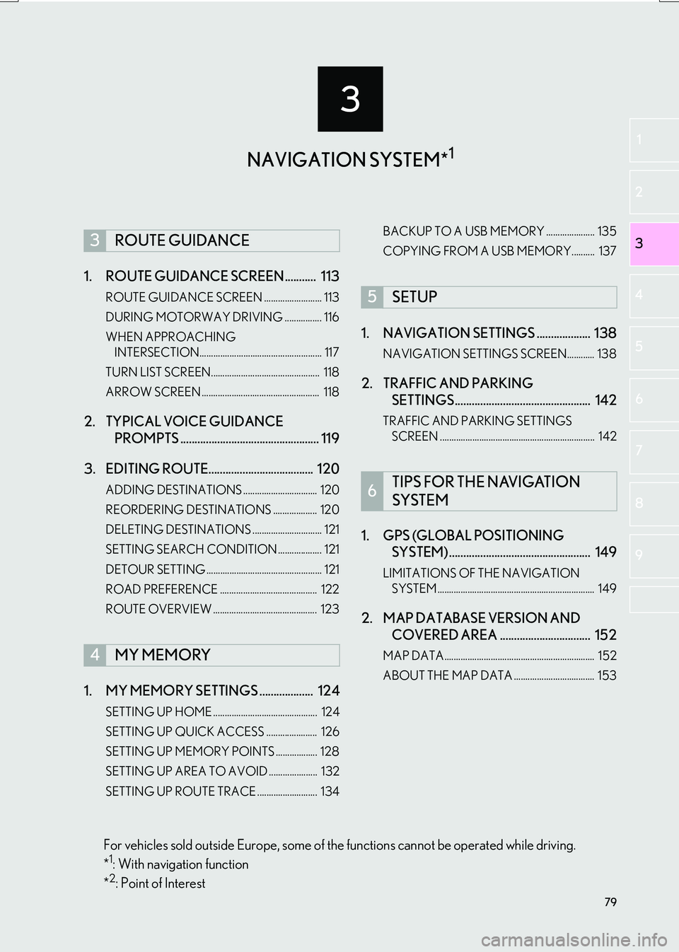
1. ROUTE GUIDANCE SCREEN ........... 113
ROUTE GUIDANCE SCREEN ......................... 113
DURING MOTORWAY DRIVING ................ 116
WHEN APPROACHING INTERSECTION..................................................... 117
TURN LIST SCREEN............................................... 118
ARROW SCREEN ................................................... 118
2. TYPICAL VOICE GUIDANCE PROMPTS ................................................. 119
3. EDITING ROUTE..................................... 120
ADDING DESTINATIONS ................................ 120
REORDERING DESTINATIONS ................... 120
DELETING DESTINATIONS .............................. 121
SETTING SEARCH CONDITION ................... 121
DETOUR SETTING .................................................. 121
ROAD PREFERENCE .......................................... 122
ROUTE OVERVIEW ............................................. 123
1. MY MEMORY SETTINGS ................... 124
SETTING UP HOME ............................................. 124
SETTING UP QUICK ACCESS ...................... 126
SETTING UP MEMORY POINTS .................. 128
SETTING UP AREA TO AVOID ..................... 132
SETTING UP ROUTE TRACE .......................... 134 BACKUP TO A USB MEMORY ..................... 135
COPYING FROM A USB MEMORY.......... 137
1. NAVIGATION SETTINGS ................... 138
NAVIGATION SETTINGS SCREEN............ 138
2. TRAFFIC AND PARKING
SETTINGS................................................ 142
TRAFFIC AND PARKING SETTINGS
SCREEN ................................................................... 142
1. GPS (GLOBAL POSITIONING SYSTEM) .................................................. 149
LIMITATIONS OF THE NAVIGATION
SYSTEM .................................................................... 149
2. MAP DATABASE VERSION AND COVERED AREA ................................ 152
MAP DATA................................................................. 152
ABOUT THE MAP DATA ................................... 153
3ROUTE GUIDANCE
4MY MEMORY
5SETUP
6TIPS FOR THE NAVIGATION
SYSTEM
NAVIGATION SYSTEM*1
For vehicles sold outside Europe, some of the functions cannot be operated while driving.
*1: With navigation function
*2: Point of Interest
Page 81 of 342

81
1. BASIC OPERATION
IS_NAVI_EE
NAVIGATION SYSTEM
3
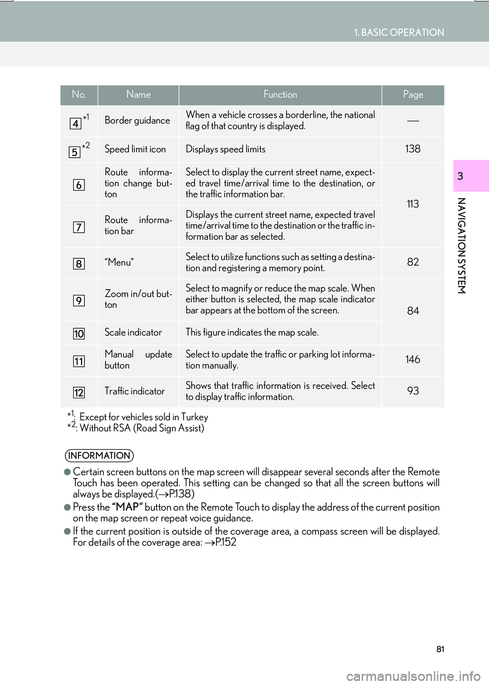
*1Border guidanceWhen a vehicle crosses a borderline, the national
flag of that country is displayed.
*2Speed limit iconDisplays speed limits138
Route informa-
tion change but-
tonSelect to display the current street name, expect-
ed travel time/arrival time to the destination, or
the traffic information bar.
113
Route informa-
tion barDisplays the current street name, expected travel
time/arrival time to the destination or the traffic in-
formation bar as selected.
“Menu”Select to utilize functions such as setting a destina-
tion and registering a memory point.82
Zoom in/out but-
tonSelect to magnify or reduce the map scale. When
either button is selected, the map scale indicator
bar appears at the bottom of the screen.
84
Scale indicatorThis figure indicates the map scale.
Manual update
buttonSelect to update the traffic or parking lot informa-
tion manually. 146
Traffic indicatorShows that traffic information is received. Select
to display traffic information.93
*
1: Except for vehicles sold in Turkey
*2: Without RSA (Road Sign Assist)
INFORMATION
●
Certain screen buttons on the map screen w ill disappear several seconds after the Remote
Touch has been operated. This setting can be changed so that all the screen buttons will
always be displayed.( →P.1 3 8 )
●Press the “MAP” button on the Remote Touch to display the address of the current position
on the map screen or repeat voice guidance.
●If the current position is outside of the cove rage area, a compass screen will be displayed.
For details of the coverage area: →P.1 5 2
No.NameFunctionPage
Page 92 of 342
92
1. BASIC OPERATION
IS_NAVI_EE
INFORMATION
●
Even when traffic/parking information is
not currently being received, traffic infor-
mation and “Info” will be displayed for a
while after traffic information has been
received.
●In some situations, calls to a POI may
automatically change to an international
call or may not be possible as a domestic
call.
STANDARD MAP ICONS
IconInformation
Town with > 1 million people
Town with 500,000-1 mil-
lion people
Town with 200,000-
500,000 people
Town with 100,000-
200,000 people
Town with 20,000-
100,000 people
Town with 10,000-20,000
people
Town with < 10,000 people
Park/Monument
Golf Course
Airport
Hospital/Polyclinic
Shopping centre
University/College
Page 93 of 342

93
1. BASIC OPERATION
IS_NAVI_EE
NAVIGATION SYSTEM
3
4. TRAFFIC AND PARKING INFORMATION
*: Can only be used when receiving RDS-TMCor TPEG (Transport Protocol Experts Group)
information. Depending on the country or ar-
ea, receiving RDS-TMC and TPEG informa-
tion may not be possible.
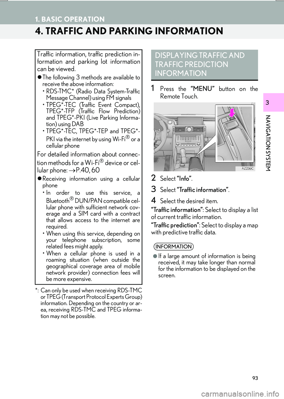
1Press the “MENU” button on the
Remote Touch.
2Select “Info”.
3Select “Traffic information” .
4Select the desired item.
“Traffic information” : Select to display a list
of current traffic information.
“Traffic prediction” : Select to display a map
with predictive traffic data.
Traffic information, traffic prediction in-
formation and parking lot information
can be viewed.
�z The following 3 methods are available to
receive the above information:
• RDS-TMC* (Radio Data System-Traffic
Message Channel) using FM signals
• TPEG*-TEC (Traffic Event Compact), TPEG*-TFP (Traffic Flow Prediction)
and TPEG*-PKI (Live Parking Informa-
tion) using DAB
• TPEG*-TEC, TPEG*-TEP and TPEG*-
PKI via the internet by using Wi-Fi
® or a
cellular phone
For detailed information about connec-
tion methods for a Wi-Fi® device or cel-
lular phone: →P.40, 60
�zReceiving informatio n using a cellular
phone
• In order to use this service, a
Bluetooth
® DUN/PAN compatible cel-
lular phone with sufficient network cov-
erage and a SIM card with a contract
that allows access to the internet are
required.
• When using this service, depending on your telephone subscription, some
related fees might apply.
• When a cellular phone is used in a roaming situation (when outside the
geographical coverage area of mobile
network provider) connection fees will
be more expensive.
DISPLAYING TRAFFIC AND
TRAFFIC PREDICTION
INFORMATION
INFORMATION
●
If a large amount of information is being
received, it may take longer than normal
for the information to be displayed on the
screen.
Page 96 of 342
96
1. BASIC OPERATION
IS_NAVI_EE
1Press the “MENU” button on the
Remote Touch.
2Select “Info”.
3Select “Parking information” .
4Select the desired parking lot.
: Number of available parking space
“Sort” : → P.97
“Search area” : Parking lot search ( →P.97)
5Check that the parking information is
displayed.
“Enter ” : Select to set as a destination.
( → P.109) If a destination has already been
set, “Add to ” and “Replace ” will be dis-
played.
• “Add to ” : Select to add a destination.
• “Replace ” : Select to delete the existing
destination(s) and set a new one.
“Map” : Select to display the map of the
parking.
“Detail” : Select to display detailed informa-
tion.
PARKING INFORMATION
The location and available spaces of
parking lots can be checked. These
parking lots can also be set as a destina-
tion.
Page 97 of 342
97
1. BASIC OPERATION
IS_NAVI_EE
NAVIGATION SYSTEM
3
1Select “Sort”.
2Select the desired sorting criteria.
“Distance” : Select t o so rt in the order of dis-
tance from the current location.
“Space” : Select to sort parking lots in the
order of most available spaces.
“Name” : Select to sort in the order of name.1Select “Search area” .
2Select the location or area to be
searched.
SORTINGSEARCHING FOR PARKING
LOT
No.Function
A search around the current position
can be performed.
A search around the currently set
destination can be performed.
The size of the search area around
the set location can be selected.
Select to change pages.
Page 111 of 342

111
2. DESTINATION SEARCH
IS_NAVI_EE
NAVIGATION SYSTEM
3
*: Can only be used when receiving TPEG
(Transport Protocol Experts Group) infor-
mation. Depending on the country or area,
receiving TPEG information may not be
possible.
1Select and hold “Start” on the entire
route map screen until a beep sounds.
�z During demo mode, “DEMO” is displayed
on the map screen.
�z To end demo mode: Press the “MAP” but-
ton on the Remote Touch.
ENTIRE ROUTE MAP SCREEN
No.Information/FunctionPage
Current position
Destination point
Type of route and its dis-
tance
Distance of the entire route
Select the desired route
from 3 possible routes.112
Select to change the route.120
• Select to start guidance.
• Select and hold to start
demo mode.
111
*Select to display traffic pre-
diction information.95
Select to display the Street
View.309
*
Select to update the traffic
or parking lot information
manually.
146
STARTING DEMO MODE
Before starting the route guidance, the
demonstration of the route guidance
can be viewed.
No.Information/FunctionPage
Page 116 of 342

116
3. ROUTE GUIDANCE
IS_NAVI_EE
■TRAFFIC INFORMATION
1Select “Traffic bar” .
2Check that the traffic information is dis-
played.
�zWhen multiple destinat ions are set, traffic
information icons are displayed up to the
nearest destination area.
�z When the distance to the destination is 65
miles (100 km) or more, traffic information
icons are displayed up to 65 miles (100
km) away from the current position.
When traffic information is received, the
traffic information bar is displayed.
The colour of the arrow indicates specif-
ic road conditions. Red indicates a
closed road, accident, etc. Orange indi-
cates a traffic jam. Blue indicates normal
traffic flow. (Note that roads that are not
covered by traffic information are also
shown in blue.)
No.Information
Icon that shows road hazard points.
Arrow that shows traffic congestion.
Displays estimated travel time delay
caused by road repairs, an accident,
etc.
DURING MOTORWAY
DRIVING
During motorway driving, this screen
displays the distance and time to the
junction/exit, or POIs in the vicinity of
the motorway exit.
No./
IconInformation/Function
Displays the exit number, junction
name or POIs that are close to a mo-
torway exit.
Distance and time from the current
position to the road traffic facilities.
Select to display the nearest road
traffic facilities from the current posi-
tion.
Select to display the distance to the
next and subsequent parking areas
and parking area POIs.
Select to scroll to farther road traffic
facilities.
Select to scroll to closer road traffic
facilities.
INFORMATION
●
When the map screen is set to full screen
display, the motorway information screen
will be displayed on the “Side Display”.