Page 61 of 90
61
1
2
3
4
5
6
6. The selected location is shown on the map.The system transitions to the next screen by selecting , or it
returns to the previous screen by selecting the button. By touching the
location displayed on the screen, you can change the destination to anywhere
on the map.
7. Navigation starts if is selected , or after 10 seconds of no user
interaction.
By touching the location displayed on the screen, you can verify the route.
Additionally, the route can be revised by selecting other options.
• : You can search for POI (point of interest)
around the selected location.
• : The selected location can be registered to Favorites.
Page 62 of 90
62
3.2 Checking route parameters and accessing route related functions
You can check different parameters of the route recommended by the navigation
system.
1. Select after selecting on the MAP screen.
2. The following pieces of information are displayed:
• The name and/or address of the destination.
• The total time of the route.
• The total length of the route.
• The route planning method (e.g. Fast).
Page 63 of 90
63
1
2
3
4
5
6
3. You have the following options on this screen (for detailed instructions on how to use them, see the next chapter):
• Select to edit the route.
• Select to display the entire route on the
map.
• Select to bypass a part of the route.
• Select to delete the active route.
There are other convenient functions.
Page 65 of 90
65
1
2
3
4
5
6
3.3.2 Editing the list of destinations (Edit Route)
You can edit the route by modifying the list of destinations.1. Select after selectin g on the MAP screen.
2. Select .
3. Edit the destination or waypoint. : Add the new destination or waypoint.
: Start the route plan in considerat ion of the selected destination or
waypoint.
4. Select the destination or waypoint to display the menu.
: Close the menu.
: Delete the selected destination or waypoint from the list.
: Move the selected destination or waypoint forward one by one.
: Move the selected destination or waypoint rearward one by one.
Page 66 of 90
66
3.3.3 Checking route alternativ
es when planning the route
You can select from different route alternat ives or change the route planning method
after you have selected a new destination.
1. Select after selectin g on the MAP screen.
2. Select .
3. The four route alternativ es are displayed next to the selected route planning
method. Select one to view it on the map.
Page 70 of 90
70
3.4 Saving a location as a Favorite destination
You can add any location to Favorites, the list of frequently used destinations.
Planning a route to one of the Favorite destinations is described on page 56.1. Select a destination as described before. It can be an address, a Place, any location on the map, a previously used destination from History, etc.
2. A searched destination can be re gistered to Favorites by selecting
on the verification screen of the destination search
results.
3.4.1 Editing the details of a Favorite destination
You can select a location that you have already saved as a Favorite and edit its
details. Adding a location to the list of Favorite destinations is described on page 70. 1. Press the Favorites button on the commander switch.
2. Select the Navigation tab.
3. The list of Favorite destinations is displayed.
Page 75 of 90

75
1
2
3
4
5
6
4.1.4 Speed limit warning (Only some countries and regions)
Maps may contain information about the speed limits of the roads. The navigation
system is able to warn you if you exceed the current limit. This information may not
be available for your region (ask your local dealer), or may not be fully correct for all
roads on the map.
The speed warning can be set from the Warning Settings (page 78).
Setting can be selected using Warning Settings:
• Audio warning: You will hear a warning beep if you exceed the speed limit by a certain percentage.
• Visual warning: If you exceed the speed limit on a road, the speed limit for the
current road is shown on the map.
You can also choose to see the speed limit sign on the map all the time.
4.1.5 Traffic information in route planning (Only some countries and regions)
The recommended route is not always the same between two points. Offline
historical traffic info rmation (historical speed informat ion or traffic patterns) can be
taken into account in the route calculation based on the time of day and the day of
week whenever suitable data exists. In addition, real-time traffic information can
help you avoid current traffic events like temporary road closures or a traffic jam
caused by an accident. Both functions are subject to data availability.
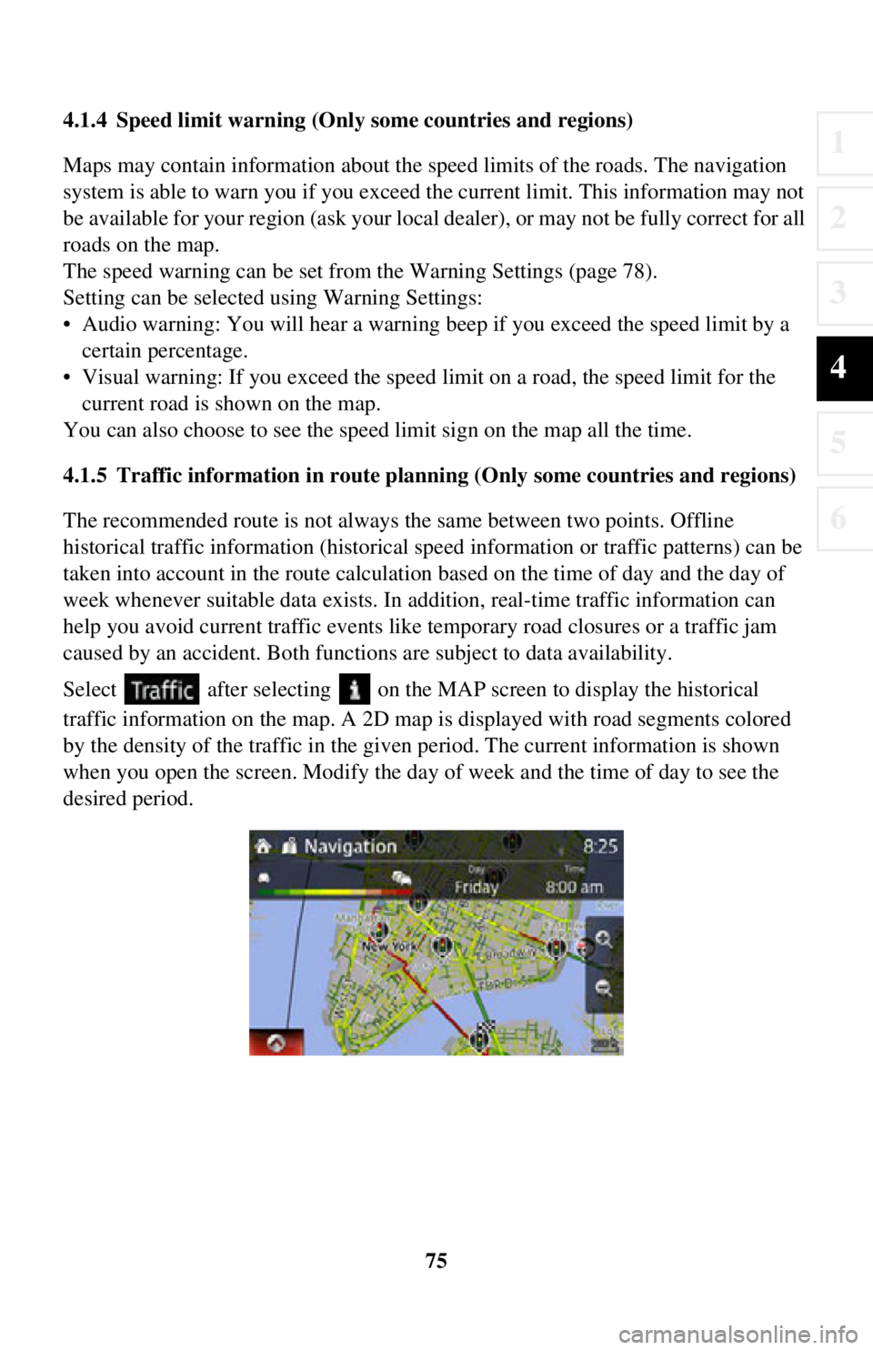
Select after selecting on the MA P screen to display the historical
traffic information on the map. A 2D map is displayed with road segments colored
by the density of the traffic in the given period. The current information is shown
when you open the screen. Modify the day of week and the time of day to see the
desired period.
Page 76 of 90
76
4.1.5.1 Historical traffic
If historical traffic informat
ion is available with the map data, the navigation system
can use it when planning a route. In norma l cases, these statistics help you avoid
usual traffic jams on the given day of week in the given hour but in some cases like
on public holidays that fall on normal weekdays, they can be misleading. You can
disable this feature in Traffic Settings (page 79).
Select after selecting on the MAP screen to display the historical
traffic information on the map.