2015 MERCEDES-BENZ C-Class navigation system
[x] Cancel search: navigation systemPage 40 of 214

Setting the time zone
To set the time zone, the Automatic Time
Automatic Time
Settings
Settings function must be activated.
X Press the 00D4button.
The Vehicle
Vehicle menu appears.
X To select Time
Time: slide 6the controller,
turn and press to confirm.
A menu appears.
X To select Time Zone:
Time Zone:: turn and press the
controller.
A list of countries or time zones appears.
The 003Bdot indicates the current setting.
X Select a country or a time zone.
A time zone list may also be displayed,
depending on the country selected.
X To select the desired time zone: turn and
press the controller.
The entry for the Automatic Time Set‐
Automatic Time Set‐
tings
tings is accepted.
Subsequent operation depends on whether
the navigation system has GPS reception and
whether the changeover function to summer
time is available.
X In the window for summer time settings,
select Automatic
Automatic.
The entry for the Automatic Time Set‐ Automatic Time Set‐
tings
tings is accepted. The Daylight Sav‐
Daylight Sav‐
ings Time (Summer)
ings Time (Summer) function is acti-
vated.
Manually switching to summer time:
X To select On
On orOff
Off turn the controller and
press to confirm.
The 003Bdot indicates the current setting.
The Automatic Time Settings Automatic Time Settings function
is deactivated 0053. Setting the time manually
X
Press the 00D4button.
The Vehicle
Vehicle menu appears.
X To select Time
Time: slide 6the controller,
turn and press to confirm.
A menu appears.
X To select Set Time Manually Set Time Manually: turn and
press the controller.
X To set the hour: turn the controller.
X To set the minutes: slide 9, turn and
press the controller.
X The time is accepted.
If Auto
Auto is set for the summer time change-
over, a prompt will appear asking whether this
should be maintained. Text reader settings
X Press the 00D4button.
The Vehicle Vehicle menu appears.
X To select System Settings
System Settings : slide6the
controller, turn and press to confirm.
A menu appears.
X To select Text Reader Speed Text Reader Speed: turn and
press the controller.
A list appears.
X Select Fast Fast,MediumMedium orSlow
Slow.
The 003Bdot indicates the current setting. 38
Text reader settingsSystem settings
Page 44 of 214

Bluetooth
®
technology is a standard for
short-range wireless data transmissions up to
approximately 10 meters. You can use Blue-
tooth ®
to connect your mobile phone to
COMAND to, for example:
R use the hands-free system
R establish an Internet connection
R listen to music using Bluetooth ®
Audio
R exchange vCards
Bluetooth ®
is a registered trademark of Blue-
tooth Special Interest Group (SIG) Inc. Activating/deactivating Bluetooth
®
X Press the 00D4button in the center con-
sole.
The Vehicle
Vehicle menu appears.
X To select System Settings System Settings : slide6the
controller, turn and press to confirm.
A menu appears.
X To select Activate Bluetooth
Activate Bluetooth: turn and
press the controller.
This switches Bluetooth ®
on 0073 or off 0053. Setting the system language
This function allows you to determine the lan-
guage for the menu displays and the naviga-
tion messages. The selected language affects
the characters available for entry.
i The navigation announcements are not
available in all languages. If a language is
not available, the navigation announce-
ments will be in English.
i When you set the system language, the
language of the Voice Control System will
change accordingly. If it is not supported
by the Voice Control System, English will be
selected. X
Press the 00D4button.
The Vehicle Vehicle menu appears.
X To select System Settings
System Settings : slide6the
controller, turn and press to confirm.
A menu appears.
X To select Language Language : turn and press the
controller.
The list of languages appears. The 003Bdot
indicates the current setting.
X Select the desired language.
COMAND loads the selected language and
sets it. Calling up and editing the Favorites
function
The Favorites function can be called up via the
system menu or via the 007Dbutton on the
controller or the touchpad.
To call up the Favorites function via the
system menu:
X Press the 00D4button.
The system menu appears.
X To select System SystemSettings
Settings: slide 6and
press the controller.
A menu appears.
X To select Favorite Favorite Functions
Functions : press the
controller.
A menu appears.
X To select the desired function, e.g. Radio
Radio:
turn and press the controller.
A menu appears.
To call up the Favorites function via the
controller or touchpad:
X Press the 007Dbutton.
Call up the Favorite Functions Favorite Functions menu.
The Favorites function can be exited at any
time. To exit the Favorites function:
R Press the 007Dbutton again
R Press the 0038button on the controller
R Press the 0038button in the display. 42
Calling up and editing the Favorites functionSystem settings
Page 46 of 214

X
Insert the SD memory card (Y page 168).
or
X Connect a USB device (e.g. a USB memory
stick) (Y page 168).
X Press the 00D4button in the center con-
sole.
The Vehicle
Vehicle menu appears.
X To select System SystemSettings
Settings: slide 6and
press the controller.
A menu appears.
X To select Data Import/Export Data Import/Export: turn and
press the controller.
X Select Import Data
Import Data orExport Data
Export Data.
i If you import data such as address data,
the existing data on COMAND is overwrit-
ten. You will see a message to this effect.
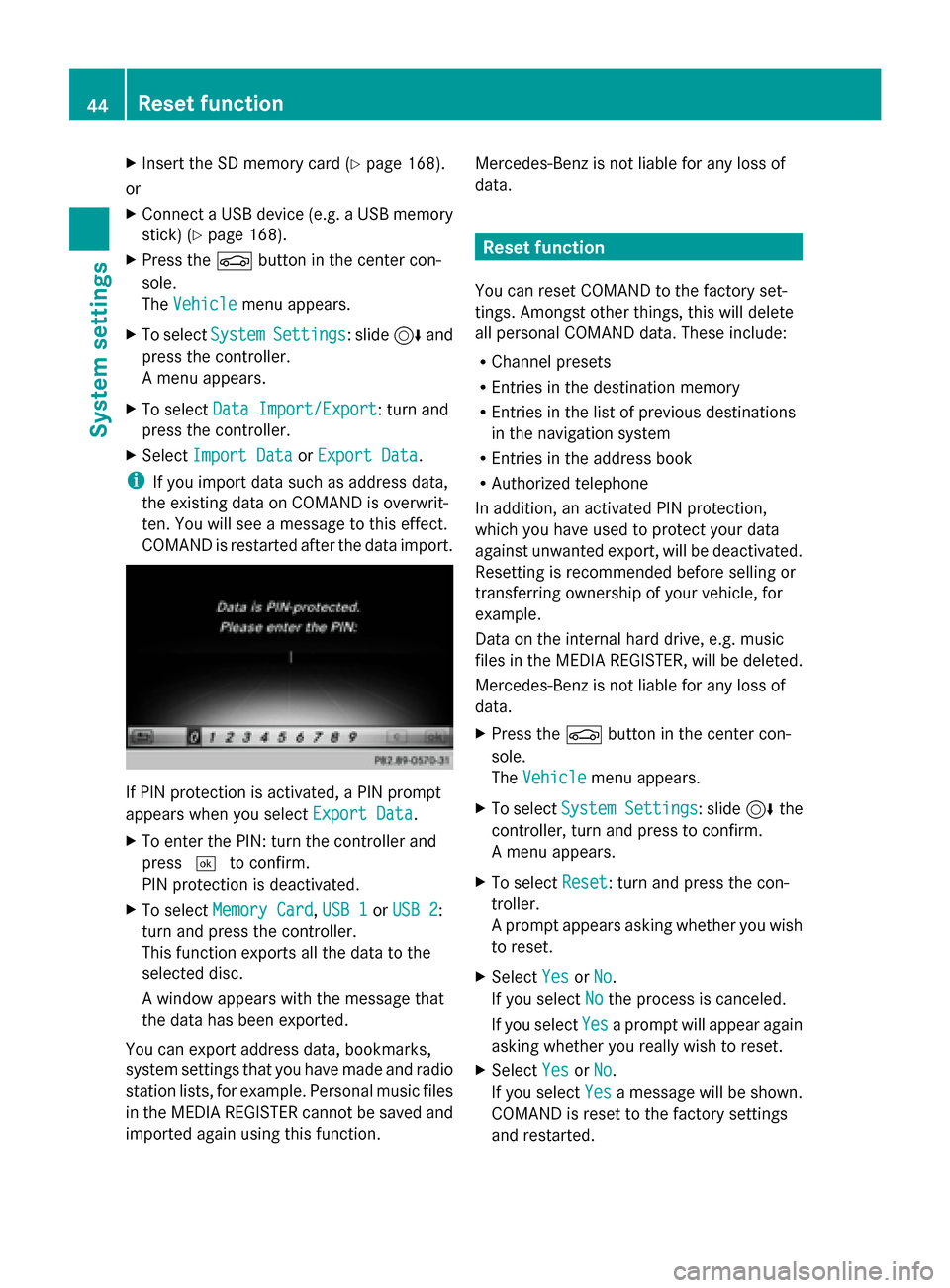
COMAND is restarted after the data import. If PIN protection is activated, a PIN prompt
appears when you select Export Data Export Data.
X To enter the PIN: turn the controller and
press 0054to confirm.
PIN protection is deactivated.
X To select Memory Card
Memory Card, USB 1 USB 1orUSB 2
USB 2:
turn and press the controller.
This function exports all the data to the
selected disc.
A window appears with the message that
the data has been exported.
You can export address data, bookmarks,
system settings that you have made and radio
station lists, for example. Personal music files
in the MEDIA REGISTER cannot be saved and
imported again using this function. Mercedes-Benz is not liable for any loss of
data. Reset function
You can reset COMAND to the factory set-
tings. Amongst other things, this will delete
all personal COMAND data. These include:
R Channel presets
R Entries in the destination memory
R Entries in the list of previous destinations
in the navigation system
R Entries in the address book
R Authorized telephone
In addition, an activated PIN protection,
which you have used to protect your data
against unwanted export, will be deactivated.
Resetting is recommended before selling or
transferring ownership of your vehicle, for
example.
Data on the internal hard drive, e.g. music
files in the MEDIA REGISTER, will be deleted.
Mercedes-Benz is not liable for any loss of
data.
X Press the 00D4button in the center con-
sole.
The Vehicle
Vehicle menu appears.
X To select System Settings System Settings : slide6the
controller, turn and press to confirm.
A menu appears.
X To select Reset Reset: turn and press the con-
troller.
A prompt appears asking whether you wish
to reset.
X Select Yes YesorNo
No.
If you select No
Nothe process is canceled.
If you select Yes
Yesa prompt will appear again
asking whether you really wish to reset.
X Select Yes
YesorNo
No.
If you select Yes
Yesa message will be shown.
COMAND is reset to the factory settings
and restarted. 44
Reset functionSystem settings
Page 64 of 214

Your COMAND equipment
These operating instructions describe all
standard and optional equipment available
for your COMAND system at the time of pur-
chase. Country-specific differences are pos-
sible. Please note that your COMAND system
may not be equipped with all the features
described. This also applies to safety-relevant
systems and functions. Therefore, the equip-
ment on your COMAND system may differ
from that in the descriptions and illustrations.
Should you have any questions concerning
equipment and operation, please consult an
authorized Mercedes-Benz Center. Introduction
Important safety notes
G
WARNING
If you operate information systems and com-
munication equipment integrated in the vehi-
cle while driving, you will be distracted from
traffic conditions. You could also lose control
of the vehicle. There is a risk of an accident.
Only operate the equipment when the traffic
situation permits. If you are not sure that this
is possible, park the vehicle paying attention
to traffic conditions and operate the equip-
ment when the vehicle is stationary.
You must observe the legal requirements for
the country in which you are currently driving
when operating COMAND.
COMAND calculates the route to the destina-
tion without taking account of the following,
for example:
R traffic lights
R stop and yield signs
R merging lanes
R parking or stopping in a no parking/no
stopping zone
R other road and traffic rules and regulations
R narrow bridges COMAND can give incorrect navigation com-
mands if the actual street/traffic situation
does not correspond with the digital map's
data. Digital maps do not cover all areas nor
all routes in an area. For example, a route may
have been diverted or the direction of a one-
way street may have changed.
For this reason, you must always observe
road and traffic rules and regulations during
your journey. Road and traffic rules and reg-
ulations always have priority over the sys-
tem's driving recommendations.
Navigation announcements are intended to
direct you while driving without diverting your
attention from the road and driving.
Please always use this feature instead of con-
sulting the map display for directions. Look-
ing at the icons or map display can distract
you from traffic conditions and driving, and
increase the risk of an accident.
General notes
Operational readiness of the navigation
system The navigation system must determine the
position of the vehicle before first use or
whenever operational status is restored.
Therefore, you may have to drive for a while
before precise route guidance is possible.
GPS reception Among other things, correct functioning of
the navigation system depends on GPS recep-
tion. In certain situations, GPS reception may
be impaired, there may be interference or
there may be no reception at all, e.g. in tun-
nels or parking garages.
i Using roof carriers may impair the correct
functioning of a roof antenna (phone, sat-
ellite radio, GPS). 62
Int
roductionNavigation
Page 69 of 214

provide guidance into and out of carpool
lanes.
X
To switch to navigation mode: press the
00CB button.
X To show the menu: press the controller.
X To select Settings Settings: turn and press the
controller.
X Select Route Settings
Route Settings.
X Select Avoid Options Avoid Options.
X Select Use Carpool Lanes
Use Carpool Lanes.
Carpool lanes will either be used 0073or
avoided 0053when calculating the route. Destination input
Important safety notes
G
WARNING
If you operate information systems and com-
munication equipment integrated in the vehi-
cle while driving, you will be distracted from
traffic conditions. You could also lose control
of the vehicle. There is a risk of an accident.
Only operate the equipment when the traffic
situation permits. If you are not sure that this
is possible, park the vehicle paying attention
to traffic conditions and operate the equip-
ment when the vehicle is stationary.
You must observe the legal requirements for
the country in which you are currently driving
when operating COMAND.
Destination entry may be blocked while driv-
ing, depending on the country specifications. General notes
The various character entry options are
described for the controller. Alternatively you
can use the touchpad to enter characters and
select menus (Y page 21). As an address
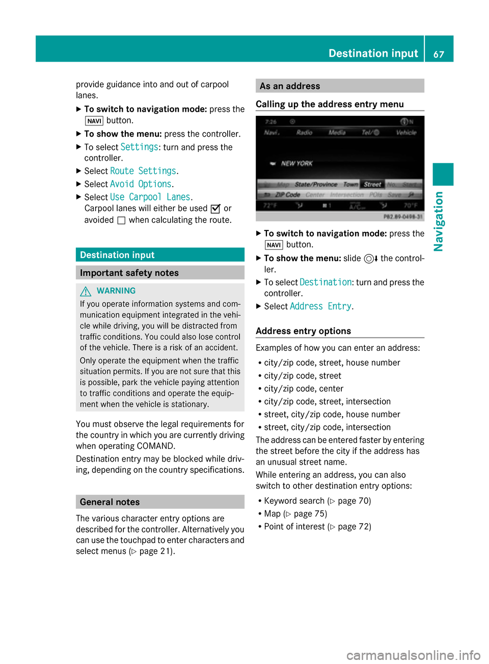
Calling up the address entry menu X
To switch to navigation mode: press the
00BE button.
X To show the menu: slide6the control-
ler.
X To select Destination Destination: turn and press the
controller.
X Select Address Entry
Address Entry.
Address entry options Examples of how you can enter an address:
R
city/zip code, street, house number
R city/zip code, street
R city/zip code, center
R city/zip code, street, intersection
R street, city/zip code, house number
R street, city/zip code, intersection
The address can be entered faster by entering
the street before the city if the address has
an unusual street name.
While entering an address, you can also
switch to other destination entry options:
R Keyword search (Y page 70)
R Map (Y page 75)
R Point of interest (Y page 72) Destination input
67Navigation Z
Page 71 of 214

X
Select the address entry menu
(Y page 67).
X To select: State/Province State/Province, ZIP Code
ZIP Code,
Center
Center orIntersection
Intersection turn, slide6
and press the controller.
X Select an entry ( Ypage 68).
Saving an address You can store the address you have entered
either as your home address or as another
navigable contact in the address book
(Y page 117).
X Call up the address entry menu
(Y page 67).
X To select Save
Save: slide 6the controller,
turn and press to confirm.
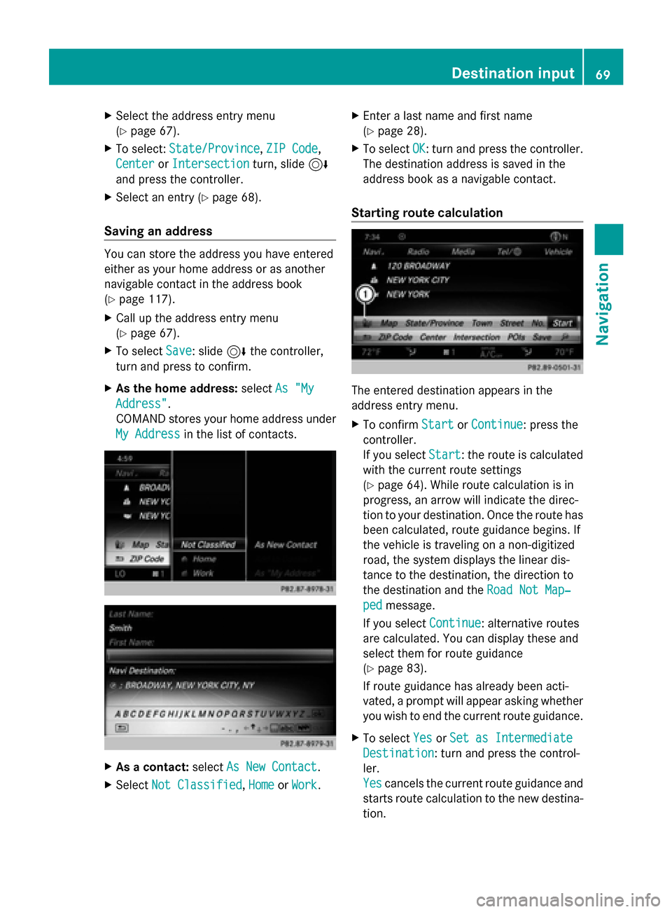
X As the home address: selectAs "My
As "My
Address" Address".
COMAND stores your home address under
My Address My Address in the list of contacts. X
As a contact: selectAs New Contact
As New Contact.
X Select Not Classified
Not Classified, Home
HomeorWork
Work. X
Enter a last name and first name
(Y page 28).
X To select OK OK: turn and press the controller.
The destination address is saved in the
address book as a navigable contact.
Starting route calculation The entered destination appears in the
address entry menu.
X
To confirm Start
Start orContinue Continue: press the
controller.
If you select Start Start: the route is calculated
with the current route settings
(Y page 64). While route calculation is in
progress, an arrow will indicate the direc-
tion to your destination. Once the route has
been calculated, route guidance begins. If
the vehicle is traveling on a non-digitized
road, the system displays the linear dis-
tance to the destination, the direction to
the destination and the Road Not Map‐ Road Not Map‐
ped
ped message.
If you select Continue
Continue: alternative routes
are calculated. You can display these and
select them for route guidance
(Y page 83).
If route guidance has already been acti-
vated, a prompt will appear asking whether
you wish to end the current route guidance.
X To select Yes YesorSet as Intermediate
Set as Intermediate
Destination
Destination: turn and press the control-
ler.
Yes Yes cancels the current route guidance and
starts route calculation to the new destina-
tion. Destination input
69Navigation Z
Page 81 of 214

Using geo-coordinates
X To switch to navigation mode: press the
00CB button.
X To show the menu: slide6the control-
ler.
X To select Destination
Destination: turn and press the
controller.
X Select Using Geo-Coordinates
Using Geo-Coordinates.
Geo-coordinates are entered in degrees,
minutes and seconds.
Entering the latitude and longitude coor-
dinates
X To change the value: turn the controller.
X To move the selection within the line: slide
1 the controller.
X To move the selection between lines: slide
4 the controller.
X To confirm the value: press the controller.
Saving a destination
X To select Save
Save: turn and press the control-
ler.
The destination can be saved as:
R a navigable contact in the address book
R My Address
Starting route calculation
X To select Start Route Guidance
Start Route Guidance: turn
and press the controller. Route guidance
Important notes
For this reason, you must always observe
road and traffic rules and regulations during
your journey. Road and traffic rules and reg-
ulations always have priority over system
driving recommendations.
COMAND calculates the route to the destina-
tion without taking account of the following,
for example:
R traffic lights
R stop and yield signs R
merging lanes
R parking or stopping in a no parking/no
stopping zone
R other road and traffic rules and regulations
R narrow bridges
COMAND may give differing navigation com-
mands if the actual street/traffic situation
does not correspond with the digital map's
data. For example, if the road layout or the
direction of a one-way street has been
changed.
For this reason, you must always observe
road and traffic rules and regulations during
your journey. Road and traffic rules and reg-
ulations always have priority over the sys-
tem's driving recommendations.
Route guidance begins once a route has been
calculated (Y page 69).
COMAND guides you to your destination by
means of navigation announcements in the
form of audible navigation announcements
and route guidance displays.
The route guidance displays can be seen if the
display is switched to navigation mode.
If you do not follow the navigation announce-
ments or if you leave the calculated route,
COMAND automatically calculates a new
route to the destination.
If the digital map contains the corresponding
information, the following applies:
R during route guidance, COMAND tries to
avoid roads with restricted access. Those
roads, for example, that are closed to
through-traffic.
R roads that have time restrictions (e.g.
closed on Sundays and public holidays) are
considered for route guidance on days
when they are open. For this purpose, the
relevant times must be correctly stored in
the database. Route guidance
79Navigation Z
Page 87 of 214

X
Turn the controller.
The marking moves along the route to the
next starting position.
X Press the controller.
The start of the traffic jam is set.
X To specify the end of a traffic jam sec-
tion: select End
End.
The next possible traffic jam section end
point is marked.
X Turn and press the controller.
X To calculate the detour: selectStart Start. Off-road
Important safety notes G
WARNING
The COMAND navigation system may direct
you to off-road routes that your vehicle may
not be capable of traversing through without
damaging your tires, wheels or vehicle. It is
the driver's sole responsibility to determine
the suitability of the route. Off-road routes
may be of varying conditions and their appro-
priateness for use may be affected by various
factors such as time of day, time of year and
immediate weather conditions that cannot be
judged or taken into consideration by the
COMAND system.
Route guidance to an off-road destina-
tion COMAND can guide you to destinations
which are within the area of the digital map,
but which are not themselves on the map.
These destinations are known as off-road
destinations, which you can enter using the
map, for example. In these cases, COMAND
guides you for as long as possible with navi-
gation announcements and displays on roads
known to the system.
If the vehicle reaches an area which is not part
of the digital map, the display appears as a
split-screen view. On the right, an arrow
appears that points to the off-road destina- tion. You hear the announcement: "Please
follow the arrow on the display". As the vehi-
cle approaches the destination, you will see
a display to this effect.
Route guidance from an off-road loca-
tion to a destination
Off-road location: the vehicle's position is on
the digital map, but the map does not contain
any information about that location.
COMAND is also able to guide you to a des-
tination even from an off-road location.
At the start of route guidance, you will see the
Road Not Mapped Road Not Mapped
message, an arrow and
the distance to the destination. The arrow
shows the compass heading to the actual
destination.
As soon as the vehicle is back on a road
known to the system, route guidance contin-
ues in the usual way.
Off-road during route guidance Due to road works, for example, there may be
differences between the data on the digital
map and the actual course of the road.
In such cases, the system will temporarily be
unable to locate the vehicle position on the
digital map. The vehicle is therefore in an off-
road position.
In the display, you will then see the
Road RoadNot
Not
Mapped
Mapped message, an arrow and the distance
to the destination. The direction arrow shows
the compass heading to the destination.
As soon as the system can assign the vehicle
position to the map again, route guidance
continues in the usual way. Real-time traffic reports
Prerequisites
i This function is currently not available for
Canada.
In order to receive real-time traffic reports via
satellite radio, you need to subscribe to SIR- Real-time traffic reports
85Navigation Z