Page 431 of 475

Navigation
Press the Settings icon > Settings > Navigation, then select from the
following:
Navigation
Map PreferencesTurn breadcrumbs on and off.
Have the system display your turn list top to
bottom or bottom to top.
Turn the Parking POI notification on and off.
Route PreferencesHave the system display the shortest route,
fastest route or most ecological route.
Have the system avoid freeways.
Have the system avoid tollroads.
Have the system avoid ferries or car trains.
Have the system use HOV (high-occupancy
vehicle) lanes.
Navigation
PreferencesHave the system use guidance prompts.
Have the system automatically fill-in
State/Province information.
Traffic PreferencesHave the system display areas where road
work occurs.
Have the system display incident map icons
on the map.
Have the system display areas where difficult
driving conditions may occur.
Have the system display areas where snow
and ice on the road may occur.
Have the system display any smog alerts.
Have the system display weather warnings.
Have the system display where there may be
reduced visibility.
Have the system turn on your radio for traffic
announcements.
Avoid AreasEnter specific areas that you would like to
avoid on planned navigation routes.
MyFord Touch�(If Equipped)431
2013 Focus(foc)
Owners Guide gf, 1st Printing
USA(fus)
Page 434 of 475
Wireless & Internet
USB Mobile
BroadbandInstead of using Wi-Fi, your system can also
use a USB mobile broadband connection to
access the internet. (You must activate your
mobile broadband device on your PC prior to
connecting it to the system.) This screen
allows you to set up what is your typical area
for your USB mobile broadband connection.
(USB mobile broadband settings may not be
displayed if the device is already activated.)
You can select the following: Country, Carrier,
Phone Number, User Name and Password.
Bluetooth SettingsShows you what device is currently paired
with the system as well as giving you your
typical Bluetooth options to connect,
disconnect, set as favorite, delete and add
device. Bluetooth is a registered trademark of
the Bluetooth SIG.
Prioritize
Connection MethodsChoose your connection methods and change
them as needed. You can select to Change
Order and have the system either always
attempt to connect using a USB mobile
broadband or using Wi-Fi.
The Wi-Fi CERTIFIED Logo is a
certification mark of the Wi-Fi Alliance.
434MyFord Touch�(If Equipped)
2013 Focus(foc)
Owners Guide gf, 1st Printing
USA(fus)
Page 435 of 475

Help
Press the Settings icon > Help, then select from the following:
Help
Where Am I?View the vehicle’s current location, if your
vehicle is equipped with navigation. If your
vehicle is not equipped with navigation,
nothing is displayed.
System InformationView the following information: Touchscreen
system serial number, vehicle identification
number (VIN), touchscreen system software
version, navigation system version (if
applicable), map database version (if
equipped with navigation), Sirius satellite
radio ESN (if activated) and Gracenote�
Database Information and Library version.
Software LicensesView the licenses for any software and
applications installed on your system.
Driving RestrictionsCertain features are disabled when your
vehicle is moving.
911 AssistTurn 911 Assist on and off. See911 Assistin
theSYNC applications and servicessection.
Voice Command ListView categorized lists of voice commands.
To access Help using the voice commands, press the voice button, then,
after the tone, say “Help”. The system provides voice commands that can
be used in the current mode.
MyFord Touch�(If Equipped)435
2013 Focus(foc)
Owners Guide gf, 1st Printing
USA(fus)
Page 441 of 475
Subcategories
Automobile Dealership
Govt. Office
Public Transit
Education
To expand these listings, press the + in front of the POI listing.
The system also allows you to sort the POIs alphabetically, by distance or
by cityseekr listings (if available).
cityseekr (If Available)
Note:cityseekr point of interest (POI) information is limited to
approximately 154 cities (132 in the U.S., 13 in Canada and 9 in Mexico).
cityseekr is a service which provides
additional information about certain POIs,
such as restaurants, hotels and attractions.
When you have selected a POI, the
location and information appear, such as
address and phone number. If the POI is
listed with cityseekr, you also see
information, such as a brief description,
check-in and check-out times, when the restaurant is open, etc.
Press More Information for a longer review, a list of services and
facilities, the average room or meal price as well as the website link.
This screen displays the POI icon, such as:
Hotel
Coffeehouse
Food & Drink
MyFord Touch�(If Equipped)441
2013 Focus(foc)
Owners Guide gf, 1st Printing
USA(fus)
Page 443 of 475

For hotels, cityseekr can provide information, such as star rating, price
category, review, check-in and check-out times, hotel service icons and
website address.
Setting Your Navigation Preferences
Select settings for the system to take into account when planning your
route.
Press the Settings icon > Settings > Navigation.
When you select: You can:
Map PreferencesTurn breadcrumbs on and off.
Have the system display your turn list top to
bottom or bottom to top.
Set the automatic parking POI notification.
When parking POI notification is on, parking
POI icons display on the map when you get
close to your destination. (This may not be
very useful in dense areas, and may clutter
the map if other POIs are also set for display.)
Route PreferencesChoose to have the system display the
shortest route, fastest route or most
ecological route.
Avoid freeways, toll roads, ferries and car
trains when planning your route.
Use high-occupancy vehicle (HOV) lanes (if
available).
Navigation
PreferencesChoose prompts to be either voice or tone
only.
Have the system automatically fill in the state
and province based on the information
already entered into the system.
MyFord Touch�(If Equipped)443
2013 Focus(foc)
Owners Guide gf, 1st Printing
USA(fus)
Page 445 of 475
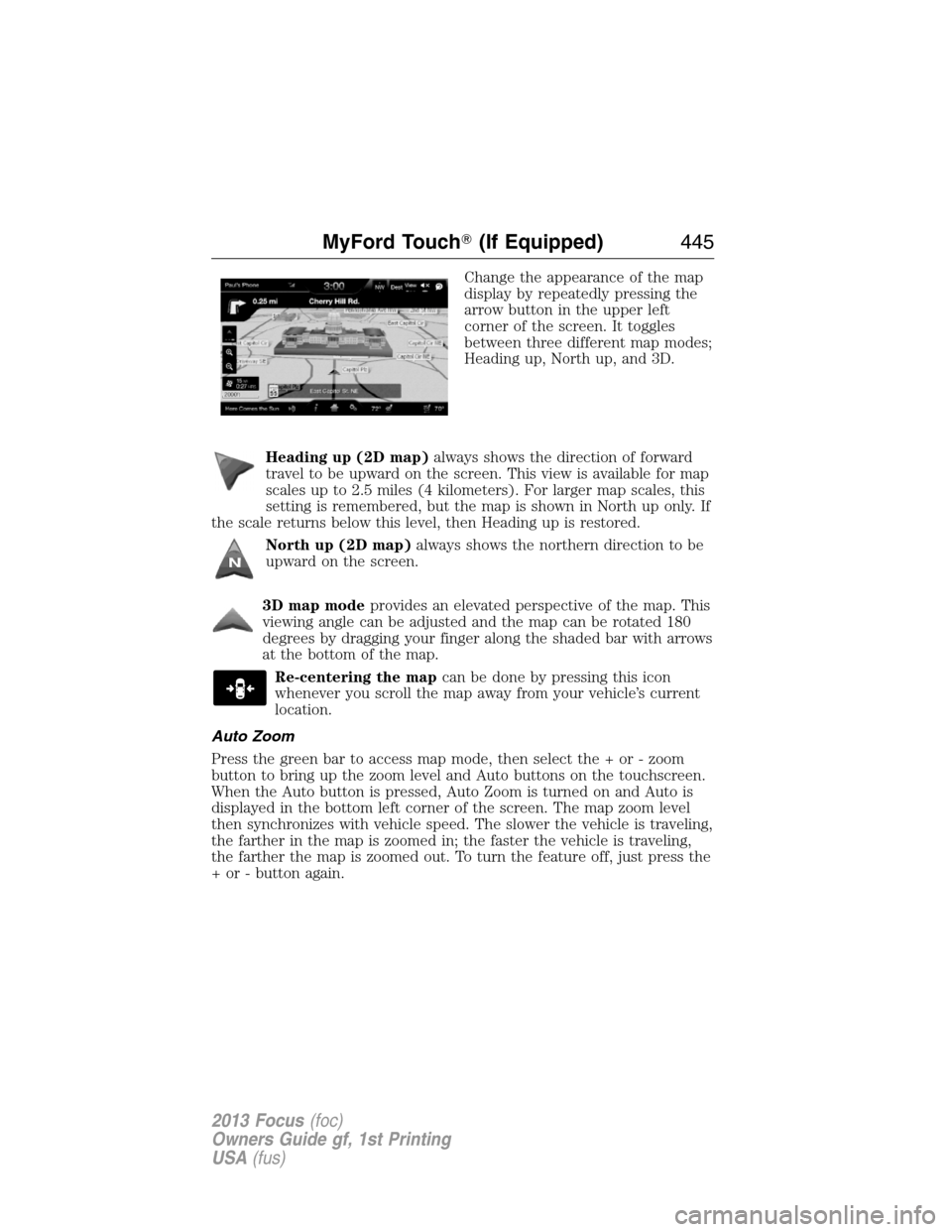
Change the appearance of the map
display by repeatedly pressing the
arrow button in the upper left
corner of the screen. It toggles
between three different map modes;
Heading up, North up, and 3D.
Heading up (2D map)always shows the direction of forward
travel to be upward on the screen. This view is available for map
scales up to 2.5 miles (4 kilometers). For larger map scales, this
setting is remembered, but the map is shown in North up only. If
the scale returns below this level, then Heading up is restored.
North up (2D map)always shows the northern direction to be
upward on the screen.
3D map modeprovides an elevated perspective of the map. This
viewing angle can be adjusted and the map can be rotated 180
degrees by dragging your finger along the shaded bar with arrows
at the bottom of the map.
Re-centering the mapcan be done by pressing this icon
whenever you scroll the map away from your vehicle’s current
location.
Auto Zoom
Press the green bar to access map mode, then select the + or - zoom
button to bring up the zoom level and Auto buttons on the touchscreen.
When the Auto button is pressed, Auto Zoom is turned on and Auto is
displayed in the bottom left corner of the screen. The map zoom level
then synchronizes with vehicle speed. The slower the vehicle is traveling,
the farther in the map is zoomed in; the faster the vehicle is traveling,
the farther the map is zoomed out. To turn the feature off, just press the
+ or - button again.
MyFord Touch�(If Equipped)445
2013 Focus(foc)
Owners Guide gf, 1st Printing
USA(fus)
Page 446 of 475
Map Icons
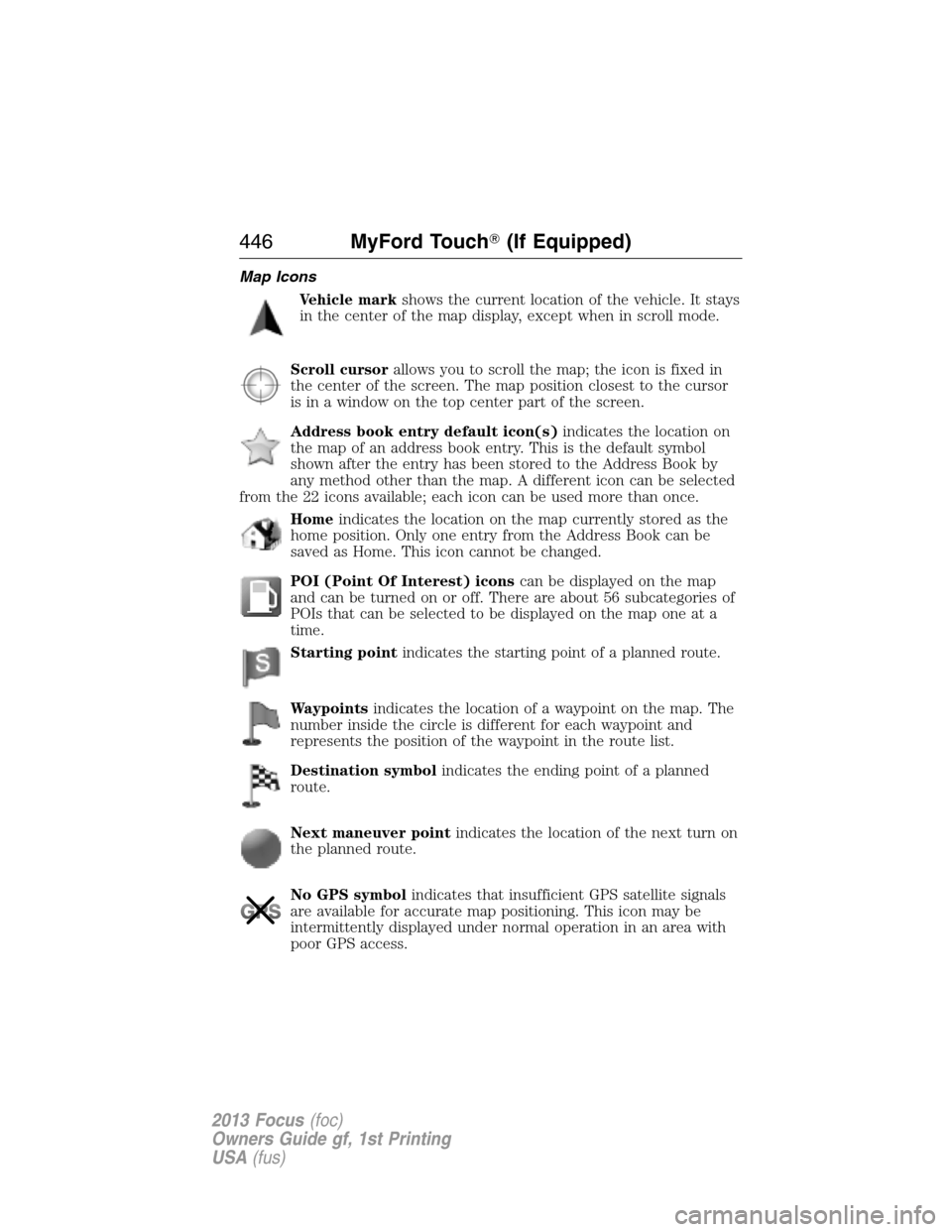
Vehicle markshows the current location of the vehicle. It stays
in the center of the map display, except when in scroll mode.
Scroll cursorallows you to scroll the map; the icon is fixed in
the center of the screen. The map position closest to the cursor
is in a window on the top center part of the screen.
Address book entry default icon(s)indicates the location on
the map of an address book entry. This is the default symbol
shown after the entry has been stored to the Address Book by
any method other than the map. A different icon can be selected
from the 22 icons available; each icon can be used more than once.
Homeindicates the location on the map currently stored as the
home position. Only one entry from the Address Book can be
saved as Home. This icon cannot be changed.
POI (Point Of Interest) iconscan be displayed on the map
and can be turned on or off. There are about 56 subcategories of
POIs that can be selected to be displayed on the map one at a
time.
Starting pointindicates the starting point of a planned route.
Waypointsindicates the location of a waypoint on the map. The
number inside the circle is different for each waypoint and
represents the position of the waypoint in the route list.
Destination symbolindicates the ending point of a planned
route.
Next maneuver pointindicates the location of the next turn on
the planned route.
No GPS symbolindicates that insufficient GPS satellite signals
are available for accurate map positioning. This icon may be
intermittently displayed under normal operation in an area with
poor GPS access.
446MyFord Touch�(If Equipped)
2013 Focus(foc)
Owners Guide gf, 1st Printing
USA(fus)
Page 447 of 475
Quick-touch Buttons
When in map mode, touch anywhere on the map display to access the
following options:
When you select: You can:
Set as DestSelect a scrolled location on the map as your
destination. (You may scroll the map by
pressing your index finger on the map display.
When you reach the desired location, simply
let go and then press Set as Dest.)
Set as WaypointSet the current location as a waypoint.
Save to FavoritesSave the current location to your favorites.
POI Icons On/OffSelect POI icons to be displayed on the map.
Up to three icons can be selected for display
on the map at the same time.
Cancel RouteCancel the active route.
View/Edit RouteAccess these features when a route is active:
•View route
•Edit destination/waypoints
•Edit turn list
•Detour
•Edit route preferences
•Edit traffic preferences
•Cancel route.
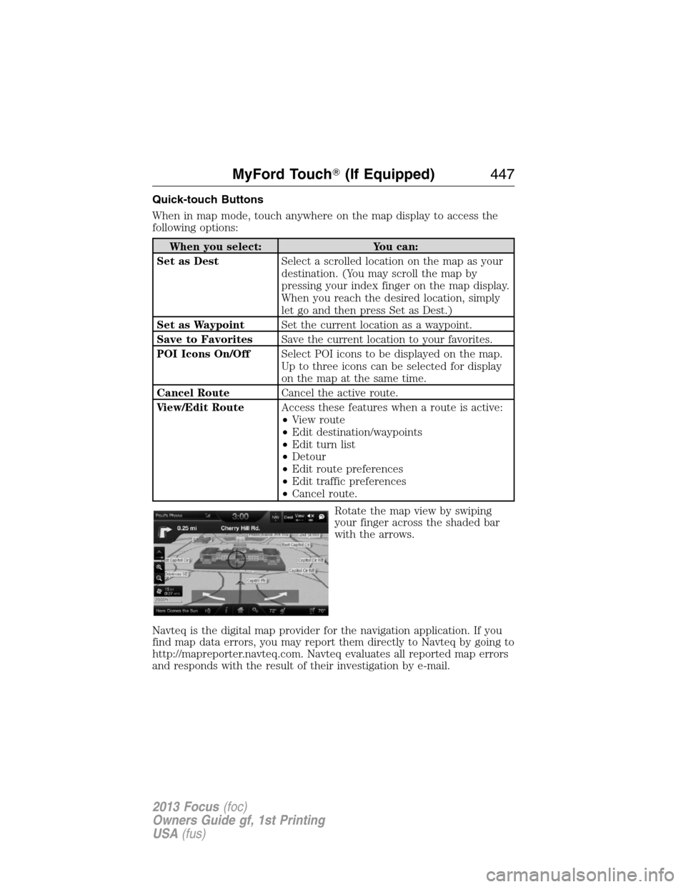
Rotate the map view by swiping
your finger across the shaded bar
with the arrows.
Navteq is the digital map provider for the navigation application. If you
find map data errors, you may report them directly to Navteq by going to
http://mapreporter.navteq.com. Navteq evaluates all reported map errors
and responds with the result of their investigation by e-mail.
MyFord Touch�(If Equipped)447
2013 Focus(foc)
Owners Guide gf, 1st Printing
USA(fus)