Page 66 of 312
ROUTE GUIDANCE
65
D
When approaching a freeway exit or
junction
When the vehicle approaches an exit or
junction, the guidance screen for the free-
way will be displayed.
1Road/area name
2Distance from the current position
to the exit or junction
3Current position
“OFF”: The guidance screen on freeway
disappears and the map screen appears.
When touching
or pushing the
“MAP/VOICE” button, the guidance
screen on freeway reappears.
DWhen approaching an intersection
When the vehicle approaches an intersec-
tion, the intersection guidance screen will
be displayed.
1Next street name
2Distance to the intersection
3Current position
“OFF”: The intersection guidance screen
disappears and the map screen appears.
When touching
or pushing the
“MAP/VOICE” button, the intersection
guidance screen reappears.
GX470_Navi_U (OM60D58U) 07/06/16
Page 67 of 312
ROUTE GUIDANCE
66
D
Other screens
TURN LIST SCREEN
On this screen, the list of turns on the guid-
ance route can be viewed.
Touching
during guidance displays
the turn list.
1Next street name or destination
name
2Turn direction
3Distance between turns
4Current street name ARROW SCREEN
On this screen, information about next
turns on the guidance route can be viewed.
Touching
during guidance displays
the arrow screen.
1Exit number, street name contain-
ing number or next street name
2Turn direction
3Distance to the next turn
4Current street name
GX470_Navi_U (OM60D58U) 07/06/16
Page 70 of 312

ROUTE GUIDANCE
69
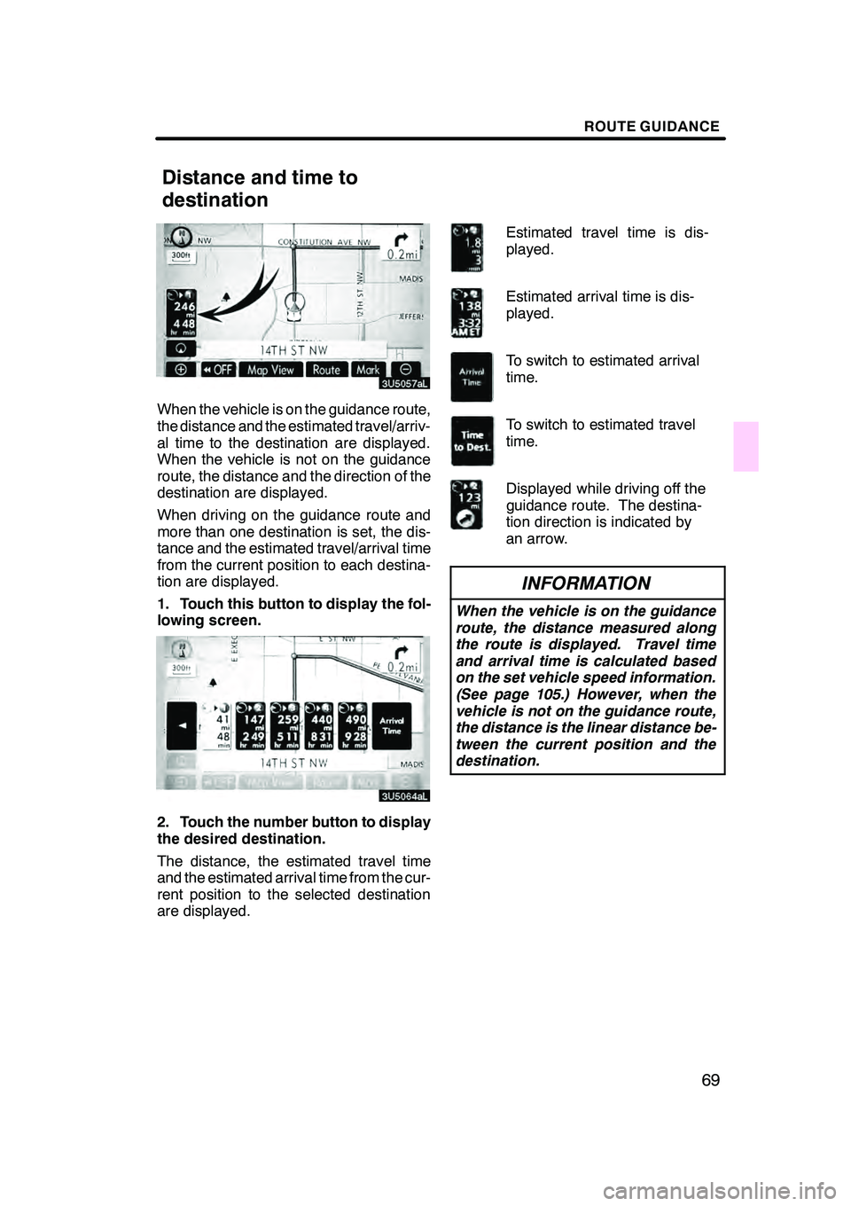
When the vehicle is on the guidance route,
the distance and the estimated travel/arriv-
al time to the destination are displayed.
When the vehicle is not on the guidance
route, the distance and the direction of the
destination are displayed.
When driving on the guidance route and
more than one destination is set, the dis-
tance and the estimated travel/arrival time
from the current position to each destina-
tion are displayed.
1. Touch this button to display the fol-
lowing screen.
2. Touch the number button to display
the desired destination.
The distance, the estimated travel time
and the estimated arrival time from the cur-
rent position to the selected destination
are displayed.Estimated travel time is dis-
played.
Estimated arrival time is dis-
played.
To switch to estimated arrival
time.
To switch to estimated travel
time.
Displayed while driving off the
guidance route. The destina-
tion direction is indicated by
an arrow.
INFORMATION
When the vehicle is on the guidance
route, the distance measured along
the route is displayed. Travel time
and arrival time is calculated based
on the set vehicle speed information.
(See page 105.) However, when the
vehicle is not on the guidance route,
the distance is the linear distance be-
tween the current position and the
destination.
GX470_Navi_U (OM60D58U) 07/06/16
Distance and time to
destination
Page 72 of 312
ROUTE GUIDANCE
71
3. Select the destination in the order of
arrival by touching the destination but-
ton.
Reordered number of arrival is displayed
on the right side of the screen.
Touching“Undo”will cancel each se-
lected order number from the previously
input number.
4. After selecting the destinations,
touch “OK”.
The system searches for the guidance
route again, and displays the entire route.
Even if “OK”is not touched, the entire
route is displayed automatically within a
few seconds when the order is fixed. A set destination can be deleted.
1. Touch “Route”.
2. Touch “Delete”.
When more than one destination is set, a
list will be displayed on the screen.
GX470_Navi_U (OM60D58U) 07/06/16
— Deleting destinations
Page 73 of 312
ROUTE GUIDANCE
72
3. Touch the destination for deletion.
“Delete All”:To delete all destinations on
the list.
A message appears to confirm the request
to delete.
4. To delete the destination(s), touch
“Yes”.
If “Yes” is touched, the data cannot be re-
covered.
If “No” is touched, the previous screen will
return.
5. If more than one destination is set,
touch “OK” after deleting the destina-
tions.
The system searches for the guidance
route again, and displays the entire route. You can designate the route conditions of
the route to the destination.
1. Touch “Route”.
2. Touch “Search Condition”.
3. Touch “Quick”, “Quick1”, “Quick2”
or “Short” and touch “OK”.
GX470_Navi_U (OM60D58U) 07/06/16
Setting route —
— Search condition
Page 74 of 312
ROUTE GUIDANCE
73
The entire route from the starting point to
the destination is displayed.
“Guide”:To start guidance.
“Route”: To change a route. (See pages
70 and 72.) While the route guidance is operating, you
can change the route to detour around a
section of the route where a delay is
caused by road repairs, or an accident,
etc.
1. Touch “Route”.
2. Touch “Detour”.
GX470_Navi_U (OM60D58U) 07/06/16
— Detour setting
Page 76 of 312
ROUTE GUIDANCE
75
A number of choices are provided on the
conditions which the system uses to deter-
mine the route to the destination.
1. Touch “Route”.
2. Touch “Route Preference” to
change the conditions that determine
the route to the destination.
3. Select the desired route preference
by touching the button.
When searching for a route, the system will
avoid routes when the indicator is off.
4. After choosing the desired route
preference, touch “OK”.You can start the route guidance from the
adjacent road.
(ex. When route guidance is set on the
freeway, but the vehicle is driven parallel
along the freeway.)
1. Touch “Route”.
2. Touch “Start from Adjacent Road”.
When there is no adjacent road, this button
will not be displayed.
GX470_Navi_U (OM60D58U) 07/06/16
— Route preference — Starting route from
adjacent road
Page 77 of 312

ROUTE GUIDANCE
76
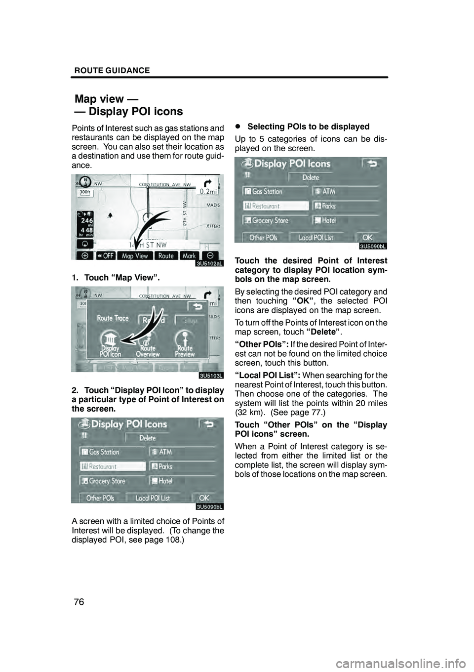
Points of Interest such as gas stations and
restaurants can be displayed on the map
screen. You can also set their location as
a destination and use them for route guid-
ance.
1. Touch “Map View”.
2. Touch “Display POI Icon” to display
a particular type of Point of Interest on
the screen.
A screen with a limited choice of Points of
Interest will be displayed. (To change the
displayed POI, see page 108.)
DSelecting POIs to be displayed
Up to 5 categories of icons can be dis-
played on the screen.
Touch the desired Point of Interest
category to display POI location sym-
bols on the map screen.
By selecting the desired POI category and
then touching “OK”, the selected POI
icons are displayed on the map screen.
To turn off the Points of Interest icon on the
map screen, touch “Delete”.
“Other POIs”: If the desired Point of Inter-
est can not be found on the limited choice
screen, touch this button.
“Local POI List”: When searching for the
nearest Point of Interest, touch this button.
Then choose one of the categories. The
system will list the points within 20 miles
(32 km). (See page 77.)
Touch “Other POIs” on the “Display
POI icons” screen.
When a Point of Interest category is se-
lected from either the limited list or the
complete list, the screen will display sym-
bols of those locations on the map screen.
GX470_Navi_U (OM60D58U) 07/06/16
Map view —
— Display POI icons