Page 49 of 64

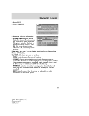
SELECT ROUTE SCREEN
The Select route screen will appear
after COMPUTE ROUTE is selected
from the
DESTINATION/WAYPOINTS LIST
screen or the SET AS
DESTINATION from the
DESTINATION MAP screen. You can
then select from any of the
following options:
•ROUTE PREFS:Press to change settings for route searches. Refer to
Route preferences.
•START ROUTE:Press to begin guidance for the selected route. All
other calculated routes will be deleted.
•CANCEL ROUTE:Press to delete the current route (which you will
not be able to retrieve.)
The system will display all computed routes, and the preferred route will
be highlighted. A route information box will appear on the right hand
side of the screen which consists of:
•ROUTE PREFERENCE ICONS:These icons indicate the status of
the route preferences. Refer toRoute preferences.
•CALCULATED POSSIBLE ROUTES:These routes will be displayed
simultaneously, each highlighted with a different color. To view the
details of each route, press the corresponding button.
RECALCULATION OF ROUTE
If the vehicle deviates from the selected guidance route, the navigation
system will automatically recalculate the route from the current location.
VOICE GUIDANCE PROMPTS
Once a route is selected, you will begin to hear voice guidance prompts.
If you are not currently on the route, there will be a prompt. There may
be up to three voice prompts for each maneuver, depending on the
vehicle speed and the distance before the maneuver. The voice prompts
will announce all road names in route guidance instructions. Road name
pronunciations may vary from local pronunciations. The last prompt will
be a double tone and will give just enough time for you to complete the
maneuver.
To adjust the volume level of the voice guidance prompts, turn the
volume control during a voice prompt, or set to the desired level on the
FEEDBACK screen. (Refer to theMenusection).
2006 Navigator(nav)
Supplement
USA(fus)
Navigation features
49
Page 50 of 64

NAVIGATION MENU
MAP PREFERENCES
Your navigation system allows you to set specific map preferences. In the
Map Preference screen you may select from:
MAP CONTENTSelect one of the
following map displays:
•CURRENT STREET NAME:
Displays the current street name
in a window at the top of the
screen.
•TIME TO DESTINATION:
Displays the distance and
estimated travel time to the selected destination on the left side of the
screen. When selected, a popup screen will also display the Estimated
Time of Arrival (ETA).
•BREADCRUMBING:Stores and allows the display of the vehicle’s
previous route(s). These routes are indicated by white dots on the
map display. The system can store up to about 140 miles/230 km.
GUIDANCE VIEW:Select one of the following ways guidance views:
•FULL SCREEN MAP MODE:
The map is displayed on the full
screen and a turn icon appears in
the upper right hand corner of
the screen.
•SPLIT SCREEN ARROW
MODE:The screen is divided in
two: the map is displayed on the
left, while a turn icon and street
name signify the upcoming
maneuver on the right.
2006 Navigator(nav)
Supplement
USA(fus)
Navigation features
50
Page 51 of 64
•SPLIT SCREEN TURN LIST
MODE:The screen is divided in
two, the map is displayed on the
left, and the planned turn list is
on the right.
Regardless which guidance view is
selected, a detailed intersection
screen will appear on the right side
of the map display when the vehicle
is approaching the next turn.
TURN LIST FORMAT:You can
select which order the guidance
instructions appear on the screen:
•TOP TO BOTTOM
•BOTTOM TO TOP
ROUTE PREFERENCES
You can select certain preferences for your route.
2006 Navigator(nav)
Supplement
USA(fus)
Navigation features
51
Page 52 of 64

•AVOID FREEWAYS / TOLL
ROADS / FERRIES:The system
will search for routes attempting
to avoid the use of freeways, toll
roads and/or ferries whenever
possible.
•PREFERRED ROUTE:The
system can search for up to three
routes: fastest route, shortest route and unrestricted route (the fastest
or shortest route without any�avoid�settings). If there are not any
Avoid settings, only two routes will be calculated and displayed. The
preferred route will be automatically highlighted on the map for route
selection.
ADDRESS BOOK
The ADDRESS BOOK tab allows
you to view and edit the address
book entries. The maximum number
of entries that can be stored in the
address book is 25. Five of these
entries can be set as Destination
Presets (to be easily accessed), and
one entry can be saved as the Home
location. The list of entries can be sorted by:
•A-Z:List entries by alphabetical order.
•DATE:List entries by date of entry.
•ICON:List entries by icon type.
VIEW/EDIT:The information related to each entry can be changed or
entered according to the following criteria:
•NAME:Input a name or leave this blank.
•LOCATION:Previously programmed address.
•PHONE NUMBER:Select to edit phone number for the specified
entry.
•ICON:Select from a list of available icons. All icons, except for the
Home icon, can be used more than once.
•QUICK DEST SET/CLEAR:A maximum of five entries can be
selected as Destination Preset entries. These entries are accessible
directly from the QUICK DEST tab under the DEST menu as well as
through any of the ADDRESS BOOK tabs.
2006 Navigator(nav)
Supplement
USA(fus)
Navigation features
52
Page 53 of 64

ADD:You can select a location by one of the following methods:
•PREVIOUS DEST
•POI
•ADDRESS
•INTERSECTION
•MAP
•FREEWAY ENT/EXIT
•PHONE NUMBER
DELETE:Press to delete the selected entry from the list.
DELETE ALL:Press to delete all entries in the address book.
SET AS DEST:Press for the DESTINATION MAP screen to appear with
more options from which to select. Refer toDestination menu.
QUICK POINTS OF INTEREST (POIS)
This tab allows you to set the five
most frequently used Point of
Interest (POI) categories.
•QUICK POI LIST:Lists five preset POI categories. You can change
any of them.
•EDIT:Press to select a different POI category/subcategory from a list.
AVOID AREAS
You can search avoiding all roads
(even freeways) within specified
avoid areas. If any road within an
avoid area is used for the route, an
icon will be displayed on the screen
for route selection. A maximum of
five areas can be stored as Avoid
Areas. They are represented on the
map as colored squares. If a road is specified as an avoid area, it is
represented by a different color to other roads.
2006 Navigator(nav)
Supplement
USA(fus)
Navigation features
53
Page 54 of 64

VIEW/EDIT:After entries are programmed, they are shown in a list.
Highlight your selection to change/edit the following attributes:
•NAME:Select to enter a different name for the area.
•LOCATION:A map with the selected location will appear on the
screen. You can then:
REDUCE AREA
SAVE AREA
EXPAND AREA
•RETURN:Saves changes to the selected area.
ADD:Add an avoid area by selecting an input method and entering the
required information:
•PREVIOUS DEST
•POI
•ADDRESS
•INTERSECTION
•MAP
•FREEWAY ENTRANCE/EXIT
•PHONE NUMBER
•CANCEL
DELETE:Press to delete the selected entry.
DELETE ALL:Press to delete all entries in the Avoid Area list.
SETTINGS
UNITS:The system can be set to
display different units:
•ENGLISH (MILES)
•METRIC (KILOMETERS
AUTO-FILL STATE/PROV:When selected, the State/Province field will
be automatically filled in based on current location for destination entry.
If it is not selected, the last State/Province will be displayed.
2006 Navigator(nav)
Supplement
USA(fus)
Navigation features
54
Page 55 of 64
AVERAGE SPEED (MPH):You can preset speeds based on driving
habits for calculation of travel time and ETA (Estimated Time Arrival).
•RESIDENTIAL
•MAIN ROADS
•FREEWAY
CALIBRATE:The navigation system supports a quick method to
calibrate the vehicle position. Under normal circumstances this
calibration is done automatically, but over a longer period of time. The
user may want to recalibrate the system if the vehicle icon is not
tracking proper position resulting in inaccurate route guidance
instructions.
•POSITION:The system supports manual adjustment of the vehicle’s
position and heading via the Map. Press to scroll on map until the
desired location is reached and press ENTER. Adjust the vehicle
heading by pressing the arrow buttons until the desired heading is
reached. Press ENTER to save the new settings.
DEFAULT SETTINGS:Press to set all the features in this screen back
to system default.
2006 Navigator(nav)
Supplement
USA(fus)
Navigation features
55
Page 56 of 64
FREQUENTLY ASKED QUESTIONS
How do I turn off the Navigation System?
Press and hold the Volume control for at least 3 seconds.
How do I hear the navigation voice prompts?
1. Press the MENU hard button.
2. Select the FEEDBACK tab.
3. Check the VOICE VOLUME LEVEL and that the NAVIGATION
GUIDANCE setting is on.
How do I recover after accidental language re-set?
1. Press the MENU hard button.
2. Select the FEEDBACK/Retour/Reaccion tab.
3. Press the ENGLISH/Anglais/Ingles button to reset language to English.
4. Press the SPANISH/Espanol/Espanol button to reset language to
Spanish.
5. Press the FRENCH/Francais/Frances button to reset language to
French.
Or, you can also turn vehicle off to restart system. Then from the
DISCLAIMER screen, select the desired language before pressing
AGREE.
2006 Navigator(nav)
Supplement
USA(fus)
Frequently asked questions
56


:You can preset speeds based on driving
habits for calculation of travel time and ETA (Estimated Time Arrival).
•RESIDENTIAL
•MAIN ROADS
•FREEWAY
CALIBRATE:The navigation syst")
