Page 19 of 88
2-DIMENSIONAL NORTH UP (2DN)
VIEW
The 2DN map is a two-dimensional (flat) repre-
sentation of the map data, similar to a road map,
focused on the vehicle’s position (vehicle icon)
with the top of the map aligned North.
Touch the compass icon to switch map to an-
other view.
3-DIMENSIONAL (3D) VIEW
The 3D map displays the map from an elevated
perspective, providing a panoramic view over a
long distance.
The map in 3D view always appears with the cur-
rent forward direction facing up (heading up) .
Touch the compass icon to switch map to an-
other view.To scroll the map in either direction:
1. Touch and release the screen anywhere on the map.
2. Touch the screen again and move your fin- ger along the screen in the direction you
wish to scroll.
After releasing and touching the map again, a
marker will be displayed at the point touched
and, if possible, the position determined.
NOTE:
When the current location of the vehicle is
recognized, the street name will be dis-
played at the bottom of the screen. When
scrolling a map and an area that is not a
road, city or POI is touched, coordinates
corresponding to the marker’s position are
displayed at the bottom of the screen.
2DNLNV24543DLNV2456LNV2463
MOVING A MAP
3-4Map settings
Page 20 of 88
RETURNING TO THE CURRENT VE-
HICLE LOCATION
The basic map screen displays the current loca-
tion of the vehicle. The current location can be
displayed again even after the map is moved, or
after the menu screen is displayed.
Press the MAP button or the BACK or
BACK button and the current location will be
displayed on the map.The Map Options menu allows you to quickly
store the current position, show position infor-
mation or destination information, and adjust the
map settings.
1. Touch the “Options” key while the route guidance map is displayed.
2. The following options are available for se- lection:
● Enter Destination
Select to open the navigation screen for
entering an address.
● Turn List
Select to display all of the turns and way-
points along the route.
● Cancel Route
Select to cancel entire route or way-
points along route. ●
POIs Along Route
Select to choose the types of points of
interest to display along the active route.
Available options are gas stations,
restaurants, ATMs, parking, rest areas,
hotels, dealerships and airports.
NOTE:
Some places of interest on divided high-
ways may show the equivalent place of in-
terest on the opposite side of the road
(such as a rest area) as being closer than
the place in your traveling direction. Con-
firm location of the place before following
the route. ●SiriusXM Traffic
Select to display all traffic events on
route and options to avoid roads along
route.
● Show Route On Map
Select to display the entire route on the
screen. The view will zoom to the neces-
sary level in order to show both the start-
ing point and destination on the screen.
LNV3002
MAP OPTIONS MENU SCREEN
Map settings3-5
Page 21 of 88
●Routing Options
Select to view options available to cus-
tomize route. Avoiding specific roads, dy-
namic guidance, route type and minimiz-
ing freeways, types of roads and ferries
can all be adjusted.
● Show Position Information
Select to display the latitude, longitude
and altitude for the current position of the
vehicle. Location can also be stored to
the Address Book.
● Show Waypoints
Select to add or show list of waypoints
along route.
● Guidance & Map Settings
Select to toggle guidance information
and map settings options.
“MAP SETTINGS FOR THE
MAP SCREEN” (page 3-7) When using the “+” or “-” for zooming in or out,
the scale on the bottom left side of the screen
changes to indicate the new scale level.
MAP SCALE
The following scales are available depending on
the map view:
Per approximately 1/2 inch (1 cm)
150 ft (50 m)
300 ft (100 m)
600 ft (200 m)
1/4 mile (500 m) 1/2 mile (1 km) 1 mile (2 km)
2.5 mi (5 km) 5 mi (10 km)
10 mi (20 km)
25 mi (50 km)
50 mi (100 km)
100 mi (200 km)
250 mi (500 km)
LNV2462
CHANGING THE MAP SCALE
3-6Map settings
Page 22 of 88
Icons of various categories of locations can be
displayed on the map.
MAP SYMBOLS
This navigation system uses symbols to display
various types of facilities. The following icons (if
so equipped) may be used on the map screen.
LOOKING AT INFORMATION ON THE
MAP
Map settings3-7
Page 24 of 88
Other settings are available for the map screen,
such as switching the map view or changing the
map direction.1. Press the
button.
2. Touch the “Settings” key. 3. Touch the “Navigation” key.
4. Touch the “Guidance & Map Settings” key.
When selected, the system will offer the fol-
lowing map setting options:
Menu Item Options
Voice Guidance Select to toggle on or off the voice guidance on map screen.
Volume Select “+” or “-” to increase or decrease voice guidance volume.
Map View Touch the “Map View” key to toggle between 2D and 3D map view.
2D-North/Heading Up Touch to toggle display between “Head” and “North” for 2D mode. When “Head” is selected, the screen always shows the map
in the driving direction. When “North” is selected, the top of the map is always orientated north. This option can only be selected
when the “Map View” is set to 2D.
Auto Zoom Touch the “Auto Zoom” key to choose a setting for automatic zooming. Available settings are “Never”, “Always” and “Only with a
route”.
Show Points of Interest On Map Select to toggle various map icons on and off including gas stations, restaurants, banks and parking.
LNV3000LNV3006
MAP SETTINGS FOR THE MAP
SCREEN
Map settings3-9
Page 25 of 88
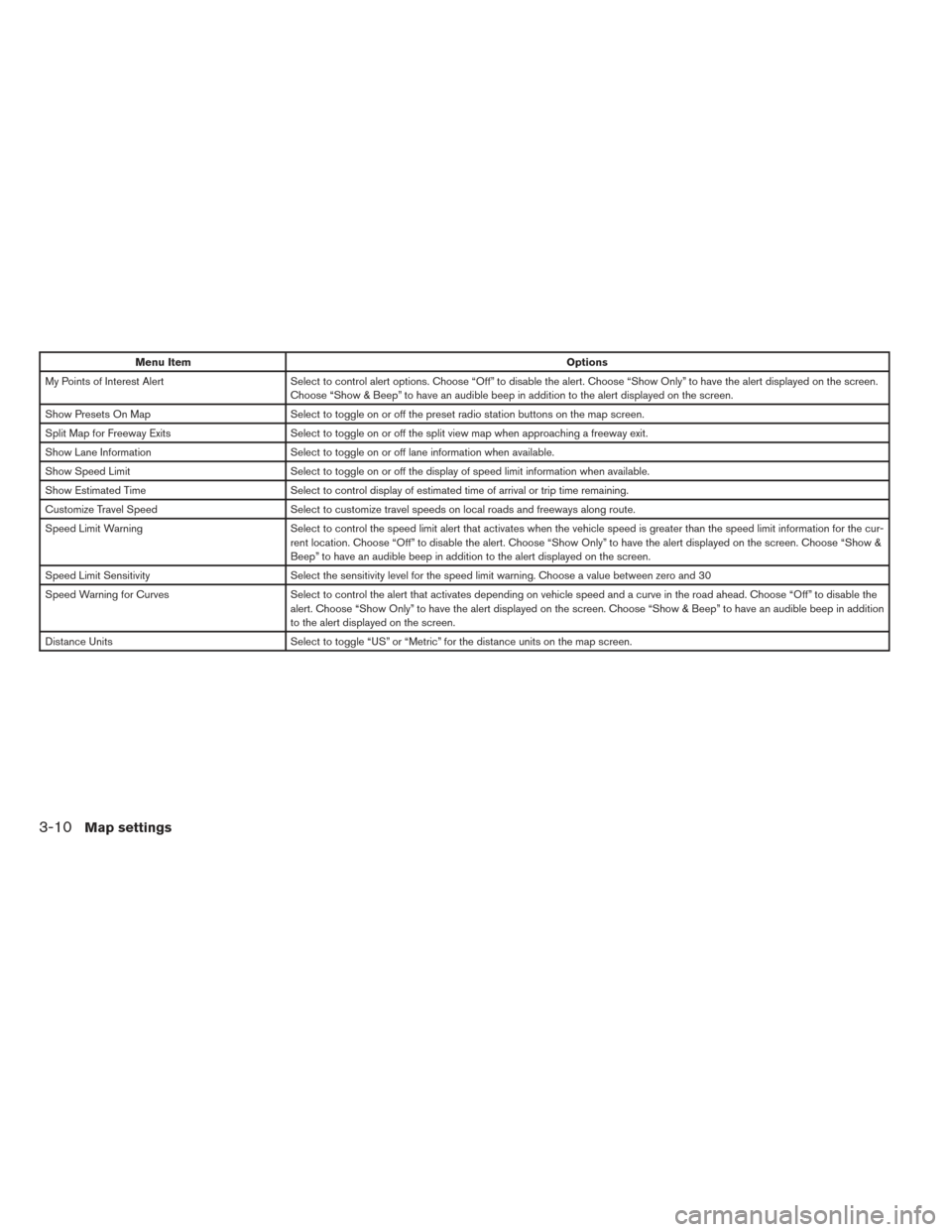
Menu ItemOptions
My Points of Interest Alert Select to control alert options. Choose “Off” to disable the alert. Choose “Show Only” to have the alert displayed on the screen.
Choose “Show & Beep” to have an audible beep in addition to the alert displayed on the screen.
Show Presets On Map Select to toggle on or off the preset radio station buttons on the map screen.
Split Map for Freeway Exits Select to toggle on or off the split view map when approaching a freeway exit.
Show Lane Information Select to toggle on or off lane information when available.
Show Speed Limit Select to toggle on or off the display of speed limit information when available.
Show Estimated Time Select to control display of estimated time of arrival or trip time remaining.
Customize Travel Speed Select to customize travel speeds on local roads and freeways along route.
Speed Limit Warning Select to control the speed limit alert that activates when the vehicle speed is greater than the speed limit information for the cu r-
rent location. Choose “Off” to disable the alert. Choose “Show Only” to have the alert displayed on the screen. Choose “Show &
Beep” to have an audible beep in addition to the alert displayed on the screen.
Speed Limit Sensitivity Select the sensitivity level for the speed limit warning. Choose a value between zero and 30
Speed Warning for Curves Select to control the alert that activates depending on vehicle speed and a curve in the road ahead. Choose “Off” to disable the
alert. Choose “Show Only” to have the alert displayed on the screen. Choose “Show & Beep” to have an audible beep in addition
to the alert displayed on the screen.
Distance Units Select to toggle “US” or “Metric” for the distance units on the map screen.
3-10Map settings
Page 26 of 88
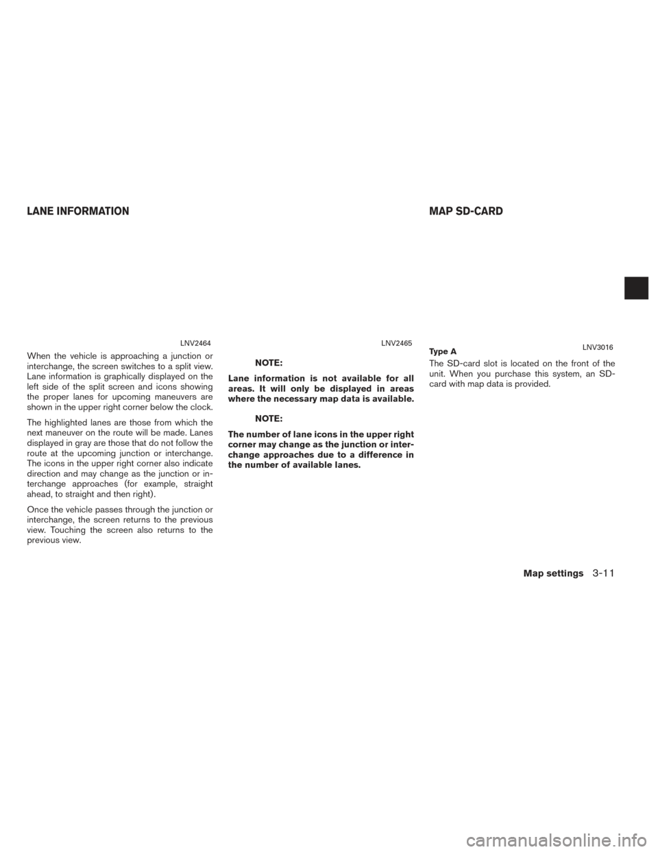
When the vehicle is approaching a junction or
interchange, the screen switches to a split view.
Lane information is graphically displayed on the
left side of the split screen and icons showing
the proper lanes for upcoming maneuvers are
shown in the upper right corner below the clock.
The highlighted lanes are those from which the
next maneuver on the route will be made. Lanes
displayed in gray are those that do not follow the
route at the upcoming junction or interchange.
The icons in the upper right corner also indicate
direction and may change as the junction or in-
terchange approaches (for example, straight
ahead, to straight and then right) .
Once the vehicle passes through the junction or
interchange, the screen returns to the previous
view. Touching the screen also returns to the
previous view.NOTE:
Lane information is not available for all
areas. It will only be displayed in areas
where the necessary map data is available.
NOTE:
The number of lane icons in the upper right
corner may change as the junction or inter-
change approaches due to a difference in
the number of available lanes. The SD-card slot is located on the front of the
unit. When you purchase this system, an SD-
card with map data is provided.
LNV2464LNV2465Ty p e ALNV3016
LANE INFORMATION
MAP SD-CARD
Map settings3-11
Page 28 of 88
●Traffic control and regulation data used in this
map data may be different from those in use at
the time this map data is used. When driving,
follow the actual traffic control signs and no-
tices on the roads.
● Reproducing or copying this map software is
strictly prohibited by law.
mWARNING
● This navigation system should not be
used to replace your own judgement.
No itinerary suggested by this navi-
gation system should ever override
any freeway regulations, your own
judgement, or a knowledge of safe
driving practices. Do not follow the
navigation system’s suggested itin-
erary if it would cause you to perform
a dangerous or illegal act, place you
in a dangerous situation, or take you
into an area you consider unsafe. ●
The advice provided by the naviga-
tion system is to be regarded as a
suggestion only. There may be times
when the navigation system displays
the vehicle’s location incorrectly,
fails to suggest the shortest route, or
fails to direct you to your desired
destination. In such instances, rely
on your own judgement taking into
account the driving conditions at the
time.
● Do not use the navigation system to
locate emergency services. The data-
base does not contain a complete
listing of emergency services such as
police stations, fire stations, hospi-
tals and walk-in clinics. Please show
discretion and ask for directions in
such instances.
● As the driver, you alone are respon-
sible for your driving safety.
– In order to avoid a traffic accident, do not operate the system while
driving. – In order to avoid a traffic accident,
operate the system only when the
vehicle is stopped at a safe place
and the parking brake is on.
– In order to avoid a traffic accident or traffic offence, remember that
actual road conditions and traffic
regulations take precedence over
the information contained on the
navigation system.
– The software may contain inaccu- rate or incomplete information
due to the passage of time, chang-
ing circumstances, and the
sources of information used.
Please respect current traffic con-
ditions and regulations at all
times while driving.
– Where actual road conditions and highway regulations differ from
the information contained on the
navigation system, abide by the
highway regulations.
– Keep the amount of time spent viewing the screen while driving to
a strict minimum.
Map settings
3-13