2016 MERCEDES-BENZ CLS-Class ESP
[x] Cancel search: ESPPage 68 of 246

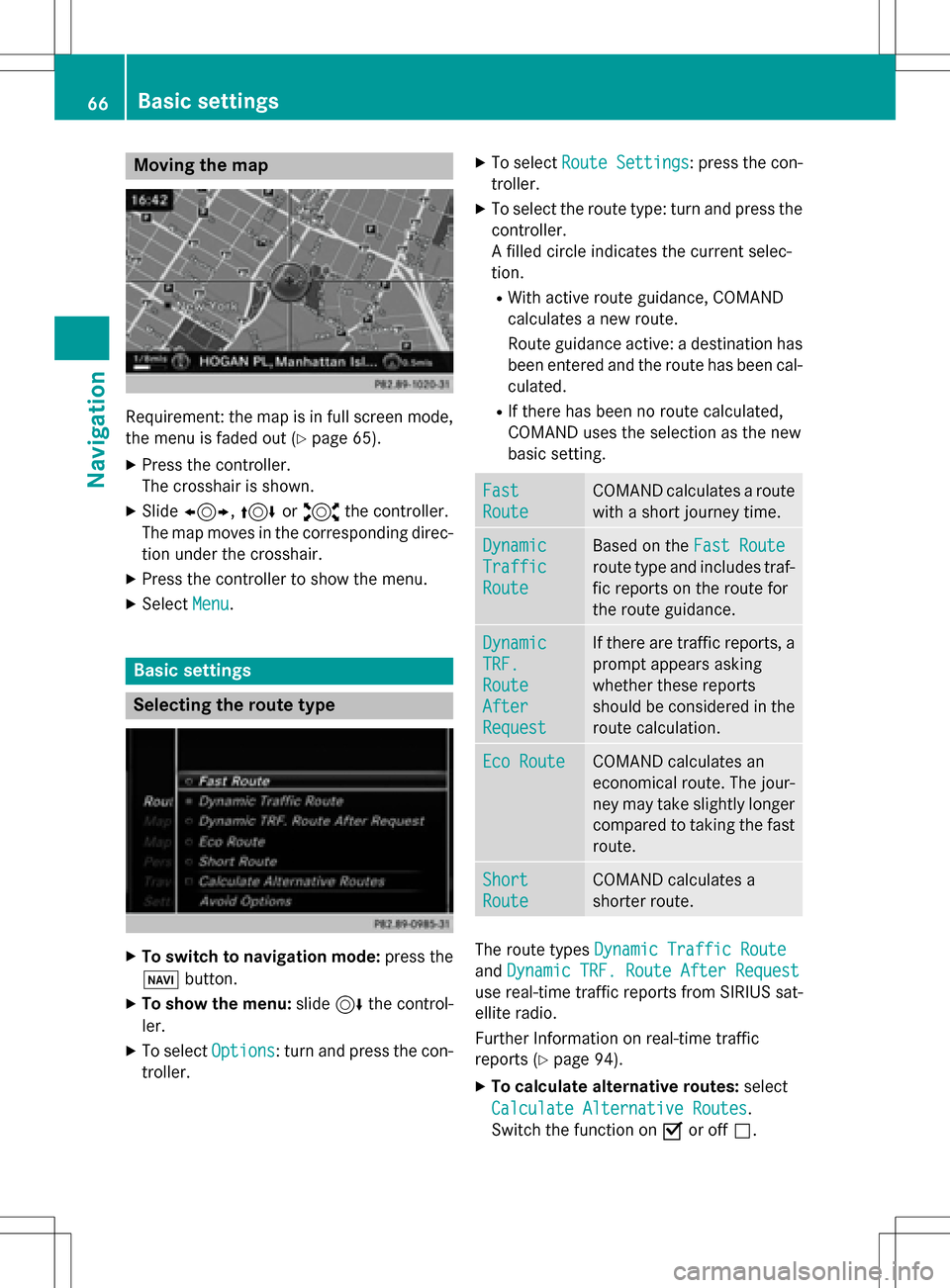
Moving the map
Requirement: the map is in full screen mode,
the menu is faded out (
Ypage 65).
XPress the controller.
The crosshair is shown.
XSlide1, 4or2 the controller.
The map moves in the corresponding direc- tion under the crosshair.
XPress the controller to show the menu.
XSelect Menu.
Basic settings
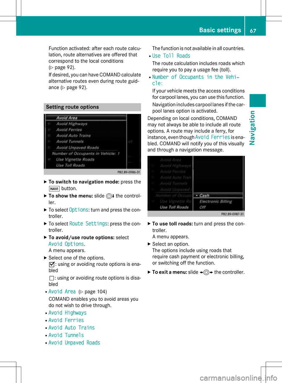
Selecting the route type
XTo switch to navigation mode: press the
Ø button.
XTo show the menu: slide6the control-
ler.
XTo select Options: turn and press the con-
troller.
XTo select Route Settings: press the con-
troller.
XTo select the route type: turn and press the
controller.
A filled circle indicates the current selec-
tion.
RWith active route guidance, COMAND
calculates a new route.
Route guidance active: a destination has
been entered and the route has been cal-
culated.
RIf there has been no route calculated,
COMAND uses the selection as the new
basic setting.
Fast
Route
COMAND calculates a route
with a short journey time.
Dynamic
Traffic
Route
Based on the Fast Route
route type and includes traf-
fic reports on the route for
the route guidance.
Dynamic
TRF.
Route
After
Request
If there are traffic reports, a
prompt appears asking
whether these reports
should be considered in the
route calculation.
Eco RouteCOMAND calculates an
economical route. The jour-
ney may take slightly longer
compared to taking the fast
route.
Short
Route
COMAND calculates a
shorter route.
The route types Dynamic Traffic Route
andDynamic TRF. Route After Request
use real-time traffic reports from SIRIUS sat-
ellite radio.
Further Information on real-time traffic
reports (
Ypage 94).
XTo calculate alternative routes: select
Calculate Alternative Routes
.
Switch the function on Oor off ª.
66Basic settings
Navigation
Page 69 of 246

Function activated: after each route calcu-
lation, route alternatives are offered that
correspond to the local conditions
(
Ypage 92).
If desired, you can have COMAND calculate
alternative routes even during route guid-
ance (
Ypage 92).
Setting route options
XTo switch to navigation mode: press the
Ø button.
XTo show the menu: slide6the control-
ler.
XTo select Options: turn and press the con-
troller.
XTo select Route Settings: press the con-
troller.
XTo avoid/use route options: select
Avoid Options
.
A menu appears.
XSelect one of the options.
O: using or avoiding route options is ena-
bled
ª: using or avoiding route options is disa-
bled
RAvoid Area(Ypage 104)
COMAND enables you to avoid areas you
do not wish to drive through.
RAvoid Highways
RAvoid Ferries
RAvoid Auto Trains
RAvoid Tunnels
RAvoid Unpaved Roads
The function is not available in all countries.
RUse Toll Roads
The route calculation includes roads which
require you to pay a usage fee (toll).
RNumber of Occupants in the Vehi‐
cle:
If your vehicle meets the access conditions for carpool lanes, you can use this function.
Navigation includes carpool lanes if the car-
pool lanes option is activated.
Depending on local conditions, COMAND
may not always be able to include all route
options. A route may include a ferry, for
instance, even though Avoid
Ferriesis ena-
bled. COMAND will notify you of this visually
and through a navigation message.
XTo use toll roads: turn and press the con-
troller.
A menu appears.
XSelect an option.
The options include using roads that
require cash payment or electronic billing,
or switching off the function.
XTo exit a menu: slide1 the controller.
Basic settings67
Navigation
Z
Page 85 of 246

Settings for personal POIs
Displaying on the map
Requirement: an SD memory card with per-
sonal POIs is inserted (
Ypage 183).
All personal POIs of the selected category are
displayed on the map with a corresponding
symbol.
If the "Alert when approaching" (
Ypage 83)
function is activated, the symbols are dis-
played up to a map scale of 2 km.
XTo switch to navigation mode: press the
ß button.
XTo show the menu: slide6the control-
ler.
XTo select Options: turn and press the con-
troller.
XSelect Personal POIs.
XSelectDisplay on the Map.
The menu displays the categories available
on the SD memory card.
XTo select a category: turn the controller and
press to confirm.
All personal POIs in the selected category
are displayed Oor not displayed ª,
depending on the previous status.
Alert when approaching
Requirement: an SD memory card with per-
sonal POIs is inserted (
Ypage 183).
If the vehicle is approaching a personal POI
and the functions are enabled, the personal
POI is highlighted on the map and an audible
signal sounds.
For this purpose, both the corresponding
function Alert When Approaching
and the
category containing the personal POI must be
activated.
XTo switch to navigation mode: press the
ß button.
XTo show the menu: slide6the control-
ler.
XTo select Options: turn and press the con-
troller.
XSelect Personal POIs.
XSelectAlert When Approaching.
The menu displays the categories available
on the SD memory card.
XSelect AudibleorOptical.
The function is switched on Oor off ª,
depending on the previous status.
XTo select a category: turn the controller and
press to confirm.
The function is switched on Oor off ª, for
all personal POIs of this category, depend-
ing on the previous setting.
Personal POIs and routes83
Navigation
Z
Page 89 of 246

Route guidance
General notes
Always observe the traffic regulations when
driving. Road and traffic rules and regulations
always have priority over system driving rec-
ommendations.
COMAND calculates the route to the destina-
tion without taking account of the following,
for example:
Rtraffic lights
Rstop and yield signs
Rparking or stopping restrictions
Rroad narrowing
Rtemporary traffic rules and regulations
COMAND can give differing navigation com-
mands if the actual street/traffic situation
does not correspond with the digital map's
data. For example, if the road layout or the
direction of a one-way street has been
changed.
Route guidance begins once a route has been
calculated (
Ypage 71).
COMAND guides you to your destination by
means of navigation announcements in the
form of audible navigation announcements
and route guidance displays.
Navigation messages guide you during the
journey without distracting you from traffic
conditions or driving. Please always use this
feature instead of consulting the map display
for directions. The symbols or the map display
could distract you from traffic conditions and
driving.
The route guidance displays can be seen if
navigation mode is switched on.
If you do not follow the navigation announce-
ments or if you leave the ca
lculated route,
COMAND automatically calculates a new
route to the destination.
If the digital map contains the corresponding information, the following applies:
Rduring route guidance, COMAND tries to
avoid roads with restricted access. These include, for example, roads which are
closed to through-traffic.
Rroads that have time restrictions (e.g.
closed on Sundays and public holidays) are
considered for route guidance on days
when they are open. For this purpose, the
relevant times must be correctly stored in
the database.
Change of direction
Overview
Changes of direction have three phases:
RPreparation phase
RAnnouncement phase
RChange-of-direction phase
Changes in direction are also shown in the
multifunction display of the instrument clus-
ter (see the vehicle Operator's Manual).
Preparation phase
COMAND prepares you for the upcoming
change of direction, e.g. with the announce-
ment "Prepare to turn right". You see the full-
screen map.
Announcement phase
:Point at which the change of direction
takes place (white dot)
;Change of direction (turn right here)
=Distance to the next change of direction
COMAND announces the imminent change of
direction. The change of direction is
Route guidance87
Navigation
Z
Page 94 of 246

RUSA: view the vicinity of the destination if
street images are available and mbrace is
activated for Internet access
(
Ypage 148)
RCanada: view the vicinity of the destina-
tion if street images are available and a
mobile phone is connected to COMAND
via Bluetooth
®(Ypage 114) or USB
(
Ypage 196)
RUSA: download data from the Internet if
an Internet address is available and
mbrace is activated for Internet access
(
Ypage 114).
RCanada: download data from the Internet
if an Internet address is available and a
mobile phone is connected to COMAND
via Bluetooth
®(Ypage 114) or USB
(
Ypage 196).
Take alternative route
If the CalculateAlternativeRoutesset-
ting is activated O, different routes will be
offered each time a route is calculated
(
Ypage 67).
You can also view these for the current route
any time from COMAND.
Route 1 is calculated with the current settings
for the route type and route options and
shown with a dark blue line.
Routes 2 and 3 are alternatives to route 1 and
also displayed with a dark blue line.
Route 4 is the most economic route and is
displayed with a green line.
XTo switch to navigation mode: press the
Ø button.
XTo show the menu: slide6the control-
ler.
XTo select Route, turn and press the con-
troller.
XSelect Alternative Route.
Route 1 is shown.
XTo display additional routes: select Nextor
Prev.
.
XTo start a new route guidance: select
Start
.
Route list
XTo switch to navigation mode: press the
Ø button.
XTo show the menu: slide6the control-
ler.
XTo select Route: turn and press the con-
troller.
XSelect Route List.
The route list shows the next change of
direction and the immediate distances
from the current vehicle position.
XTo display additional route sections:
turn the controller.
The position of the change of direction that
belongs to the respective route section is
indicated on the map with a cross.
92Route guidance
Navigation
Page 95 of 246

Where am I?
XTo switch to navigation mode:press the
Ø button.
XTo show the menu: slide6the control-
ler.
XTo select Position: turn and press the
controller.
XSelect Where am I?.
The street you are currently on and the pre-
vious and next intersections are displayed.
Traffic jam function
XTo switch to navigation mode: press the
Ø button.
XTo show the menu: slide6the control-
ler.
XTo select Route: turn and press the con-
troller.
XSelect Detour.
XTo specify the start of the traffic jam
section: selectBeginning
.
The next possible traffic jam section start-
ing point is marked.
XTurn the controller.
The marking moves along the route to the
next starting position.
XPress the controller.
The start of the traffic jam is set.
XTo specify the end of a traffic jam sec-
tion: select End
.
The next possible traffic jam section end
point is marked.
XTurn the controller.
The marking moves along the route to the
next end position.
XPress the controller.
The end of the traffic jam is determined.
XTo calculate the detour: selectStart.
Off-road
General notes
The COMAND navigation system may direct
you to off-road routes that your vehicle may
not be capable of traversing through without
damaging your tires, wheels or vehicle. It is
the driver’s sole responsibility to determine
the suitability of the route. The status and
navigability of off-road routes may be influ-
enced by various factors such as time of day,
time of year and current weather conditions.
The COMAND system is unable to assess
these factors or take them into consideration.
Route guidance to an off-road destina-
tion
COMAND can guide you to destinations
which are within the area of the digital map,
but which are not themselves on the map.
These destinations are known as off-road
destinations, which you can enter using the
map, for example. In these cases, COMAND
guides you for as long as possible with navi-
gation announcements and displays on roads
known to the system.
If the vehicle reaches an area which is not part
of the digital map, the display appears as a
Route guidance93
Navigation
Z
Page 102 of 246

XTo switch to navigation mode:press the
ß button.
XTo show the menu: slide6the control-
ler.
XTo select Destination: turn and press the
controller.
XSelect From Last Destinations.
The "Last destinations" memory appears.
XTo save the destination: select the desti-
nation.
The destination address appears.
XStore the destination in the address book
(
Ypage 98).
XSave the destination to the SD card
(
Ypage 99).
XTo view the details: while in the "Last des-
tinations" memory, turn the controller and
highlight the entry.
XSlide 9the controller.
A menu appears.
XTo select Details: press the controller.
iThe destination address can be changed if
desired.
XTo delete one or all destinations: while in
the "Last destinations" memory, turn the
controller and highlight the entry.
XSlide 9the controller.
A menu appears.
XTo select DeleteorDelete All: turn and
press the controller.
A prompt appears.
XSelect YesorNo.
Selecting Yes
deletes the selected desti-
nation or all destinations.
Map functions
General notes
Company logos displayed on the map are
trademarks of the respective companies and
used solely for the purpose of indicating the
locations of these companies. The use of such
logos on the map does not indicate approval of, support of or advertising by these compa-
nies for the navigation system itself.
Map settings
Setting the map scale
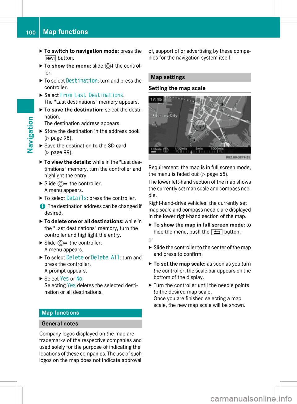
Requirement: the map is in full screen mode,
the menu is faded out (
Ypage 65).
The lower left-hand section of the map shows
the currently set map scale and compass nee-
dle.
Right-hand-drive vehicles: the currently set
map scale and compass needle are displayed
in the lower right-hand section of the map.
XTo show the map in full screen mode: to
hide the menu, push the %button.
or
XSlide the controller to the center of the map
and press to confirm.
XTo set the map scale: as soon as you turn
the controller, the scale bar appears on the bottom of the display.
XTurn the controller until the needle points
to the desired map scale.
Once you are finished selecting a map
scale, the new map scale will be shown.
100Map functions
Navigation
Page 123 of 246

Adding a call
:Addsacall
If th emobile phone network provide rand th e
mobile phon esupport th efunction ,you can
mak eanother call during an existing call .The
previously active call is held .
XTo select°2:tur nand press th econtroller .
XMake acall:
RUsing th etelephon emen u (Ypage 119)
RRedial (Ypage 119)
RUsing call list s (Ypage 135)
RUsing thephone book (Ypage 119)
RUsing speeddial (Ypage 119)
Switching the microphone on oroff
This function is available in th etelephon e
men uduring an active phone call .
Switchin goff th emicrophone:
XTo switch to th emen ubar: slide 6the
controller .
XTo selectMicrophon eOff:tur nand press
th econtroller .
If th emicrophon eis switched off ,th eQ
symbol and th eThe
microphon eisoff.
message are displayed.
Switchin gon th emicrophone:
XSelec tMicrophon eOn.
The Qsymbol disappears. The The
microphoneis on.message is shown.
Sending DTMF tones
This function is no tsupported by all mobile
phones.
Answering machines or other device scan be
controlled by DTMF tones, e.g. for remot e
quer yfunctions.
XIf you would lik eto listen to th emessage s
on your answering machine, for example,
dial th ecorresponding number .
Transmitting individual characters :
XOnceaconnection has been established to
th eanswer phone, select th edesired char-
acters in th etelephon emenu: tur nand
press th econtroller eac htime.
or
XPre ssthecorresponding ke yon th enumber
keypad.
Every characte rselected will be transmit -
te dimmediately.
iYou can also sen dDTMF tone susin gth e
Voic eControl Syste m(see th eseparat e
operating instructions).
Calls with several pa rticipants
Switching between calls (call waiting)
If you mak eanother call ,you can switch
between th etwo call s(call waiting). This func-
tion depend son your mobile phone network
provide rand th emobile phone (see th eman -
ufacturer' soperating instructions).
The call sare marke d 1and 2. The active call is
highlighted.
Using the telephone121
Telephone
Z