Page 97 of 298

Selection Action
Using Map
Using Map X
Enter a destination
using the map
(Y page 93). From Memory From Memory
Card Card X
Select a personal POI
(Y page 99). From From
Mercedes- Mercedes-
Benz Apps Benz Apps X
Enter a destination
from Mercedes-Benz
Apps (Y page 96). Using Geo- Using Geo-
Coordinates Coordinates X
Enter a destination
using the geo-coordi-
nates (Y page 97). X
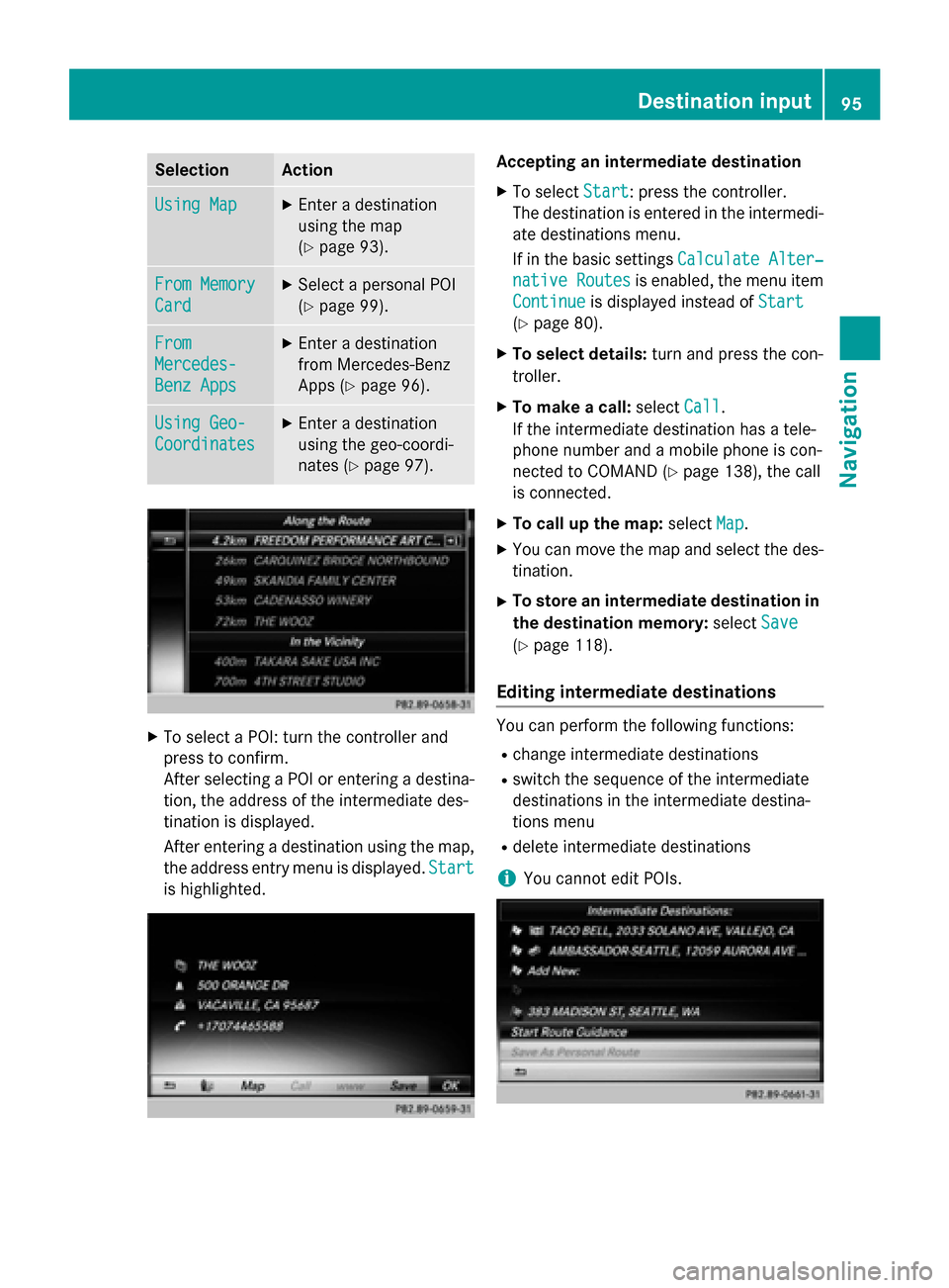
To select a POI: turn the controller and
press to confirm.
After selecting a POI or entering a destina- tion, the address of the intermediate des-
tination is displayed.
After entering a destination using the map,
the address entry menu is displayed. Start
Start
is highlighted. Accepting an intermediate destination
X To select Start
Start: press the controller.
The destination is entered in the intermedi-
ate destinations menu.
If in the basic settings Calculate Alter‐ Calculate Alter‐
native Routes
native Routes is enabled, the menu item
Continue Continue is displayed instead of Start Start
(Y page 80).
X To select details: turn and press the con-
troller.
X To make a call: selectCall
Call.
If the intermediate destination has a tele-
phone number and a mobile phone is con-
nected to COMAND (Y page 138), the call
is connected.
X To call up the map: selectMap
Map.
X You can move the map and select the des-
tination.
X To store an intermediate destination in
the destination memory: selectSave Save
(Y page 118).
Editing intermediate destinations You can perform the following functions:
R
change intermediate destinations
R switch the sequence of the intermediate
destinations in the intermediate destina-
tions menu
R delete intermediate destinations
i You cannot edit POIs. Destination input
95Navigation Z
Page 98 of 298

X
To select an intermediate destination in the
intermediate destinations menu: turn and
press the controller.
A menu appears.
X To change an intermediate destination:
select Edit
Edit in the menu.
X Change the address, e.g. the city and
street.
X To select OK OK: turn and press the controller.
The intermediate destinations menu
appears and displays the changed inter-
mediate destination.
You can change the sequence of the inter-
mediate destinations entered and the desti-
nation. To change the sequence, at least one
intermediate destination and the destination
must have been entered.
X To change the order: in the menu, select
Move
Move.
X Turn the controller and move the intermedi-
ate destination or destination to the
desired position.
X Press the controller.
X To delete an intermediate destination:
select Delete
Delete in the menu.
Accepting intermediate destinations
for the route X
To select Start Route Guidance Start Route Guidance in the
intermediate destinations menu: press the
controller.
The route is calculated with the entered
intermediate destinations.
If an intermediate destination was passed
during route guidance, the intermediate
destination will be displayed in the inter-
mediate destinations menu with a green
tick mark. Once the route has been recal-
culated, the intermediate destination is
deleted from the intermediate destinations
menu. Searching for a gas station when the
fuel level is low Requirement: the setting
Gas on Reserve Gas on Reserve
must be enabled (Y page 81).
If the fuel tank reserve level is displayed, you
will see the Gas
Gason
onReserve
Reserve Do
Doyou
you want
want
to start a search for surrounding
gas stations? gas stations? message.
X To select Yes YesorNo
No: turn and press the con-
troller.
If you select Yes Yes, the gas station search
starts. When the search is complete, a list
of the gas stations available along the route or in the vicinity is displayed.
If you select No No, the search is canceled.
X Select the gas station.
The address of the gas station is displayed.
X To select Start
Start: press the controller.
The selected gas station is entered into
position 1 of the intermediate destinations menu. Route guidance begins.
If the intermediate destinations menu
already contains four intermediate desti-
nations, a prompt will be displayed, asking
you whether you wish to enter the gas sta-
tion into position 1. If you select Yes
Yes, the
gas station is transferred into the list and
intermediate destination 4 is deleted. Entering a destination from
Mercedes-Benz Apps
Requirement: mbrace must be activated for
the Mercedes-Benz Apps (Y page 173).
X To switch to navigation mode: press the
00BE button.
X To show the menu: slide6the control-
ler.
X To select Destination Destination: turn and press the
controller.
X Select From Mercedes-Benz Apps
From Mercedes-Benz Apps.
A list shows the available destinations that have been transmitted to the vehicle up to
this point (Y page 181).96
Destination inputNavigation
Page 99 of 298

Using geo-coordinates
X To switch to navigation mode: press the
00CB button.
X To show the menu: slide6the control-
ler.
X To select Destination
Destination: turn and press the
controller.
X Select Using Geo-Coordinates
Using Geo-Coordinates.
Geo-coordinates are entered in degrees,
minutes and seconds.
Entering the latitude and longitude coor-
dinates
X To change the value: turn the controller.
X To move the selection within the line: slide
1 the controller.
X To move the selection between lines: slide
4 the controller.
X To confirm the value: press the controller.
Saving destination
X To select Save
Save: turn and press the control-
ler.
The destination can be saved as:
R a navigable contact in the address book
R to an SD memory card
R My Address
Starting route calculation
X To select Start Route Guidance Start Route Guidance: turn
and press the controller. Personal POIs and routes
General notes
The use of personal POIs for displaying traffic surveillance equipment is not permitted in
every country. Please observe the country-
specific regulations and always drive at a suit-
able speed.
Personal POIs are filed in categories:
R Not Classified Not Classified
Standard entry for personal POIs
R Mercedes-Benz Apps Mercedes-Benz Apps Personal POIs (destinations, routes) that
you have imported via the online functions
(Y page 183)
R Categories which you have created your-
self, e.g. on your PC
Personal routes are not categorized. Settings for personal POIs
Displaying on the map Requirement: an SD memory card with per-
sonal POIs is inserted (Y
page 215).
All personal POIs of the selected category are displayed on the map with a corresponding
symbol.
If the "Alert when approaching" (Y page 98)
function is activated, the symbols are dis-
played up to a map scale of 2 km.
X To switch to navigation mode: press the
00CB button.
X To show the menu: slide6the control-
ler.
X To select Options Options: turn and press the con-
troller.
X Select Personal POIs
Personal POIs.
X Select Display on the Map
Display on the Map.
The menu displays the categories available on the SD memory card.
X To select a category: turn the controller and
press to confirm.
All personal POIs in the selected category
are displayed 0073or not displayed 0053,
depending on the previous status. Personal POIs and routes
97Navigation Z
Page 100 of 298

Alert when approaching
Requirement: an SD memory card with per-
sonal POIs is inserted (Y page 215).
If the vehicle is approaching a personal POI,
this is highlighted on the map and/or an audi-
ble signal sounds.
For this purpose both the corresponding func-
tion "Alert when approaching" and the cate-
gory containing the personal POI must be
activated.
X To switch to navigation mode: press the
00CB button.
X To show the menu: slide6the control-
ler.
X To select Options
Options: turn and press the con-
troller.
X Select Personal POIs Personal POIs.
X Select Approaching POI Cue
Approaching POI Cue .
The menu displays the categories available on the SD memory card.
X Select Audible
Audible orOptical
Optical.
The function is switched on 0073or off 0053,
depending on the previous status.
X To select a category: turn the controller and
press to confirm.
The function is switched on 0073or off 0053, for
all personal POIs of this category, depend-
ing on the previous setting. Saving personal POIs and routes
General notes Personal POIs and routes are geodata which
are saved in the open GPX (
GPS Exchange)
format on the SD memory card.
Personal POI from current vehicle posi-
tion or crosshair position X
Insert the SD memory card (Y page 215).
X To switch to navigation mode: press the
00CB button.
X When the map is displayed, press the con-
troller until a message appears.
The current vehicle position is saved to the
Not Not Classified
Classified category on the SD mem-
ory card and also stored in the "Last desti-
nations" memory.
If the "Move map" function is selected
(Y page 79), the crosshair position is saved.
i If no SD memory card is inserted, the per-
sonal POI will only be stored in the "Last
destinations" memory.
Personal POI from destination address X
Insert the SD memory card (Y page 215).
X To switch to navigation mode: press the
00CB button.
X Call up the address entry menu and enter
the destination address (Y page 83).
X To select Save Save: slide 6the controller.
X Turn and press the controller.
X To select To
ToMemory
Memory Card
Card: turn and press
the controller.
X Enter the name.
X Select a category.
The current address is saved as a personal
point of interest on the SD memory card.
i You can select a destination from the
From Last Destinations From Last Destinations orFrom Con‐
From Con‐
tacts
tacts memories and save it on the SD
memory card. 98
Personal POIs and routesNavigation
Page 101 of 298

R
From Last Destinations
(Y page 88)
R From Contacts From Contacts (Ypage 89)
Personal route from a tour including
intermediate destinations X
Insert the SD memory card (Y page 215).
X To switch to navigation mode: press the
00CB button.
X Enter a destination, e.g. by address
(Y page 83).
X Start route calculation (Y page 86).
X Create intermediate destinations
(Y page 94).
X To select Save SaveAs
AsPersonal
Personal Route
Routein the
intermediate destinations menu: turn and
press the controller.
The route is saved in the "Personal routes" file on the SD memory card. Importing personal destinations and
routes via Mercedes-Benz Apps
You can use Mercedes-Benz Apps (e. g. Down-
load POI, Local Search) to import destinations
to navigation (Y page 181). These have their
own symbol and are filed in the Mercedes-
Mercedes-
Benz Apps Benz Apps category.
You can save the imported destinations and
routes as personal POIs and routes
(Y page 98).
When importing routes, please note:
R The Mercedes-Benz Apps may generate a
route based on a different map from the
one used by COMAND. Points on the route
may therefore be situated off the digital
roads. For this reason an imported route
commenced in COMAND may deviate from the original route from the Mercedes-Benz
Apps.
R The Mercedes-Benz Apps minimize the
number of route points offered. For this
reason an imported route commenced in COMAND may deviate from the original
route from the Mercedes-Benz Apps. Selecting and editing personal POIs
and routes
Selecting Personal POI
X Insert the SD memory card (Y page 215).
X To switch to navigation mode: press the
00CB button.
X To show the menu: slide6the control-
ler.
X To select Destination Destination: turn and press the
controller.
X Select From Memory Card
From Memory Card.
The menu displays the categories available on the SD memory card.
X To select a category or Personal Routes
Personal Routes:
turn and press the controller.
The available personal POIs or route entries
are displayed.
X Select personal POI or personal route.
The address of the personal POI appears or
the personal route is displayed in the map.
If a large number of entries are stored, a reg-
ister for quick selection appears. Personal
POIs and routes can be saved and sorted with different character sets (e. g. ABC, Cyrillic, Arabic). Personal POIs and routes
99Navigation Z
Page 102 of 298

Selecting a register
X Slide 9the controller.
X To select a character: turn and press the
controller.
Selecting character set for sorting
X To highlight 0054, slide9the controller.
X Press the controller.
The available character sets are displayed.
The 003Bdot indicates the current setting.
X Turn and press the controller.
Editing Personal route
X Select personal POI or personal route
(Y page 99).
Exploring personal POI or route X To select Map Map: turn and press the controller.
The map with the crosshair appears and
shows the destination.
X Scroll the map (Y page 120).
X Set the map scale (Y page 120).
X To return to the menu: press the 0038but-
ton.
Placing a call to the personal POI X To select Call
Call: turn and press the control-
ler.
If a mobile phone is connected to COMAND and the telephone number is available, the
call is connected (Y page 145). Changing name and symbol
X To select Edit
Edit: turn and press the control-
ler.
X Select Change Name Change Name orEdit Icon
Edit Icon.
X To change name: enter character
(Y page 36).
X To change symbol: select a symbol.
The symbol is saved.
Deleting personal POI or route
X To select Delete Delete: turn and press the con-
troller.
A prompt will appear.
X Select Yes YesorNo
No.
If you select Yes
Yes, the personal destination
or personal route is deleted.
Selecting outward and return route
X To select Swap
Swap: turn and press the control-
ler.
The starting and destination positions of
your personal route, and thus the direction for route guidance, are switched round.
One-way streets or restricted intersections
are taken into consideration. Therefore, the outward and return routes may differ from
each other.
Saving personal POI
X To select Save
Save: turn and press the control-
ler.
X To continue saving (Y page 118).
Starting route guidance
X To select Start Start: turn and press the con-
troller. 100
Personal POIs and routesNavigation
Page 103 of 298

Recording the route
General notes When recording the route, bear in mind the
following:
R if the SD memory card is inserted, it must
not removed during recording.
R if route recording is started manually, it
must be finished manually before COMAND is switched off (e .g. when the engine is
switched off).
R COMAND minimizes the number of route
points recorded. Therefore when the
recorded route is subsequently com-
menced, it may differ from the route that
was originally recorded.
Starting/finishing route recording X
Insert the SD memory card (Y page 215).
X To switch to navigation mode: press the
00CB button.
X To show the menu: slide6the control-
ler.
X To select Destination
Destination: turn and press the
controller.
X Select From Memory Card From Memory Card.
X Select Start Route Recording
Start Route Recording .
The route is recorded and REC appears at
the bottom edge of the screen.
X To stop recording, select End Route
End Route
Recording
Recording from the menu.
The route is stored under Personal
Personal
Routes
Routes .
Displaying/editing the recorded route X
Insert the SD memory card (Y page 215).
X To switch to navigation mode: press the
00CB button.
X To show the menu: slide6the control-
ler.
X To select Destination
Destination: turn and press the
controller.
X Select From Memory Card
From Memory Card. X
Select Personal Routes
Personal Routes .
Previously recorded routes are displayed.
X To select Route: turn and press the con-
troller.
The map appears with a menu. The
recorded route is shown on the map in blue.
Starting route calculation
X Select Start Start.
Changing the name and symbol
X Select Edit Edit.
X Select Change Name
Change Name orEdit Icon
Edit Icon.
X To change the name: enter characters
(Y page 36).
X To change symbol: select a symbol.
The symbol is saved. Route guidance
General notes
For this reason, you must always observe
road and traffic rules and regulations during
your journey. Road and traffic rules and reg-
ulations always have priority over system
driving recommendations.
COMAND calculates the route to the destina- tion without taking account of the following,
for example:
R traffic lights
R stop and yield signs
R merging lanes
R parking or stopping in a no parking/no
stopping zone
R other road and traffic rules and regulations
R narrow bridges
COMAND may give differing navigation com-
mands if the actual street/traffic situation
does not correspond with the digital map's
data. For example, if the road layout or the
direction of a one-way street has been
changed.
For this reason, you must always observe
road and traffic rules and regulations during Route guidance
101Navigation Z
Page 104 of 298

your journey. Road and traffic rules and reg-
ulations always have priority over the sys-
tem's driving recommendations.
Route guidance begins once a route has been calculated (Y page 86).
COMAND guides you to your destination by
means of navigation announcements in the
form of audible navigation announcements
and route guidance displays.
The route guidance displays can be seen if the
display is switched to navigation mode.
If you do not follow the navigation announce- ments or if you leave the calculated route,
COMAND automatically calculates a new
route to the destination.
If the digital map contains the corresponding
information, the following applies:
R during route guidance, COMAND tries to
avoid roads with restricted access. Those
roads, for example, that are closed to
through-traffic.
R roads that have time restrictions (e.g.
closed on Sundays and public holidays) are
considered for route guidance on days
when they are open. For this purpose, the
relevant times must be correctly stored in
the database. 102
Route guidanceNavigation