2015 MERCEDES-BENZ C-Class lock
[x] Cancel search: lockPage 60 of 214

X
Call up the climate control menu
(Y page 54).
X To select Ionization Ionization: turn and press the
controller.
You switch it on or off, depending on the
previous status.
Exiting a menu
X Press the 0038button.
Auxiliary heating You can pre-set three departure times for
automatic activation of the auxiliary heating.
Selecting the pre-set time:
X Call up the climate control menu
(Y page 54).
X To select Auxiliary Heating
Auxiliary Heating: turn and
press the controller.
X Turn the controller.
Changing the pre-set time:
X Call up the climate control menu
(Y page 54).
X To select Auxiliary Heating Auxiliary Heating: turn and
press the controller.
X To select the departure time that will be
changed: turn and press the controller.
A menu for changing the time opens. X
To select the required setting element (ana-
log clock, hours or minutes): slide 5and
9 the controller.
X To change the setting: turn the controller.
X To exit the menu: press the controller. AGILITY SELECT
General notes
With the AGILITY SELECT menu you can con-
figure the drive, suspension and steering set-
tings for the Individual
Individual drive program. The
configuration you have programmed only
takes effect once you have activated the
Individual Individual drive program using the AGILITY
SELECT switch (see the vehicle Operator's
Manual). Configuration via the controller
X Press the 00D4button.
The vehicle menu is displayed.
X To select AGILITY SELECT AGILITY SELECT : turn and press
the controller.
The menu for setting the Individual Individualdrive
program appears.
X To select Drive
Drive,Suspension
Suspension orSteer‐
Steer‐
ing
ing : turn and press the controller.
X To select individual settings: turn the con-
troller and press to confirm. 58
AGILITY SELECTVehicle functions
Page 69 of 214

provide guidance into and out of carpool
lanes.
X
To switch to navigation mode: press the
00CB button.
X To show the menu: press the controller.
X To select Settings Settings: turn and press the
controller.
X Select Route Settings
Route Settings.
X Select Avoid Options Avoid Options.
X Select Use Carpool Lanes
Use Carpool Lanes.
Carpool lanes will either be used 0073or
avoided 0053when calculating the route. Destination input
Important safety notes
G
WARNING
If you operate information systems and com-
munication equipment integrated in the vehi-
cle while driving, you will be distracted from
traffic conditions. You could also lose control
of the vehicle. There is a risk of an accident.
Only operate the equipment when the traffic
situation permits. If you are not sure that this
is possible, park the vehicle paying attention
to traffic conditions and operate the equip-
ment when the vehicle is stationary.
You must observe the legal requirements for
the country in which you are currently driving
when operating COMAND.
Destination entry may be blocked while driv-
ing, depending on the country specifications. General notes
The various character entry options are
described for the controller. Alternatively you
can use the touchpad to enter characters and
select menus (Y page 21). As an address
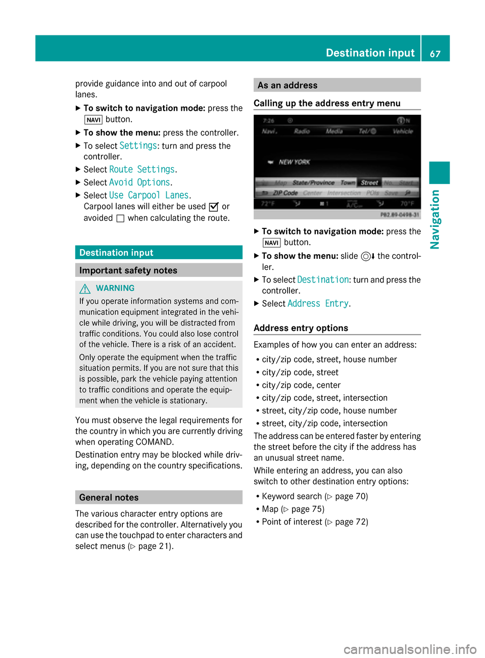
Calling up the address entry menu X
To switch to navigation mode: press the
00BE button.
X To show the menu: slide6the control-
ler.
X To select Destination Destination: turn and press the
controller.
X Select Address Entry
Address Entry.
Address entry options Examples of how you can enter an address:
R
city/zip code, street, house number
R city/zip code, street
R city/zip code, center
R city/zip code, street, intersection
R street, city/zip code, house number
R street, city/zip code, intersection
The address can be entered faster by entering
the street before the city if the address has
an unusual street name.
While entering an address, you can also
switch to other destination entry options:
R Keyword search (Y page 70)
R Map (Y page 75)
R Point of interest (Y page 72) Destination input
67Navigation Z
Page 77 of 214

Selecting a point of interest
Requirement for "Calling a POI": a mobile
phone is connected to COMAND
(Y page 104).
Requirements for "Viewing the vicinity of the
destination" and "Loading data from the Inter-
net": mbrace must be activated for Internet
access (Y page 136). The complete address of the POI is shown.
Viewing the vicinity of the destination
X To select symbol 0043: turn the controller and
press to confirm.
If street images are available, the street in
the vicinity of the destination address is
shown.
Calling up the map
X Select Map
Map.
X Move the map, change the map scale and
select the POI (Y page 75).
Calling up the POI
X Select Call Call.
If a telephone number is available,
COMAND switches to the telephone func-
tion.
Loading data from the Internet
X Select www
www.
If an Internet address is available, data is
loaded from the Internet.
Saving a POI
X To select Save
Save: turn and press the control-
ler.
The POI can be saved as: R
a navigable contact in the address book
R My Address
Starting route calculation
X To select Continue Continue: press the controller. Using Map
0043
Crosshair
0044 Distance of crosshair position from cur-
rent vehicle position
X To switch to navigation mode: press the
00CB button.
X To show the menu: slide6the control-
ler.
X To select Destination Destination: turn and press the
controller.
X Select Using Map
Using Map.
The map with crosshair is shown.
X To move the map: slide1, 4or
2 the controller.
X To change the map scale: turn the con-
troller until the desired map scale is
selected.
The scale is displayed at the bottom. Turn-
ing clockwise zooms out from the map;
turning counter-clockwise zooms in. Destination input
75Navigation Z
Page 84 of 214

Highway information facilitates route guid-
ance to a POI and use of the traffic jam func-
tion. The remaining route on the highway in
this case is blocked in the direction of travel
from the selected exit.
Starting route guidance and using addi-
tional functions
X To select a POI: turn the controller and
press to confirm.
The POI details are displayed.
The POI can now be:
R stored in the address book
(Y page 89)
R viewed on the map (Y page 94)
R called if a phone is connected and a
phone number is available
(Y page 110).
R selected for route guidance and a route
to it calculated (Y page 69).
Using the traffic jam function
X To select Detour
Detour: turn and press the con-
troller.
The traffic jam function appears
(Y page 84). Navigation announcements
Repeating navigation announcements If you missed the current navigation
announcement, you can call it up again. X
To switch to navigation mode: press the
00BE button.
X To show the menu: slide6the control-
ler.
X Select 006A: turn and press the controller.
i If you previously assigned the Repeat Repeat
Spoken
Spoken Driving
Driving Recommendations
Recommendations func-
tion to the Favorites button, you can select
the function using the Favorites button
instead (Y page 42).
Setting the volume manually X
Set the volume using the thumbwheel to
the right of the controller during the navi-
gation announcement.
i When you start the engine, the volume will
be at its lowest setting.
Switching navigation announcements
on/off X
To switch off navigation announce-
ments: during a navigation announcement,
press the thumbwheel to the right of the
controller.
or
X During a navigation announcement, press
the 0063 button on the multifunction steer-
ing wheel.
The Spoken Spoken driving
driving recommendations
recommendations
have been deactivated.
have been deactivated. message
appears.
X To switch navigation announcements
back on: press the controller.
X Select 006A: turn and press the controller.
COMAND automatically switches the naviga-
tion announcements back on when:
R a new route is calculated.
R you switch COMAND on again or start the
engine.
A navigation message is given if the route is
recalculated during dynamic route guidance
due to new traffic reports (Y page 85).82
Route guidanceNavigation
Page 88 of 214

IUS XM Satellite Radio Traffic Message
Service.
Further information on satellite radio
(Y page 157).
COMAND can receive traffic reports via sat-
ellite radio and take account of these for
route guidance in the navigation system.
Received traffic reports are displayed on the
map either as text or as symbols. Real-time traffic reports on the map
COMAND can show certain traffic incidents
on the map with symbols (type of incident)
and colored lines (extent). Traffic reports are
shown on the map at scales of 0.05 mi to
20 mi.
X To hide the menu: slide5and press the
controller.
The map can be seen in the full-screen dis-
play.
X To set the map scale: turn the controller
until the desired map scale is selected. 0043
Traffic jam on the route
0044 Slow-moving traffic on the route
0087 Road blocked
0085 Traffic disruption
0083 Traffic warning
0084 Dashed red and white line delimiting the
traffic warning
006B Road block (crosses along the affected
road)
006C Slow-moving traffic (orange line along the
affected route)
006D Traffic jam (red line along the affected
route) Displaying real-time traffic reports
Starting a search for traffic reports 86
Real-time traffic reportsNavigation
Page 96 of 214

Additional functions:
R
Moving the map (Y page 64)Map display
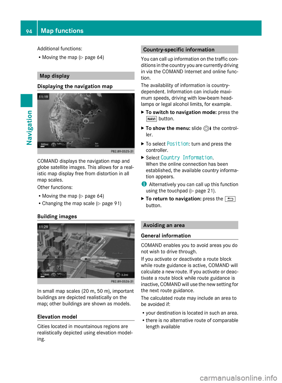
Displaying the navigation map COMAND displays the navigation map and
globe satellite images. This allows for a real-
istic map display free from distortion in all
map scales.
Other functions:
R Moving the map (Y page 64)
R Changing the map scale (Y page 91)
Building images In small map scales (20 m, 50 m), important
buildings are depicted realistically on the
map; other buildings are shown as models.
Elevation model Cities located in mountainous regions are
realistically depicted using elevation model-
ing. Country-specific information
You can call up information on the traffic con-
ditions in the country you are currently driving
in via the COMAND Internet and online func-
tion.
The availability of information is country-
dependent. Information can include maxi-
mum speeds, driving with low-beam head-
lamps or legal alcohol limits, for example.
X To switch to navigation mode: press the
00BE button.
X To show the menu: slide6the control-
ler.
X To select Position Position: turn and press the
controller.
X Select Country Information
Country Information.
When the online connection has been
established, the available country informa-
tion appears.
i Alternatively you can call up this function
using the touchpad (Y page 21).
X To return to navigation: press the0038
button. Avoiding an area
General information COMAND enables you to avoid areas you do
not wish to drive through.
If you activate or deactivate a route block
while route guidance is active, COMAND will
calculate a new route. If you activate or deac-
tivate a route block while route guidance is
inactive, COMAND will use the new setting for
the next route guidance.
The calculated route may include an area to
be avoided if:
R
your destination is located in such an area.
R there is no alternative route of comparable
length available 94
Map functionsNavigation
Page 97 of 214

Highways within blocked areas are always
taken into consideration in the route calcula-
tion.
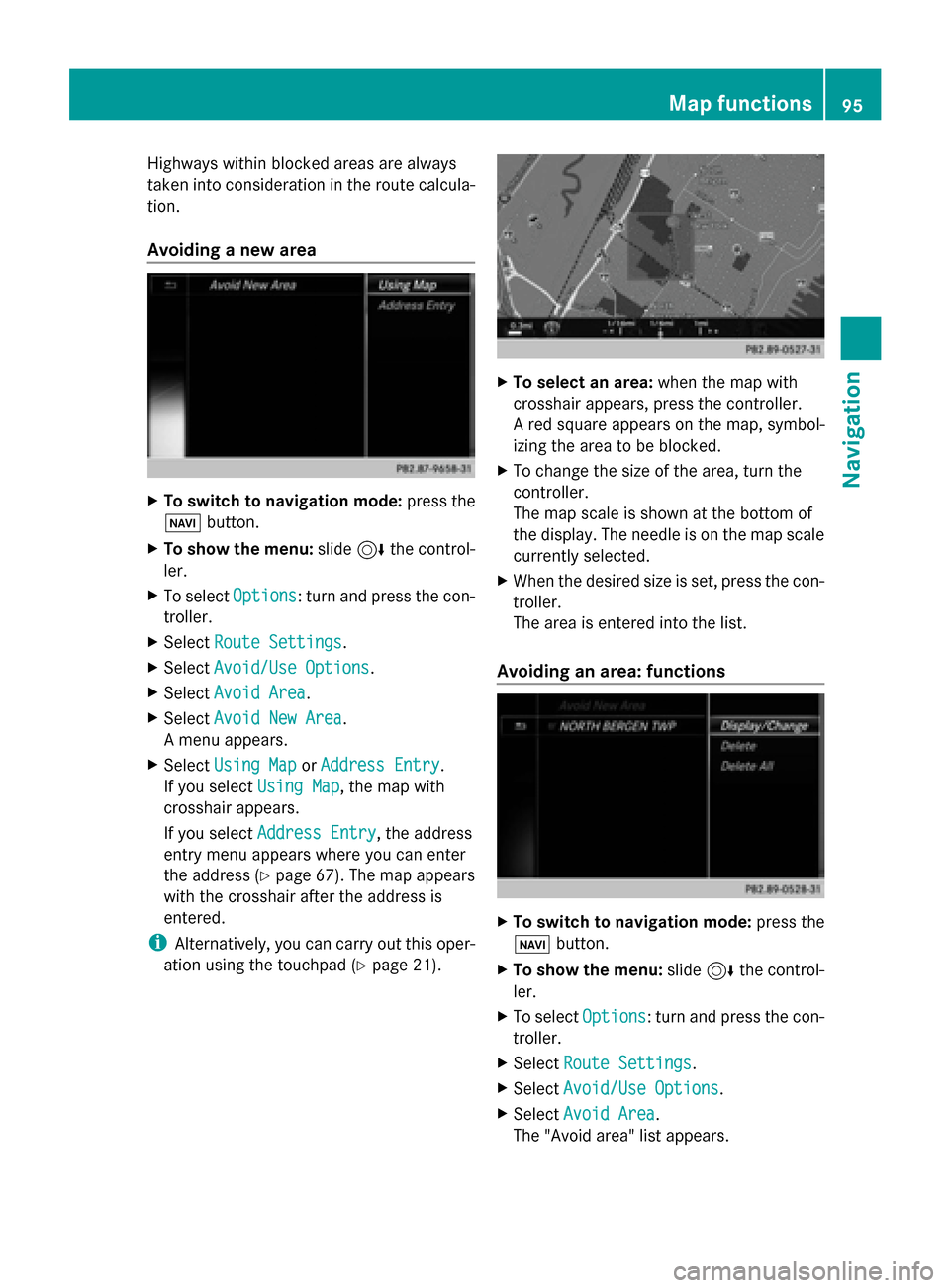
Avoiding a new area X
To switch to navigation mode: press the
00BE button.
X To show the menu: slide6the control-
ler.
X To select Options
Options: turn and press the con-
troller.
X Select Route Settings
Route Settings .
X Select Avoid/Use Options Avoid/Use Options.
X Select Avoid Area
Avoid Area .
X Select Avoid New Area
Avoid New Area .
A menu appears.
X Select Using Map
Using Map orAddress Entry
Address Entry.
If you select Using Map
Using Map, the map with
crosshair appears.
If you select Address Entry
Address Entry, the address
entry menu appears where you can enter
the address (Y page 67). The map appears
with the crosshair after the address is
entered.
i Alternatively, you can carry out this oper-
ation using the touchpad (Y page 21). X
To select an area: when the map with
crosshair appears, press the controller.
A red square appears on the map, symbol-
izing the area to be blocked.
X To change the size of the area, turn the
controller.
The map scale is shown at the bottom of
the display. The needle is on the map scale
currently selected.
X When the desired size is set, press the con-
troller.
The area is entered into the list.
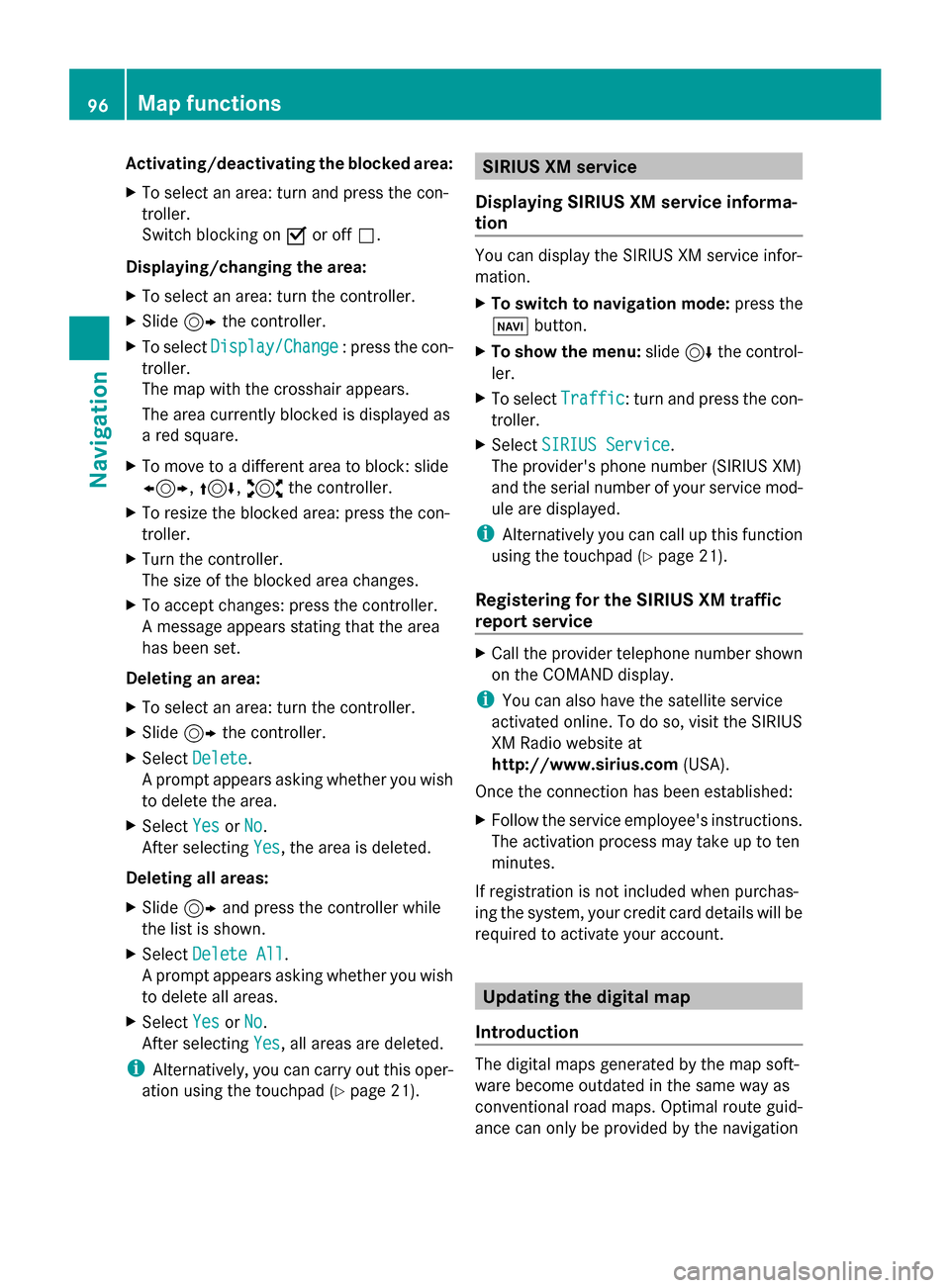
Avoiding an area: functions X
To switch to navigation mode: press the
00CB button.
X To show the menu: slide6the control-
ler.
X To select Options Options: turn and press the con-
troller.
X Select Route Settings
Route Settings .
X Select Avoid/Use Options
Avoid/Use Options.
X Select Avoid Area
Avoid Area .
The "Avoid area" list appears. Map functions
95Navigation Z
Page 98 of 214

Activating/deactivating the blocked area:
X To select an area: turn and press the con-
troller.
Switch blocking on 0073or off 0053.
Displaying/changing the area:
X To select an area: turn the controller.
X Slide 9the controller.
X To select Display/Change
Display/Change : press the con-
troller.
The map with the crosshair appears.
The area currently blocked is displayed as
a red square.
X To move to a different area to block: slide
1, 4,2the controller.
X To resize the blocked area: press the con-
troller.
X Turn the controller.
The size of the blocked area changes.
X To accept changes: press the controller.
A message appears stating that the area
has been set.
Deleting an area:
X To select an area: turn the controller.
X Slide 9the controller.
X Select Delete
Delete .
A prompt appears asking whether you wish
to delete the area.
X Select Yes
Yes orNo No.
After selecting Yes
Yes , the area is deleted.
Deleting all areas:
X Slide 9and press the controller while
the list is shown.
X Select Delete All
Delete All .
A prompt appears asking whether you wish
to delete all areas.
X Select Yes
Yes orNo No.
After selecting Yes
Yes , all areas are deleted.
i Alternatively, you can carry out this oper-
ation using the touchpad ( Ypage 21). SIRIUS XM service
Displaying SIRIUS XM service informa-
tion You can display the SIRIUS XM service infor-
mation.
X
To switch to navigation mode: press the
00BE button.
X To show the menu: slide6the control-
ler.
X To select Traffic Traffic: turn and press the con-
troller.
X Select SIRIUS Service
SIRIUS Service.
The provider's phone number (SIRIUS XM)
and the serial number of your service mod-
ule are displayed.
i Alternatively you can call up this function
using the touchpad ( Ypage 21).
Registering for the SIRIUS XM traffic
report service X
Call the provider telephone number shown
on the COMAND display.
i You can also have the satellite service
activated online. To do so, visit the SIRIUS
XM Radio website at
http://www.sirius.com (USA).
Once the connection has been established:
X Follow the service employee's instructions.
The activation process may take up to ten
minutes.
If registration is not included when purchas-
ing the system, your credit card details will be
required to activate your account. Updating the digital map
Introduction The digital maps generated by the map soft-
ware become outdated in the same way as
conventional road maps. Optimal route guid-
ance can only be provided by the navigation96
Map functionsNavigation