2015 MERCEDES-BENZ C-Class ESP
[x] Cancel search: ESPPage 67 of 214

Menu item
Eco Route Eco Route COMAND calculates an
economical route. The jour-
ney may take slightly longer
compared to taking the fast
route.
Menu item
Short Short
Route Route COMAND calculates a
shorter route.
X
To calculate alternative routes: select
Calculate Alternative Routes Calculate Alternative Routes.
Switch the function on 0073or off 0053.
Function activated: after each route calcu-
lation, route alternatives are offered that
correspond to the local conditions
(Y page 83).
If desired, you can have COMAND calculate
alternative routes even during route guid-
ance (Y page 83). X
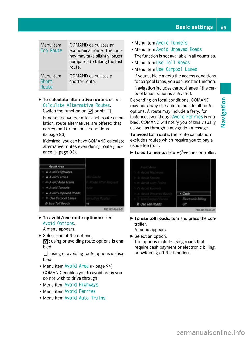
To avoid/use route options: select
Avoid Options Avoid Options.
A menu appears.
X Select one of the options.
0073: using or avoiding route options is ena-
bled
0053: using or avoiding route options is disa-
bled
R Menu item Avoid Area Avoid Area (Ypage 94)
COMAND enables you to avoid areas you
do not wish to drive through.
R Menu item Avoid Highways Avoid Highways
R Menu item Avoid Ferries
Avoid Ferries
R Menu item Avoid Auto Trains
Avoid Auto Trains R
Menu item Avoid Tunnels
Avoid Tunnels
R Menu item Avoid Unpaved Roads
Avoid Unpaved Roads
The function is not available in all countries.
R Menu item Use Toll Roads
Use Toll Roads
R Menu item Use Carpool Lanes
Use Carpool Lanes
If your vehicle meets the access conditions
for carpool lanes, you can use this function.
Navigation includes carpool lanes if the car-
pool lanes option is activated.
Depending on local conditions, COMAND
may not always be able to include all route
options. A route may include a ferry, for
instance, even though Avoid AvoidFerries
Ferries is ena-
bled. COMAND will notify you of this visually
as well as through a navigation message.
To avoid toll roads: the route calculation
excludes routes which require you to pay a
usage fee (toll).
X To exit a menu: slide1 the controller. X
To use toll roads: turn and press the con-
troller.
A menu appears.
X Select an option.
The options include using roads that
require cash payment or electronic billing,
or switching off the function. Basic settings
65Navigation Z
Page 81 of 214

Using geo-coordinates
X To switch to navigation mode: press the
00CB button.
X To show the menu: slide6the control-
ler.
X To select Destination
Destination: turn and press the
controller.
X Select Using Geo-Coordinates
Using Geo-Coordinates.
Geo-coordinates are entered in degrees,
minutes and seconds.
Entering the latitude and longitude coor-
dinates
X To change the value: turn the controller.
X To move the selection within the line: slide
1 the controller.
X To move the selection between lines: slide
4 the controller.
X To confirm the value: press the controller.
Saving a destination
X To select Save
Save: turn and press the control-
ler.
The destination can be saved as:
R a navigable contact in the address book
R My Address
Starting route calculation
X To select Start Route Guidance
Start Route Guidance: turn
and press the controller. Route guidance
Important notes
For this reason, you must always observe
road and traffic rules and regulations during
your journey. Road and traffic rules and reg-
ulations always have priority over system
driving recommendations.
COMAND calculates the route to the destina-
tion without taking account of the following,
for example:
R traffic lights
R stop and yield signs R
merging lanes
R parking or stopping in a no parking/no
stopping zone
R other road and traffic rules and regulations
R narrow bridges
COMAND may give differing navigation com-
mands if the actual street/traffic situation
does not correspond with the digital map's
data. For example, if the road layout or the
direction of a one-way street has been
changed.
For this reason, you must always observe
road and traffic rules and regulations during
your journey. Road and traffic rules and reg-
ulations always have priority over the sys-
tem's driving recommendations.
Route guidance begins once a route has been
calculated (Y page 69).
COMAND guides you to your destination by
means of navigation announcements in the
form of audible navigation announcements
and route guidance displays.
The route guidance displays can be seen if the
display is switched to navigation mode.
If you do not follow the navigation announce-
ments or if you leave the calculated route,
COMAND automatically calculates a new
route to the destination.
If the digital map contains the corresponding
information, the following applies:
R during route guidance, COMAND tries to
avoid roads with restricted access. Those
roads, for example, that are closed to
through-traffic.
R roads that have time restrictions (e.g.
closed on Sundays and public holidays) are
considered for route guidance on days
when they are open. For this purpose, the
relevant times must be correctly stored in
the database. Route guidance
79Navigation Z
Page 86 of 214

Routes 1, 2 and 4 are displayed with a dark
blue line (Y page 64).
Route 3 is the most economic route and is
displayed with a green line.
X To switch to navigation mode: press the
00BE button.
X To show the menu: slide6the control-
ler.
X To select Route
Route: turn and press the con-
troller.
X Select Alternative Route
Alternative Route.
Route 1 is shown.
X To display additional routes: select Next Nextor
Previous
Previous.
X To start a new route guidance: select
Start
Start.
Route list X
To switch to navigation mode: press the
00BE button.
X To show the menu: slide6the control-
ler.
X To select Route
Route: turn and press the con-
troller.
X Select Route List
Route List.
The route list shows the next change of
direction and the immediate distances
from the current vehicle position.
X To display additional route sections:
turn the controller.
The position of the change of direction that
belongs to the respective route section is
indicated on the map with a cross. Where am I?
X
To switch to navigation mode: press the
00BE button.
X To show the menu: slide6the control-
ler.
X To select Position
Position: turn and press the
controller.
X Select Where am I?
Where am I?.
The street you are currently on and the pre-
vious and next intersections are displayed. Traffic jam function
X
To switch to navigation mode: press the
00BE button.
X To show the menu: slide6the control-
ler.
X To select Route Route: turn and press the con-
troller.
X Select Detour
Detour .
X To specify the start of the traffic jam
section: selectBeginning
Beginning .
The next possible traffic jam section start-
ing point is marked. 84
Route guidanceNavigation
Page 87 of 214

X
Turn the controller.
The marking moves along the route to the
next starting position.
X Press the controller.
The start of the traffic jam is set.
X To specify the end of a traffic jam sec-
tion: select End
End.
The next possible traffic jam section end
point is marked.
X Turn and press the controller.
X To calculate the detour: selectStart Start. Off-road
Important safety notes G
WARNING
The COMAND navigation system may direct
you to off-road routes that your vehicle may
not be capable of traversing through without
damaging your tires, wheels or vehicle. It is
the driver's sole responsibility to determine
the suitability of the route. Off-road routes
may be of varying conditions and their appro-
priateness for use may be affected by various
factors such as time of day, time of year and
immediate weather conditions that cannot be
judged or taken into consideration by the
COMAND system.
Route guidance to an off-road destina-
tion COMAND can guide you to destinations
which are within the area of the digital map,
but which are not themselves on the map.
These destinations are known as off-road
destinations, which you can enter using the
map, for example. In these cases, COMAND
guides you for as long as possible with navi-
gation announcements and displays on roads
known to the system.
If the vehicle reaches an area which is not part
of the digital map, the display appears as a
split-screen view. On the right, an arrow
appears that points to the off-road destina- tion. You hear the announcement: "Please
follow the arrow on the display". As the vehi-
cle approaches the destination, you will see
a display to this effect.
Route guidance from an off-road loca-
tion to a destination
Off-road location: the vehicle's position is on
the digital map, but the map does not contain
any information about that location.
COMAND is also able to guide you to a des-
tination even from an off-road location.
At the start of route guidance, you will see the
Road Not Mapped Road Not Mapped
message, an arrow and
the distance to the destination. The arrow
shows the compass heading to the actual
destination.
As soon as the vehicle is back on a road
known to the system, route guidance contin-
ues in the usual way.
Off-road during route guidance Due to road works, for example, there may be
differences between the data on the digital
map and the actual course of the road.
In such cases, the system will temporarily be
unable to locate the vehicle position on the
digital map. The vehicle is therefore in an off-
road position.
In the display, you will then see the
Road RoadNot
Not
Mapped
Mapped message, an arrow and the distance
to the destination. The direction arrow shows
the compass heading to the destination.
As soon as the system can assign the vehicle
position to the map again, route guidance
continues in the usual way. Real-time traffic reports
Prerequisites
i This function is currently not available for
Canada.
In order to receive real-time traffic reports via
satellite radio, you need to subscribe to SIR- Real-time traffic reports
85Navigation Z
Page 93 of 214

X
To delete one or all destinations: while
in the "Last destinations" memory, turn the
controller and highlight the entry.
X Slide 00520096the controller.
A menu appears.
X To select Delete
Delete orDelete All
Delete All : turn and
press the controller.
A prompt appears.
X Select Yes
Yes orNo No.
Selecting Yes
Yesdeletes the selected desti-
nation or all destinations. Map functions
General notes
Company logos displayed on the map are
trademarks of the respective companies and
used solely for the purpose of indicating the
locations of these companies. The use of such
logos on the map does not indicate approval
of, support of or advertising by these compa-
nies for the navigation system itself. Map settings
Setting the map scale Requirement: the map is in full screen mode,
the menu is faded out (Y page 63).
The lower left-hand section of the map shows
the currently set map scale and compass nee-
dle.
Right-hand-drive vehicles: the currently set
map scale and compass needle are displayed
in the lower right-hand section of the map.
Displaying the map in full screen mode
X To hide the menu: press the 0038button.
or
X Slide the controller to the center of the map
and press to confirm. X
To set the map scale: as soon as you turn
the controller, the scale bar appears on the
bottom of the display.
X Turn the controller until the needle points
to the desired map scale.
Once you are finished selecting a map
scale, the new map scale will be shown.
i Alternatively, you can carry out this oper-
ation using the touchpad (Y page 21).
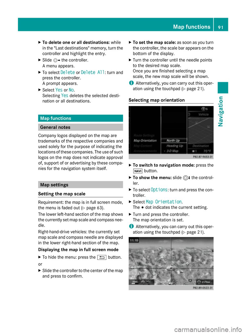
Selecting map orientation X
To switch to navigation mode: press the
00CB button.
X To show the menu: slide6the control-
ler.
X To select Options Options: turn and press the con-
troller.
X Select Map Orientation
Map Orientation.
The 003Bdot indicates the current setting.
X Turn and press the controller.
The map orientation is set.
i Alternatively, you can carry out this oper-
ation using the touchpad (Y page 21). Map functions
91Navigation Z
Page 113 of 214

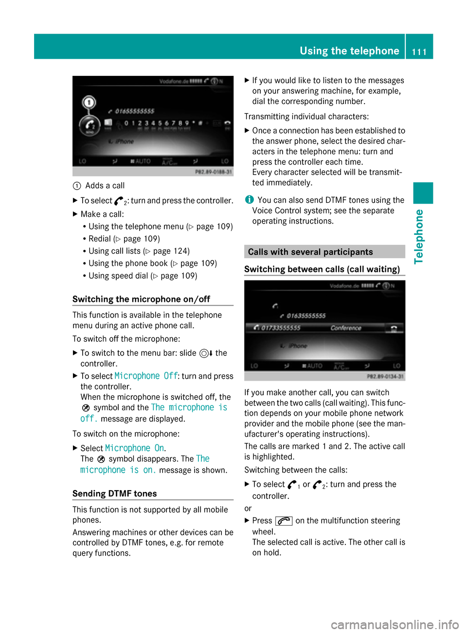
0043
Adds a call
X To select °
2: turn and press the controller.
X Make a call:
R
Using the telephone menu (Y page 109)
R Redial (Y page 109)
R Using call lists (Y page 124)
R Using the phone book (Y page 109)
R Using speed dial (Y page 109)
Switching the microphone on/off This function is available in the telephone
menu during an active phone call.
To switch off the microphone:
X To switch to the menu bar: slide 6the
controller.
X To select Microphone Off
Microphone Off : turn and press
the controller.
When the microphone is switched off, the
004D symbol and the The microphone is
The microphone is
off. off. message are displayed.
To switch on the microphone:
X Select Microphone On
Microphone On.
The 004Dsymbol disappears. The The
The
microphone is on.
microphone is on. message is shown.
Sending DTMF tones This function is not supported by all mobile
phones.
Answering machines or other devices can be
controlled by DTMF tones, e.g. for remote
query functions. X
If you would like to listen to the messages
on your answering machine, for example,
dial the corresponding number.
Transmitting individual characters:
X Once a connection has been established to
the answer phone, select the desired char-
acters in the telephone menu: turn and
press the controller each time.
Every character selected will be transmit-
ted immediately.
i You can also send DTMF tones using the
Voice Control system; see the separate
operating instructions. Calls with several participants
Switching between calls (call waiting) If you make another call, you can switch
between the two calls (call waiting). This func-
tion depends on your mobile phone network
provider and the mobile phone (see the man-
ufacturer's operating instructions).
The calls are marked 1 and 2. The active call
is highlighted.
Switching between the calls:
X
To select °
1or
°
2: turn and press the
controller.
or
X Press 0061on the multifunction steering
wheel.
The selected call is active. The other call is
on hold. Using the telephone
111Telephone Z
Page 124 of 214

Saving or editing the contact data on
COMAND does not change the contacts on
the mobile phone. If automatic download-
ing of phone contacts is activated,
COMAND displays the copy ¥with the
changed data. To add additional data, such
as additional phone numbers or e-mail
addresses, select this contact. In this way,
you avoid creating additional copies of the
mobile phone entry. Deleting the contact
X Call up the address book (Y page 117).
X Search for a contact (Y page 117).
X To select G: slide 9the controller.
X To select Delete Entry
Delete Entry: turn and press
the controller.
X To select Yes Yes: turn and press the controller.
The contact is deleted.
or
X To select No
No: turn and press the controller.
The process is canceled. Importing contacts
Information and requirements Contacts can be imported as vCards (vcf
files). A vCard is an electronic business card.
A memory card, USB device or a Bluetooth ®
connection can be used for importing.
i Up to 2000 entries can be imported into
the address book. A message notifies you
when the maximum number is reached. In
order to be able to then import new con-
tacts, you have to delete existing contacts
(Y page 122). Source Prerequisites
Memory card The SD memory card is
inserted. It contains
importable contact details. USB device The USB device is inserted
into the USB port. It con-
tains importable contact
details.
Bluetooth
®
connection If the sending of vCards is
supported via Bluetooth
®
,
vCards can be received on
mobile phones or net-
books, for example.
Bluetooth ®
must be acti-
vated in COMAND and on
the respective device (see
the manufacturer's operat-
ing instructions). Importing from the memory card or USB
device
Contacts imported from the memory card or
from a USB device can be recognized by the
00BB
symbol.
The following conditions must be fulfilled in
order to import vCards:
R vCards (vcf files) may be located in the main
directory or in folders. COMAND allows you
to select the relevant folders directly.
R vCards must have the file extension ".vcf".
i COMAND supports vCards in versions 2.1
and 3.0. X
To switch to the menu bar in the telephone
menu or the address book: slide 6the
controller.
X To select Options Options: turn and press the con-
troller. 122
Address bookTelephone
Page 131 of 214

Changing the displayed name of the e-
mail account X
Call up the settings menu for messages
(Y page 127).
X To highlight an e-mail account: turn the
controller.
X To select G: slide 9the controller.
X To select Own E-Mail Address
Own E-Mail Address: turn and
press the controller.
The input menu for entering your own e-
mail address is displayed. Downloading messages manually
X To call up the telephone menu: press the
002B button.
X To switch to the menu bar: slide 6the
controller.
X To select 0083: turn and press the controller.
The message menu is displayed.
X To switch to the menu bar: slide 6the
controller.
X To select Download
Download: turn and press the
controller.
Downloading text messages and e-mails
from the phone
X Select From the Phone From the Phone.
The messages are downloaded. If you have
selected Automatic Download
Automatic Download in the e-
mail settings, manual downloading is not
possible.
Updating from the e-mail server by the
mobile phone
X Select From the E-Mail Server
From the E-Mail Server .
The e-mails in the mobile phone are
updated.
This function is not supported by all mobile
phones. Reading messages
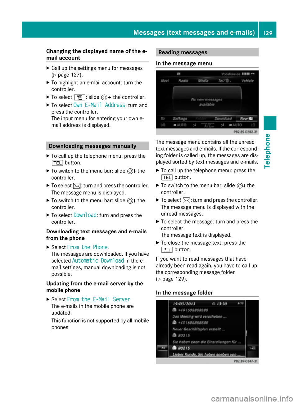
In the message menu The message menu contains all the unread
text messages and e-mails. If the correspond-
ing folder is called up, the messages are dis-
played sorted by text messages and e-mails.
X
To call up the telephone menu: press the
002B button.
X To switch to the menu bar: slide 6the
controller.
X To select 0083: turn and press the controller.
The message menu is displayed with the
unread messages.
X To select the message: turn and press the
controller.
The message text is displayed.
X To close the message text: press the
0038 button.
If you want to read messages that have
already been read again, you have to call up
the corresponding message folder
(Y page 129).
In the message folder Messages (text messages and e-mails)
129Telephone Z