2015 MERCEDES-BENZ C-Class sat nav
[x] Cancel search: sat navPage 19 of 214

R
Navigation system
-Navigation via the hard drive
- Destination entry using keyword search
- Realistic 3D map with textured city mod-
els
- Navigation functions such as Drive Infor-
mation and Google™ Maps
- Dynamic route guidance with traffic
reports via SIRIUS satellite radio
R Communication
-Messaging functions (text messages,
email)
- Address book
- Internet browser
- Mercedes-Benz Apps with Google™
Local Search, Destination/Route Down-
load, Weather, Facebook, Google™
Street View, Internet radio, stock prices,
news and much more
- Mercedes-Benz Mobile Website
- WLAN interface for the connection of a
smartphone to COMAND
- WLAN hotspot functionality to connect a
tablet PC or laptop in order to enable
access to the Internet using the custom-
er's mobile phone
R SIRIUS Weather
-Weather data as an information chart
(current forecast, 5-day preview,
detailed information)
- Weather data on the weather map, for
example as rain radars, storm character-
istics, and tracking of tropical cyclones
(hurricanes, typhoons) R
Vehicle functions
-Vehicle settings, such as ambient light-
ing, belt adjustment and tow-away alarm
- 360° camera
- Rear view camera
- Climate control functions, such as cli-
mate mode, perfume atomizer and aux-
iliary heating
- AGILITY SELECT (individual drive pro-
gram)
R Favorites button
Fast access to favorites functions using the
favorites button on the controller or on the
touchpad Display
General notes !
Do not use the space in front of the dis-
play for storage. Objects placed here could
damage the display or impair its function.
Avoid any direct contact with the display
surface. Pressure on the display surface
may result in impairments to the display,
which could be irreversible.
Wearing polarized sunglasses may impair
your ability to read the display.
The display has an automatic temperature-
controlled switch-off feature. The brightness
is automatically reduced if the temperature is
too high. The display may temporarily switch
off completely. Overview
17Overview and operation
Page 64 of 214

Your COMAND equipment
These operating instructions describe all
standard and optional equipment available
for your COMAND system at the time of pur-
chase. Country-specific differences are pos-
sible. Please note that your COMAND system
may not be equipped with all the features
described. This also applies to safety-relevant
systems and functions. Therefore, the equip-
ment on your COMAND system may differ
from that in the descriptions and illustrations.
Should you have any questions concerning
equipment and operation, please consult an
authorized Mercedes-Benz Center. Introduction
Important safety notes
G
WARNING
If you operate information systems and com-
munication equipment integrated in the vehi-
cle while driving, you will be distracted from
traffic conditions. You could also lose control
of the vehicle. There is a risk of an accident.
Only operate the equipment when the traffic
situation permits. If you are not sure that this
is possible, park the vehicle paying attention
to traffic conditions and operate the equip-
ment when the vehicle is stationary.
You must observe the legal requirements for
the country in which you are currently driving
when operating COMAND.
COMAND calculates the route to the destina-
tion without taking account of the following,
for example:
R traffic lights
R stop and yield signs
R merging lanes
R parking or stopping in a no parking/no
stopping zone
R other road and traffic rules and regulations
R narrow bridges COMAND can give incorrect navigation com-
mands if the actual street/traffic situation
does not correspond with the digital map's
data. Digital maps do not cover all areas nor
all routes in an area. For example, a route may
have been diverted or the direction of a one-
way street may have changed.
For this reason, you must always observe
road and traffic rules and regulations during
your journey. Road and traffic rules and reg-
ulations always have priority over the sys-
tem's driving recommendations.
Navigation announcements are intended to
direct you while driving without diverting your
attention from the road and driving.
Please always use this feature instead of con-
sulting the map display for directions. Look-
ing at the icons or map display can distract
you from traffic conditions and driving, and
increase the risk of an accident.
General notes
Operational readiness of the navigation
system The navigation system must determine the
position of the vehicle before first use or
whenever operational status is restored.
Therefore, you may have to drive for a while
before precise route guidance is possible.
GPS reception Among other things, correct functioning of
the navigation system depends on GPS recep-
tion. In certain situations, GPS reception may
be impaired, there may be interference or
there may be no reception at all, e.g. in tun-
nels or parking garages.
i Using roof carriers may impair the correct
functioning of a roof antenna (phone, sat-
ellite radio, GPS). 62
Int
roductionNavigation
Page 87 of 214

X
Turn the controller.
The marking moves along the route to the
next starting position.
X Press the controller.
The start of the traffic jam is set.
X To specify the end of a traffic jam sec-
tion: select End
End.
The next possible traffic jam section end
point is marked.
X Turn and press the controller.
X To calculate the detour: selectStart Start. Off-road
Important safety notes G
WARNING
The COMAND navigation system may direct
you to off-road routes that your vehicle may
not be capable of traversing through without
damaging your tires, wheels or vehicle. It is
the driver's sole responsibility to determine
the suitability of the route. Off-road routes
may be of varying conditions and their appro-
priateness for use may be affected by various
factors such as time of day, time of year and
immediate weather conditions that cannot be
judged or taken into consideration by the
COMAND system.
Route guidance to an off-road destina-
tion COMAND can guide you to destinations
which are within the area of the digital map,
but which are not themselves on the map.
These destinations are known as off-road
destinations, which you can enter using the
map, for example. In these cases, COMAND
guides you for as long as possible with navi-
gation announcements and displays on roads
known to the system.
If the vehicle reaches an area which is not part
of the digital map, the display appears as a
split-screen view. On the right, an arrow
appears that points to the off-road destina- tion. You hear the announcement: "Please
follow the arrow on the display". As the vehi-
cle approaches the destination, you will see
a display to this effect.
Route guidance from an off-road loca-
tion to a destination
Off-road location: the vehicle's position is on
the digital map, but the map does not contain
any information about that location.
COMAND is also able to guide you to a des-
tination even from an off-road location.
At the start of route guidance, you will see the
Road Not Mapped Road Not Mapped
message, an arrow and
the distance to the destination. The arrow
shows the compass heading to the actual
destination.
As soon as the vehicle is back on a road
known to the system, route guidance contin-
ues in the usual way.
Off-road during route guidance Due to road works, for example, there may be
differences between the data on the digital
map and the actual course of the road.
In such cases, the system will temporarily be
unable to locate the vehicle position on the
digital map. The vehicle is therefore in an off-
road position.
In the display, you will then see the
Road RoadNot
Not
Mapped
Mapped message, an arrow and the distance
to the destination. The direction arrow shows
the compass heading to the destination.
As soon as the system can assign the vehicle
position to the map again, route guidance
continues in the usual way. Real-time traffic reports
Prerequisites
i This function is currently not available for
Canada.
In order to receive real-time traffic reports via
satellite radio, you need to subscribe to SIR- Real-time traffic reports
85Navigation Z
Page 88 of 214

IUS XM Satellite Radio Traffic Message
Service.
Further information on satellite radio
(Y page 157).
COMAND can receive traffic reports via sat-
ellite radio and take account of these for
route guidance in the navigation system.
Received traffic reports are displayed on the
map either as text or as symbols. Real-time traffic reports on the map
COMAND can show certain traffic incidents
on the map with symbols (type of incident)
and colored lines (extent). Traffic reports are
shown on the map at scales of 0.05 mi to
20 mi.
X To hide the menu: slide5and press the
controller.
The map can be seen in the full-screen dis-
play.
X To set the map scale: turn the controller
until the desired map scale is selected. 0043
Traffic jam on the route
0044 Slow-moving traffic on the route
0087 Road blocked
0085 Traffic disruption
0083 Traffic warning
0084 Dashed red and white line delimiting the
traffic warning
006B Road block (crosses along the affected
road)
006C Slow-moving traffic (orange line along the
affected route)
006D Traffic jam (red line along the affected
route) Displaying real-time traffic reports
Starting a search for traffic reports 86
Real-time traffic reportsNavigation
Page 89 of 214

X
To switch to navigation mode: press the
00BE button.
X To show the menu: slide6the control-
ler.
X To select Traffic
Traffic: turn and press the con-
troller.
If satellite signals cannot be received or
there are no traffic reports, you will see a
message to this effect.
X To close the report: press the controller.
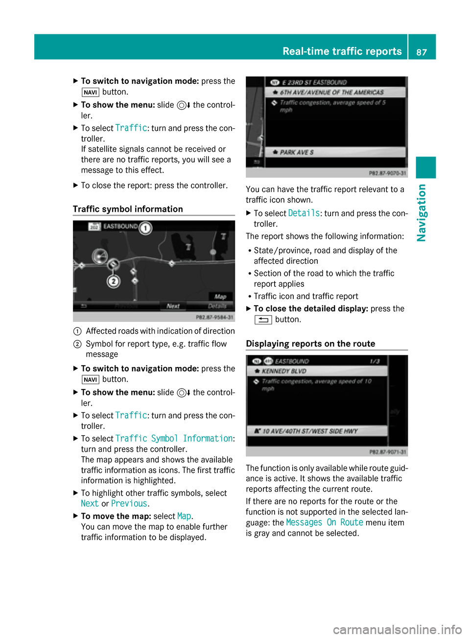
Traffic symbol information 0043
Affected roads with indication of direction
0044 Symbol for report type, e.g. traffic flow
message
X To switch to navigation mode: press the
00BE button.
X To show the menu: slide6the control-
ler.
X To select Traffic
Traffic: turn and press the con-
troller.
X To select Traffic
Traffic Symbol
Symbol Information Information:
turn and press the controller.
The map appears and shows the available
traffic information as icons. The first traffic
information is highlighted.
X To highlight other traffic symbols, select
Next
Next orPrevious Previous.
X To move the map: selectMap
Map.
You can move the map to enable further
traffic information to be displayed. You can have the traffic report relevant to a
traffic icon shown.
X
To select Details Details: turn and press the con-
troller.
The report shows the following information:
R State/province, road and display of the
affected direction
R Section of the road to which the traffic
report applies
R Traffic icon and traffic report
X To close the detailed display: press the
0038 button.
Displaying reports on the route The function is only available while route guid-
ance is active. It shows the available traffic
reports affecting the current route.
If there are no reports for the route or the
function is not supported in the selected lan-
guage: the
Messages On Route Messages On Route menu item
is gray and cannot be selected. Real-time traffic reports
87Navigation Z
Page 95 of 214

Selecting text information on the map
X To switch to navigation mode: press the
00CB button.
X To show the menu: slide6the control-
ler.
X To select Options
Options: turn and press the con-
troller.
X Select Map Content
Map Content.
X Select Text Information On Map
Text Information On Map.
The 003Bdot indicates the current setting.
X Turn and press the controller.
Current Street Current Street shows the current street
at the bottom of the display.
Geo-coordinates
Geo-coordinates shows the longitude
and latitude, elevation and number of sat-
ellites received.
X Turn and press the controller.
i The elevation shown may deviate from the
actual elevation.
i Alternatively, you can carry out this oper-
ation using the touchpad (Y page 21).
Switching highway information on/off
X To switch to navigation mode: press the
00CB button.
X To show the menu: slide6the control-
ler.
X To select Options
Options: turn and press the con-
troller.
X Select Map Content
Map Content.
X Select Highway Information Highway Information.
Switch the display in the map on 0073or off
0053. Further information (Y page 81).
i Alternatively, you can carry out this oper-
ation using the touchpad (Y page 21).
Displaying the next crossroads
X To switch to navigation mode: press the
00CB button.
X To show the menu: slide6the control-
ler.
X To select Options
Options: turn and press the con-
troller. X
Select Map Content
Map Content.
X Select Next Intersecting Street
Next Intersecting Street.
Switch the display in the map on 0073or off
0053.
Showing the map version
X To switch to navigation mode: press the
00CB button.
X To show the menu: slide6the control-
ler.
X To select Options Options: turn and press the con-
troller.
X Select Map Content Map Content.
X Select Map Version Map Version.
Information on the current map version is
shown.
i Alternatively, you can carry out this oper-
ation using the touchpad (Y page 21).
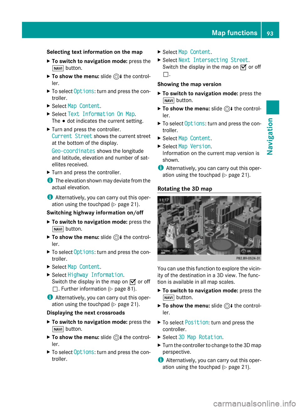
Rotating the 3D map You can use this function to explore the vicin-
ity of the destination in a 3D view. The func-
tion is available in all map scales.
X
To switch to navigation mode: press the
00BE button.
X To show the menu: slide6the control-
ler.
X To select Position Position: turn and press the
controller.
X Select 3D Map Rotation
3D Map Rotation.
X Turn the controller to change to the 3D map
perspective.
i Alternatively, you can carry out this oper-
ation using the touchpad (Y page 21). Map functions
93Navigation Z
Page 96 of 214

Additional functions:
R
Moving the map (Y page 64)Map display
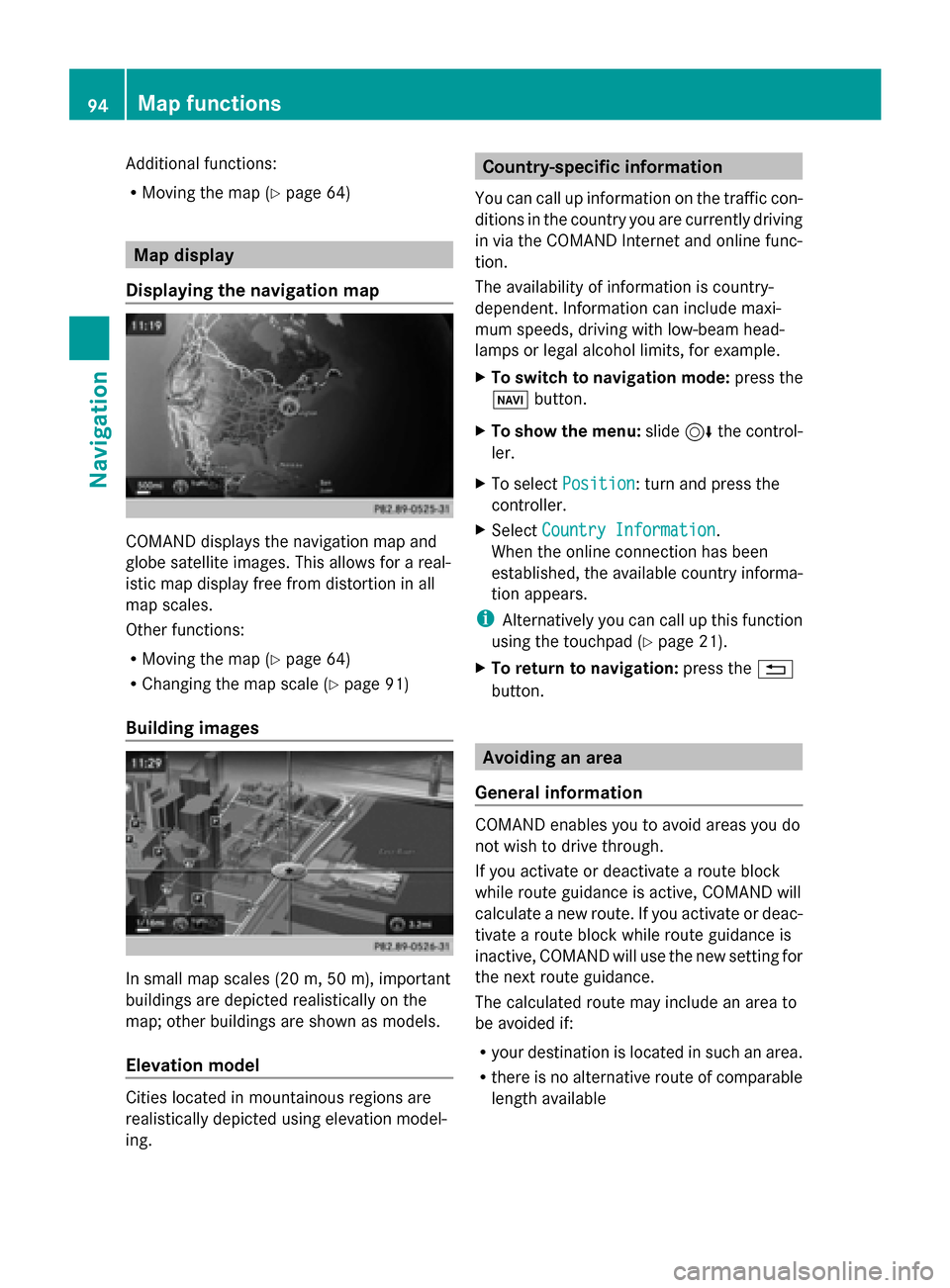
Displaying the navigation map COMAND displays the navigation map and
globe satellite images. This allows for a real-
istic map display free from distortion in all
map scales.
Other functions:
R Moving the map (Y page 64)
R Changing the map scale (Y page 91)
Building images In small map scales (20 m, 50 m), important
buildings are depicted realistically on the
map; other buildings are shown as models.
Elevation model Cities located in mountainous regions are
realistically depicted using elevation model-
ing. Country-specific information
You can call up information on the traffic con-
ditions in the country you are currently driving
in via the COMAND Internet and online func-
tion.
The availability of information is country-
dependent. Information can include maxi-
mum speeds, driving with low-beam head-
lamps or legal alcohol limits, for example.
X To switch to navigation mode: press the
00BE button.
X To show the menu: slide6the control-
ler.
X To select Position Position: turn and press the
controller.
X Select Country Information
Country Information.
When the online connection has been
established, the available country informa-
tion appears.
i Alternatively you can call up this function
using the touchpad (Y page 21).
X To return to navigation: press the0038
button. Avoiding an area
General information COMAND enables you to avoid areas you do
not wish to drive through.
If you activate or deactivate a route block
while route guidance is active, COMAND will
calculate a new route. If you activate or deac-
tivate a route block while route guidance is
inactive, COMAND will use the new setting for
the next route guidance.
The calculated route may include an area to
be avoided if:
R
your destination is located in such an area.
R there is no alternative route of comparable
length available 94
Map functionsNavigation
Page 98 of 214

Activating/deactivating the blocked area:
X To select an area: turn and press the con-
troller.
Switch blocking on 0073or off 0053.
Displaying/changing the area:
X To select an area: turn the controller.
X Slide 9the controller.
X To select Display/Change
Display/Change : press the con-
troller.
The map with the crosshair appears.
The area currently blocked is displayed as
a red square.
X To move to a different area to block: slide
1, 4,2the controller.
X To resize the blocked area: press the con-
troller.
X Turn the controller.
The size of the blocked area changes.
X To accept changes: press the controller.
A message appears stating that the area
has been set.
Deleting an area:
X To select an area: turn the controller.
X Slide 9the controller.
X Select Delete
Delete .
A prompt appears asking whether you wish
to delete the area.
X Select Yes
Yes orNo No.
After selecting Yes
Yes , the area is deleted.
Deleting all areas:
X Slide 9and press the controller while
the list is shown.
X Select Delete All
Delete All .
A prompt appears asking whether you wish
to delete all areas.
X Select Yes
Yes orNo No.
After selecting Yes
Yes , all areas are deleted.
i Alternatively, you can carry out this oper-
ation using the touchpad ( Ypage 21). SIRIUS XM service
Displaying SIRIUS XM service informa-
tion You can display the SIRIUS XM service infor-
mation.
X
To switch to navigation mode: press the
00BE button.
X To show the menu: slide6the control-
ler.
X To select Traffic Traffic: turn and press the con-
troller.
X Select SIRIUS Service
SIRIUS Service.
The provider's phone number (SIRIUS XM)
and the serial number of your service mod-
ule are displayed.
i Alternatively you can call up this function
using the touchpad ( Ypage 21).
Registering for the SIRIUS XM traffic
report service X
Call the provider telephone number shown
on the COMAND display.
i You can also have the satellite service
activated online. To do so, visit the SIRIUS
XM Radio website at
http://www.sirius.com (USA).
Once the connection has been established:
X Follow the service employee's instructions.
The activation process may take up to ten
minutes.
If registration is not included when purchas-
ing the system, your credit card details will be
required to activate your account. Updating the digital map
Introduction The digital maps generated by the map soft-
ware become outdated in the same way as
conventional road maps. Optimal route guid-
ance can only be provided by the navigation96
Map functionsNavigation