Page 89 of 106
Navigation 161
Reference Data
• (Day Map Color):
Select the screen color used in daytime mode.
• (Night Map Color):
Select the screen color used in nighttime mode. •
(Track Logs):
Turns the path log save function on or off (saves in positional order
for each trip).
• (Place Markers):
Select a spot displayed on th e map during navigation. We
recommend reducing the number of spots displayed as much as
possible as the map is difficult to see if there are too many spots.
Because of this, the software is designed to allow multiple spot
displays. Follow the steps below.
- Touch the check box to show or hide the spot category.
- Touch the spot category name to open a sub-category.
- Touch (More) to save the currentl y displayed spot position, or read
spot displays saved previously. You can also restore the default display
settings.
Day Map Color
Night Map Color
Track Logs
Place Markers
More
Page 90 of 106
:
You can set the data fields displaye d at the corner of the Map screen
to match your")
162 Navigation
Reference Data
Visual Guidance
Changes settings related to Map screen guidance.• (Data Fields):
You can set the data fields displaye d at the corner of the Map screen
to match your needs. Touch this button and select the guidance you
want to display. Values may differ when driving without having set a
destination in route navigation. You can select altitude and so on for
a standard trip data, or select route data related to the final
destination or the next waypoint on the route.
• (Highway Services):
Displays service area information while driving on the expressway.
You can turn this function on and off.
• (Facility Types):
Touch this button and select the service area information display
items you want to display.
• (Signposts):
When information is available, lane information similar to overhead
road traffic signs is displayed at th e top of the map. You can turn this
function on and off.
• (Junction View):
When approaching an expressway exit or a complicated intersection,
the map switches to a 3D display if the necessary information can be
displayed. •
(Route Progress Bar):
Turns on the route progress bar which is displayed as a straight line
to the left of the map. This show s the progress made on the current
route. When a blue arrow is used to indicate position, the arrow
continues to rise as you drive towards your destination. Waypoints
and traffic conditions are displayed on the line.
Data Fields
Highway Services
Facility Types
Signposts
Junction View
Route Progress Bar
Page 91 of 106
:
Sets the units used by the prog ram to measure distance. Voice
guidance languages do")
Navigation 163
Reference Data
Units and Formats
Sets display units and the date display.• (Units and Formats):
Sets the units used by the prog ram to measure distance. Voice
guidance languages do not support all units displayed in the list.
You can select to display the time in various international date
formats.
Types of display units and date display settings: • (Distance):
Switches the units used to display distance.
• (Fuel Economy):
Switches the units used to display fuel consumption.
• (Currency):
Displays the keyboard screen allowing you to enter the currency
name. (For the keyboard, see “Using the Keyboard” on Page 82.)
• (Date Format):
Switches the units used to display the date.
• (Date Delimiter):
Switches the date delimiter.
• (Coordinate Display Format):
Switches the coordinate display format.
Tr i p M o n i to r
Contains useful information on the user's distance moved in the trip
logs and path logs. You can save trip logs automatically by turning this
setting on, or save them manually wh en arriving at a destination. You
can view all logs on the trip monitor. Launch the trip monitor from the
“Others” menu. • (Enable Auto-Saving):
The trip monitor saves statistical data for the distance traveled. You
can set it so that the route is sa ved automatically if you need a log
after driving.
• Trip Database Size:
This is not a button. This line indi cates the current size of the trip
database. This shows the total for all saved trip logs and path logs.
• (Save Track Log):
You can save path logs (positional order acquired from GPS receiver)
in the trip log.
Units and Formats
Distance
Fuel Economy
Currency
Date Format
Date Delimiter
Coordinate Display Format
Enable Auto-Saving
Save Track Log
Page 92 of 106
, but to acquire a 3D position at least four
signals")
164 Navigation
Glossary
2D/3D GPS reception
The GPS receiver uses signals from satellites to calculate its current
position (the user's position), but to acquire a 3D position at least four
signals are necessary, including alti tude. The GPS device may not be
able to acquire signals from four sate llites as they are constantly moving
and obstacles may block satellite signals. Although the accuracy
decreases when only three signals ca n be acquired, and altitude data
cannot be sent, the receiver can ca lculate a latitude and longitude GPS
position. Only 2D reception is possible.
Route being navigated
The route currently being navigated. When a destination is set, the
route will be continuously navigate d until the destination is deleted,
you arrive at the destination, or the software is closed. Also see “Route”.
City center
The center of the city/town is not th e geographical center of the city/
town, but a location set by the cartog rapher. In towns and villages, this
is usually the most important intersec tion, while in larger cities it is
selected from multiple important intersections.
Color design
The color design used for the map an d menu screens differs for daytime
and nighttime. Each design has a different graphic setting, with 2D and
3D each having colors for roads, bl ocks, seas, and lakes, whilst shadow
changes and shadows are displayed differently in 3D mode.
Daytime screen and nighttime scr een designs for the map and menu
are selected one at a time. The desi gn changes automatically when day
becomes night and night becomes day. GPS accuracy
Various factors can contribute to a margin of error between the user's
actual position and the position
acquired from the GPS device. For
example, signal delays in the iono sphere or reflections from objects
around the GPS equipment, can infl uence the accuracy with which the
GPS device can calculate the user's position.
Maps
Although this software uses digita l maps, these are not simply digital
conversions from printed maps. The 2D mode digital map represents
roads in the same way as a traditional printed map, using color
classifications to show streets, roads, and changes in altitude.
In 3D mode, you can confirm differ ences in altitude for mountains,
valleys, highland roads and so on, an d display areas of cities using 3D
landmarks and 3D images of buildings.
The digital map can be used intera ctively. You can zoom in and out
(enlarge/reduce), tilt up and down, an d rotate left and right. By using
navigation that supports GPS, you ca n easily plan your route with the
digital maps.
North Up Map Direction
North Up mode rotates the map so th at North is always at the top of
the map. You can use this direction with Find On Map and so on. Also
see “Heads-up Map Direction”.
Page 93 of 106
,
presenting them as they occur unti")
Navigation 165
Glossary
Route
The route is an ordered arrangement of the route events (the next
change in the route - right or left turns, roundabouts, and so on),
presenting them as they occur until you reach your destination. If there
is one starting point, there must be at least one destination. On startup,
the start point is the current position (or the last confirmed position). If
you need to check a route that is not currently being driven, you can
move the start point to wherever you want.
Heads-up Map Direction
Heads-up mode rotates the map so that the direction you are currently
traveling is always at the top of the map. This is the default direction in
3D map display mode. Also see “North Up Map Direction”.
Glossary
To enhance your enjoyment of this pr oduct, please familiarize yourself
with the following terms. • GPS (Global Positioning System)
GPS is a system that detects the current location (latitude, longitude,
altitude) by receiving radio waves fr om 4 or more GPS satellites in
normal situations, or sometimes from 3 satellites.
These satellites are launched and managed by the US Department of
Defense mainly for military use, bu t they are also open for private
use. This unit performs navigati on using GPS information, various
sensors, and road map data.
Page 94 of 106

166 Navigation
Glossary
•Wide area map, detailed map
The wide area map is a map of a la rge area, and the detailed map is a
map of a small area. The scales of the maps are 1/20,480,000,
1/10,240,000, 1/5,120,000, 1/ 2, 560,000, 1/1,280,000, 1/640,000,
1/320,000, 1/160,000, 1/80,000, 1/40,000, 1/20,000, 1/10,000, and
1/5,000.
• Positioning
The quality of the GPS positioning is displayed in the top right of the
menu screen. The greater the number of displayed symbols, the
higher the precision of the GPS positioning. •
2D positioning and 3D positioning
GPS calculates positions using triangulation.
The distance to the satellite can be determined when the radio wave
from that satellite is received, and the current location can be
measured by receiving radio waves from 3 satellites.
However, because there is a margin of error in the GPS satellites and
navigation unit, positioning is performed in only the 2 dimensions of
latitude and longitude when radio waves from only 3 satellites can
be received. The precision will be lower in this case. When radio
waves from 4 or more GPS satellites are received, positioning is
performed in the 3 dimensions of la titude, longitude, and altitude.
3D positioning is more precise than 2D positioning, and it reduces
the margin of error in the vehicle location display.
Actual position
Signals do not cross at one point
Position determined by 2D positioning
Page 95 of 106

Navigation 167
End-user License Agreement
1 The contracting parties
1.1 This Agreement has been entered into by and between NNG Kft.
(registered seat: 23 Bérc utca, H- 1016 Budapest, Hungary; Company
reg.no.: 01-09-891838) as Licensor (hereinafter: Licensor) and You as
the User (hereinafter: User; the User and the Licensor jointly referred
to as: Parties) in subject of the use of the software product specified in
this Agreement.
2 Conclusion of the Agreement
2.1 The Parties hereby acknowledge that this Agreement shall be concluded by implicit conduct of the Parties without signing the
Agreement.
2.2 The User hereby acknowledges th at following the lawful acquisition
of the software product constituti ng the object of this Agreement
(Section 4), any degree of use, inst allation into a computer or other
hardware, installation of such hardwa re into a vehicle, pressing of the
“Accept” button displayed by the so ftware during installation or use
(hereinafter referred to as Use) sh all mean that the User has accepted
the terms and conditions of this Agreement as legally binding.
2.3 This Agreement shall by no means authorize use of the software product by those persons having un lawfully acquired the software
product or having unlawfully installed it on a computer or in a vehicle.
3 Relevant laws and regulations
3.1 Any action related to this Agreem ent will be governed by the laws of
the Republic of Hungary, with spec ific reference to Act IV of 1959 on
the Civil Code and to Act LXXVI of 1999 on Copyrights shall apply.
3.2 The original language version of this Agreement is the Hungarian
version. This Agreement has versions in other languages as well. In
case of dispute the Hungarian version shall prevail. 4 Object of the Agreement and Termination
4.1 The object of this Agreement shall be the navigation guidance
software product of Licensor (hereina fter referred to as the Software
Product).
4.2 The Software Product shall include the operating computer program, its complete documentation, the map database pertaining thereto
and any third-party content and services accessib le through the
Software Product (hereinafter: Database).
4.3 Any form of display, storage, codi ng, including printed, electronic or
graphic display, storage, source or object code, or any other as yet
undefined form of display, storage, or coding, or any medium thereof
shall be deemed parts of the Software Product.
4.4 Error corrections, additions, upda tes used by the User following the
conclusion of this Agreement shal l also be deemed parts of the
Software Product.
4.5 Your rights under this Agreement will terminate immediately without
notice from Licensor if you materially breach it or take any action in
derogation of Licensor's and/or its Licensor's rights to the Software
Product. Licensor may terminate th is Agreement should any Software
Product become, or Licensor's reasonable opinion likely to become,
the subject of a claim of intellectu al property infringement or trade
secret misappropriation. Upon termin ation, you will cease use of, and
destroy Software Product and conf irm compliance in writing to
Licensor
Page 96 of 106

168 Navigation
End-user License Agreement
5 Rights under copyright
5.1 Unless otherwise provided by law or contractual provisions, the Licensor is the sole and exclusive owner of all material copyrights
vested in the Software Product.
5.2 Copyrights extend to the whole Software Product and to its parts separately as well.
5.3 The owner(s) of the copyrights of the Database forming part of the
Software Product is (are) the natura l person(s) or corporate entity(ies)
listed in the Appendix to this Agr eement or in the “About” menu item
of the operating computer progra m (hereinafter referred to as
Database Owner). The user's manual of the Software Product includes
the name of the menu option wher e all the owners of the Database
items are listed. The Licensor here by states that it has obtained
sufficient usage and representation rights from the Database owners
in order to utilise the Database, to of fer it for utilisation and to transfer
it for utilisation as set forth in this Agreement.
5.4 Pursuant to this Agreement, all ri ghts vested in the Software Product
shall remain in the ownership of the Licensor, except for those to
which the User is entitled under la w or by virtue of this Agreement. 6 Rights of the User
6.1 The User is entitled to install th
e Software Product into one hardware
device (desktop, handheld, portable computer, navigation device),
and to run and use one copy of the Software Product or a preinstalled
copy of the Software Product thereon.
6.2 The User is entitled to make one backup copy of the Software
Product. However, if the Software Pr oduct operates after installation
without the use of the original me dia copy, then the original media
copy shall be deemed to be a backup copy. In all other cases, the User
is only entitled to use the backup copy if the original media copy of
the Software Product has been ascertainably and unequivocally
rendered unsuitable for its lawful and intended use.
 1
1 2
2 3
3 4
4 5
5 6
6 7
7 8
8 9
9 10
10 11
11 12
12 13
13 14
14 15
15 16
16 17
17 18
18 19
19 20
20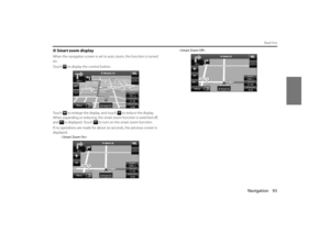 21
21 22
22 23
23 24
24 25
25 26
26 27
27 28
28 29
29 30
30 31
31 32
32 33
33 34
34 35
35 36
36 37
37 38
38 39
39 40
40 41
41 42
42 43
43 44
44 45
45 46
46 47
47 48
48 49
49 50
50 51
51 52
52 53
53 54
54 55
55 56
56 57
57 58
58 59
59 60
60 61
61 62
62 63
63 64
64 65
65 66
66 67
67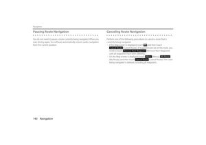 68
68 69
69 70
70 71
71 72
72 73
73 74
74 75
75 76
76 77
77 78
78 79
79 80
80 81
81 82
82 83
83 84
84 85
85 86
86 87
87 88
88 89
89 90
90 91
91 92
92 93
93 94
94 95
95 96
96 97
97 98
98 99
99 100
100 101
101 102
102 103
103 104
104 105
105:
Select the screen color used in daytime mode.
• (Night Map Color):
Select the screen color used in nighttime mode. •
(Track Logs):
Turns the pa")