2014 Seat Leon 5D navigation
[x] Cancel search: navigationPage 43 of 84
Navigation
● In the System setup menu, press the
S y
stem information function button.
● Press Update software to import the stored
navigation data.
● Follow the instructions displayed on the
screen.
Once installed, the memory card can be re-
moved. The memory card must be prepared
for removal ››› page 23. CAUTION
Do not remove the memory card while the
navigation data is being installed. The memo-
ry card may be irreparably damaged! Note
● The navigation memory card may not be
used as memory storage for other files. The
Infotainment system will not recognise the
files saved on it.
● SEAT recommends a CLASS 10 1)
memory
card for the use of navigation data. The use of
other memory cards could limit its operation. Navigation main men
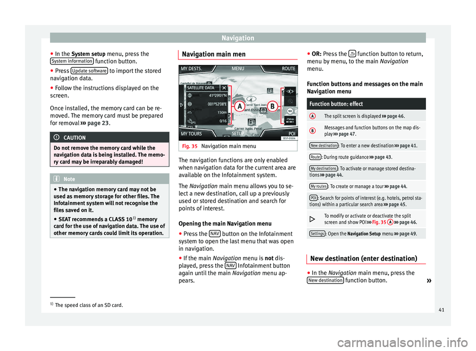
Fig. 35
Navigation main menu The navigation functions are only enabled
when navigation data for the current area are
available on the Infotainment system.
The
Navigation
main menu allows you to se-
l
ect a new destination, call up a previously
used or stored destination and search for
points of interest.
Opening the main Navigation menu
● Press the NAV button on the Infotainment
system to open the last menu that was open
in navigation.
● If the main Navigation menu is
not
dis-
p
layed, press the NAV Infotainment button
again until the main Navigation menu ap-
pe ar
s. ●
OR: Press the function button to return,
menu by menu, to the main Navigation
menu.
Function buttons and messages on the main
Navigation menu
Function button: effect
AThe split screen is displayed ››› page 46.
BMessages and function buttons on the map dis-
play ››› page 47.
New destination: To enter a new destination ››› page 41.
Route: During route guidance ››› page 43.
My destinations: To activate or manage stored destina-
tions ››› page 44.
My routes: To create or manage a tour ››› page 44.
POI: Search for points of interest (e.g. hotels, petrol sta-
tions) within a particular search area ››› page 45.
To modify or activate or deactivate the split
screen and show POI
››› Fig. 35 A
››› page 46.
Settings: Open the Navigation Setup menu ››› page 49. New destination (enter destination)
●
In the Navigation
main menu, press the
New de
stination function button.
»1)
The speed class of an SD card.
41
Page 44 of 84
Navigation
● Press the Options function button and se-
lect the required type of destination entry
( Address, Point of Interest
or On the map).
Ad dr
ess
After entering a country and a town, you can
start navigating towards the centre of the se-
lected town.
When narrowing down the destination ad-
dress, please note that every entry restricts
the av
ailable range of subsequent selections.
For instance, if the street you are looking for
is not
in the postcode area you have selected
in a previous window, you will not be able to
find the street at the street selection stage.
Function button: effect
Country: To select the desired country.
Location: To enter the desired town or postcode.
Street: To enter the desired street name.
House number: To enter the desired house number.
Dipped beam: To select the desired intersection.
Last destinations: Open the My destinations menu
››› page 44.
Start: Start route guidance to the selected address. Points of Interest (POI)
Start route guidance to a point of interest.
Function button: effect
Search area: To select the search area for the points of in-
terest.
Near current location: The points of interest are
searched for near the current location.
Near destinationa) : The points of interest are
searched for near the destination.
Along the routea) : The points of interest are searched
for along the route.
Near address: The points of interest are searched for
near the address.
Select on map: The points of interest are searched
for near the destination selected on the map. To se-
lect a destination on the map, press the Edit
func-
tion button.
Search category: Select the main category (e.g. Vehicle
and travel), the category (e.g. Airports) and then the de-
sired entry from the list.
Save: To save the selected point of interest in the
destination memory ››› page 44.
Dial number: Establishes a telephone connection to
the number registered under the point of interest.
Start: Starts guided navigation to the selected
point of interest.
Find name: To search for a point of interest by entering
the name or by means of synonyms of categories (e.g.
“Sleep” for hotels and hostels).
a) This function button is only displayed with route guidance ac-
tivated.
Using the
● Select the destination on the map or enter
the GPS coordinates and confirm with OK .
Function button: effect
Save: To save the selected point of interest in the desti-
nation memory ››› page 44.
Edit: To edit a destination or to enter another destina-
tion.
Route options: To adjust route options, see Navigation
Setup ››› page 49.
Start: Starts guided navigation to the selected point of
interest. After starting route guidance
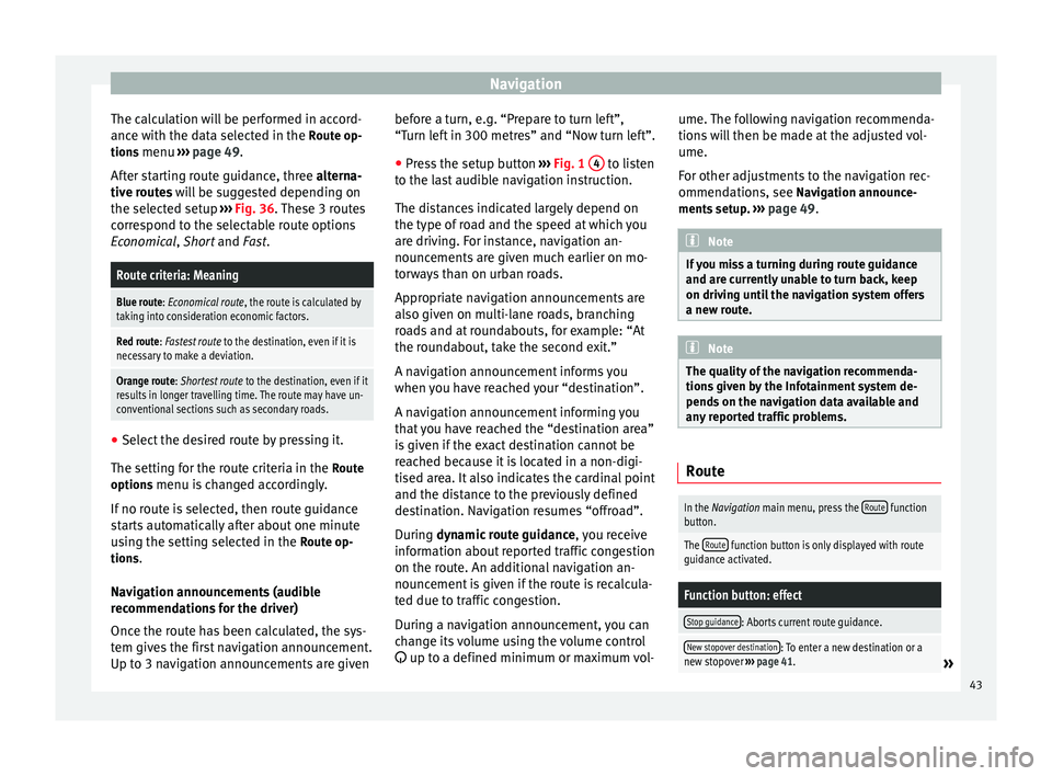
Fig. 36
Route calculation. After starting route guidance, the route to the
first destination will be calculated.
42
Page 45 of 84
Navigation
The calculation will be performed in accord-
ance with the data selected in the Route op- tions menu ››› page 49 .
Af t
er starting route guidance, three
alterna-
tive routes will be suggested depending on
the selected setup ››› Fig. 36. These 3 routes
correspond to the selectable route options
Economical
, Short and Fast.
Route criteria: Meaning
Blue route: Economical route, the route is calculated by taking into consideration economic factors.
Red route: Fastest route to the destination, even if it is
necessary to make a deviation.
Orange route: Shortest route to the destination, even if it
results in longer travelling time. The route may have un-
conventional sections such as secondary roads. ●
Select the desired route by pressing it.
The setting for the route criteria in the Route
options menu is changed accordingly.
If no route is selected, then route guidance
starts automatically after about one minute
using the setting selected in the Route op-
tions .
Navigation announcements (audible
recommendations for the driver)
Once the route has been calculated, the sys-
tem gives the first navigation announcement.
Up to 3 navigation announcements are given before a turn, e.g. “Prepare to turn left”,
“Turn left in 300 metres” and “Now turn left”.
● Press the setup button ››› Fig. 1 4 to listen
to the last audible navigation instruction.
The distances indicated largely depend on
the type of road and the speed at which you
are driving. For instance, navigation an-
nouncements are given much earlier on mo-
torways than on urban roads.
Appropriate navigation announcements are
also given on multi-lane roads, branching
roads and at roundabouts, for example: “At
the roundabout, take the second exit.”
A navigation announcement informs you
when you have reached your “destination”.
A navigation announcement informing you
that you have reached the “destination area”
is given if the exact destination cannot be
reached because it is located in a non-digi-
tised area. It also indicates the cardinal point
and the distance to the previously defined
destination. Navigation resumes “offroad”.
During dynamic route guidance
,
y
ou receive
information about reported traffic congestion
on the route. An additional navigation an-
nouncement is given if the route is recalcula-
ted due to traffic congestion.
During a navigation announcement, you can
change its volume using the volume control
up to a defined minimum or maximum vol- ume. The following navigation recommenda-
tions will then be made at the adjusted vol-
ume.
For other adjustments to the navigation rec-
ommendations, see Navigation announce-
ments
setup. ››› page 49. Note
If you miss a turning during route guidance
and are currently unable to turn back, keep
on driving until the navigation system offers
a new route. Note
The quality of the navigation recommenda-
tions given by the Infotainment system de-
pends on the navigation data available and
any reported traffic problems. Route
In the Navigation main menu, press the
Route function
button.
The Route function button is only displayed with route
guidance activated.
Function button: effect
Stop guidance: Aborts current route guidance.
New stopover destination: To enter a new destination or a
new stopover ››› page 41.» 43
Page 46 of 84
NavigationFunction button: effect
Route information: View route information for current
route.
Store destination: To store the selected destina-
tion in the destination memory.
Congestion ahead: To exclude a section (of 0.2 to 10 km in
length) from the current route, e.g. to avoid congestion.
To cancel the exclusion, press the Route
function button
and then Cancel congestion.
Change route: The map of the calculated route appears
and by holding a finger on the route and dragging the
finger across said map, the route is changed to the
road(s) that you want and the new route is then recalcu-
lated. My destinations (destination memory)
The stored destinations can be selected from
the My destinations
menu.
● Press the My destinations function button in
the main Navigation
menu.
● Sel
ect the desired function button.
Store position ,
Destinations or
Home address .
Store position ● By pressing the Store position function but-
ton, the indicated position is stored as Flag-
ged destination in the Destination memory.
To permanently retain the position stored as
a Flagged destination, it must be renamed in the Destination memory. Otherwise the stored
position will be overwritten the next time a
flagged destination is stored.
● Mark the Flagged destination in the Destina-
tion memory.
● Press the Save function button.
The name can be changed in the following in-
put window. Press the function button to
store the destination.
Destinations and contacts
● Select the desired function button.
Function button: effect
Recent destinations: View of destinations for which a route
has already been started.
Dest. memory: View of destinations stored manually and
from imported vCards ››› page 48, Importing vCards
(electronic business cards) .
Favourites: View of destinations stored as favourites.
Contacts: View of entries in the phonebook that have a
stored address (postal address). Home address
Only one address or position can be stored
as the home address at any one time. The
stored home address can be edited or over-
written.If a home address has already been stored,
route guidance will be started to the stored
home address.
If a home address has not yet been stored,
an address can be assigned as the home ad-
dress.
Assigning the home address for the first time:
Position: Press to store the vehicle's current position as
the home address.
Address: Press to enter the home address manually.
Editing the home address:
The home address can be edited in the Navigation setup
menu ››› page 49.
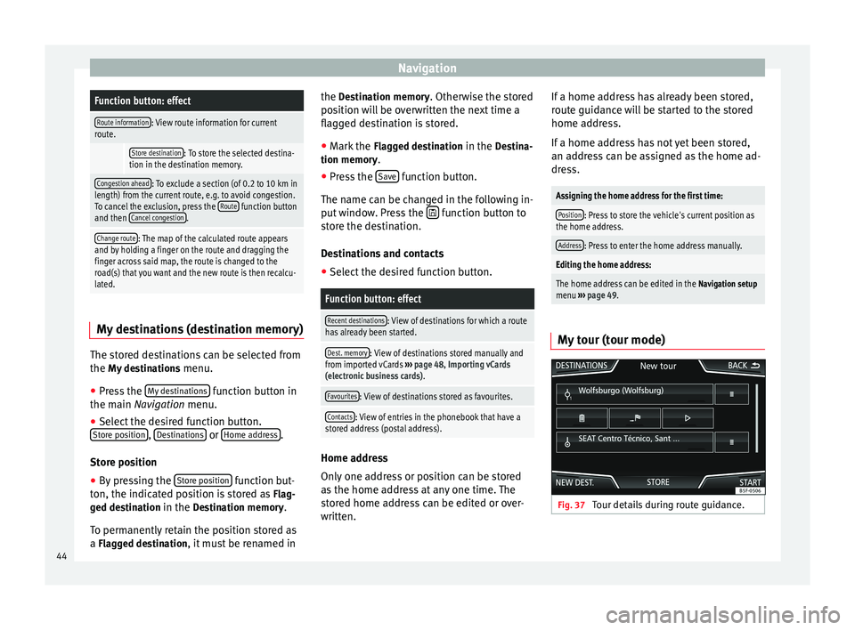
My tour (tour mode) Fig. 37
Tour details during route guidance.44
Page 47 of 84
Navigation
Several destinations can be defined in tour
mode. A trip with multiple destinations is
called a “Tour”.
The “starting point” of a tour is always the
vehicle position determined by the Infotain-
ment system. The “destination” is the end
point of a tour. “Stopover destinations” are
driven to before the destination.
● Press the My tours function button in the
main Navigation
menu.
● Sel
ect the desired function button ( Edit
tour, New tour or Tour Memory).
Function buttons on the My tours pop-up
window
Function button: effect
Edit waypoint toura) : To edit and store the active tour.
New tour: To create a new tour.
Tour memory: To Delete, Edit or Start a stored tour.
a)
This function button is only displayed when route guidance is
activated in tour mode.
Display and function buttons on the New tour
and Edit tour
menu
Function button or message: function or meaning
Stopover.
Destination.
...Estimated time of arrival at destination.
...Calculated distance to destination.
Press on the destination to display the function but-
tons.
Delete destination.
To start guidance direct to the selected
destination. Destinations that come before
the selected destination are ignored.
To open the detailed view of the destina-
tion in question.
Available function buttons.
New desti-
nationTo add a new destination to the tour.
My desti-
nationsTo add a new destination from My destina-
tions to the tour.
StoringTo store the created tour in the tour memo-
ry.
StartTo start route guidance.
CalculateTo update calculated distance and estima-
ted arrival time. a)
StopTo stop route guidance to the active desti-
nation.b)
To move a stopover or a destination to an-
other position on the list. Press and drag
to move the destination.
a)
This function button is only displayed with route guidance ac-
tivated and when a destination has been added to the tour.
b) This function button is only displayed with route guidance ac-
tivated.
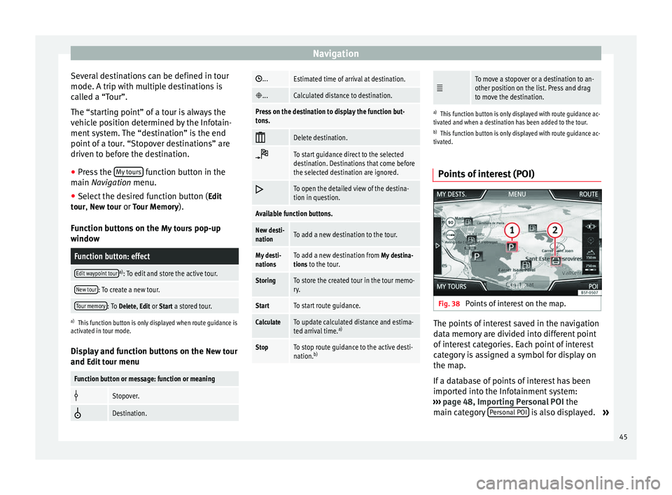
Points of interest (POI) Fig. 38
Points of interest on the map. The points of interest saved in the navigation
data memory are divided into different point
of interest categories. Each point of interest
category is assigned a symbol for display on
the map.
If a database of points of interest has been
imported into the Infotainment system:
››› page 48, Importing Personal POI the
main category Personal POI is also displayed.
»
45
Page 48 of 84
Navigation
In the Map setup menu, the categories of
points of
interest to display on the map can
be configured ››› page 49. Up to 10 catego-
ries
of points of interest can be selected.
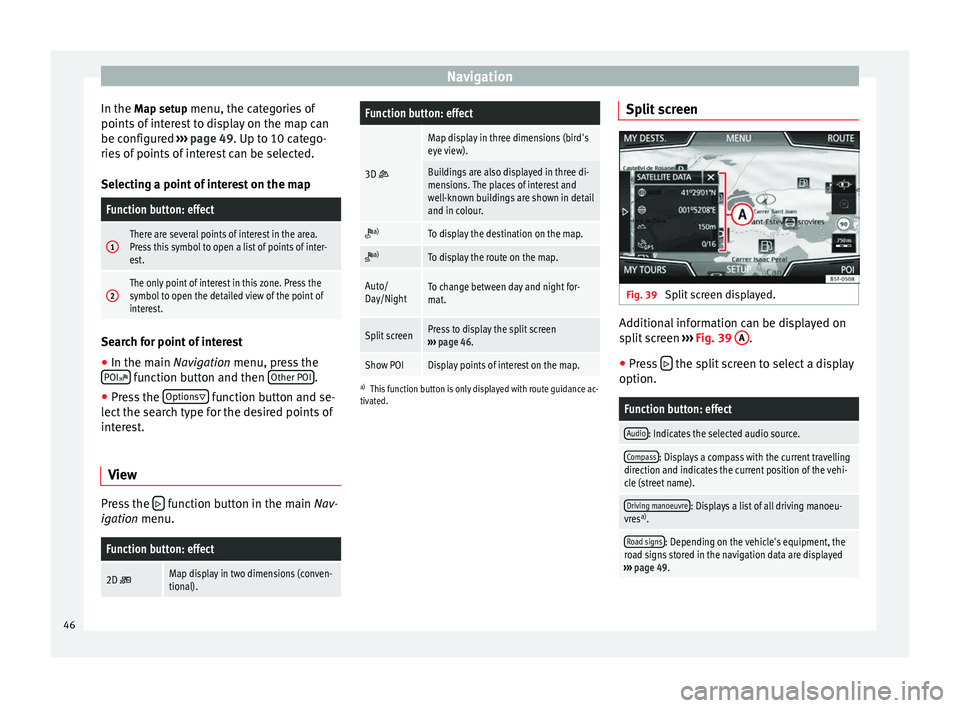
Selecting a point of interest on the map
Function button: effect
1There are several points of interest in the area.
Press this symbol to open a list of points of inter-
est.
2The only point of interest in this zone. Press the
symbol to open the detailed view of the point of
interest. Search for point of interest
●
In the main Navigation menu, press the
POI function button and then
Other POI .
● Press the Options
function button and se-
lect the search type for the desired points of
interest.
View Press the
function button in the main Nav-
igation menu.
Function button: effect
2D Map display in two dimensions (conven-
tional).
Function button: effect
3D
Map display in three dimensions (bird's
eye view).
Buildings are also displayed in three di-
mensions. The places of interest and
well-known buildings are shown in detail
and in colour.
a)To display the destination on the map.
a)To display the route on the map.
Auto/
Day/NightTo change between day and night for-
mat.
Split screenPress to display the split screen
››› page 46.
Show POIDisplay points of interest on the map.
a)
This function button is only displayed with route guidance ac-
tivated.
Split screen Fig. 39
Split screen displayed. Additional information can be displayed on
split screen
››› Fig. 39 A .
● Press the split screen to select a display
option.
Function button: effect
Audio: Indicates the selected audio source.
Compass: Displays a compass with the current travelling
direction and indicates the current position of the vehi-
cle (street name).
Driving manoeuvre: Displays a list of all driving manoeu-
vres a)
.
Road signs: Depending on the vehicle's equipment, the
road signs stored in the navigation data are displayed
››› page 49. 46
Page 49 of 84
NavigationFunction button: effect
Satellite data: current vehicle position in coordinates and
GPS status (satellite reception).
a) This function button is only displayed with route guidance ac-
tivated.
Press the function button to deactivate the
split screen.
Map display Fig. 40
Messages and function buttons on
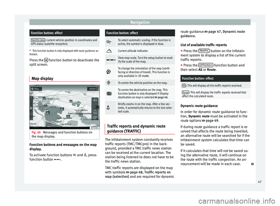
the map display. Function buttons and messages on the map
display.
To activate function buttons
and , press
function button .
Function button: effect
To select automatic scaling. If the function is
active, the symbol is displayed in blue.
Current altitude indicator.
View map scale. Turn the setup button to mod-
ify the scale of the map.
To change the orientation of the map (north-
facing or direction of travel). This function is
only available in 2D mode.
To centre the vehicle position on the map.
To centre the destination on the map. This
function button is only displayed if
Display
destination on map is selected ››› page 46.
Briefly zooms in on the map. After a few sec-
onds, it automatically returns to the last selec-
ted scale.
Traffic reports and dynamic route
guidance (TRAFFIC)
The Infotainment system constantly receives
traffic reports (TMC/TMCpro) in the back-
ground, provided a TMC traffic news station
can be received at the current location. The
station being listened to does not have to be
the traffic news station.
TMC traffic reports are displayed on the map
with symbols
››› page 48, Traffic reports on
map (selection) and are required for dynamic r
out
e guidance
››› page 47, Dynamic route
guidance
.
List of available traffic reports
● Press the TRAFFIC button on the Infotain-
ment system to display a list of the current
traffic reports.
● Press the OPTIONS function button and
then select All or Route.
Function button: effect
All: This will display all the traffic reports received.
Route: This will display the traffic reports received that
affect the calculated route. Dynamic route guidance
In order for dynamic route guidance to func-
tion,
Dynamic route
must be activated in the
route options ›››
page 49.
If during route guidance a traffic report is re-
ceived that affects the route being travelled,
an alternative route will be searched for if the
Infotainment system calculates that time can
be saved.
If it calculates that time will not be saved us-
ing the alternative route, it will continue on
the route with the traffic congestion. An an-
nouncement will be made in each case. »
47
Page 50 of 84
Navigation
Shortly before arriving at the announced con-
gested traffic, it will be announced once
again.
Avoiding congestion by following the instruc-
tions of a traffic report does not always save
time as the alternate roads may be at a
standstill. The quality of the dynamic route
guidance depends on the information con-
tained in the traffic reports.
The remainder of the route to be travelled
may be manually excluded to cause a new
route calculation ››› page 43.
Traffic reports on map (selection)Symbol: Meaning
: Traffic congestion
: Traffic jam
: Accident
: Black ice
: Risk of skidding
: Danger
: Road works
Symbol: Meaning
: Strong wind
: Road closed to traffic
During route guidance, traffic congestion that
does
not affect the route calculated is dis-
p l
ayed in grey.
The extent of the traffic congestion along the
route calculated is shown by a red line.
Any incidents that affect the route calculated
and have caused the route to be recalculated
are displayed in orange.
The position of a symbol indicates the start
of the traffic congestion if it is clearly defined
in the traffic report.
Importing vCards (electronic business
cards) Importing vCards to the destination memory
● Insert the data storage device with the stor-
ed vCards or connect it to the Infotainment
system ›››
page 23 .
● Pr e
ss the SETUP function button in the
main Navigation
menu.
● In the Nav
igation setup menu, press the
Import destinations function button.●
Select the data carrier with the vCards
saved in the list.
● Press Import all vCards in the folder .
● Confirm the import notice with the OK function button.
The saved vCards will now be in the destina-
tion memory
››› page 44 and may be used for
n av
igation. Note
Only one address per vCard can be imported.
In the event any vCards have several address-
es, only the main address will be imported. Importing Personal POI
Importing the Personal POI to a points of
interest destination memory
● Insert the data storage device with the stor-
ed Personal POI or connect it to the Infotain-
ment system ›››
page 23 .
● Pr e
ss the Infotainment MENU button and
then select Setup .
● In the System setup
menu, press the
System information function button.
● Press Update software to import the Personal
POI.
● Confirm the import notice with the OK function button.
48