Page 12 of 112
90 Navigation
Read First
Map Screen
Navigating on the Map
In the navigation menu startup screen, the currently active map is
reduced and displayed in (Show Map).
To enlarge the map, touch (Show Map) to open the Map
screen.
This map shows the current position (shown as the vehicle marked as a
blue arrow), recommended routes (orange lines), and the immediate
surrounding area.
When GPS positioning is not active, the vehicle marker is clear. The
latest confirmed position is displayed. Colored spots are displayed on the circle around the satellite icon in the
top left corner. The more spots ther
e are on the circle, the higher the
accuracy of the GPS positioning.
When GPS positioning is active, the ve hicle marker is displayed in full-
color, and the current position is shown.
Show Map
Show Map
Page 21 of 112
Navigation 99
Read First
■Smart zoom display
When the navigation screen is set to auto zoom, this function is turned
on.
Touch to display the control button.
Touch to enlarge the display, and touch to reduce the display.
When expanding or reducing, the smart zoom function is switched off,
and is displayed. Touch to turn on the smart zoom function.
If no operations are made for about six seconds, the previous screen is
displayed.
■
Map operations
You can touch a position on the ma p, and then check that position
during navigation. The map's current position tracking function stops
(the car marker (a blue arrow by defa ult) is not fixed in position on the
screen), and the control buttons are displayed allowing you to change
the map display.
Page 79 of 112

Navigation 157
Navigation
Voice Control Navigation
By using the voice control system (voice input microphone
and button), you can set the destination by giving voice
commands. This enables you to use functions that are usually
inoperable while driving.
1By using the voice recognition button you can use voice
commands to operate the navigation. (See Page 295.)
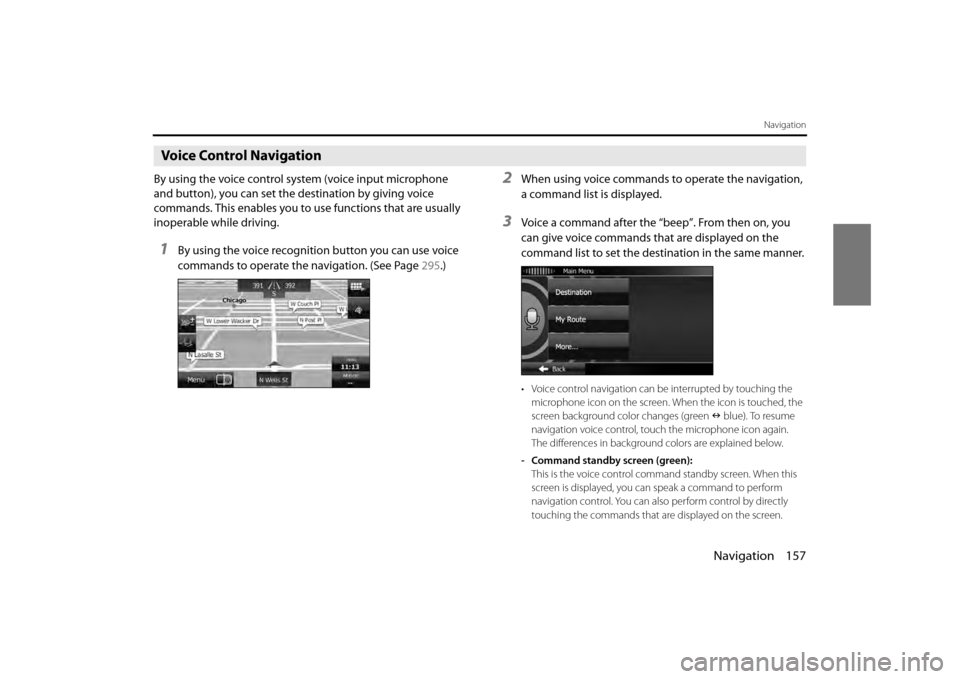
2When using voice commands to operate the navigation,
a command list is displayed.
3Voice a command after the “beep”. From then on, you
can give voice commands that are displayed on the
command list to set the destination in the same manner.
• Voice control navigation can be interrupted by touching the
microphone icon on the screen. When the icon is touched, the
screen background color changes (green blue). To resume
navigation voice control, touc h the microphone icon again.
The differences in background colors are explained below.
- Command standby screen (green): This is the voice control command standby screen. When this
screen is displayed, you can speak a command to perform
navigation control. You can also perform control by directly
touching the commands that ar e displayed on the screen.
Page 80 of 112
158 Navigation
Navigation
- Manual mode screen (blue):This screen appears when voice control is interrupted. You can
perform control by directly touching the commands that are
displayed on the screen.
- Talkback screen (yellow): This screen appears while the ta lkback voice is being played
when a command is recognized.
- Command recognition failed screen (red): This screen appears when command recognition failed.
Page 96 of 112

174 Navigation
Reference Data
Visual Guidance
Changes settings related to Map screen guidance.• (Data Fields):
You can set the data fields displaye d at the corner of the Map screen
to match your needs. Touch this button and select the guidance you
want to display. Values may differ when driving without having set a
destination in route navigation. You can select altitude and so on for
a standard trip data, or select route data related to the final
destination or the next waypoint on the route.
• (Highway Services):
Displays service area information while driving on the expressway.
You can turn this function on and off.
• (Facility Types):
Touch this button and select the service area information display
items you want to display.
• (Signposts):
When information is available, lane information similar to overhead
road traffic signs is displayed at th e top of the map. You can turn this
function on and off.
• (Junction View):
When approaching an expressway exit or a complicated intersection,
the map switches to a 3D display if the necessary information can be
displayed. •
(Route Progress Bar):
Turns on the route progress bar which is displayed as a straight line
to the left of the map. This show s the progress made on the current
route. When a blue arrow is used to indicate position, the arrow
continues to rise as you drive towards your destination. Waypoints
and traffic conditions are displayed on the line.
Data Fields
Highway Services
Facility Types
Signposts
Junction View
Route Progress Bar