2012 NISSAN PATHFINDER radio
[x] Cancel search: radioPage 8 of 235
This navigation system is certified as a Class 1
laser product.
The navigation system complies with DHHS
Rules 21 CFR Chapter 1, Subchapter J.
WARNING
.Do not disassemble or modify this
system. There are no user service-
able parts in this navigation sys-
tem.
. If maintenance, adjustments and
operations other than those speci-
fied in this manual are attempted,
injury due to laser radiation and
exposure could occur.
Required XM®Radio and XM NavTraffic®
monthly subscriptions are sold separately after
a trial period. XM NavTraffic®are only available in
select markets. For more information,
see www.xmradio.com/navtraffic.
LASER PRODUCT
1-4Introduction
Page 10 of 235
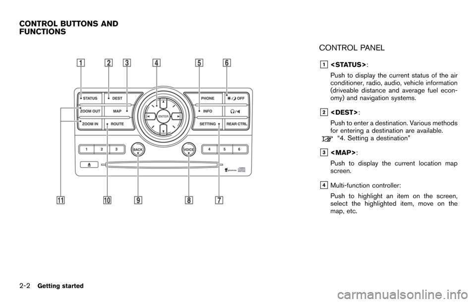
CONTROL PANEL
&1
Push to display the current status of the air
conditioner, radio, audio, vehicle information
(driveable distance and average fuel econ-
omy) and navigation systems.
&2
Push to enter a destination. Various methods
for entering a destination are available.
“4. Setting a destination”
&3
Page 145 of 235
XM NavTraffic®information is a subscription
service offered by XM®Satellite Radio.
This service provides real-time information
regarding traffic flow, accidents, road construc-
tion and other incidents, where available.
XM NavTraffic
®combines information from
commercial and public traffic data providers
including government departments of transpor-
tation, police, emergency services, road sen-
sors, cameras and aircraft reports. The traffic
information is broadcast to the vehicle by the
XM
®satellites. Available traffic information on
the route the driver selected is shown on the
navigation screen so traffic conditions between
you and the destination are known. Three types
of real-time traffic information for major road-
ways are shown on the navigation system:
* Unscheduled traffic data for example, acci-
dents and disabled vehicles.
* Scheduled traffic data, for example road
construction and road closures.
* Traffic flow information (rate of speed data) .
WARNING
XM NavTraffic®information is not a
substitute for attentive driving. Traffic
conditions change constantly and emergency situations can arise with-
out warning. Relying only on XM
NavTraffic
®information may lead to
a collision and could result in serious
personal injury.
NOTE:
Flow information is provided only for
roads equipped with traffic sensors and
is not available in all markets covered by
the service. Flow data may not be available
on portions of a road that is under
construction.
XM NavTraffic
®information is available in limited
markets. To subscribe or to check if this service
is available in your area:
call 1-800-XM-RADIO (1-800-967-2346) or
see www.xmradio.com/navtraffic
INFO:
If you do not have a contract for XM NavTraffic
®
traffic information service, a message appears,
and it will not be possible to check the
information on the traffic information system.
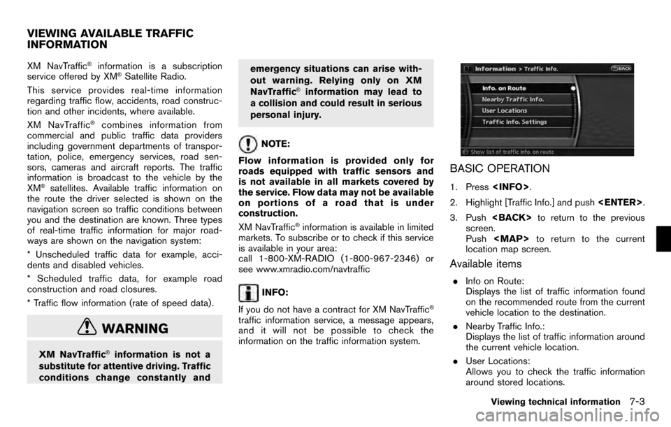
BASIC OPERATION
1. Press
2. Highlight [Traffic Info.] and push
3. Push
screen.
Push
Page 158 of 235
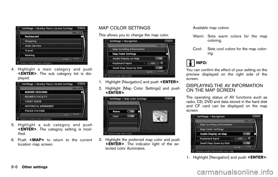
4. Highlight a main category and push
played.
5. Highlight a sub category and push
ified.
6. Push
Page 197 of 235
DETOUR
If you want to make a detour due to traffic
conditions, you can use the Detour function to
calculate an alternative route. The NISSAN
Navigation System can calculate a route using
secondary roads that will return you to primary
roads after a specified number of miles.
For more information on the Detour function,
refer to section 5.
BirdviewTM
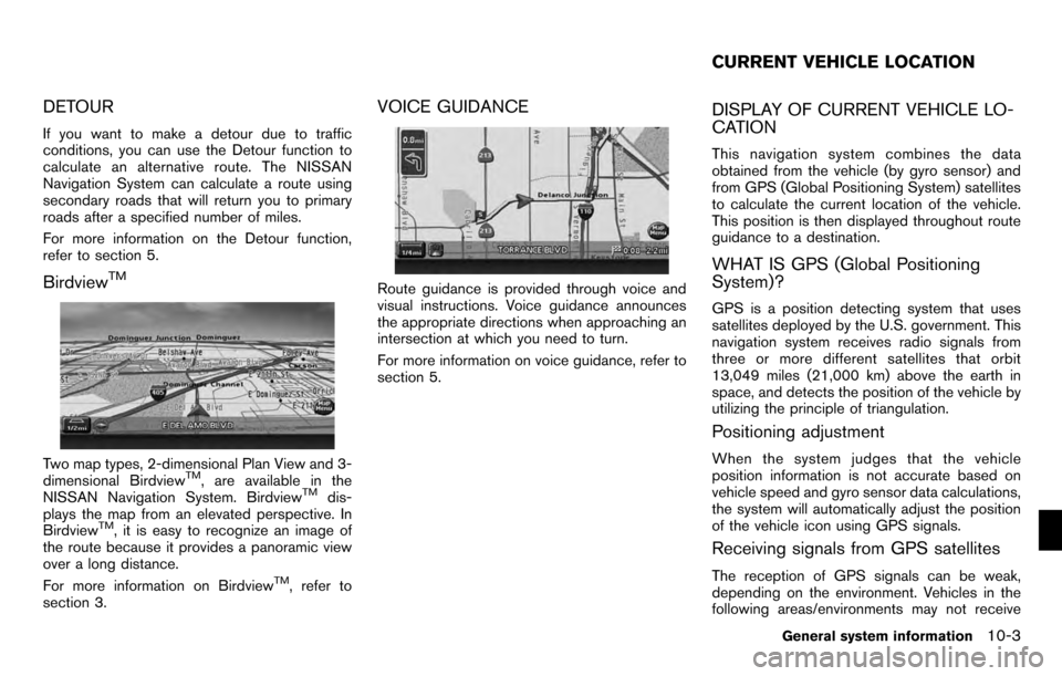
Two map types, 2-dimensional Plan View and 3-
dimensional BirdviewTM, are available in the
NISSAN Navigation System. BirdviewTMdis-
plays the map from an elevated perspective. In
Birdview
TM, it is easy to recognize an image of
the route because it provides a panoramic view
over a long distance.
For more information on Birdview
TM, refer to
section 3.
VOICE GUIDANCE
Route guidance is provided through voice and
visual instructions. Voice guidance announces
the appropriate directions when approaching an
intersection at which you need to turn.
For more information on voice guidance, refer to
section 5.
DISPLAY OF CURRENT VEHICLE LO-
CATION
This navigation system combines the data
obtained from the vehicle (by gyro sensor) and
from GPS (Global Positioning System) satellites
to calculate the current location of the vehicle.
This position is then displayed throughout route
guidance to a destination.
WHAT IS GPS (Global Positioning
System)?
GPS is a position detecting system that uses
satellites deployed by the U.S. government. This
navigation system receives radio signals from
three or more different satellites that orbit
13,049 miles (21,000 km) above the earth in
space, and detects the position of the vehicle by
utilizing the principle of triangulation.
Positioning adjustment
When the system judges that the vehicle
position information is not accurate based on
vehicle speed and gyro sensor data calculations,
the system will automatically adjust the position
of the vehicle icon using GPS signals.
Receiving signals from GPS satellites
The reception of GPS signals can be weak,
depending on the environment. Vehicles in the
following areas/environments may not receive
CURRENT VEHICLE LOCATION
General system information10-3
Page 207 of 235

.Because it is not possible to consider data
concerning roads that are seasonally avail-
able or unavailable, a route may be displayed
that does not match the actual traffic
restrictions. Be sure to follow the actual
traffic restrictions while driving.
. Canada and Alaska contain many roads with
incomplete map data. As a result, when
searching for a route, the route may include
roads with incomplete data. In regions
where road data is not complete, voice
guidance may stop for long periods of time.
Be sure to follow the actual traffic restric-
tions while driving. .
The XM NavTraffic®information service is
not provided for some cities. In addition, the
cities for which the traffic information service
is provided may be changed.
. In some cases, infrastructure problems may
prevent the complete display of the traffic
information. This is not a malfunction.
. Due to infrastructure problems, or due to the
time when the traffic information service
broadcast is received, the displayed infor-
mation may differ from the actual traffic
conditions.
. Depending on the traffic information, a
detour route may be slower than the original
route.
. XM NavTraffic
®is a service of XM®Satellite
Radio. XM NavTraffic®is only available in
select markets within the 48 contiguous
United States and is subject to data avail-
ability. Reception of the XM
®signal may vary
depending on location. It requires a monthly
premium subscription. The service provider
is solely responsible for the quality and
accuracy of the information provided. All
fees and programming are subject to
change. For more details on the XM
NavTraffic
®service, terms and conditions,
please visit
www.xmradio.com.
You can also contact XM
®Radio at 1-800-XM-RADIO (1-800-967-2346) .
. As of January 31, 2009, the XM NavTraffic
®
service covers 80 major metropolitan mar-
kets. For the most current list of markets
covered, please refer to
www.xmradio.com/navtraffic, or call XM
®
Radio customer support at 1-800-XM-
RADIO (1-800-967-2346) .
. Due to road maintenance, infrastructure
problems (e.g. malfunction of road sensors,
outage of central computer of infrastructure)
or natural disasters, there are times when
some or all traffic information may not be
available.
. Incident information is based on human
collection. Not all incidents that have hap-
pened are collected and provided.
. Due to infrastructure problems, or transmis-
sion delay, there are times when the
information may differ from the actual con-
dition. Always observe safe driving practices
and follow all traffic regulations.
. Due to the coverage and quality of traffic
information and road conditions, it is not
always possible for the system to provide
the shortest time route even when traffic
information is considered.
. Traffic information that is displayed may
differ from information from other media
NOTES ON XM NavTraffic®
INFORMATION
General system information10-13
Page 208 of 235
(e.g., radio) , as other media may use
different information sources.HOW TO ORDER MAP DATA UP-
DATES
To order updated mapdata, contact the
NISSAN NAVIGATION SYSTEM HELPDESK.
See the contact information on the inside front
cover of this manual.
ABOUT THE MAP DATA
1. This map data has been prepared by ZENRIN CO., LTD. under license from
Navigation Technologies Corporation.
ZENRIN CO., LTD. has added, processed
and digitized data based on the digital road
map data of Navigation Technologies Cor-
poration. Due to the production timing of the
map data, some new roads may not be
included in this map data or some of the
names or roads may be different from those
at the time you use this map data.
2. Traffic control and regulation data used in this map data may be different from those at
the time you use this map data due to the
data production timing. When driving your
vehicle, follow the actual traffic control signs
and notices on the roads.
3. Reproducing or copying this map software is strictly prohibited by law.
Published by Nissan North America, Inc.
*C2006 Navigation Technologies. All rights
reserved. “Certain business data provided by
infoUSA.com, Inc. Copyright 2006. All rights
reserved”.
WARNING
. This navigation system should not
be used to replace your own judge-
ment. No itinerary suggested by
this navigation system should ever
override any highway regulations,
your own judgement, or a knowl-
edge of safe driving practices. Do
not follow the navigation system’s
suggested itinerary if it would
cause you to perform a dangerous
or illegal act, place you in a danger-
ous situation, or take you into an
area you consider unsafe.
. The advice provided by the naviga-
tion system is to be regarded as a
suggestion only. There may be
times when the navigation system
displays the vehicle’s location in-
correctly, fails to suggest the short-
est route, or fails to direct you to
your desired destination. In such
MAP DATA
10-14General system information