Page 215 of 270
Black plate (219,1)
Model "NISSAN_NAVI" EDITED: 2007/ 2/ 26
NAV3107
Contrast
Adjust the display contrast by tilting the joystick
in the direction of [+] or [−].
INFO:
The preview of the map screen is displayed on
the right side of the screen.
NAI0480
Background Color
Push<>(Day/Night) to choose the back-
ground color. Adjust the background color
brightness by tilting the joystick in the direction
of [+] or [−].
INFO:
When you turn the headlight switch on, the
background color changes.
NAV3044Bright background color
NAV3045Dark background color
Other settings8-15
Page 216 of 270

Black plate (220,1)
Model "NISSAN_NAVI" EDITED: 2007/ 2/ 26
VOLUME ADJUSTMENT
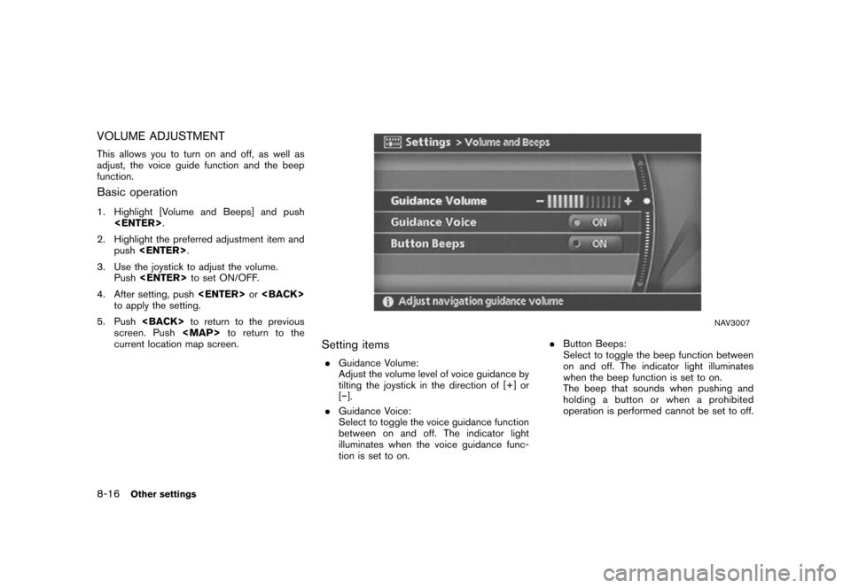
This allows you to turn on and off, as well as
adjust, the voice guide function and the beep
function.
Basic operation
1. Highlight [Volume and Beeps] and push
.
2. Highlight the preferred adjustment item and
push.
3. Use the joystick to adjust the volume.
Pushto set ON/OFF.
4. After setting, pushor
to apply the setting.
5. Pushto return to the previous
screen. Push
Page 223 of 270

Black plate (227,1)
Model "NISSAN_NAVI" EDITED: 2007/ 2/ 26
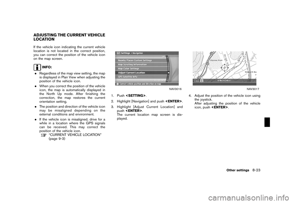
If the vehicle icon indicating the current vehicle
location is not located in the correct position,
you can correct the position of the vehicle icon
on the map screen.
INFO:
.Regardless of the map view setting, the map
is displayed in Plan View when adjusting the
position of the vehicle icon.
.When you correct the position of the vehicle
icon, the map is automatically displayed in
the North Up mode. After finishing the
correction, the map restores the current
orientation setting.
.The position and direction of the vehicle icon
may be misaligned depending on the
external conditions and environment.
.If the vehicle icon is misaligned, drive for a
while in a location where the GPS signals
can be received. This may correct the
position of the vehicle icon.
“CURRENT VEHICLE LOCATION”
(page 9-3)
NAV3016
1. Push.
2. Highlight [Navigation] and push.
3. Highlight [Adjust Current Location] and
push.
The current location map screen is dis-
played.
NAV3017
4. Adjust the position of the vehicle icon using
the joystick.
After adjusting the position of the vehicle
icon, push.
ADJUSTING THE CURRENT VEHICLE
LOCATION
Other settings8-23
Page 224 of 270
Black plate (228,1)
Model "NISSAN_NAVI" EDITED: 2007/ 2/ 26
NAV3018
5. Adjust the direction of the vehicle icon using
the joystick.
After adjusting the direction of the vehicle
icon, push.
NAV3019
6. A message is displayed, and the adjusted
vehicle location is stored.
8-24Other settings
Page 227 of 270

Black plate (25,1)
9 General system information
Model "NISSAN_NAVI" EDITED: 2007/ 2/
Features of this navigation system.......................... 9-2
Route guidance............................................. 9-2
Points of interest (POI) directory........................ 9-2
Address book................................................ 9-2
Avoid area.................................................... 9-2
Automatic reroute........................................... 9-2
Detour......................................................... 9-2
Birdview
TM................................................... 9-3
Voice guidance.............................................. 9-3
Current vehicle location....................................... 9-3
Display of current vehicle location...................... 9-3
What is GPS (Global Positioning System)?.......... 9-3
Accuracy of positioning................................... 9-4
Incorrect display of vehicle position.................... 9-6
Detailed Map Coverage Areas (MCA) for the
navigation system........................................... 9-8
When a gray road is displayed on the map.......... 9-9Route calculation............................................... 9-9
Route guidance............................................... 9-11
Basics of voice guidance............................... 9-11
Directions provided and the distances to guide
points........................................................ 9-11
Repeating voice guidance.............................. 9-14
Notes on voice guidance............................... 9-14
Map DVD-ROM............................................... 9-15
How to order map DVD-ROM updates.............. 9-15
About the map DVD-ROM............................. 9-15
Map DVD-ROM drive location......................... 9-16
Disc replacement......................................... 9-17
How to handle the DVD-ROM......................... 9-18
How to handle the display.................................. 9-19
Characteristics of a liquid crystal display............ 9-19
Maintenance of the display............................. 9-20
Page 229 of 270

Black plate (233,1)
Model "NISSAN_NAVI" EDITED: 2007/ 2/ 26
NAV2710
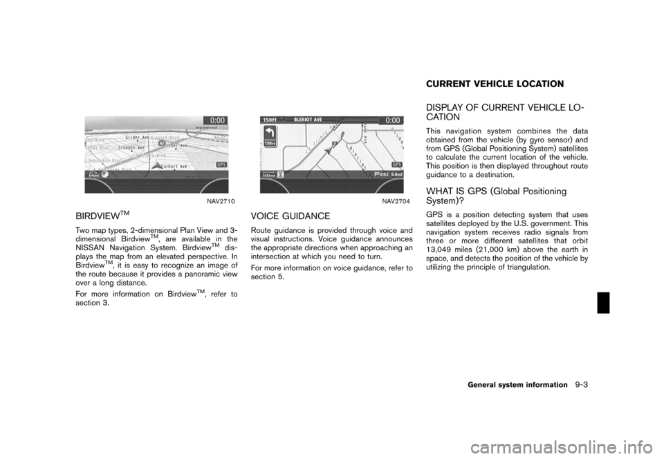
BIRDVIEWTM
Two map types, 2-dimensional Plan View and 3-
dimensional BirdviewTM, are available in the
NISSAN Navigation System. BirdviewTMdis-
plays the map from an elevated perspective. In
Birdview
TM, it is easy to recognize an image of
the route because it provides a panoramic view
over a long distance.
For more information on Birdview
TM, refer to
section 3.
NAV2704
VOICE GUIDANCE
Route guidance is provided through voice and
visual instructions. Voice guidance announces
the appropriate directions when approaching an
intersection at which you need to turn.
For more information on voice guidance, refer to
section 5.
DISPLAY OF CURRENT VEHICLE LO-
CATION
This navigation system combines the data
obtained from the vehicle (by gyro sensor) and
from GPS (Global Positioning System) satellites
to calculate the current location of the vehicle.
This position is then displayed throughout route
guidance to a destination.
WHAT IS GPS (Global Positioning
System)?
GPS is a position detecting system that uses
satellites deployed by the U.S. government. This
navigation system receives radio signals from
three or more different satellites that orbit
13,049 miles (21,000 km) above the earth in
space, and detects the position of the vehicle by
utilizing the principle of triangulation.
CURRENT VEHICLE LOCATION
General system information9-3
Page 232 of 270
Black plate (236,1)
Model "NISSAN_NAVI" EDITED: 2007/ 2/ 26
INCORRECT DISPLAY OF VEHICLE
POSITION
The following cases may affect the display
accuracy of the vehicle’s position or traveling
direction. The accuracy will return to normal if
the driving conditions return to normal.
NAI0426
*When there is a similar road nearby.
NAI0427
*When the vehicle is traveling in an area with a grid
pattern road system.
NAI0428
*When the vehicle is passing through a large Y-
shaped intersection/junction.
NAI0429
*When the vehicle is traveling on a continuous,
slowly curving road.
9-6General system information
Page 235 of 270

Black plate (239,1)
Model "NISSAN_NAVI" EDITED: 2007/ 2/ 26
WHEN A GRAY ROAD IS DISPLAYED
ON THE MAP
.When you are driving on a road displayed in
gray after the vehicle has deviated from the
suggested route during route guidance,
automatic rerouting may not start immedi-
ately.
.The navigation system does not provide
route guidance for roads displayed in dark
green. Therefore, if the destination is set on
a road displayed in dark green, the enlarged
map display will return to the ordinary map
screen at some point on a suggested route
that is near the destination. Also, voice
guidance will stop at some point on a
suggested route that is near the destination.
.POI information and street names near
roads displayed in gray may not be con-
tained in the map data..There may be cases that carpool lanes are
included on a suggested route when the
automatic rerouting function is activated,
even if the “Use Time Restricted Roads” is
turned off.
“SETTING CONDITIONS FOR THE
ROUTE CALCULATION”
(page 5-12)
.The navigation system does not provide
route guidance for roads displayed in dark
green.
.If the destination is set on a dark green road,
the enlarged map display will switch to the
ordinary map screen at some point and
suggest a route that is near the destination.
The distance and direction to the endpoint
of the suggested route will be displayed in
the lower right corner of the screen.
Also, at this time, voice guidance will
announce, “En route to your destination,
some roads contain incomplete map data.
Turn guidance will not be provided in this
area”.
When approaching the endpoint of the
suggested route, voice guidance will an-
nounce, “Entering the road with incomplete
map data. Please use the direction arrow
and distance information to proceed to your
destination.”
To reach your destination, refer to the mapscreen. Always follow actual roads and
regulations and drive safely.
.The suggested route may not be the short-
est, nor are other circumstances such as
traffic jams considered.
.Because of the inevitable difference in road
conditions and circumstances between the
time you use this system and the time the
information was produced for the DVD,
there may be discrepancies in roads and
regulations. In such cases, follow the actual
information available.
.During route calculation, the map will not
scroll, however the vehicle icon will move
with the actual vehicle’s movement.
.During route calculation, buttons such as