Page 189 of 769
188 Control systemsCOMAND navigation (introduction)When positioning is complete, route guid-
ance is once again possible using naviga-
tion announcements and route guidance
displays.
Interrupting the journey during route
guidance
The following applies if you interrupt the
journey during route guidance and contin-
ue the journey later:�
COMAND resumes route guidance au-
tomatically if you continue the journey
within 2 hours.
�
Route guidance is canceled if you con-
tinue the journey after more than
2 hours. It will be necessary to resume
the canceled route guidance manually
(�page 240).Hard disk errors
COMAND has an integrated hard disk on
which the map software is saved.
If an area of the hard disk has an error,
COMAND can no longer access the map
data in this area, for example, when calcu-
lating a route.
The message “Navigation Unavailable.
Please refer to the operating instructions.”
appears.
�
Deleting message: Switch COMAND
off and back on.
Units of measurement
The units of measurement in navigation
mode are identical to those set in the in-
strument cluster.
Input restrictions
The input restrictions are imposed starting
at a particular vehicle speed. The restric-
tions are canceled as soon as the speed
drops below a certain value.
When the restriction is active, certain oper-
ations or entries are not possible.
You will notice this by the fact that some
menu items cannot be selected or certain
operations will not be possible.
i
The journey is interrupted if you park the ve-
hicle and switch off COMAND.
The journey is continued when you switch
COMAND back on and start driving on.
i
If you switch the navigation system off/on,
it will be operational again until it has to access
the faulty area of the hard disk again. The mes-
sage will then appear again. Consult an autho-
rized Mercedes-Benz Center.
Page 190 of 769
189 Control systems
COMAND navigation (introduction)
Navigation system menu overviewi
The components and operating principles of
COMAND can be found on (
�page 83).
Info
(only with route
guidance active)
Traffic (TMC)
Route
(only with route
guidance active)
Position
RPT
(only with route
guidance active)
Destination
Information about
the active route guid-
ance
Call up real-time traf-
fic messages
�
Call up route info
�
Call up route
browser
�
Call up the de-
tour function
�
Call up the save
position memory
function
�
Center the map
on the vehicle’s
position
�
Center the map
on the destina-
tion position
Repeat the current
navigation an-
nouncement
Select:�
a destination
�
stopover
�
save destination
�
cancel route
guidance
Page 191 of 769
190 Control systemsCOMAND navigation (introduction)Calling up the map display and switching to navigation mode�
Press the N shortcut button once or
twice.
or
�
In the main function line, select “Navi”.
Both of these will call up the map display.
You will see the map with the menu system
either shown or hidden.
Illustration: map with route guidance inac-
tive and with the menu system shown1Current vehicle position
Illustration: map with route guidance inac-
tive and with the menu system hidden
(full screen mode)1Current vehicle position
2Set map orientation (
�page 193)
3Map scale selected (
�page 191)
i
The number of times you have to press the
N shortcut button depends on the operating
mode currently selected.
Page 192 of 769
191 Control systems
COMAND navigation (introduction)
Hiding or showing the menu system�
Hiding: Slide qm.
The “Full Screen” menu item appears in
the main area of the display; it is auto-
matically selected.
�
Press n.
The menu system is hidden. The map
can be seen in the full screen.
�
Showing: Press n in the full-screen
map display.Adjusting the map scale
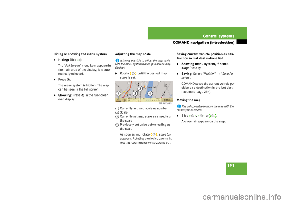
�
Rotate ymz until the desired map
scale is set.
1Currently set map scale as number
2Scale
3Currently set map scale as a needle on
the scale
4Previously set value before calling up
the scale
As soon as you rotate ymz, scale 2
appears. Rotating clockwise zooms in,
rotating counterclockwise zooms out.Saving current vehicle position as des-
tination in last destinations list
�
Showing menu system, if neces-
sary: Press n.
�
Saving: Select “Position” � “Save Po-
sition”.
COMAND saves the current vehicle po-
sition as a destination in the last desti-
nations (
�page 254).
Moving the map
�
Slide qmr, omp or wmx.
A crosshair appears on the map.
i
It is only possible to adjust the map scale
with the menu system hidden (full-screen map
display).
i
It is only possible to move the map with the
menu system hidden.
Page 193 of 769
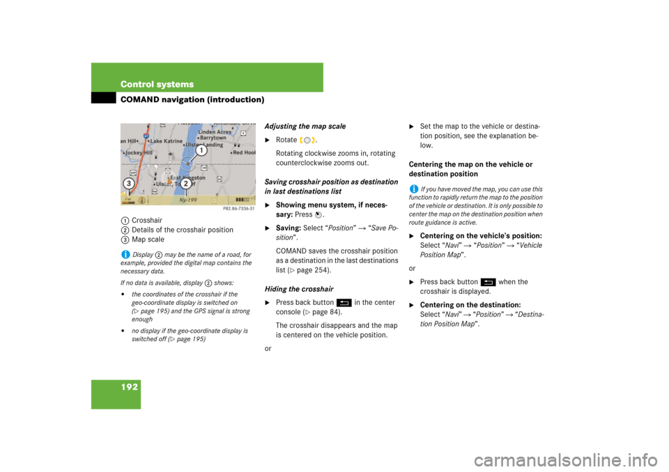
192 Control systemsCOMAND navigation (introduction)1Crosshair
2Details of the crosshair position
3Map scaleAdjusting the map scale
�
Rotate ymz.
Rotating clockwise zooms in, rotating
counterclockwise zooms out.
Saving crosshair position as destination
in last destinations list
�
Showing menu system, if neces-
sary: Press n.
�
Saving: Select “Position” � “Save Po-
sition”.
COMAND saves the crosshair position
as a destination in the last destinations
list (
�page 254).
Hiding the crosshair
�
Press back button L in the center
console (
�page 84).
The crosshair disappears and the map
is centered on the vehicle position.
or
�
Set the map to the vehicle or destina-
tion position, see the explanation be-
low.
Centering the map on the vehicle or
destination position
�
Centering on the vehicle’s position:
Select “Navi” � “Position” � “Vehicle
Position Map”.
or
�
Press back button L when the
crosshair is displayed.
�
Centering on the destination:
Select “Navi” � “Position” � “Destina-
tion Position Map”.
i
Display 2 may be the name of a road, for
example, provided the digital map contains the
necessary data.
If no data is available, display 2 shows:
�
the coordinates of the crosshair if the
geo-coordinate display is switched on
(�page 195) and the GPS signal is strong
enough
�
no display if the geo-coordinate display is
switched off (
�page 195)
i
If you have moved the map, you can use this
function to rapidly return the map to the position
of the vehicle or destination. It is only possible to
center the map on the destination position when
route guidance is active.
Page 194 of 769
193 Control systems
COMAND navigation (introduction)
Basic settings
Map perspective
COMAND can display the map from a
bird's eye view or in the normal map view.�
Select map perspective:
Select “Navi” � “Navi” � “Map Dis-
play”.
The map display list appears. A dot R
indicates the current setting.
�
Select “Bird’s-eye view”.
The bird's eye view is switched on or
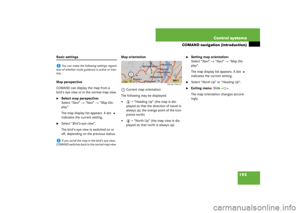
off, depending on the previous status.Map orientation
1Current map orientation
The following may be displayed:
�
8 = “Heading Up” (the map is dis-
played so that the direction of travel is
always up; the orange point of the icon
points north)
�
9 = “North Up” (the map view is dis-
played so that north is always up)
�
Setting map orientation:
Select “Navi” � “Navi” � “Map Dis-
play”.
The map display list appears. A dot R
indicates the current setting.
�
Select “North Up” or “Heading Up”.
�
Exiting menu: Slide omp.
The map orientation changes accord-
ingly.
i
You can make the following settings regard-
less of whether route guidance is active or inac-
tive.
i
If you scroll the map in the bird's eye view,
COMAND switches back to the normal map view.
Page 195 of 769
194 Control systemsCOMAND navigation (introduction)Setting POI symbols
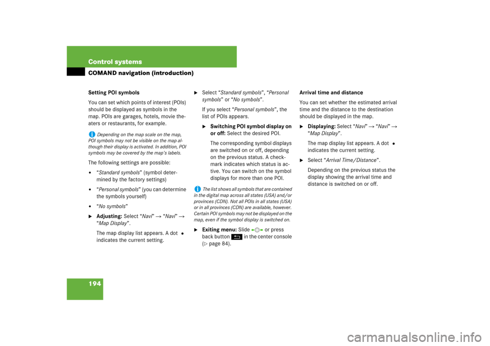
You can set which points of interest (POIs)
should be displayed as symbols in the
map. POIs are garages, hotels, movie the-
aters or restaurants, for example.
The following settings are possible:�
“Standard symbols” (symbol deter-
mined by the factory settings)
�
“Personal symbols” (you can determine
the symbols yourself)
�
“No symbols”
�
Adjusting: Select “Navi” � “Navi” �
“Map Display”.
The map display list appears. A dot R
indicates the current setting.
�
Select “Standard symbols”, “Personal
symbols” or “No symbols”.
If you select “Personal symbols”, the
list of POIs appears.�
Switching POI symbol display on
or off: Select the desired POI.
The corresponding symbol displays
are switched on or off, depending
on the previous status. A check-
mark indicates which status is ac-
tive. You can switch on the symbol
displays for more than one POI.
�
Exiting menu: Slide omp or press
back button L in the center console
(�page 84).Arrival time and distance
You can set whether the estimated arrival
time and the distance to the destination
should be displayed in the map.
�
Displaying: Select “Navi” � “Navi” �
“Map Display”.
The map display list appears. A dot R
indicates the current setting.
�
Select “Arrival Time/Distance”.
Depending on the previous status the
display showing the arrival time and
distance is switched on or off.
i
Depending on the map scale on the map,
POI symbols may not be visible on the map al-
though their display is activated. In addition, POI
symbols may be covered by the map’s labels.
i
The list shows all symbols that are contained
in the digital map across all states (USA) and/or
provinces (CDN). Not all POIs in all states (USA)
or in all provinces (CDN) are available, however.
Certain POI symbols may not be displayed on the
map, even if the symbol display is switched on.
Page 196 of 769
195 Control systems
COMAND navigation (introduction)
Current street
You can set whether the current street you
are driving on should be displayed in the
map.�
Displaying: Select “Navi” � “Navi” �
“Map Display”.
The map display list appears. A dot R
indicates the current setting.
�
Select “Current Street”.
Depending on the previous status the
display showing the current street is
switched on or off.Geo-coordinate display
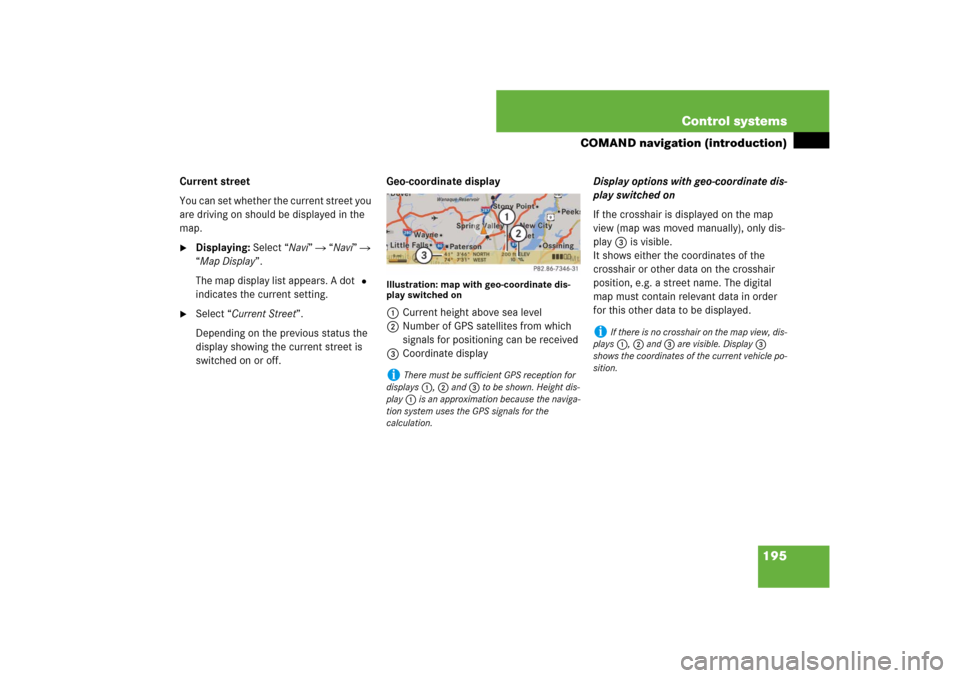
Illustration: map with geo-coordinate dis-
play switched on1Current height above sea level
2Number of GPS satellites from which
signals for positioning can be received
3Coordinate displayDisplay options with geo-coordinate dis-
play switched on
If the crosshair is displayed on the map
view (map was moved manually), only dis-
play 3 is visible.
It shows either the coordinates of the
crosshair or other data on the crosshair
position, e.g. a street name. The digital
map must contain relevant data in order
for this other data to be displayed.i
There must be sufficient GPS reception for
displays 1, 2 and 3 to be shown. Height dis-
play 1 is an approximation because the naviga-
tion system uses the GPS signals for the
calculation.
i
If there is no crosshair on the map view, dis-
plays 1, 2 and 3 are visible. Display 3
shows the coordinates of the current vehicle po-
sition.