2002 LINCOLN BLACKWOOD display
[x] Cancel search: displayPage 22 of 48
Guidance in partly mapped areas
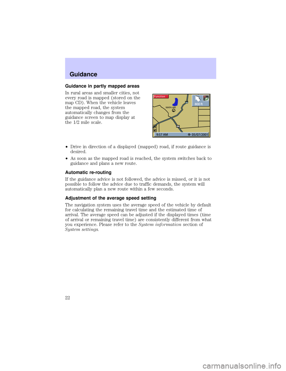
In rural areas and smaller cities, not
every road is mapped (stored on the
map CD). When the vehicle leaves
the mapped road, the system
automatically changes from the
guidance screen to map display at
the 1/2 mile scale.
²Drive in direction of a displayed (mapped) road, if route guidance is
desired.
²As soon as the mapped road is reached, the system switches back to
guidance and plans a new route.
Automatic re-routing
If the guidance advice is not followed, the advice is missed, or it is not
possible to follow the advice due to traffic demands, the system will
automatically plan a new route within a few seconds.
Adjustment of the average speed setting
The navigation system uses the average speed of the vehicle by default
for calculating the remaining travel time and the estimated time of
arrival. The average speed can be adjusted if the displayed times (time
of arrival or remaining travel time) are consistently different from what
you experience. Please refer to theSystem informationsection of
System settings.
Guidance
22
Page 23 of 48
ALTERNATIVE ROUTE / DETOUR
The navigation system can calculate
an alternative route only during
guidance for an adjustable distance,
e.g.1-10km(1-6miles).
This function can be used to get
around traffic jams or if you do not
agree with the current route
planning of the navigation system.
The alternative route is calculated
from the current vehicle position for
the selected distance.
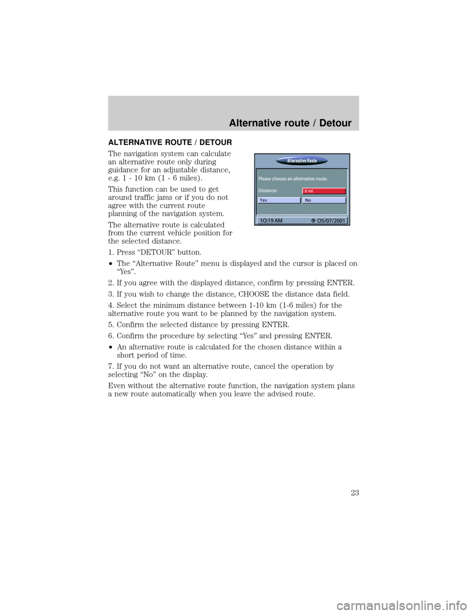
1. Press ªDETOURº button.
²The ªAlternative Routeº menu is displayed and the cursor is placed on
ªYesº.
2. If you agree with the displayed distance, confirm by pressing ENTER.
3. If you wish to change the distance, CHOOSE the distance data field.
4. Select the minimum distance between 1-10 km (1-6 miles) for the
alternative route you want to be planned by the navigation system.
5. Confirm the selected distance by pressing ENTER.
6. Confirm the procedure by selecting ªYesº and pressing ENTER.
²An alternative route is calculated for the chosen distance within a
short period of time.
7. If you do not want an alternative route, cancel the operation by
selecting ªNoº on the display.
Even without the alternative route function, the navigation system plans
a new route automatically when you leave the advised route.
Alternative route / Detour
23
Page 24 of 48
ADDRESS BOOK
The navigation system provides you
with the option of storing 100
destination addresses in a personal
address book, which is divided into
2 categories: ªBusinessº and
ªPrivate.º
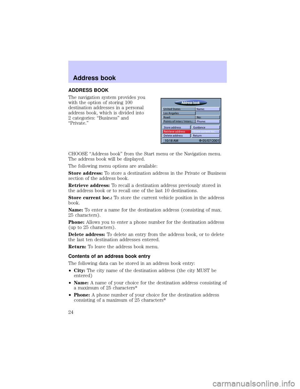
CHOOSE ªAddress bookº from the Start menu or the Navigation menu.
The address book will be displayed.
The following menu options are available:
Store address:To store a destination address in the Private or Business
section of the address book.
Retrieve address:To recall a destination address previously stored in
the address book or to recall one of the last 10 destinations.
Store current loc.:To store the current vehicle position in the address
book.
Name:To enter a name for the destination address (consisting of max.
25 characters).
Phone:Allows you to enter a phone number for the destination address
(up to 25 characters).
Delete address:To delete an entry from the address book, or to delete
the last ten destination addresses entered.
Return:To leave the address book menu.
Contents of an address book entry
The following data can be stored in an address book entry:
²City:The city name of the destination address (the city MUST be
entered)
²Name:A name of your choice for the destination address consisting of
a maximum of 25 characters*
²Phone:A phone number of your choice for the destination address
consisting of a maximum of 25 characters*
Address book
24
Page 26 of 48

Retrieve addresses from the address book
1. CHOOSE ªRetrieve addressº from the Navigation menu.
2. CHOOSE ªPrivateº or ªBusinessº.
²The list of addresses already stored in the address book is displayed .
²The list is sorted in alphabetical order
3. CHOOSE the desired address from the list.
²The selected address is entered as the new destination address.
Storing the current car position in the address book
If you are at a location you would like to store in the address book, such
as a new restaurant:
1. CHOOSE ªAddress bookº from the Navigation menu.
2. CHOOSE ªStore current loc.º from the Address book menu.
Editing an address book entry
1. CHOOSE the ªAddress bookº function in the ªStart Menu.º
²If, for example, you would like to load an address for editing, then
choose the ªRetrieve addressº function (not accessible if no addresses
have been stored in the address book).
²If you want to delete an entry, the choose the ªDelete addressº
function.
2. Select the desired address book category.
²A list with the names of the stored addresses is then displayed (only if
the list is not empty). Press ENTER and the entire address will be
displayed.
3. Confirm the address selection by pressing ENTER.
²The selected address is deleted or shown in the ªAddress bookº menu
where it can now be modified and stored again.
²Select the ªGuidanceº function in the menu if you want to activate
guidance for the address shown in the ªAddress bookº menu.
Address book
26
Page 27 of 48
VIA POINTS
If you want to pass certain
addresses or locations on the way to
your ultimate destination, you can
store these via points in the
Navigation menu. The navigation
system will calculate the route to
next via point and will continue
planning to the following via point,
when the previous one was reached.
Select ªVia pointsº from the Navigation menu.
²The ªVia Pointº menu is displayed.
The following options are available:
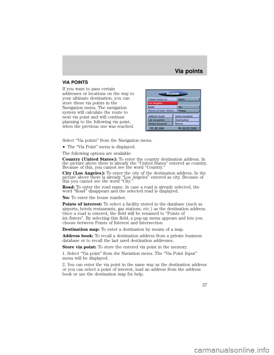
Country (United States):To enter the country destination address. In
the picture above there is already the ªUnited Statesº entered as country.
Because of this, you cannot see the word ªCountry.º
City (Los Angeles):To enter the city of the destination address. In the
picture above there is already ªLos Angelesº entered as city. Because of
this you cannot see the word ªCity.º
Road:To enter the road name. In case a road is already selected, the
word ªRoadº disappears and the selected road is displayed.
No:To enter the house number.
Points of interest:To select a facility stored in the database (such as
airports, hotels restaurants, gas stations, etc.) as the destination address.
Once a road is entered, the field will be renamed to ªPoints of
int./Intersº. By selecting this field, a pop-up menu appears and lets you
choose between Points of Interest and Intersection.
Destination map:To enter a destination by means of a map.
Address book:To recall a destination address from a private business
database or to recall the last used destination addresses.
Store via point:To store the entered via point in the memory.
1. Select ªVia pointº from the Naviation menu. The ªVia Point Inputº
menu will be displayed.
2. You can enter the via point in the same way as the destination address
or you can select a point of interest, load an address from the address
book or use the destination map for help.
Via points
27
Page 28 of 48

3. Select ªStore via point,º and confirm by pressing ENTER.
List via point:To show the list of stored via points. (max. listing of 25).
²Select ªList via pointº in the Navigation menu. The list of stored via
points will be displayed.
Delete via point:To delete an entry from the list of via points.
1. Select ªDelete via pointº. The list of stored via points will be displayed.
2. Select the via point you want to delete. A security check prevents you
from deleting via points by mistake. If you select ªYes,º the selected via
point is deleted from the memory.
Tip:How to delete all via points without deleting the current destination
address. If you already have stored the current destination address in the
address book, skip number one.
1. Store the current destination address in the address book
2. Select ªDelete Destinationº from the ªSelect destinationº menu.
3. Confirm the security check ªDelete via points?º with ªYes.º All via
points and the destination address are deleted.
4. Retrieve the last used destination address with ªRetrieve addressº
from the Navigation menu.
Return:To return to the Navigation menu.
²The maximum number of via points is limited to 25.
²The via points are reached in the order of entry.
²View via points can be entered at any time on the way to the
destination address.
²When a certain via point has been passed, it is deleted from the list of
via points.
Via points
28
Page 29 of 48
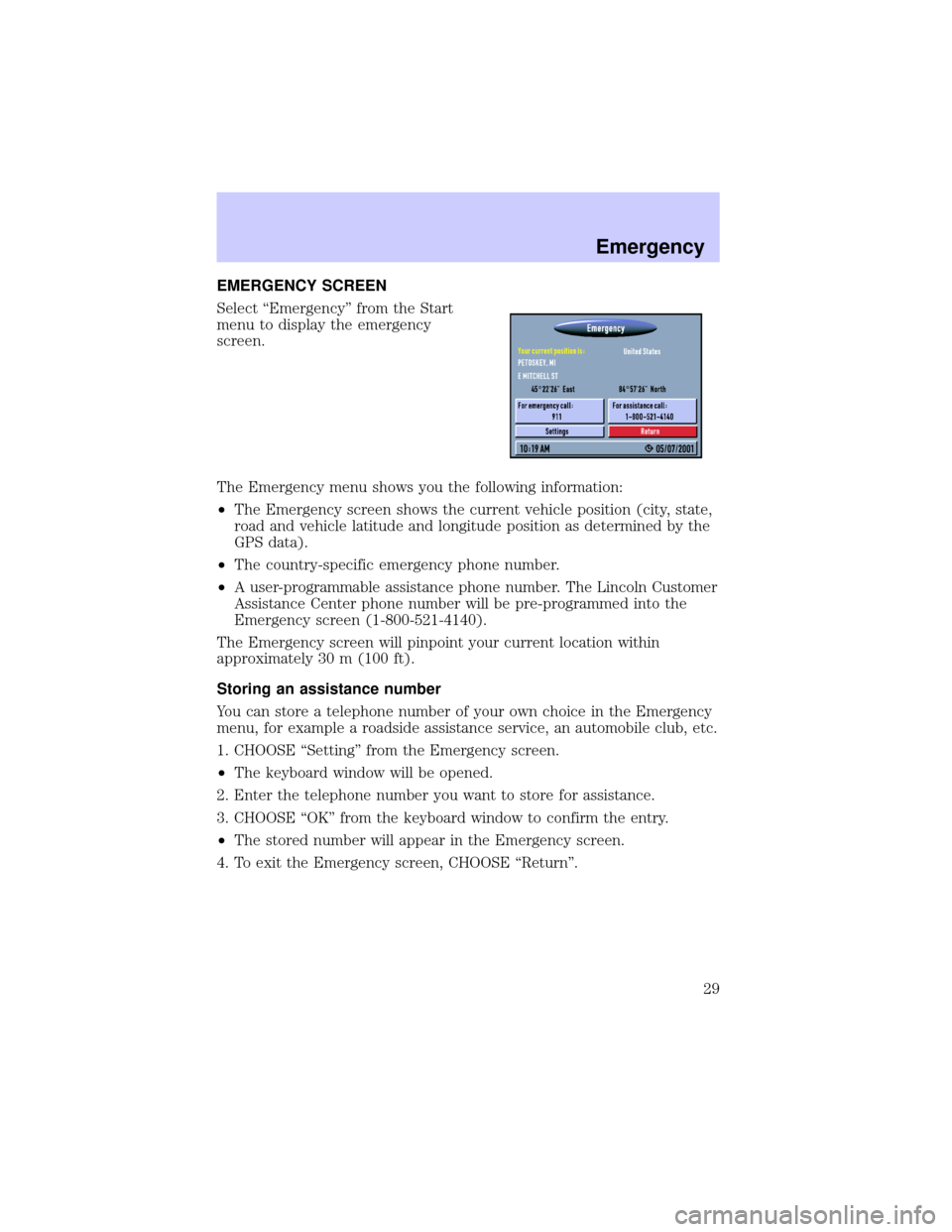
EMERGENCY SCREEN
Select ªEmergencyº from the Start
menu to display the emergency
screen.
The Emergency menu shows you the following information:
²The Emergency screen shows the current vehicle position (city, state,
road and vehicle latitude and longitude position as determined by the
GPS data).
²The country-specific emergency phone number.
²A user-programmable assistance phone number. The Lincoln Customer
Assistance Center phone number will be pre-programmed into the
Emergency screen (1-800-521-4140).
The Emergency screen will pinpoint your current location within
approximately 30 m (100 ft).
Storing an assistance number
You can store a telephone number of your own choice in the Emergency
menu, for example a roadside assistance service, an automobile club, etc.
1. CHOOSE ªSettingº from the Emergency screen.
²The keyboard window will be opened.
2. Enter the telephone number you want to store for assistance.
3. CHOOSE ªOKº from the keyboard window to confirm the entry.
²The stored number will appear in the Emergency screen.
4. To exit the Emergency screen, CHOOSE ªReturnº.
Emergency
29
Page 30 of 48

Limitations of the Emergency Feature
The performance of the Navigation System Emergency function is limited
by the following conditions:
²If the ignition switch is not in the ON or ACC position.
²If the vehicle is involved in an accident, damage to equipment may
have occurred.
²If the vehicle battery is dead, discharged or disconnected, the system
will not operate.
²If a CD digital road map is not loaded, the Emergency feature will not
perform properly. The correct CD digital road map must be loaded and
your location must be digitized in detail, in order for the name of the
street where you are currently located to show up on the display.
²Obstructions may cause the system to be temporarily inoperative.
Global positioning satellite signals and cellular telephone signals that
relay vehicle positioning and communications data may be obstructed
while inside tunnels, parking garages etc.
In some instances, the street name may not be displayed. For example,
you traveled outside the CD digital road map boundaries, the incorrect
CD is loaded, or you are in a remote, non-digitized area on the CD.
However, as long as the global positioning system is operating properly,
your current longitude and latitude will be displayed.
Emergency
30