2020 MAZDA MODEL CX-3 display
[x] Cancel search: displayPage 72 of 92

72
3.4 Saving a location as a Favorite destination
You can add any location to Favorites, the list of frequently used destinations.
Planning a route to one of the Favorite destinations is described on page 58. 1.
Select a destination as described before. It can be an address, a Place, any
location on the map, a previously used destination from History, etc.
2.
A searched destination can be registered to Favorites by selecting
on the verification screen of the destination search
results.
3.4.1 Editing the details of a Favorite destination
You can select a location that you have already saved as a Favorite and edit its
details. Adding a location to the list of Favorite destinations is described on page 72. 1.
Press the Favorites button on the commander switch.
2.
Select the Navigation tab.
3.
The list of Favorite destinations is displayed.
NAV-999VU1EH.indb 722017/12/06 13:18:35
Page 77 of 92

77
1
2
3
4
5
6
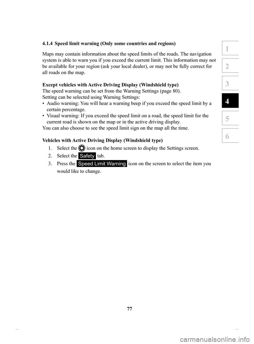
4.1.4 Speed limit warning (Only some countries and regions)
Maps may contain information about the speed limits of the roads. The navigation
system is able to warn you if you exceed the current limit. This information may not
be available for your region (ask your local dealer), or may not be fully correct for
all roads on the map.
Except
vehicles with Active Driving Display (Windshield type)
The speed warning can be set from the W
arning Settings (page 80).
Setting can be selected using Warning Settings:
•
Audio warning: You will hear a warning beep if you exceed the speed limit by a
certain percentage.
•
Visual warning: If you exceed the speed limit on a road, the speed limit for the
current road is shown on the map or in the active driving display .
You can also choose to see the speed limit sign on the map all the time.
V
ehicles
with Active Driving Display (Windshield type)
1.
Select the icon on the home screen to display the Settings screen.
2.
Select the Safety tab.
3.
Press the Speed Limit Warning icon on the screen to select the item you
would like to change.
NAV-999VU1EH.indb 772017/12/06 13:18:35
Page 78 of 92

78
4.1.5
Traffic information in route planning (Only some countries and regions)
The recommended route is not always the same between two points. Offline
historical traffic information (historical speed information or traffic patterns) can be
taken into account in the route calculation based on the time of day and the day of
week whenever suitable data exists.
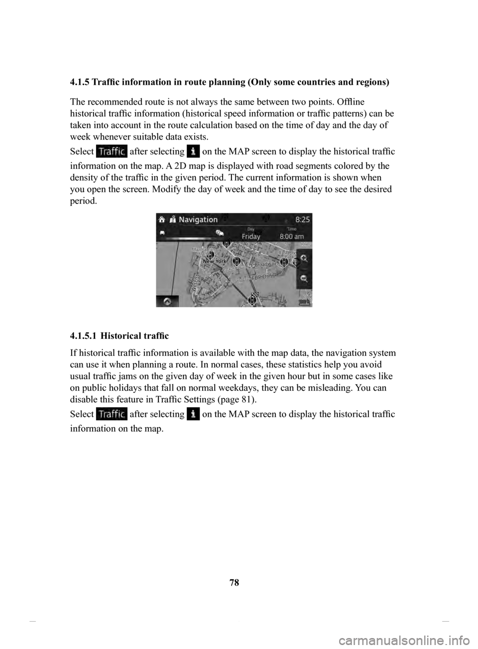
Select
after selecting on the MAP screen to display the historical traffic
information on the map. A 2D map is displayed with road segments colored by the
density of the traffic in the given period. The current information is shown when
you open the screen. Modify the day of week and the time of day to see the desired
period.
4.1.5.1 Historical traffic
If historical traffic information is available with the map data, the navigation system
can use it when planning a route. In normal cases, these statistics help you avoid
usual traffic jams on the given day of week in the given hour but in some cases like
on public holidays that fall on normal weekdays, they can be misleading. You can
disable this feature in T
raffic Settings (page 81).
Select
after selecting on the MAP screen to display the historical traffic
information on the map.
NAV-999VU1EH.indb 782017/12/06 13:18:35
Page 79 of 92

79
1
2
3
4
5
6
4.2 Settings menu
You can configure the program settings, and modify the behaviour of the navigation
system. Select
after selecting on the MAP screen.
ButtonDescription
You can fine-tune the appearance of the Map screen. Adjust
the map view to your needs, show or hide 3D buildings, and
manage POI (point of interest) display settings (which POI
to show on map).
A guidance-related setting is available during route
guidance.
A setting related to warnings is available.
Refer to Changing the road types used in route planning
(page 70).
A setting for traffic information is available.
A setting for on-line service is available.
Some functions are not available depending on some countries and regions.
NAV-999VU1EH.indb 792017/12/06 13:18:35
Page 80 of 92

80
4.2.1 Guidance
Settings
Button
Description
The guidance audio volume can be changed during
route guidance.
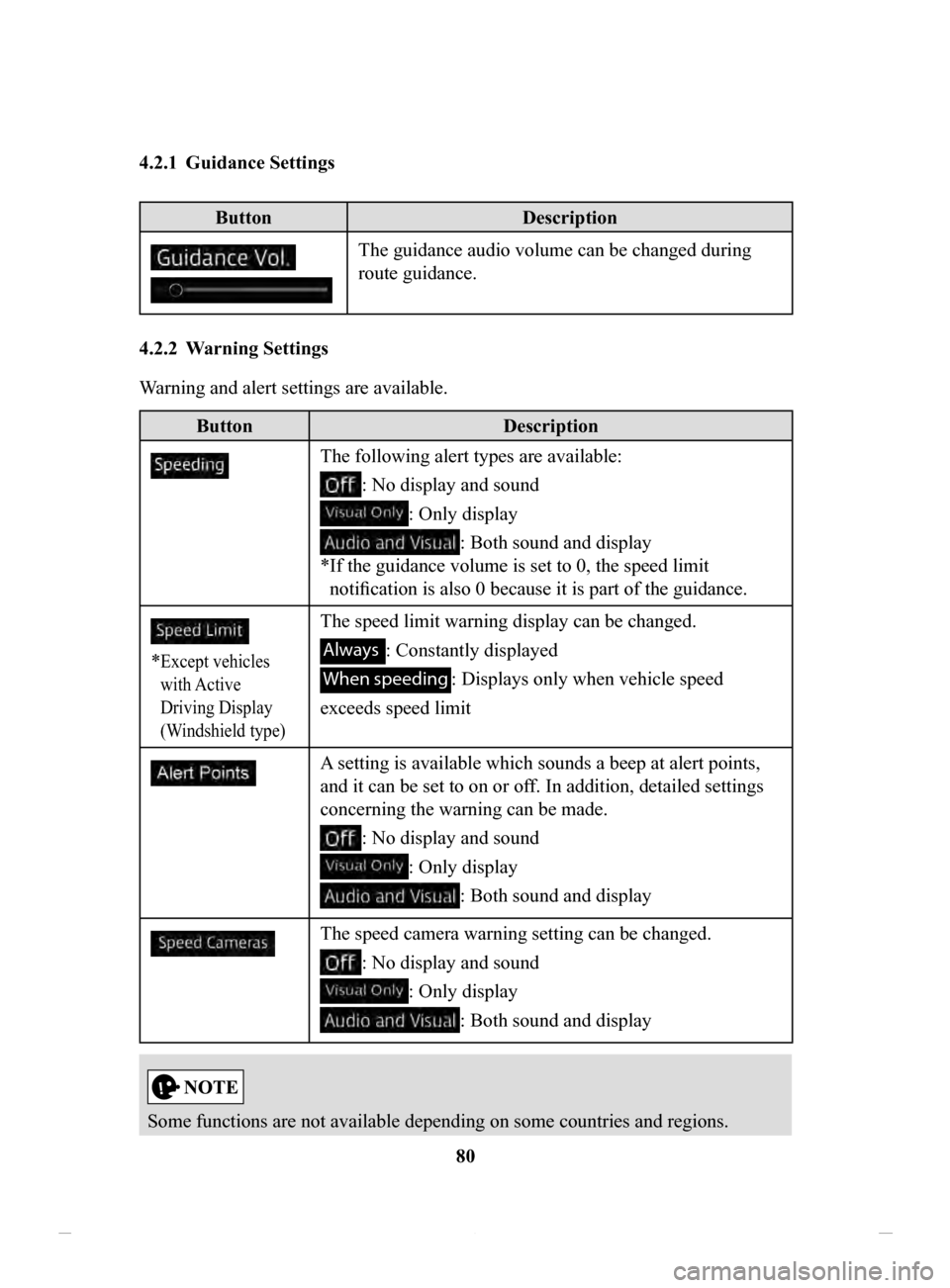
4.2.2 Warning
Settings
Warning and alert settings are available.
Button Description
The following alert types are available:
: No display and sound
: Only display
: Both sound and display
*
If the guidance volume is set to 0, the speed limit
notification is also 0 because it is part of the guidance.
* Except vehicles
with Active
Driving Display
(Windshield type)
The speed limit warning display can be changed.
Always : Constantly displayed
When speeding : Displays only when vehicle speed
exceeds speed limit
A setting is available which sounds a beep at alert points,
and it can be set to on or off. In addition, detailed settings
concerning the warning can be made.
: No display and sound
: Only display
: Both sound and display
The speed camera warning setting can be changed.
: No display and sound
: Only display
: Both sound and display
Some functions are not available depending on some countries and regions.
NAV-999VU1EH.indb 802017/12/06 13:18:36
Page 83 of 92

83
1
2
3
4
5
6
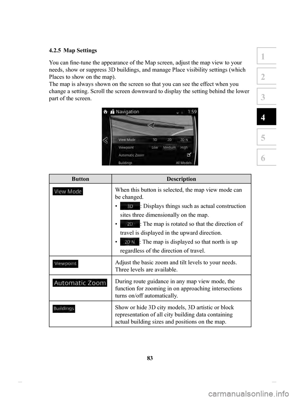
4.2.5 Map Settings
You can fine-tune the appearance of the Map screen, adjust the map view to your
needs, show or suppress 3D buildings, and manage Place visibility settings (which
Places to show on the map).
The map is always shown on the screen so that you can see the effect when you
change a setting. Scroll the screen downward to display the setting behind the lower
part of the screen.
Button Description
When this button is selected, the map view mode can
be changed.
•
: Displays things such as actual construction
sites three dimensionally on the map.
•
: The map is rotated so that the direction of
travel is displayed in the upward direction.
•
: The map is displayed so that north is up
regardless of the direction of travel.
Adjust the basic zoom and tilt levels to your needs.
Three levels are available.
During route guidance in any map view mode, the
function for zooming in on approaching intersections
turns on/off automatically.
Show or hide 3D city models, 3D artistic or block
representation of all city building data containing
actual building sizes and positions on the map.
NAV-999VU1EH.indb 832017/12/06 13:18:36
Page 85 of 92

85
1
2
3
4
5
6
4.2.6 Visual Guidance settings
Adjust how the software helps you navigate with different kinds of route related
information on the Map screen.
ButtonDescription
Whenever adequate information is available, lane
information similar to the real ones on road signs
above the road is displayed at the top of the map.
You can turn this feature on or off.
If you are approaching a highway/freeway exit or
a complex intersection and the needed information
exists, the map is replaced with a 3D view of the
junction. You can turn this feature on or let the map
be displayed for the whole route.
When entering tunnels, the surface roads and
buildings can be disturbing. This feature shows a
generic picture of a tunnel instead of the map. A top-
down overview of the tunnel and remaining distance
are also displayed.
NAV-999VU1EH.indb 852017/12/06 13:18:36
Page 87 of 92

87
1
2
3
4
5
6
5 Glossary
Active route
The currently navigated route. Whenever a destination is set, the route is active until
you delete it or reach your destination. See also: Route.
City Center
The city center is not the geometric center of the city but an arbitrary point the
map creators have chosen. In cities and villages, it is usually the most important
intersection; in larger cities, it is one of the important intersections.
Color theme
The navigation system has different color themes for daytime and nighttime which
can be selected as desired.
One daytime scheme and one nighttime scheme is always selected for the map and
for the menus.
The navigation system uses them when it switches from day to night and back.
GPS accuracy
Several factors have impact on the deviation between your real position and the one
given by the GPS device. For example, signal delay in the ionosphere or reflecting
objects near the GPS device have a different and varying impact on how accurately
the GPS device can calculate your position.
Map
The navigation system works with digital maps which are not simply the
computerized versions of traditional paper maps. Similarly to paper road maps, the
2D mode of digital maps show you streets, roads, and elevation by colors.
In 3D mode, you can see the altitude differences, for example valleys and
mountains, elevated roads, and in selected cities 3D landmarks and 3D buildings are
also displayed.
You can use digital maps interactively: you can zoom in and out (increase or
decrease the scale), you can tilt them up and down, and rotate them left and right. In
GPS-supported navigation, digital maps facilitate route planning.
North-up
map orientation
In North-up mode the map is rotated so its top always faces North. This is the
orientation for example in Find on Map.
Road
Safety Camera
This function is not available in some countries and regions.
Special alert points for speed, red light or bus lane cameras. Dif ferent data sources
are available. You can configure the navigation system to warn you when you
approach one of these cameras.
Detecting the location of Road Safety Cameras is prohibited in certain countries.
It is the sole responsibility of the driver to check whether this feature can be used
during the trip.
The software is capable of showing and warning for more than just cameras. V
arious
other types of proximity alert points like school zones and railway crossings are also
available.
Route
A sequence of maneuvers (for example, turns and roundabouts) to reach the
destination. The route contains one start point and one or more destinations.
T
rack-up
map orientation
In Track-up mode the map is rotated so its top always points in the current driving
direction.
This is the default orientation in 3D map view mode.
Vehicle
marker
The current position is indicated by a blue arrow on the map. The direction the blue
arrow is pointed indicates the current heading.
NAV-999VU1EH.indb 872017/12/06 13:18:36