Page 14 of 147

12
Quick Reference GuideTroubleshootingFor more Information (P125)
Why does the vehicle position icon on the map appear
slightly off my actual position, especially at intersections?
This is normal. The navigation system is unaware of the
width of intersections. Large differences in vehicle position
can indicate a temporary loss of the GPS signal.
Why does the “Arrival time” display sometimes increase
even though I am getting closer to my destination?
The “Arrival time” is based on the speed limit on each
road. Depending on the traffic conditions, the “Arrival
time” may be calculated to be earlier or later.
Why does my clock frequently change the time forward
and backward by one hour?
The clock setting is automatically updated based on your
GPS location. If you are driving near a time zone border,
the automatic update likely is the reason.
How do I turn on the navigation system voice guidance?
1.Press the (Home) icon.
Select Settings > System > Sound/Beep tab.
Turn up Guidance Volume, if guidance volume is low.
2.Select and then press the (Back) icon. Select
Settings > Navigation and enable Voice Prompts.
For more details, see the Owner’s Manual.
How do I specify a destination when an entered city or
street could not be found?
Try selecting the destination directly from the map.
Page 52 of 147
50
uuOther SettingsuDevice
System Setup
Device
Hu (Back)uSettingsuDevice
Select an option.
The following options are available:
•About: Displays the device information.
2About P. 51
•Travel History: Allows the system to record information for suggested routes,
previous routes and destinations, and Trip Log features.
•Clear Travel History: Deletes the recorded information.
•Update Map: Displays the description screen of map update.
2Obtaining a Navigation Update P. 134
Page 86 of 147
uuMap OperationuMap Menu
84
Navigation
Hu (Menu)uWhere Am I?
You can confirm your current location, address, and nearest intersection.
Select an option.
The following options are available:
•Save: Saves your current location.
2Saving Your Current Location P. 21
•Hospitals/Police Stations/EV Stations: Searches for a hospital, police station, or
EV station around your current location.
2Searching Near Establishment P. 96
■Viewing the Current Location Information1Viewing the Current Location Information
Vehicle position may not be displayed when:
•The vehicle is traveling off-road.
•The vehicle position data cannot be updated.
Page 88 of 147

86
uuMap OperationuTraffic Information
Navigation
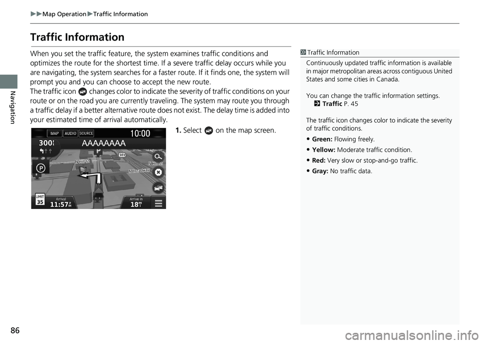
Traffic Information
When you set the traffic feature, the system examines traffic conditions and
optimizes the route for the shortest time. If a severe traffic delay occurs while you
are navigating, the system searches for a faster route. If it finds one, the system will
prompt you and you can choose to accept the new route.
The traffic icon changes color to indicate the severity of traffic conditions on your
route or on the road you are currently traveling. The system may route you through
a traffic delay if a better alternative route does not exist. The delay time is added into
your estimated time of arrival automatically.
1.Select on the map screen.1Traffic Information
Continuously updated traffic information is available
in major metropolitan areas across contiguous United
States and some cities in Canada.
You can change the traffic information settings.
2Traffic P. 45
The traffic icon changes color to indicate the severity
of traffic conditions.
•Green: Flowing freely.
•Yellow: Moderate traffic condition.
•Red: Very slow or stop-and-go traffic.
•Gray: No traffic data.
Page 96 of 147
94
uuChanging Your RouteuAdding Waypoints
Navigation
Adding Waypoints
Add waypoints (pit stops) along the route to your destination.
1.While en route, select a search
method to add a new destination
or waypoint.
2Entering a Destination P. 54
2.Select a place. Select Go!.
3.Select Add to Active Route.
uSelect Start New Route to set
the location as your new
destination.
2Entering a New Destination
P. 98
4.Select and hold , or
and then move the destination to
the desired position.
5.Select Done.
uThe route is automatically
recalculated and displayed on
the map screen.
1Adding Waypoints
When you add a waypoint, the system may take
some time to update the arrival time.
Page 131 of 147
129
uuTroubleshootinguUpdate, Coverage, Map Errors
Troubleshooting
Update, Coverage, Map Errors
Display, Accessories
ProblemSolution
My city is not part of a fully verified detailed
coverage area.The mapping database is constantly undergoing revision.
Does the navigation system work outside North
America?The system contains maps for the United States of America, Canada, Mexico,
Puerto Rico, US Virgin Islands, Cayman Islands, Bahamas, French Guiana,
Guadeloupe, Martinique, Saint Barthelemy, and Jamaica. The navigation system
will not work in other countries.
2Map Coverage P. 135
ProblemSolution
The display appears dim when starting the car in
really cold weather.This is normal. The display will become brighter after a few minutes.
Page 133 of 147
131
Reference Information
System Limitations................................132
GPS ......................................................132
Address Calculation ..............................132
Database ..............................................132
Customer Assistance.............................134
Resolving Problems ...............................134
Obtaining a Navigation Update .............134
Honda Automobile Customer Service
Contact Information ............................134
Visiting Your Dealer ..............................135
Map Coverage ......................................135
Traffic Information ................................135Legal Information................................. 136
User Agreement ................................... 136
Page 135 of 147
133
uuSystem LimitationsuDatabase
Reference Information
The database does not include, analyze,
process, consider, or reflect any of the
following categories of information:
• Neighborhood quality or safety
• Population density
• Availability or proximity of law
enforcement
• Emergency, rescue, medical, or other
assistance
• Construction work, zones, or hazards
• Road and lane closures
• Legal restrictions (such as vehicular type,
weight, load, height, and speed
restrictions)
• Road slope or grade
• Bridge height, width, weight, or other
limits
• Traffic facilities safety
• Special events
• Pavement characteristics or conditions
Every effort has been made to verify that
the database is accurate. The number of
inaccuracies you experience increases the
longer you go without obtaining an
updated map database.
2Obtaining a Navigation Update P. 134
We assume no liability for any incident that
may result from an error in the program, or
from changed conditions not noted above.