2017 SUBARU BRZ tow
[x] Cancel search: towPage 122 of 334

120 Navigation
Navigation
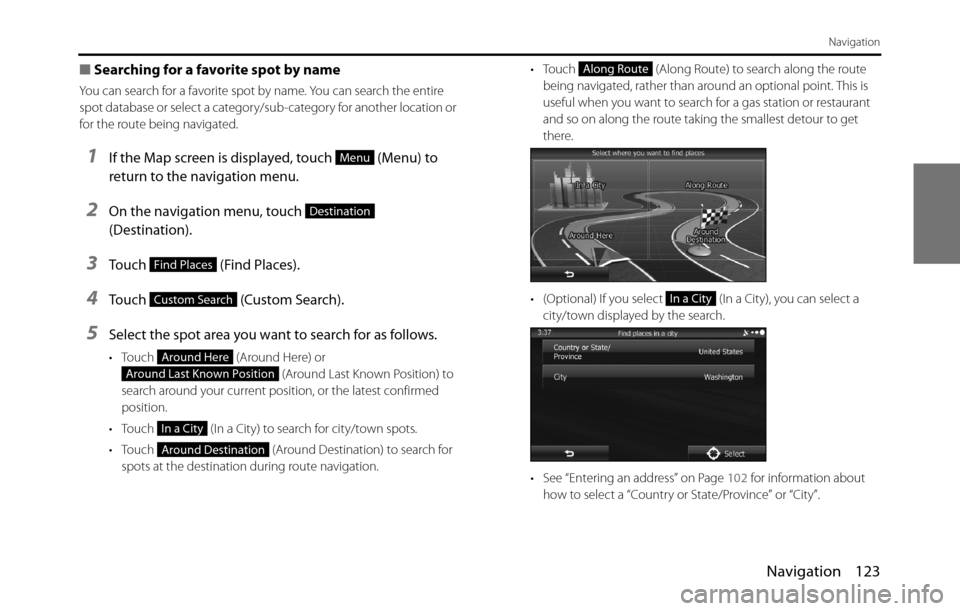
• Touch (Along Route) to search along the route
being navigated, rather than around an optional point. This is
useful when you want to search for a gas station or restaurant
and so on along the route taking the smallest detour to get
there.
• (Optional) If you select (In a City), you can select a
city/town displayed by the search.
• See “Entering an address” on Page 102 for information about
how to select a “Country or State/Province” or “City”.6By selecting a main category (such as accommodations),
or by touching (List All Places), the entire
list of spots around the position you selected or along
the route is displayed.
7By selecting a sub-category (such as hotels or motels)
from the main category, or by touching (List
All Places), the entire list of spots around the position
you selected or along the route is displayed.
Along Route
In a City
List All Places
List All Places
Page 125 of 334

Navigation 123
Navigation
■Searching for a favorite spot by name
You can search for a favorite spot by name. You can search the entire
spot database or select a category/sub-category for another location or
for the route being navigated.
1If the Map screen is displayed, touch (Menu) to
return to the navigation menu.
2On the navigation menu, touch
(Destination).
3Touch (Find Places).
4Touch (Custom Search).
5Select the spot area you want to search for as follows.
• Touch (Around Here) or
(Around Last Known Position) to
search around your current position, or the latest confirmed
position.
• Touch (In a City) to search for city/town spots.
• Touch (Around Destination) to search for
spots at the destination during route navigation.• Touch (Along Route) to search along the route
being navigated, rather than around an optional point. This is
useful when you want to search for a gas station or restaurant
and so on along the route taking the smallest detour to get
there.
• (Optional) If you select (In a City), you can select a
city/town displayed by the search.
• See “Entering an address” on Page 102 for information about
how to select a “Country or State/Province” or “City”.
Menu
Destination
Find Places
Custom Search
Around Here
Around Last Known Position
In a City
Around Destination
Along Route
In a City
Page 166 of 334

164 Navigation
Reference Data
Visual Guidance
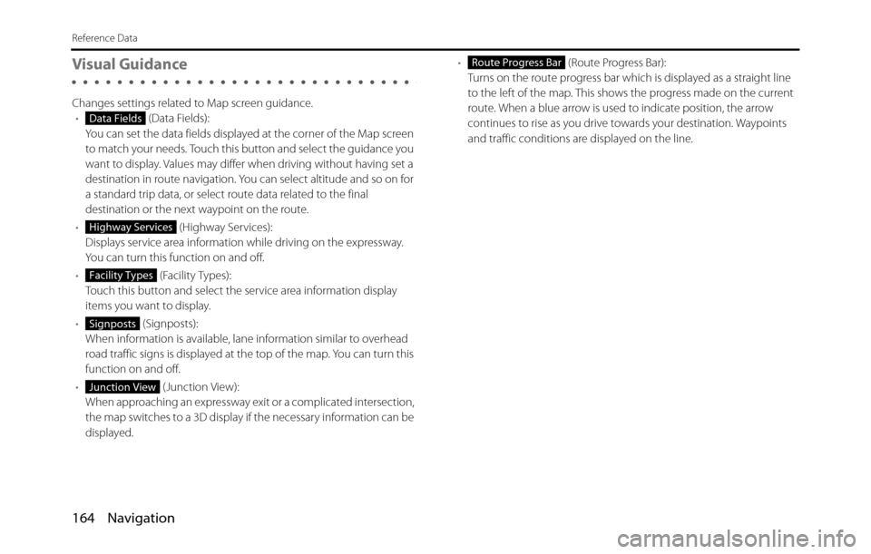
Changes settings related to Map screen guidance.
• (Data Fields):
You can set the data fields displayed at the corner of the Map screen
to match your needs. Touch this button and select the guidance you
want to display. Values may differ when driving without having set a
destination in route navigation. You can select altitude and so on for
a standard trip data, or select route data related to the final
destination or the next waypoint on the route.
• (Highway Services):
Displays service area information while driving on the expressway.
You can turn this function on and off.
• (Facility Types):
Touch this button and select the service area information display
items you want to display.
• (Signposts):
When information is available, lane information similar to overhead
road traffic signs is displayed at the top of the map. You can turn this
function on and off.
• (Junction View):
When approaching an expressway exit or a complicated intersection,
the map switches to a 3D display if the necessary information can be
displayed.• (Route Progress Bar):
Turns on the route progress bar which is displayed as a straight line
to the left of the map. This shows the progress made on the current
route. When a blue arrow is used to indicate position, the arrow
continues to rise as you drive towards your destination. Waypoints
and traffic conditions are displayed on the line.
Data Fields
Highway Services
Facility Types
Signposts
Junction View
Route Progress Bar
Page 168 of 334

166 Navigation
Glossary
2D/3D GPS reception
The GPS receiver uses signals from satellites to calculate its current
position (the user's position), but to acquire a 3D position at least four
signals are necessary, including altitude. The GPS device may not be
able to acquire signals from four satellites as they are constantly moving
and obstacles may block satellite signals. Although the accuracy
decreases when only three signals can be acquired, and altitude data
cannot be sent, the receiver can calculate a latitude and longitude GPS
position. Only 2D reception is possible.
Route being navigated
The route currently being navigated. When a destination is set, the
route will be continuously navigated until the destination is deleted,
you arrive at the destination, or the software is closed. Also see “Route”.
City center
The center of the city/town is not the geographical center of the city/
town, but a location set by the cartographer. In towns and villages, this
is usually the most important intersection, while in larger cities it is
selected from multiple important intersections.
Color design
The color design used for the map and menu screens differs for daytime
and nighttime. Each design has a different graphic setting, with 2D and
3D each having colors for roads, blocks, seas, and lakes, whilst shadow
changes and shadows are displayed differently in 3D mode.
Daytime screen and nighttime screen designs for the map and menu
are selected one at a time. The design changes automatically when day
becomes night and night becomes day.GPS accuracy
Various factors can contribute to a margin of error between the user's
actual position and the position acquired from the GPS device. For
example, signal delays in the ionosphere or reflections from objects
around the GPS equipment, can influence the accuracy with which the
GPS device can calculate the user's position.
Maps
Although this software uses digital maps, these are not simply digital
conversions from printed maps. The 2D mode digital map represents
roads in the same way as a traditional printed map, using color
classifications to show streets, roads, and changes in altitude.
In 3D mode, you can confirm differences in altitude for mountains,
valleys, highland roads and so on, and display areas of cities using 3D
landmarks and 3D images of buildings.
The digital map can be used interactively. You can zoom in and out
(enlarge/reduce), tilt up and down, and rotate left and right. By using
navigation that supports GPS, you can easily plan your route with the
digital maps.
North Up Map Direction
North Up mode rotates the map so that North is always at the top of
the map. You can use this direction with Find On Map and so on. Also
see “Heads-up Map Direction”.
Page 205 of 334

Audio and Visual 203
Audio Operations
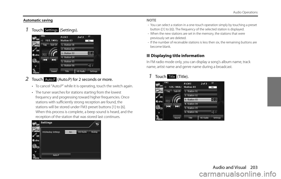
Automatic saving
1Touch (Settings).
2Touch (Auto.P) for 2 seconds or more.
• To cancel “Auto.P” while it is operating, touch the switch again.
• The tuner searches for stations starting from the lowest
frequency and progressing toward higher frequencies. Once
stations with sufficiently strong reception are found, the
stations will be stored under FM3 preset buttons [1] to [6].
When this process is complete, a beep sound is heard, and the
reception of the station that was stored last continues.NOTE
•You can select a station in a one-touch operation simply by touching a preset
button ([1] to [6]). The frequency of the selected station is displayed.
•When the new stations are set in the memory, the stations that were
previously set are deleted.
•If the number of receivable stations is less then six, the remaining buttons are
become blank.
■Displaying title information
In FM radio mode only, you can display a song's album name, track
name, artist name and genre name during a broadcast.
1Touch (Title).
Settings
Auto.PTitle
Page 268 of 334

266 Audio and Visual
How to Operate Portable Audio Devices
Using Aha�¥ by HARMAN
About Aha
Aha is a cloud-based app that connects to your car and gives you
access to your favorite web content safely and easily. There are over
30,000 stations spanning internet radio, personalized music,
audiobooks, Facebook, Twitter, restaurant and hotel searches, weather
and more.
For more about Aha, go to aharadio.com.
When connecting iPhone and iPod touch or Android devices with the
Aha application installed, you can control, view, and hear Aha content
through the navigation system in this vehicle. You may be also display
POI information from the Aha application on the navigation system
map screen and route to these POIs.
The following devices can use this function.
•iPhone and iPod touch
•Android�¥ devices
In this chapter, iPhone and iPod touch or Android devices will be
referred to as a smartphone.
WA R N I N G
•For safety reasons, certain functions are not available while
your vehicle is in motion.
•Do not connect or operate the smartphone while driving.
•Be sure to park the vehicle in a safe location before
connecting or operating the smartphone.
CAUTION
• Certain functions (such as touch panel operation and/or
video image) offered by this unit may not be used while
driving.
•Be careful not to exceed the data usage limits for your
smartphone. Doing so will result in additional data usage
charges from your phone carrier.
•If you lose the data in a smartphone or other device while
using it with this unit, no compensation will be given for the
lost data.
•Do not leave smartphone devices inside the vehicle. The
temperature inside the vehicle can often rise to a very high
level in hot weather and it may result in a malfunction of the
device.
•Do not put your weight on the connected smartphone or
put anything on it. Damage could result.
•Never insert any objects other than iPhone/iPod touch
connection cables into the connection slot on the iPhone/
iPod touch. Damage could result.
•In order to maximize signal reception, performance and
precision of the smartphone, please ensure the smartphone
is placed as close to the navigation unit as possible, while
ensuring it is stowed and secure while driving. Never
attempt to operate your smartphone device directly while
driving.
Page 302 of 334
![SUBARU BRZ 2017 1.G Navigation Manual 300 Other
Other Operations
AvoidAvoidTransits to the screen that allows you
to set detour routes
Bypass
BackBackTransits to the previous screen
Bottom [ , , , ] [ ] [ ] BottomTransits to the botto SUBARU BRZ 2017 1.G Navigation Manual 300 Other
Other Operations
AvoidAvoidTransits to the screen that allows you
to set detour routes
Bypass
BackBackTransits to the previous screen
Bottom [ , , , ] [ ] [ ] BottomTransits to the botto](/manual-img/17/7185/w960_7185-301.png)
300 Other
Other Operations
AvoidAvoidTransits to the screen that allows you
to set detour routes
Bypass
BackBackTransits to the previous screen
Bottom [ , , , ] [ ] [ ] BottomTransits to the bottom of the list
CancelCancelExits from the voice recognition mode
and transits to the map, main or other
menu.
Change cityChange [] cityChanges the city name in the address
currently being recognized (in the
voice recognition mode) Change [] town
Change house numberChange [] house numberChanges the house number in the
address currently being recognized (in
the voice recognition mode)
Change street in line 1Change [] street in line 1Changes the city name listed in the
first line of the list and currently being
recognized (on the screen that allows
you to select a list when addresses are
recognized in the voice recognition
mode)
Change street in line 2Change [] street in line 2Changes the city name listed in the
second line of the list and currently
being recognized (on the screen that
allows you to select a list when
addresses are recognized in the voice
recognition mode) Voice command PhraseFunction
GoJumpMoveScrolltothe
the
the
the
the
the