Page 46 of 130
2.14
TRAFFIC (2/2)
Traffic display
The navigation system indicates traffic
incidents:
– with an alternate color on the map;
– by displaying traffic icons on the map.
A traffic icon is displayed on the naviga-
tion screen to show you whether traf-
fic incidents are announced. When an
incident occurs on your route, an icon
indicates the type of upcoming incident
on your route.
Precautions regarding
navigation
Use of the navigation
system does not in any way
replace the responsibility or vigi-
lance of the driver when driving the
vehicle.
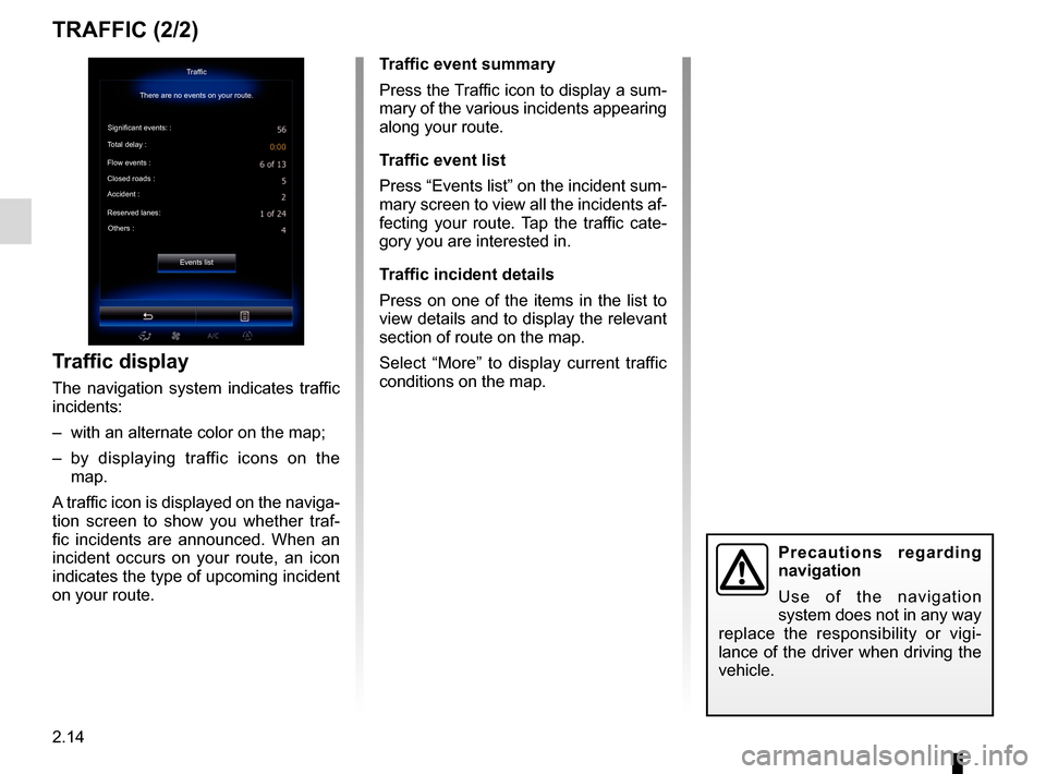
Traffic event summary
Press the Traffic icon to display a sum-
mary of the various incidents appearing
along your route.
Traffic event list
Press “Events list” on the incident sum-
mary screen to view all the incidents af-
fecting your route. Tap the traffic cate-
gory you are interested in.
Traffic incident details
Press on one of the items in the list to
view details and to display the relevant
section of route on the map.
Select “More” to display current traffic
conditions on the map.Traffic
There are no events on your route.
Significant events: :
Total delay :
Flow events :
Closed roads :
Accident :
Reserved lanes: Others :
Events list
Page 47 of 130
2.15
ROUTE (1/4)
Edit route
Current GPS Position
Add
Precautions regarding
navigation
Use of the navigation
system does not in any way
replace the responsibility or vigi-
lance of the driver when driving the
vehicle.
Add
Add
Go
1
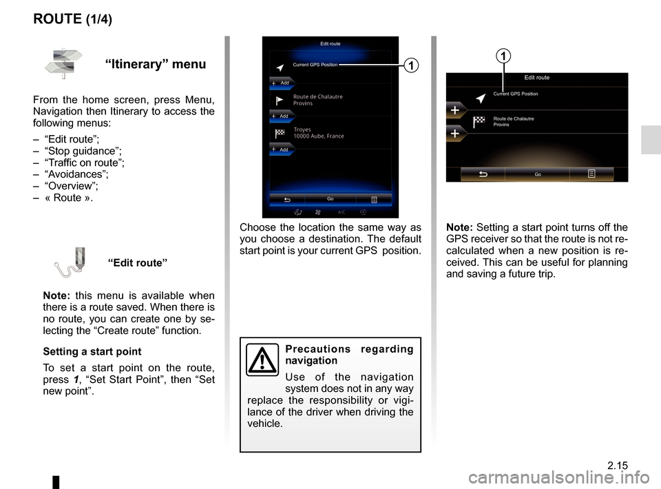
Choose the location the same way as
you choose a destination. The default
start point is your current GPS position.
“Itinerary” menu
From the home screen, press Menu,
Navigation then Itinerary to access the
following menus:
– “Edit route”;
– “Stop guidance”;
– “Traffic on route”;
– “Avoidances”;
– “Overview”;
– « Route ».
“Edit route”
Note: this menu is available when
there is a route saved. When there is
no route, you can create one by se-
lecting the “Create route” function.
Setting a start point
To set a start point on the route,
press 1, “Set Start Point”, then “Set
new point”.
Edit route
Current GPS Position
Route de Chalautre
Provins
Go
Note: Setting a start point turns off the
GPS receiver so that the route is not re-
calculated when a new position is re-
ceived. This can be useful for planning
and saving a future trip.
1
Page 52 of 130
2.20
NAVIGATION SETTINGS (2/4)
“Speed warning”
Maps may contain information about
the speed limits of the road segments.
The navigation system is able to warn
you if you exceed the current limit. This
information may not be available for
your region, or may not be fully correct
for all roads on the map.
The following warning types are avail-
able:
– “Speed limit always visible”: acti-vate this function so that the speed
limit for the section of road taken is
always displayed on the navigation
screen.
– “Speed warning”: the current speed limit is displayed in red and flashes
on the map when you exceed it.
– “Overspeed warning sound”: a beep sounds when you exceed the speed
limit.“Safety warnings”
This function enables you to get a beep
and/or visual warning when you ap-
proach sensitive areas such as near
schools, level crossings, hazardous
areas, etc.
You can programme the navigation
system so that it displays these in-
creased vigilance points on the map,
and so that you can be warned by a
beep when you approach these areas.
For some of these areas, there is a
legal or recommended speed limit. The
beep may differ depending on whether
you are driving under or over the speed
limit.
Choose to be warned when approach-
ing these increased vigilance areas or
only when you are exceeding the speed
limit.
Precautions regarding
navigation
Use of the navigation
system does not in any way
replace the responsibility or vigi-
lance of the driver while driving the
vehicle.
In certain countries it is illegal to ac-
tivate the camera warning option
and this could lead to prosecution.
“Warning sign alerts”
Activate this function to be informed
when approaching specific sections of
road (obstacles, tight corners, cross-
ings, etc.) by road sign displays on
the map screen. For each category
of warning sign, set the warning type
(audio and/or visual) and the distance
from the hazard from which you want to
receive a warning.
Page 80 of 130
4.8
PHONEBOOK
Note: the contacts saved on the SIM
card are not visible. Only contacts
saved on the phone are visible.
Updating the phonebook
You can transfer your phone contacts
into the handset memory of your hands-
free phone system via Bluetooth® (if
your phone allows this).
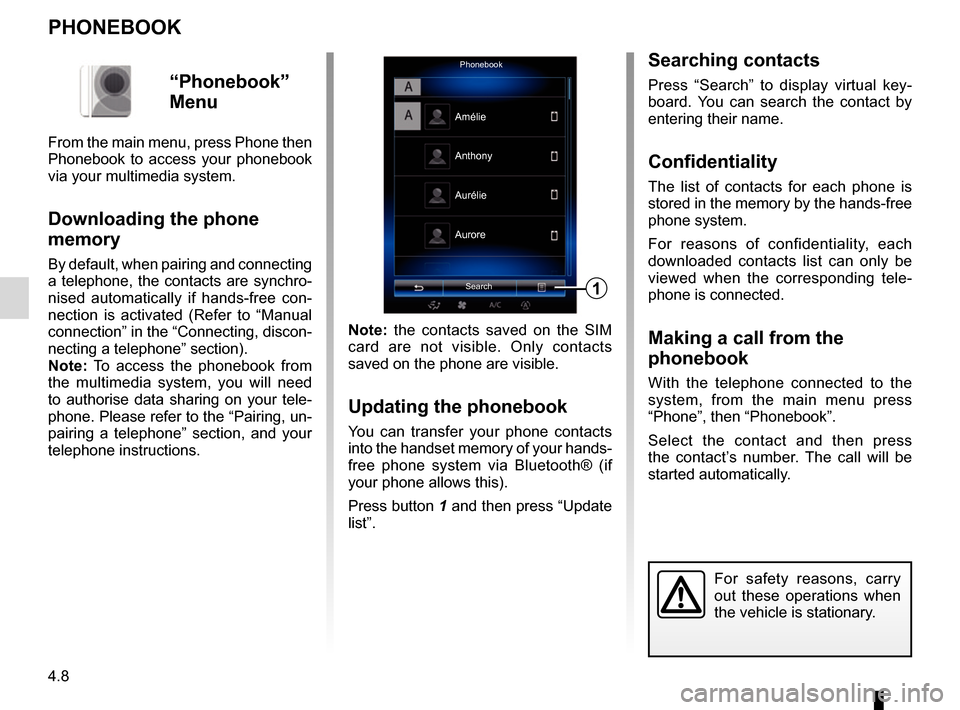
Press button 1 and then press “Update
list”.
PhonebookSearch
Anthony
Aurore
1
Amélie
Aurélie
“Phonebook”
Menu
From the main menu, press Phone then
Phonebook to access your phonebook
via your multimedia system.
Downloading the phone
memory
By default, when pairing and connecting
a telephone, the contacts are synchro-
nised automatically if hands-free con-
nection is activated (Refer to “Manual
connection” in the “Connecting, discon-
necting a telephone” section).
Note: To access the phonebook from
the multimedia system, you will need
to authorise data sharing on your tele-
phone. Please refer to the “Pairing, un-
pairing a telephone” section, and your
telephone instructions.
Searching contacts
Press “Search” to display virtual key-
board. You can search the contact by
entering their name.
Confidentiality
The list of contacts for each phone is
stored in the memory by the hands-free
phone system.
For reasons of confidentiality, each
downloaded contacts list can only be
viewed when the corresponding tele-
phone is connected.
Making a call from the
phonebook
With the telephone connected to the
system, from the main menu press
“Phone”, then “Phonebook”.
Select the contact and then press
the contact’s number. The call will be
started automatically.
For safety reasons, carry
out these operations when
the vehicle is stationary.
Page 100 of 130
6.4
SEATS (2/3)
One-touch foldingAll
FoldSettings
Courtesy for passenger seat
Position On
On
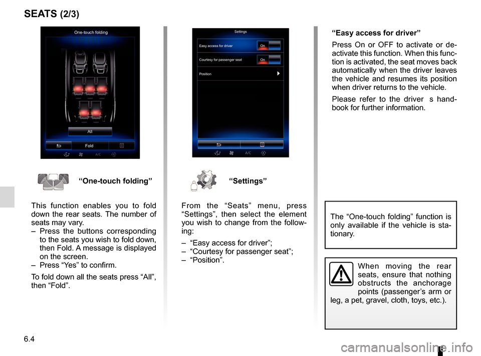
“One-touch folding”
This function enables you to fold
down the rear seats. The number of
seats may vary.
– Press the buttons corresponding to the seats you wish to fold down,
then Fold. A message is displayed
on the screen.
– Press “Yes” to confirm.
To fold down all the seats press “All”,
then “Fold”.“Settings”
From the “Seats” menu, press
“Settings”, then select the element
you wish to change from the follow-
ing:
– “Easy access for driver”;
– “Courtesy for passenger seat”;
– “Position”. “Easy access for driver”
Press On or OFF to activate or de-
activate this function. When this func-
tion is activated, the seat moves back
automatically when the driver leaves
the vehicle and resumes its position
when driver returns to the vehicle.
Please refer to the driver�s hand-
book for further information.
When moving the rear
seats, ensure that nothing
obstructs the anchorage
points (passenger’s arm or
leg, a pet, gravel, cloth, toys, etc.).
The “One-touch folding” function is
only available if the vehicle is sta-
tionary.
Easy access for driver
Page 125 of 130
7.9
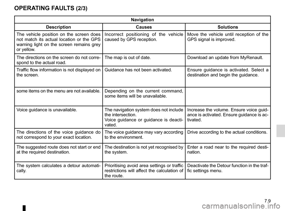
OPERATING FAULTS (2/3)
Navigation
Description Causes Solutions
The vehicle position on the screen does
not match its actual location or the GPS
warning light on the screen remains grey
or yellow. Incorrect positioning of the vehicle
caused by GPS reception. Move the vehicle until reception of the
GPS signal is improved.
The directions on the screen do not corre-
spond to the actual road. The map is out of date. Download an update from MyRenault.
Traffic flow information is not displayed on
the screen. Guidance has not been activated.
Ensure guidance is activated. Select a
destination and begin the guidance.
some items on the menu are not available. Depending on the current command,
some items will be unavailable.
Voice guidance is unavailable. The navigation system does not include the intersection.
Voice guidance or guidance is deacti-
vated.Increase the volume. Ensure voice guid-
ance is activated. Ensure guidance is ac-
tivated.
The directions of the voice guidance do
not correspond to your exact location. The voice guidance may vary according
to the environment.Drive according to the actual conditions.
The suggested route does not start or end
at the required destination. The destination is not yet recognised by
the system.Enter a road near to the required desti-
nation.
The system calculates a detour automati-
cally. Prioritising avoid area settings or traffic
restrictions will affect the calculation of
the route.Deactivate the Detour function in the traf-
fic settings menu.