2016 MERCEDES-BENZ SL-CLASS ROADSTER navigation
[x] Cancel search: navigationPage 365 of 614
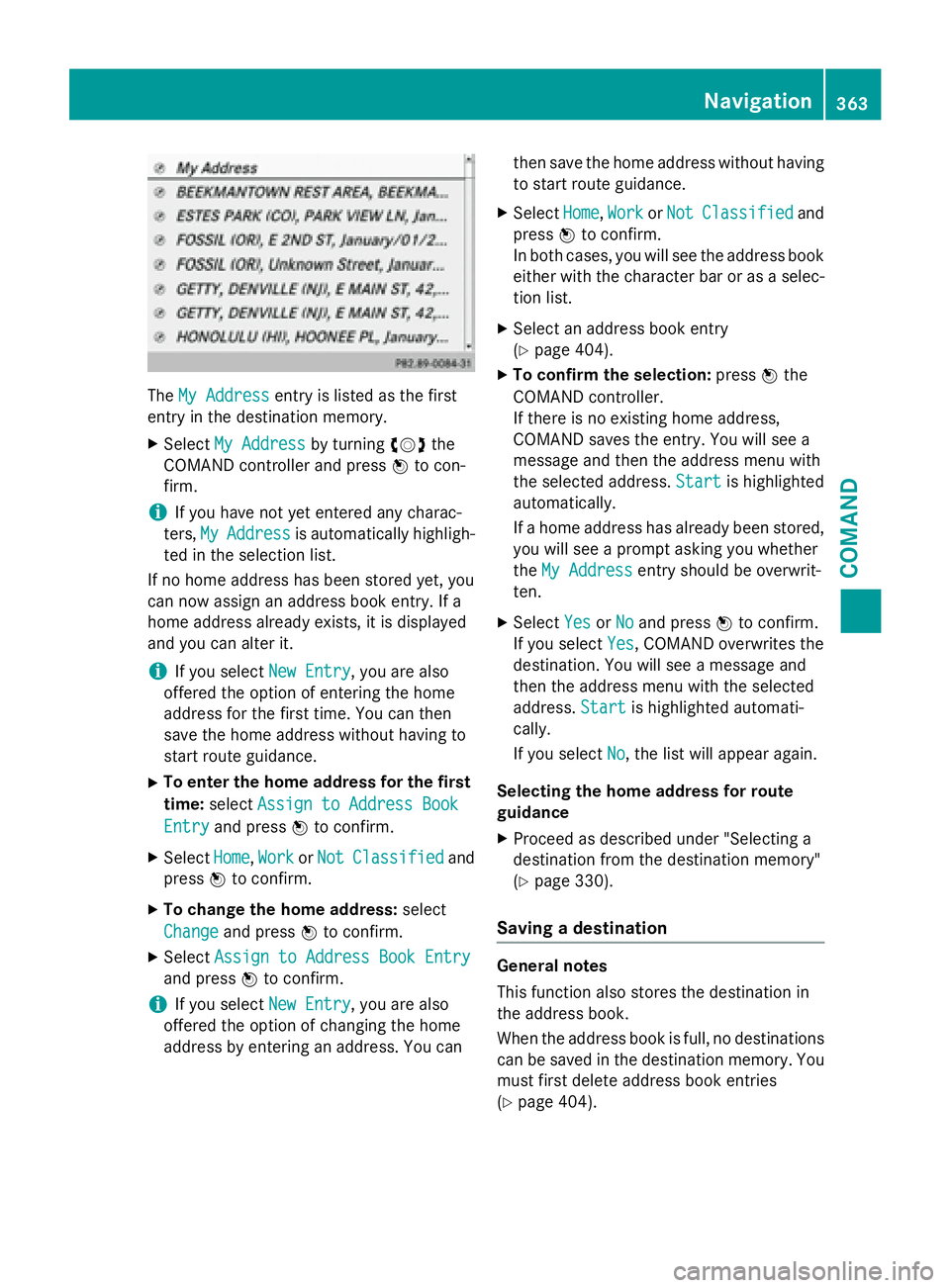
TheMy Addressentry is listed as the first
entry in the destination memory.
XSelect My Addressby turning cVdthe
COMAND controller and press Wto con-
firm.
iIf you have not yet entered any charac-
ters, My
Addressis automatically highligh-
ted in the selection list.
If no home address has been stored yet, you
can now assign an address book entry. If a
home address already exists, it is displayed
and you can alter it.
iIf you select New Entry, you are also
offered the option of entering the home
address for the first time. You can then
save the home address without having to
start route guidance.
XTo enter the home address for the first
time: select Assign to Address Book
Entryand press Wto confirm.
XSelect Home,Workor NotClassifiedand
press Wto confirm.
XTo change the home address: select
Change
and press Wto confirm.
XSelect Assign to Address Book Entry
and press Wto confirm.
iIf you select New Entry, you are also
offered the option of changing the home
address by entering an address. You can then save the home address without having
to start route guidance.
XSelect
Home,Workor NotClassifiedand
press Wto confirm.
In both cases, you will see the address book either with the character bar or as a selec-
tion list.
XSelect an address book entry
(
Ypage 404).
XTo confirm the selection: pressWthe
COMAND controller.
If there is no existing home address,
COMAND saves the entry. You will see a
message and then the address menu with
the selected address. Start
is highlighted
automatically.
If a home address has already been stored,
you will see a prompt asking you whether
the My Address
entry should be overwrit-
ten.
XSelect YesorNoand press Wto confirm.
If you select Yes
, COMAND overwrites the
destination. You will see a message and
then the address menu with the selected
address. Start
is highlighted automati-
cally.
If you select No
, the list will appear again.
Selecting the home address for route
guidance
XProceed as described under "Selecting a
destination from the destination memory"
(
Ypage 330).
Saving a destination
General notes
This function also stores the destination in
the address book.
When the address book is full, no destinations
can be saved in the destination memory. You
must first delete address book entries
(
Ypage 404).
Navigation363
COMAND
Z
Page 366 of 614
After destination entry
XThe destination has been entered and is
shown intheaddr ess entry menu
(
Ypage 324).
XSe lect Savebysliding VÆand turning
cVd the COMAND controller and press W
to confirm.
You can now select storing options
(
Ypage 364).
During route guidance
XTo show the menu: pressWthe COMAND
controller.
XSe lect Destinationin the navigation sys-
tem menu bar byturning cVdthe
COMAND controller and press Wto con-
firm.
XSe lect SaveDestinationand press Wto
confirm.
You can now select storing options
(
Ypage 364).
From the list ofprevious destinations
XTo show the menu: pressWthe COMAND
controller.
XSe lect Destinationin the navigation sys-
tem menu bar byturning cVdthe
COMAND controller and press Wto con-
firm.
XSe lect From Last Destinationsand
press Wto confirm.
The listof last destinations appears.
XSelect a destination byturning cVdthe
COMAND controller and press Wto con-
firm.
The destination address isshown.
XSe lect Saveand press Wto confirm.
You can now select storing options
(
Ypage 364). Selecting storing options
Once you have chosen one of the following
options for storing a destination, you can
specify storage options:
RAfter destination entry (Ypage 364)
RDuring route guidance (Ypage 364)
RFrom the
listof previous destinations
(
Ypage 330)
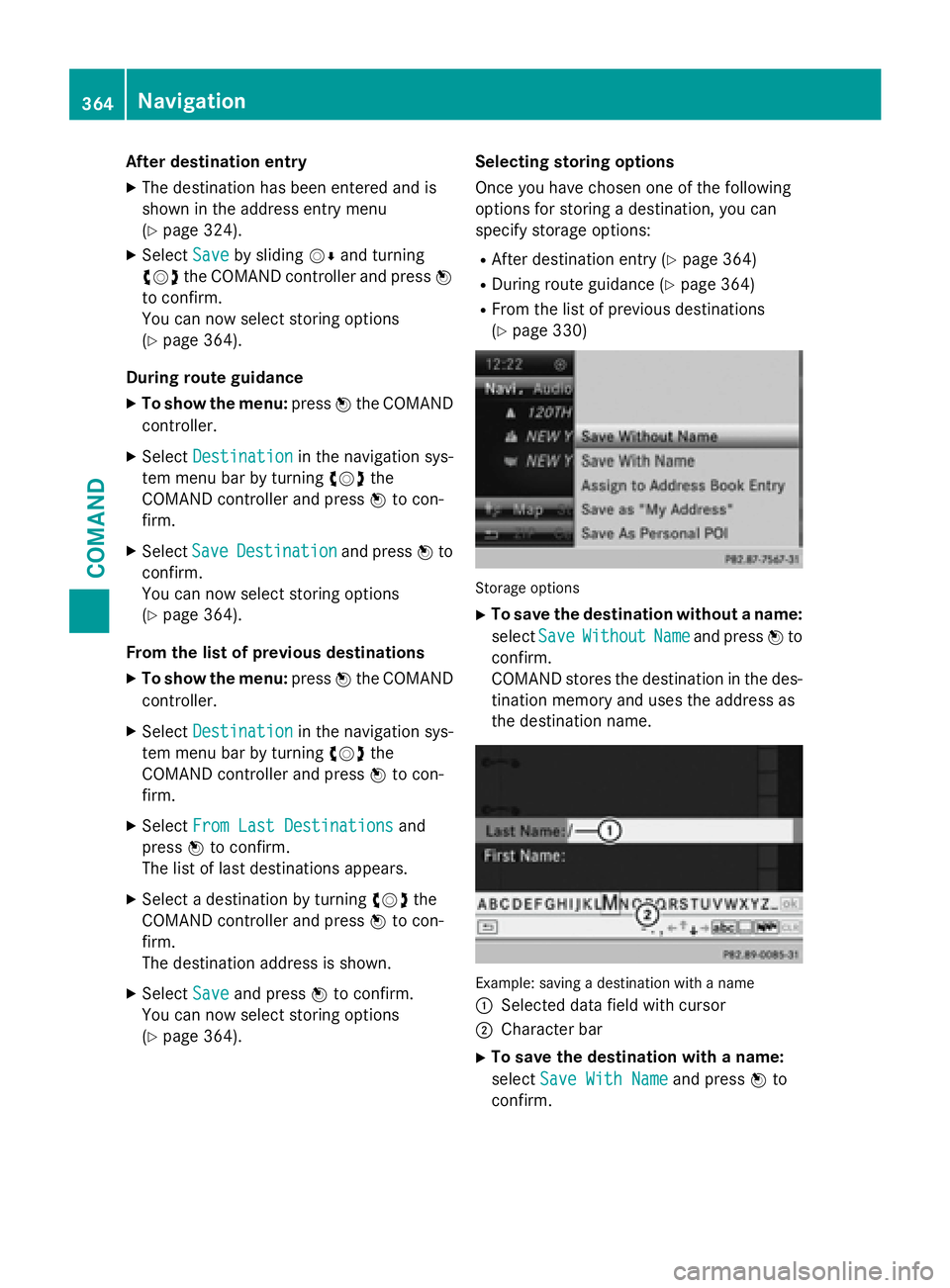
Storag eoption s
XTo save the destination without a name:
select Save
WithoutNameand press Wto
confirm.
COMAND stores the destination inthe des-
tination memory and uses the address as
the destination name.
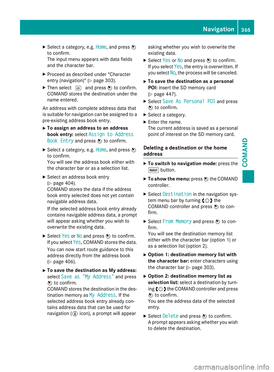
Example: saving adestination wit h anam e
:
Se lected data field with cursor
;Character bar
XTo save the destination with a name:
select Save With Name
and press Wto
confirm.
364Navigation
COMAND
Page 367 of 614
XSelect a category, e.g.Home, and pressW
to confirm.
The input menu appears with data fields
and the character bar.
XProceed as described under "Character
entry (navigation)" (
Ypage 303).
XThen select ¬and press Wto confirm.
COMAND stores the destination under the
name entered.
An address with complete address data that
is suitable for navigation can be assigned to a
pre-existing address book entry.
XTo assign an address to an address
book entry: selectAssign to Address
Book Entryand press Wto confirm.
XSelect a category, e.g. Home, and pressW
to confirm.
You will see the address book either with
the character bar or as a selection list.
XSelect an address book entry
(
Ypage 404).
COMAND stores the data if the address
book entry selected does not yet contain
navigable address data.
If the selected address book entry already
contains navigable address data, a prompt
will appear asking whether you wish to
overwrite the existing data.
XSelect YesorNoand press Wto confirm.
If you select Yes
, COMAND stores the data.
You can now start route guidance to this
address directly from the address book
(
Ypage 406).
XTo save the destination as My address:
select Save as "My Address"
and press
W to confirm.
COMAND stores the destination in the des-
tination memory as My Address
. If the
selected address book entry already con-
tains address data that can be used for
navigation ( Licon), a prompt will appear asking whether you wish to overwrite the
existing data.
XSelect
YesorNoand press Wto confirm.
If you select Yes
, the entry is overwritten. If
you select No
, the process will be canceled.
XTo save the destination as a personal
POI:insert the SD memory card
(
Ypage 447).
XSelect Save As Personal POIand press
W to confirm.
XSelect a category.
XEnter the name.
The current address is saved as a personal
point of interest on the SD memory card.
Deleting a destination or the home
address
XTo switch to navigation mode: press the
Ø button.
XTo show the menu: pressWthe COMAND
controller.
XSelect Destinationin the navigation sys-
tem menu bar by turning cVdthe
COMAND controller and press Wto con-
firm.
XSelect From Memoryand press Wto con-
firm.
You will see the destination memory list
either with the character bar (option 1) or
as a selection list (option 2).
XOption 1: destination memory list with
the character bar: enter characters using
the character bar (
Ypage 303).
XOption 2: destination memory list as
selection list: select a destination by turn-
ing cVd the COMAND controller and press
W to confirm.
You see the address data of the selected
entry.
XSelect Deleteand press Wto confirm.
A prompt appears asking whether you wish
to delete the destination.
Navigation365
COMAND
Z
Page 368 of 614
XSelectYesorNoand press Wto confirm.
If you select Yes
, COMAND deletes the
destination. You will see a message to this
effect.
If you select No
, the process will be can-
celed.
iIf the navigable address data for the des-
tination being deleted is also assigned to an
address book entry, COMAND will also
delete this data from there. If the corre-
sponding address book entry does not con-
tain any further data, such as telephone
numbers, COMAND deletes the entire
address book entry.
Last destinations
Introduction
COMAND automatically stores the previous
destinations for which route calculation has
been started. If the memory is full, COMAND
deletes the oldest destination. You can also
save a destination from the list of previous
destinations in the destination memory. It will
be stored there permanently.
Storing a destination permanently in
the destination memory
XProceed as described in the "From the list
of previous destinations" section
(
Ypage 330).
Storing the vehicle position in the list of
previous destinations
XTo switch on navigation mode: press the
Ø function button.
XTo show the menu: pressWthe COMAND
controller.
XSelect Positionin the navigation system
menu bar by turning cVdthe COMAND
controller and press Wto confirm.
XSelect SaveVehiclePositionand press
W to confirm.
COMAND stores the current vehicle posi-
tion as a destination in the list of previous
destinations.
Storing the crosshair position in the list
of previous destinations
A crosshair appears on the map if you have
moved the map manually (
Ypage 367). You
can store the crosshair position as a destina-
tion in the list of previous destinations.
XTo show the menu: pressWthe COMAND
controller.
XSelect Positionin the navigation system
menu bar by turning cVdthe COMAND
controller and press Wto confirm.
XSelect Save Crosshair Positionand
press Wto confirm.
Deleting one of the previous destina-
tions
XTo switch on navigation mode: press the
Ø function button.
XTo show the menu: pressWthe COMAND
controller.
XSelect Destinationin the navigation sys-
tem menu bar by turning cVdthe
COMAND controller and press Wto con-
firm.
XSelect From Last Destinationsand
press Wto confirm.
The list of last destinations appears.
XSelect the desired destination and press W
to confirm.
The destination address appears.
XSelect Deleteand press Wto confirm.
A prompt appears asking whether the entry
should be deleted.
XSelect YesorNoand press Wto confirm.
If you select Yes
, the entry is deleted.
366Navigation
COMAND
Page 369 of 614
If you selectNo, the process will be can-
celed.
Map operation and map settings
General notes
Company logos displayed on the map are
trademarks of the respective companies and
used solely for the purpose of indicating the
locations of these companies. The use of such logos on the map does not indicate approval
of, support of or advertising by these compa-
nies for the navigation system itself.
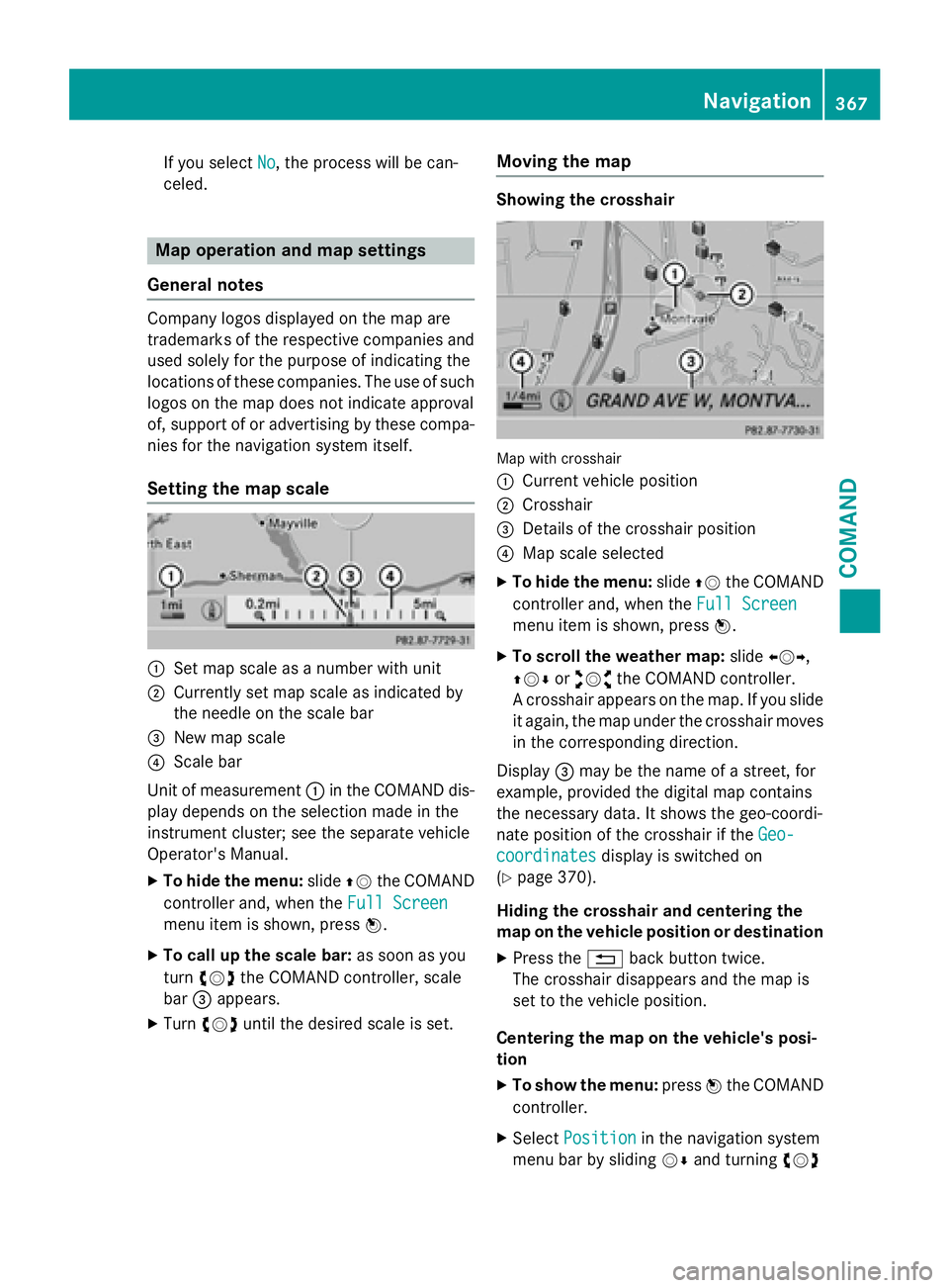
Setting the map scale
:Set map scale as a number with unit
;Currently set map scale as indicated by
the needle on the scale bar
=New map scale
?Scale bar
Unit of measurement :in the COMAND dis-
play depends on the selection made in the
instrument cluster; see the separate vehicle
Operator's Manual.
XTo hide the menu: slideZVthe COMAND
controller and, when the Full Screen
menu item is shown, press W.
XTo call up the scale bar:as soon as you
turn cVd the COMAND controller, scale
bar =appears.
XTurn cVd until the desired scale is set.
Moving the map
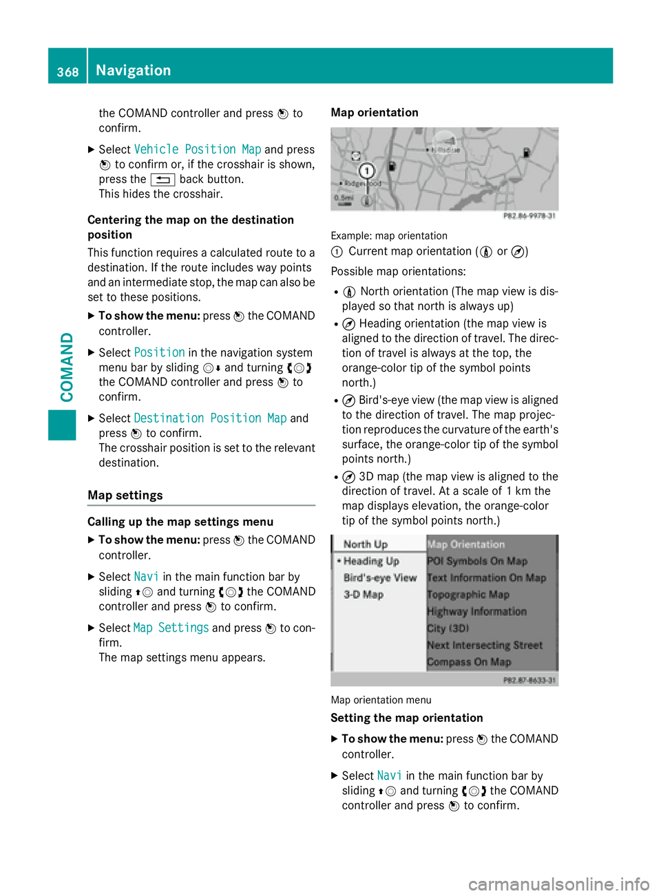
Showing the crosshair
Map with crosshair
:
Current vehicle position
;Crosshair
=Details of the crosshair position
?Map scale selected
XTo hide the menu: slideZVthe COMAND
controller and, when the Full Screen
menu item is shown, press W.
XTo scroll the weather map: slideXVY,
ZVÆ oraVb the COMAND controller.
A crosshair appears on the map. If you slide
it again, the map under the crosshair moves
in the corresponding direction.
Display =may be the name of a street, for
example, provided the digital map contains
the necessary data. It shows the geo-coordi-
nate position of the crosshair if the Geo-
coordinatesdisplay is switched on
(
Ypage 370).
Hiding the crosshair and centering the
map on the vehicle position or destination
XPress the %back button twice.
The crosshair disappears and the map is
set to the vehicle position.
Centering the map on the vehicle's posi-
tion
XTo show the menu: pressWthe COMAND
controller.
XSelect Positionin the navigation system
menu bar by sliding VÆand turning cVd
Navigation367
COMAND
Z
Page 370 of 614
the COMAND controller and pressWto
confirm.
XSelect Vehicle Position Mapand press
W to confirm or, if the crosshair is shown,
press the %back button.
This hides the crosshair.
Centering the map on the destination
position
This function requires a calculated route to a
destination. If the route includes way points
and an intermediate stop, the map can also be
set to these positions.
XTo show the menu: pressWthe COMAND
controller.
XSelect Positionin the navigation system
menu bar by sliding VÆand turning cVd
the COMAND controller and press Wto
confirm.
XSelect Destination Position Mapand
press Wto confirm.
The crosshair position is set to the relevant
destination.
Map settings
Calling up the map settings menu
XTo show the menu: pressWthe COMAND
controller.
XSelect Naviin the main function bar by
sliding ZVand turning cVdthe COMAND
controller and press Wto confirm.
XSelect MapSettingsand press Wto con-
firm.
The map settings menu appears. Map orientation
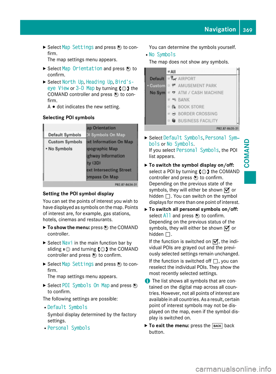
Example: map orientation
:
Current map orientation (
0or¤)
Possible map orientations:
R0 North orientation (The map view is dis-
played so that north is always up)
R¤ Heading orientation (the map view is
aligned to the direction of travel. The direc-
tion of travel is always at the top, the
orange-color tip of the symbol points
north.)
R¤ Bird's-eye view (the map view is aligned
to the direction of travel. The map projec-
tion reproduces the curvature of the earth's surface, the orange-color tip of the symbol
points north.)
R¤ 3D map (the map view is aligned to the
direction of travel. At a scale of 1 km the
map displays elevation, the orange-color
tip of the symbol points north.)
Map orientation menu
Setting the map orientation
XTo show the menu: pressWthe COMAND
controller.
XSelect Naviin the main function bar by
sliding ZVand turning cVdthe COMAND
controller and press Wto confirm.
368Navigation
COMAND
Page 371 of 614
XSelectMapSettingsand press Wto con-
firm.
The map settings menu appears.
XSelect Map Orientationand press Wto
confirm.
XSelect North Up,Heading Up, Bird's-
eye Viewor 3-D Mapby turning cVdthe
COMAND controller and press Wto con-
firm.
A # dot indicates the new setting.
Selecting POI symbols
Setting the POI symbol display
You can set the points of interest you wish to
have displayed as symbols on the map. Points
of interest are, for example, gas stations,
hotels, cinemas and restaurants.
XTo show the menu: pressWthe COMAND
controller.
XSelect Naviin the main function bar by
sliding ZVand turning cVdthe COMAND
controller and press Wto confirm.
XSelect MapSettingsand press Wto con-
firm.
The map settings menu appears.
XSelect POISymbolsOnMapand press W
to confirm.
The following settings are possible:
RDefault Symbols
Symbol display determined by the factory
settings.
RPersonal Symbols
You can determine the symbols yourself.
RNo Symbols
The map does not show any symbols.
XSelect DefaultSymbols,PersonalSym‐
bolsor No Symbols.
If you select Personal Symbols
, the POI
list appears.
XTo switch the symbol display on/off:
select a POI by turning cVdthe COMAND
controller and press Wto confirm.
Depending on the previous state of the
symbols, they will either be shown Oor
hidden ª. You can switch on the symbol
displays for more than one point of interest.
XTo switch all personal symbols on/off:
select All
and press Wto confirm.
Depending on the previous status of the
symbols, they will either be shown Oor
hidden ª.
If the function is switched on O, the indi-
vidual POIs are grayed out and the previ-
ously selected settings remain unchanged.
If the function is switched off ª, you can
reselect the individual POIs. They show the
most recently selected settings.
iThe list shows all symbols that are con-
tained on the digital map across all coun-
tries. However, not all points of interest are
available in all countries. As a result, certain
point of interest symbols may not be dis-
played on the map, even if the symbol dis-
play is switched on.
XTo exit the menu: press thekback
button.
Navigation369
COMAND
Z
Page 372 of 614
Selecting map information
Map information in the display
During route guidance, you can have map
information shown at the bottom edge of the
display.
XTo show the menu:pressWthe COMAND
controller.
XSelect Naviin the main function bar by
sliding ZVand turning cVdthe COMAND
controller and press Wto confirm.
XSelect MapSettingsand press Wto con-
firm.
The map settings menu appears.
XSelect Text Information On Mapand
press Wto confirm.
A # dot indicates the current setting.
XSelect Current Street,Geo-coordi‐
natesor Noneand press Wto confirm.
XTo exit the menu: slideXVY the COMAND
controller.
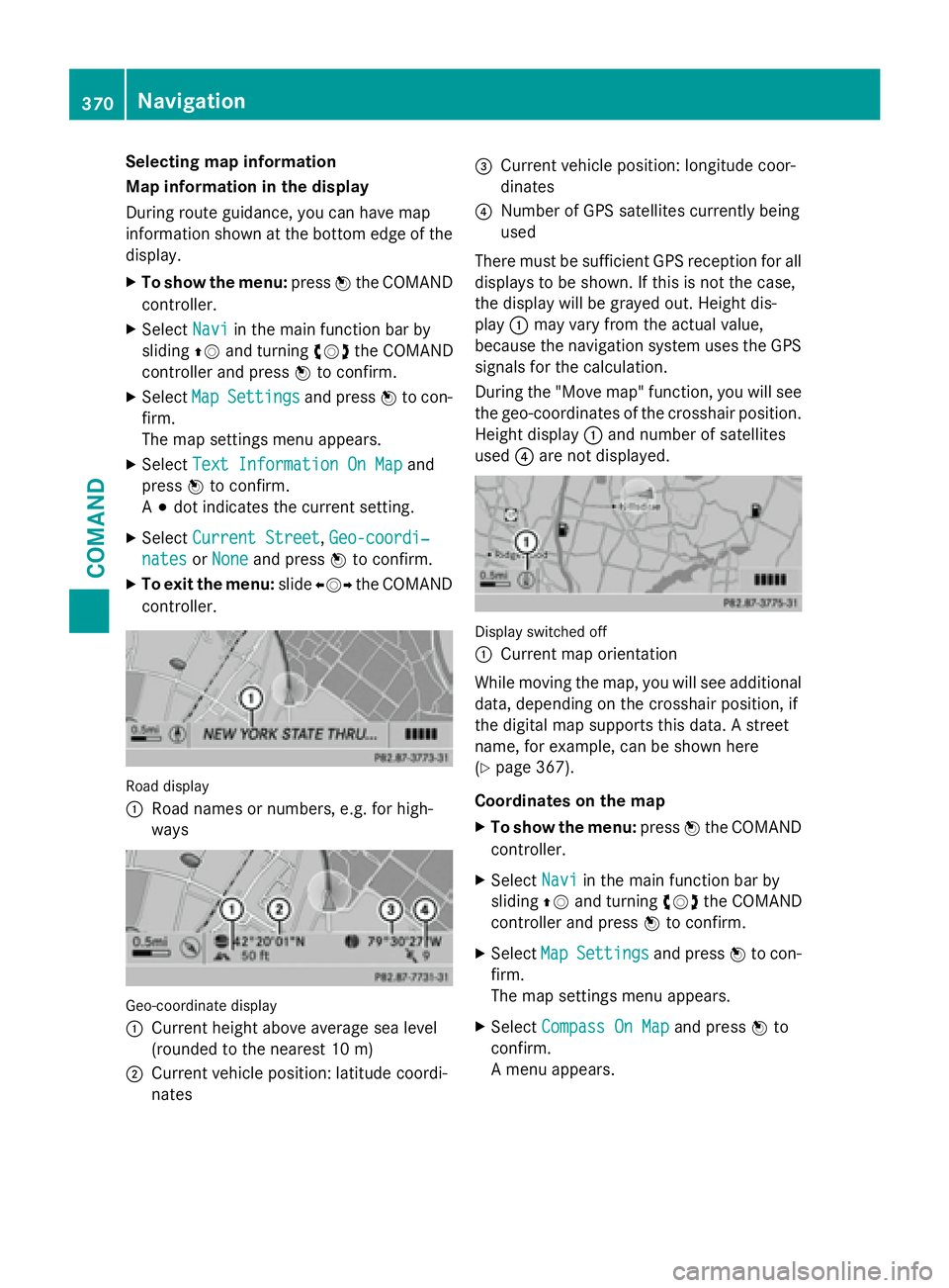
Road display
:
Road names or numbers, e.g. for high-
ways
Geo-coordinate display
:
Current height above average sea level
(rounded to the nearest 10 m)
;Current vehicle position: latitude coordi-
nates
=Current vehicle position: longitude coor-
dinates
?Number of GPS satellites currently being
used
There must be sufficient GPS reception for all
displays to be shown. If this is not the case,
the display will be grayed out. Height dis-
play :may vary from the actual value,
because the navigation system uses the GPS
signals for the calculation.
During the "Move map" function, you will see
the geo-coordinates of the crosshair position.
Height display :and number of satellites
used ?are not displayed.
Display switched off
:
Current map orientation
While moving the map, you will see additional
data, depending on the crosshair position, if
the digital map supports this data. A street
name, for example, can be shown here
(
Ypage 367).
Coordinates on the map
XTo show the menu: pressWthe COMAND
controller.
XSelect Naviin the main function bar by
sliding ZVand turning cVdthe COMAND
controller and press Wto confirm.
XSelect MapSettingsand press Wto con-
firm.
The map settings menu appears.
XSelect Compass On Mapand press Wto
confirm.
A menu appears.
370Navigation
COMAND