2016 MERCEDES-BENZ AMG GT S lock
[x] Cancel search: lockPage 76 of 226

XTo switch to navigation mode:slide5
the controller.
XTo select Navi: turn and press the control-
ler.
The map displays the current vehicle posi-
tion or the navigation menu appears.
XIf the navigation menu appears, press the
controller.
The map shows the vehicle's current posi-
tion.
XTo show the menu: slide6the control-
ler.
XTo select Destination: turn and press the
controller.
XSelect Using Map.
The map with crosshair is shown.
XTo move the map: slide1, 4or
2 the controller.
XTo change the map scale: turn the con-
troller until the desired map scale is selec-
ted.
The scale is displayed at the bottom.
To enlarge the map: turn the controller
counter-clockwise.
To zoom the map out: turn the controller
clockwise.
XTo select a destination: press the con-
troller.
The list contains the Menu
menu item. If
several destinations are available in the
area around the crosshair, these are also
displayed.
XTo show the menu: press the controller.
XTo select a destination from the selection
list: turn and press the controller.
If the digital map provides navigable
address data, you will see the destination
address in the address entry menu.
XTo start route calculation: selectStart.
Entering intermediate destinations
Introduction
You can also map the route to the destination yourself by entering up to four intermediate
destinations. The sequence of the intermedi-
ate destinations can be changed at any time.
COMAND provides a selection of predefined
destinations in eight categories for this pur-
pose, e.g. GAS STATION
orRESTAURANT. You
can also use the destination entry options to
enter intermediate destinations.
Creating intermediate destinations
XTo switch to navigation mode: slide5
the controller.
XTo select Navi: turn and press the control-
ler.
The map displays the current vehicle posi-
tion or the navigation menu appears.
XIf the navigation menu appears, press the
controller.
The map shows the vehicle's current posi-
tion.
XTo show the menu: slide6the control-
ler.
74Destination entry
Navigation
Page 88 of 226

Calling up the selection mode
XWhen highway information is displayed,
slide9 the controller.
The marker is on the highway information.
The associated position is highlighted on
the map.
XTo select the desired rest stop/freeway
exit: turn and press the controller.
The available POIs are displayed.
Starting route guidance to a POI
XTo select a POI: turn the controller and
press to confirm.
The POI details are displayed.
You can perform the following functions:
Rstore in the address book (Ypage 96)
Rview on the map (Ypage 101)
Rcalled if a phone is connected and a
phone number is available (
Ypage 120).
Rselect for route guidance and a route to it
calculated (
Ypage 65).
Using the traffic jam function
Highway information enables the use of the
traffic jam function. The remaining route on
the highway in this case is blocked in the
direction of travel from the selected exit.
XTo select Detour: turn and press the con-
troller.
The traffic jam function appears
(
Ypage 89).
Destination reached
Once the destination is reached, you will see
the checkered flag. Route guidance is fin-
ished.
Navigation announcements
Repeating navigation announcements
If you missed the current navigation
announcement, you can call it up again.
86Route guidance
Navigation
Page 93 of 226

Off-road during route guidance
Due to road works, for example, there may be
differences between the data on the digital
map and the actual course of the road.
In such cases, the system will temporarily be
unable to locate the vehicle position on the
digital map. The vehicle is therefore in an off-
road position.
In the display, you will then see theRoad
Not
Mappedmessage, an arrow and the distance
to the destination. The direction arrow shows
the compass heading to the destination.
As soon as the system can assign the vehicle
position to the map again, route guidance
continues in the usual way.
Real-time traffic reports
Prerequisites
This function is currently not available for
Canada.
In order to receive real-time traffic reports via
satellite radio, you need to subscribe to SIR-
IUS XM Satellite Radio Traffic Message Ser-
vice.
Further information on satellite radio
(
Ypage 172).
COMAND can receive traffic reports via sat-
ellite radio and take account of these for
route guidance in the navigation system.
Received traffic reports are displayed on the
map either as text or as symbols.
Real-time traffic reports on the map
COMAND can show certain traffic incidents
on the map with symbols (type of incident)
and colored lines (extent). Traffic reports are
shown on the map at scales of 1/32 mi to
20 mi.
When :is displayed, traffic reports can be
received or traffic reports are available. If it is not displayed, no reception is possible.
XTo hide the menu: slide5and press the
controller.
The map can be seen in the full-screen dis-
play.
XTo set the map scale: turn the controller
until the desired map scale is selected.
:Traffic jam on the route
;Slow-moving traffic on the route
=Road blocked
?Traffic disruption
ATraffic warning
BDashed red and white line delimiting the
traffic warning
CRoad block (crosses along the affected
road)
DSlow-moving traffic (orange line along the
affected route)
ETraffic jam (red line along the affected
route)
Real-time traffic reports91
Navigation
Z
Page 104 of 226

in via the COMAND Internet and online func-
tion.
The availability of information is country-
dependent. Information can include maxi-
mum speeds, driving with low-beam head-
lamps or legal alcohol limits, for example.
XTo switch to navigation mode:slide5
the controller.
XTo select Navi: turn and press the control-
ler.
The map displays the current vehicle posi-
tion or the navigation menu appears.
XIf the navigation menu appears, press the
controller.
The map shows the vehicle's current posi-
tion.
XTo show the menu: slide6the control-
ler.
XTo select Position: turn and press the
controller.
XSelect Country Information.
When the online connection has been
established, the available country informa-
tion appears.
iAlternatively you can call up this function
using the touchpad (
Ypage 25).
XTo return to navigation: press the%
button.
Avoiding an area
General notes
COMAND enables you to avoid areas you do
not wish to drive through.
If you activate or deactivate a route block
while route guidance is active, COMAND will
calculate a new route. If you activate or deac-
tivate a route block while route guidance is
inactive, COMAND will use the new setting for
the next route guidance. The calculated route may include an area to
be avoided if:
Ryour destination is located in such an area.
Rthere is no alternative route of comparable
length available
Highways within blocked areas are always
taken into consideration in the route calcula-
tion.
iAlternatively, you can carry out this oper-
ation using the touchpad (
Ypage 25).
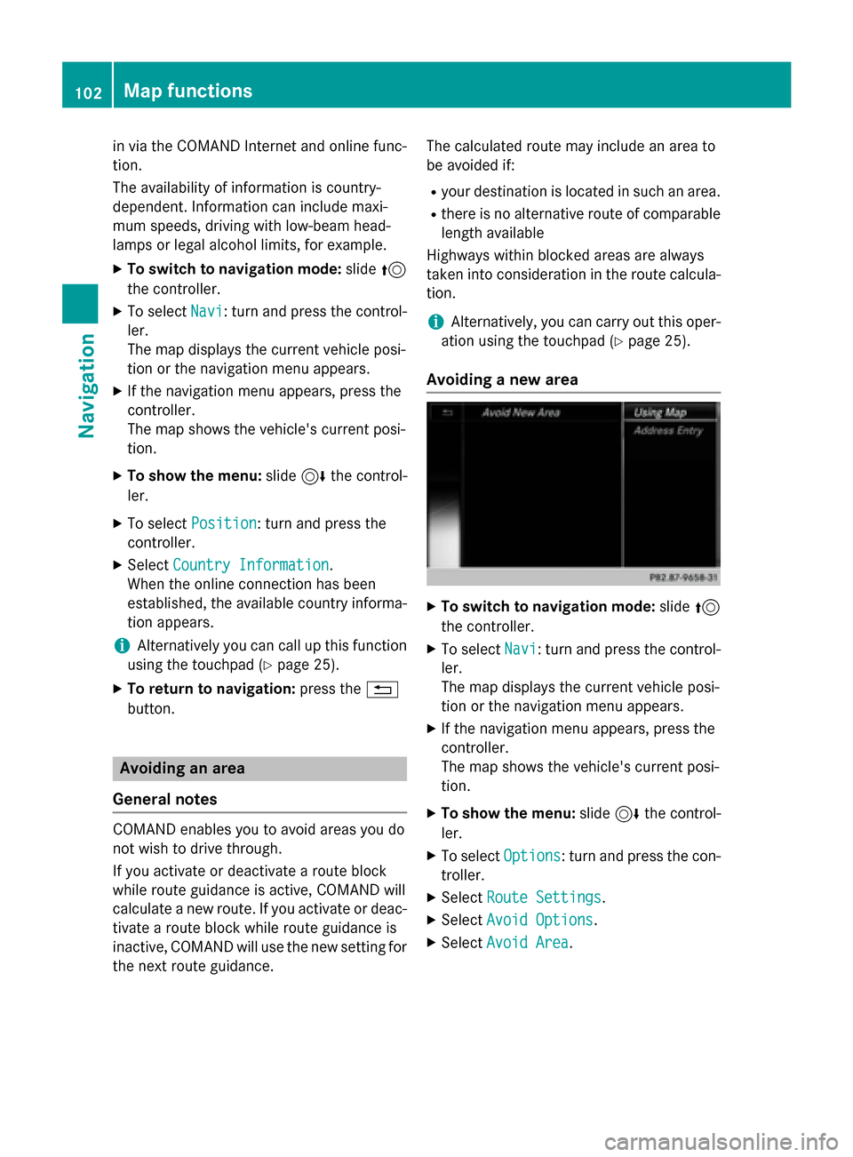
Avoiding a new area
XTo switch to navigation mode: slide5
the controller.
XTo select Navi: turn and press the control-
ler.
The map displays the current vehicle posi-
tion or the navigation menu appears.
XIf the navigation menu appears, press the
controller.
The map shows the vehicle's current posi-
tion.
XTo show the menu: slide6the control-
ler.
XTo select Options: turn and press the con-
troller.
XSelect Route Settings.
XSelectAvoid Options.
XSelectAvoid Area.
102Map functions
Navigation
Page 105 of 226

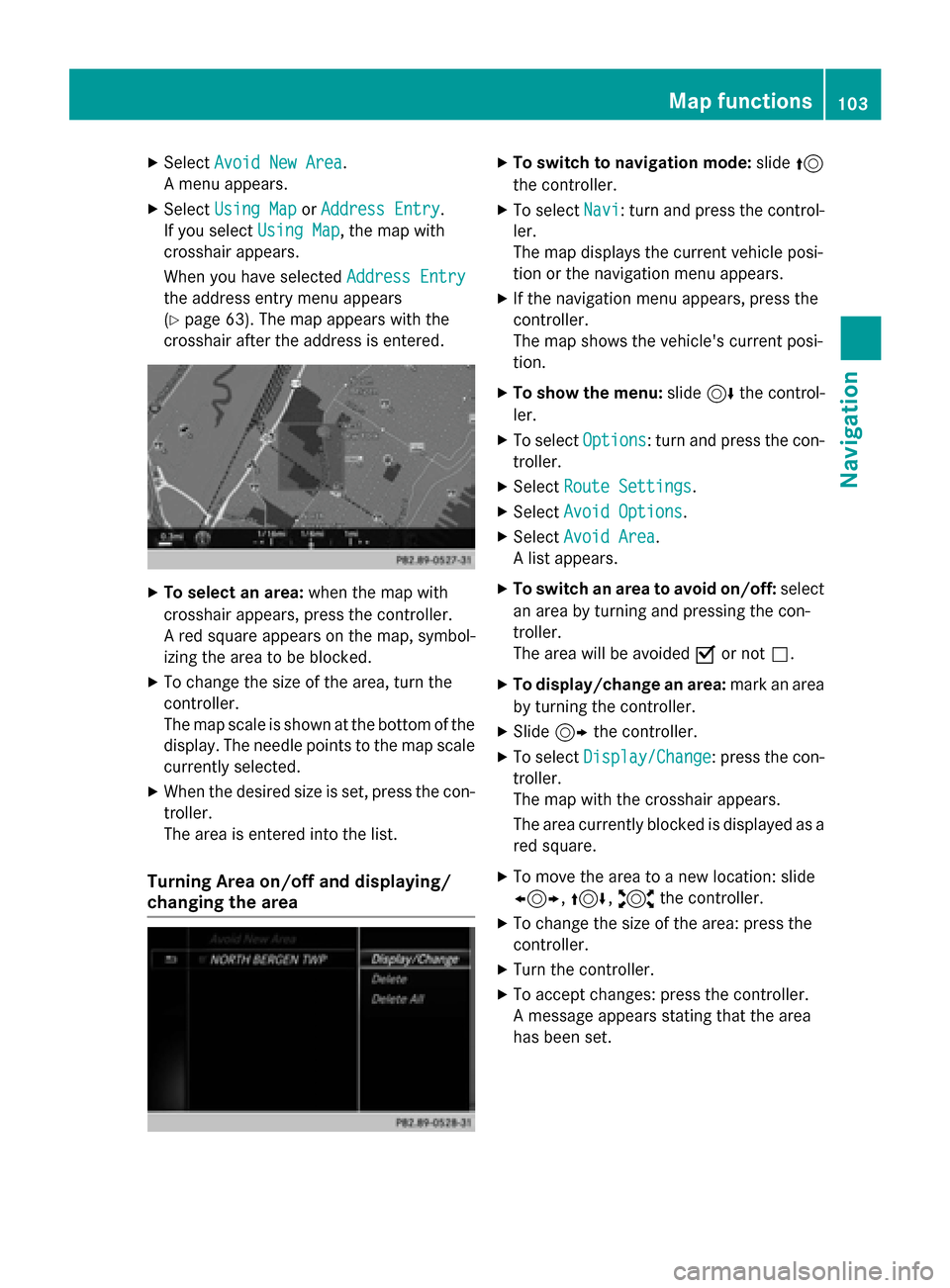
XSelectAvoid New Area.
A menu appears.
XSelect Using MaporAddress Entry.
If you select Using Map
, the map with
crosshair appears.
When you have selected Address Entry
the address entry menu appears
(
Ypage 63). The map appears with the
crosshair after the address is entered.
XTo select an area: when the map with
crosshair appears, press the controller.
A red square appears on the map, symbol-
izing the area to be blocked.
XTo change the size of the area, turn the
controller.
The map scale is shown at the bottom of the
display. The needle points to the map scale
currently selected.
XWhen the desired size is set, press the con- troller.
The area is entered into the list.
Turning Area on/off and displaying/
changing the area
XTo switch to navigation mode: slide5
the controller.
XTo select Navi: turn and press the control-
ler.
The map displays the current vehicle posi-
tion or the navigation menu appears.
XIf the navigation menu appears, press the
controller.
The map shows the vehicle's current posi-
tion.
XTo show the menu: slide6the control-
ler.
XTo select Options: turn and press the con-
troller.
XSelect Route Settings.
XSelectAvoid Options.
XSelectAvoid Area.
A list appears.
XTo switch an area to avoid on/off: select
an area by turning and pressing the con-
troller.
The area will be avoided Oor not ª.
XTo display/change an area: mark an area
by turning the controller.
XSlide 9the controller.
XTo select Display/Change: press the con-
troller.
The map with the crosshair appears.
The area currently blocked is displayed as a
red square.
XTo move the area to a new location: slide
1, 4,2the controller.
XTo change the size of the area: press the
controller.
XTurn the controller.
XTo accept changes: press the controller.
A message appears stating that the area
has been set.
Map functions103
Navigation
Z
Page 140 of 226

Prerequisites
To use the message functions, the connected
mobile phone must support the MAP Blue-
tooth
®profile. The prompt for the MAP Blue-
tooth®profile may have to be confirmed on
the mobile phone.
With some mobile phones, some settings still
have to be made after connecting to
COMAND (see the manufacturer's operating
instructions). The messages are displayed the
next time you connect to COMAND.
An e-mail account must be set up on the
mobile phone for the e-mail function (see the
manufacturer’s operating instructions).
To read and write e-mails in COMAND, the e-
mail account first needs to be configured
(
Ypage 139).
Some mobile phones with the MAP Blue-
tooth
®profile:
Ronly show new text messages.
Rdo not support the deleting or editing of
text messages.
Rdo not support the drafts folder for text
messages.
Rdo not support the sending of text mes-
sages.
Rdo not support the e-mail function.
Rdo not send messages in a locked status.
Not all mobile phones available on the market
are equally suitable. You can obtain further
information about settings and supported
functions of Bluetooth
®-capable mobile
phones on the Internet at
www.mercedes-benz-mobile.com .
Or call the Mercedes-Benz Customer Assis-
tance Center at 1-800-FOR-MERCedes
(1-800-367-6372) (for the USA) or Customer
Relations at 1-800-387-0100 (for Canada).
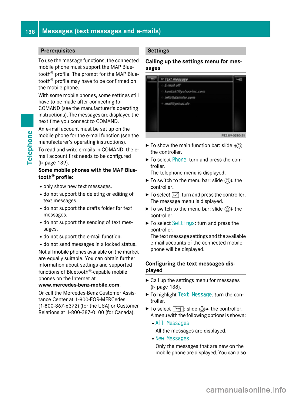
Settings
Calling up the settings menu for mes-
sages
XTo show the main function bar: slide 5
the controller.
XTo select Phone: turn and press the con-
troller.
The telephone menu is displayed.
XTo switch to the menu bar: slide 6the
controller.
XTo select 1: turn and press the controller.
The message menu is displayed.
XTo switch to the menu bar: slide 6the
controller.
XTo select Settings: turn and press the
controller.
The text message settings and the available
e-mail accounts of the connected mobile
phone will be displayed.
Configuring the text messages dis-
played
XCall up the settings menu for messages
(
Ypage 138).
XTo highlight Text Message: turn the con-
troller.
XTo select G: slide 9the controller.
A menu with the following options is shown:
RAll Messages
All the messages are displayed.
RNew Messages
Only the messages that are new on the
mobile phone are displayed. You can also
138Messages (text messages and e-mails)
Telephone
Page 165 of 226

XTo show the menu:press the%but-
ton.
XTo select 3: turn and press the control-
ler.
A menu appears.
XSelect Settings.
You can activate/deactivate the following
settings:
RDownload Images Automatically
It may take some time to download the
contents of websites that contain a large
amount of images. Therefore, it may be
useful to deactivate this option.
RBlock Pop-Ups
Pop-ups are windows (usually with adver-
tisements) which are displayed automati-
cally when you call up a website. You can
block these displays.
RActivate Javascript
Javascript makes it possible to display and
interact with dynamic content on the web-
site.
RAllow Cookies
Some websites save information in small
text files (cookies) on your system. You can
determine whether cookies may be stored.
REnable Internet Audio
You can switch the browser's audio play-
back on or off here.
RHide Scroll Bars
You can show or hide the scroll bar here.
RShow Link Target
You can display the link's URL here.
RCharacter Size
You can select the font size which is used
when displaying the website.
RCharacter Code
You can select a different character set
here, e.g. if the characters of a website
appear distorted.
Changing settings
XTo select the desired setting: turn and
press the controller.
Switch the setting on Oor off ª.
Changing the character size or character code.
XSelect Character SizeorCharacter
Code.
XTo select the setting you require: turn and
press the controller.
iIf you change the settings, the websites
may not be displayed correctly.
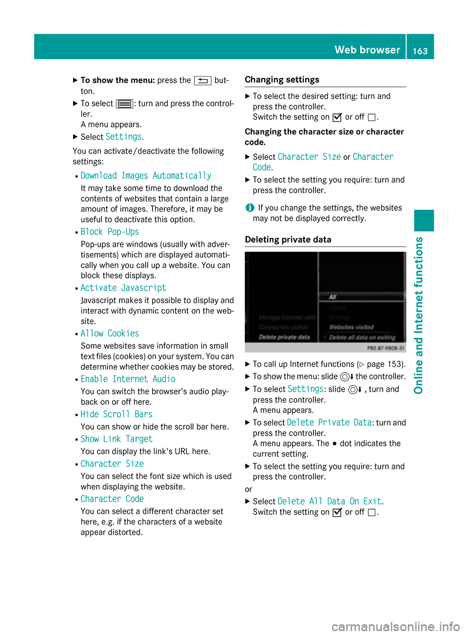
Deleting private data
XTo call up Internet functions (Ypage 153).
XTo show the menu: slide 6the controller.
XTo select Settings: slide6, turn and
press the controller.
A menu appears.
XTo select DeletePrivateData: turn and
press the controller.
A menu appears. The #dot indicates the
current setting.
XTo select the setting you require: turn and
press the controller.
or
XSelect Delete All Data On Exit.
Switch the setting on Oor off ª.
Web browser163
Online and Internet functions
Z
Page 174 of 226

Calling up sound settings
XIn radio mode: slide6the controller.
The radio menu bar appears.
XTo select à: turn and press the control-
ler.
The sound menu appears (
Ypage 210).
Displaying information
This function is available in HD FM radio and
HD AM radio mode.
Reception is only possible if the radio stations
provide the relevant information.
XIn radio mode: slide 6the controller.
XTo select Info: turn and press the control-
ler.
If the station supports this function, addi-
tional information will be shown.
If available, you will see:
Rstation abbreviation
Rthe current track
Rthe artist of the current track
Rinformation about the current program
Rhotline number for the station or latest
headlines
Back to radio display:
XTo select Info: slide6and press the
controller.
Satellite radio
General notes
The satellite radio mode requires satellite
radio equipment and registration with a sat-
ellite radio provider.
Note that the categories and channels shown
in the illustrations depend on the program
content offered by the provider. The illustra-
tions and descriptions in these operating
instructions may therefore differ from the
channels and categories offered by the pro-
vider.
Satellite radio mode may be temporarily
unavailable or interrupted for a variety of rea-
sons. These include environmental or topo-
graphical conditions as well as other factors
beyond the control of Mercedes-Benz USA,
LLC. This means operation may not be possi-
ble in certain areas.
These include:
Rtunnels
Rparking garages
Rlocations inside or next to buildings
Rlocations in the vicinity of other structures
SIRIUS XM Satellite Radio offers more than
140 digital-quality radio channels providing
100% commercial-free music, sports, news
and entertainment.
SIRIUS XM Satellite Radio employs a fleet of
high-performance satellites to broadcast
around the clock throughout the USA and
Canada.
The satellite radio program is available for a
monthly fee. Details are available from the
SIRIUS XM Service Center and at
http://www.siriusxm.com (USA) or
http://www.sir iusxm
.ca(Canada).
Your new Mercedes-Benz vehicle comes with
SIRIUS XM Satellite Radio pre-installed at the factory. This service is free for a six-month
trial period. About a month before the trial
period ends, information will be provided on
how to extend this subscription. An acoustic
signal sounds and a message is shown,
172Satellite radio
Radio