Page 65 of 143

Navigation65
To return to the current location,
select the RESET screen button in
the interaction selector bar.
Zooming
To zoom in on a selected map
location, select the ZOOM IN screen
button.
To zoom back out and display a larger area around the selected location,
select the ZOOM OUT screen button.
Overview button
During active route guidance, an
OVERVIEW screen button is
displayed in the interaction selector
bar.
To display an overview of the route
currently active on the map, select the OVERVIEW screen button.
The screen button changes to
RESET .
To return to the normal view, select
the RESET screen button.
Changing the map view
To toggle between the different map
views ( 3D View , Heading Up View ,
North Up View ), repeatedly select the
x screen button in the application
tray.
Notice
The map view may also be adapted
via the navigation menu (see below).
Information on the current
location Select the MENU screen button in the
interaction selector bar to display the navigation menu.
Select the Current Location list item to
display the respective submenu
indicating details on the nearest
address, the coordinates, and Points
of interest ( 3 69) around the current
location.
Page 66 of 143

66Navigation
Nearest address
From this submenu, you may store
the nearest address to the system.
Select the Nearest Address screen
button to display the destination
details view.
Find a detailed description on how to save an address
■ as or to a contact 3 32.
■ as a favourite 3 28.
Points of interest
From this submenu, you may start
route guidance to one of the nearest
points of interest.
Select the desired point of interest.
The destination details view is
displayed.
Select the Go screen button.
Find a detailed description on how to
enter a destination 3 69.
Map view
View
Select the MENU screen button in the
interaction selector bar and then
select the Map View list item to
display the respective submenu.
Select the desired map view ( 3D
View , Heading Up View , North Up
View ).
Audio information
If Audio Information is activated,
audio control screen buttons are
displayed in the interaction selector
bar of the map view.
Select the MENU screen button in the
interaction selector bar and then
select the Map View list item to
display the respective submenu.
Set Audio Information to On or Off.Display mode
Select the MENU screen button in the
interaction selector bar and then
select the Map View list item to
display the respective submenu.
Select Day / Night Mode to display the
respective submenu.
Depending on the external lighting
conditions, activate Day or Night .
If you wish the screen to adjust
automatically, activate the Auto menu
item.
POI icons
Select the MENU screen button in the
interaction selector bar and then
select the Display "Points of Interest"
Icons list item to display the
respective submenu.
If POI Icons is activated, points of
interest around the current location or
along the route are displayed on the
map.
Set POI Icons to On or Off.
If POI Icons is set to On, select the
POI categories you wish to be
displayed.
Page 67 of 143

Navigation67
Select Clear All to unselect all
categories.
Navigation data managementSelect the MENU screen button in the
interaction selector bar and then
select the Personal Data list item.
A list of different data storage
locations of the navigation application
is displayed.
Contacts list
Select Address Book to display the
respective submenu.Deleting all entries
To delete all entries in the contacts
list, select the Delete All Entries list
item. You are prompted with a message.
Confirm the message to delete the
entire contacts list.Editing the contacts list
Select Edit Address Book to display
the contacts list.
Find a detailed description on editing
the contacts list 3 32.Recent destinations list
Select Recent Destinations to display
the respective submenu.Deleting all destinations
To delete all entries in the recent
destinations list, select the Delete All
Destinations list item. You are
prompted with a message.
Confirm the message to delete the
entire recent destinations list.Deleting individual destinations
Select Delete Individual Destinations
to display the recent destinations list.
To delete a destination, select the ─
icon next to the respective
destination. You are prompted with a
message.
Confirm the message to delete the
destination.
Downloaded POIs
Select My POIs to display the
respective submenu.
POIs which were previously
downloaded to the system may be
deleted. The other POIs remain within
the system.
Deleting all downloaded POIs
To delete all entries in the contacts
list, select the Delete All My POIs list
item. You are prompted with a message.
Confirm the message to delete the
entire POIs list.Deleting categories
Select Delete Individual Categories to
display a list of POI categories.
To delete a category, select the ─ icon
next to the respective category. You
are prompted with a message.
Confirm the message to delete the
category.
Uploading destination data to a USB
device
For later use, e.g. in other cars, you
can store the vehicle contacts list and POIs previously downloaded (see
"Creating and downloading user
defined POIs" below) on a USB
device:
Select Upload Saved Locations .
Page 68 of 143

68Navigation
The contacts list and POI data is
stored on the connected USB device
in the folders "F:\myContacts"
respective "F:\myPOIs", where "F:\" is
the root folder of the USB device.
Notice
This function may only be carried out if a USB device with sufficient
storage space is connected.
Downloading contacts data
You can exchange your vehicle
contacts list data with Infotainment systems in other cars:
To upload the data to a USB device, see "Uploading navigation data to a
USB device" above.
Connect the USB device to the
Infotainment system of another car
3 55.
A message is displayed that prompts
you to confirm the download.
After confirmation, the contacts data
is downloaded to the Infotainment
system.
The downloaded contacts are then
selectable via the CONTACTS menu
3 32.Creating and downloading user
defined POIs (My POIs)
In addition to the predefined POIs
already stored in the Infotainment
system, you can create user defined
POIs that meet your personal
requirements. After creation, such
user defined POIs can be
downloaded to the Infotainment
system.
For each POI, you need to define the GPS coordinates (longitude and
latitude values) of the respective
location and a descriptive name.
After downloading the POI data to the
Infotainment system, you will find the
respective POIs as selectable
destinations in the My POIs menu,
see "Selecting a point of interest" in chapter "Destination input" 3 69.
Creating a text file with POI data
Create a text file (e.g. by using a
simple text editor software) with an
arbitrary name and the file
extension .poi, e.g. "TomsPOIs.poi".Notice
Character encoding UTF-8
(Unicode) needs to be selected
when storing the text file. Otherwise
the POI data may not be imported
correctly to the system.
Enter the POI data into the text file in
the following format:
Longitude coordinate, Latitude
coordinate, "Name of POI",
"Additional information", "Phone
number"
Example:
7.0350000, 50.6318040, "Michaels
Home", "Bonn, Hellweg 6",
"02379234567" , see image above.
Page 69 of 143

Navigation69
The GPS coordinates must be
expressed in decimal degrees and can be taken, e.g., from a
topographical map.
The additional information and phone number strings are optional. If, e.g.,
no additional information is required,
"" needs to be entered at the
respective position.
Example:
7.0350000, 50.6318040, "Michaels
Home", "", "02379234567" .
The POI name and the additional
information string may not exceed 60
characters each. The phone number
string may not exceed 30 characters.
The POI data of each destination
address must be entered in a single
separate line, see image above.
Storing the POI data on a USB drive
In the root directory of a USB drive,
create a folder named " myPOIs",
e.g. "F:\myPOIs", where "F:\" is the
root directory of the USB drive.
In the "myPOIs" folder, store the text
file with your POIs, e.g. "F:\myPOIs
\TomsPOIs.poi".Organising the POI data in several subfolders
Optionally you can organise the text
files in several randomly named
subfolders (max. depth of subfolder
structure: 2).
Examples: F:\myPOIs\AnnsPOIs or
F:\myPOIs\MyJourney\London,
where F:\ is the root directory of the USB drive.
Notice
In a folder only subfolders or only POI files may be stored. A mixture of both will not be imported correctly to the system.
After downloading individual POI data
organised in that way to the
Infotainment system (see download
description further below), the My
POIs menu will show a list of
selectable submenus.
After selecting a submenu, further
submenus or the related list of
imported POI categories will be
displayed.Downloading the POI data to the
Infotainment system
Connect the USB device with your
user defined POI data to the USB port
3 55 of the Infotainment system.
A message is displayed that prompts
you to confirm the download.
After confirmation, the POI data will
be downloaded to the Infotainment system.
The downloaded POIs are then
selectable as destinations via the My
POIs menu, see "Selecting a point of
interest" in chapter "Destination input" 3 69.
Destination input The navigation application provides
different options to set a destination
for route guidance.
Press the ; button and then select
the NAV icon to display the navigation
map.
Page 70 of 143

70Navigation
Entering an address via
keyboard Select the DESTINATION screen
button in the interaction selector bar
and then select the ADDRESS tab.
You may enter an address,
crossroads or the name of a road.
Find a detailed description on the keyboards 3 24.
Find important information on the country-specific input orders for
destination addresses 3 61.
Notice
If a different input order is used than specified for the respective country,
the system may not find the desired
destination.
Enter the destination address in the
proper postal address order of your
country. Example: Thomas Lewis
Way Southampton .
The navigation systems accepts
incomplete inputs to some extend.
Example: Lewis Way Southampton .
For destinations abroad, add the
country name or three-letter country
code to the end of the input. Example: Megisserie Paris FRA .
To confirm your input, select the Go
screen button in the top left corner of
the screen.
If there is more than one destination
possible according to the information
entered, a list of all matching
destinations found is displayed.
Select the desired address.
The destination details view is
displayed.
To start route guidance, select the
Go screen button.
Selecting an address from the
recent destinations list
Select the DESTINATION screen
button in the interaction selector bar
and then select the RECENT tab.
A list of all recently entered
destinations is displayed.
Page 71 of 143

Navigation71
Select one of the entries. The
destination details view is displayed.
To start route guidance, select the
Go screen button.
Selecting an address from the
contacts list
Select the DESTINATION screen
button in the interaction selector bar
and then select the CONTACTS tab.
The contacts list is displayed.Quick function icon
If there is only one address stored for a contact, a quick route icon is
displayed next to the respective entry
in the contacts list.
Select the y screen button to directly
display the destination details view.
To start route guidance, select the
Go screen button.
Contact details view
If there is more than one address
stored for a contact, select the
desired contacts entry. The contact
details view is displayed.
Select one of the addresses stored for
the contact. The destination details
view is displayed.
To start route guidance, select the
Go screen button.
Selecting a point of interest
A point of interest (POI) is a specific
location that might be of general interest, e.g. a petrol station, a
parking area or a restaurant.
The data stored within the navigation
system contains a great number of
predefined POIs, which are indicated
on the map (if activated, 3 63).
You may also store individual POIs
within the system, see "Creating and
downloading user defined POIs" in
chapter "Usage" 3 63. Those POIs
are selectable as destinations via the
POI main category My POIs.
To select a POI as destination for route guidance, select the
DESTINATION screen button in the
interaction selector bar and then
select the POIS tab. A list of POI main
categories is displayed.
Page 72 of 143

72Navigation
Setting a search locationNotice
The search location is specified by
the map section chosen. If you scroll the map, zoom in or out or start route
guidance, the POIs in the list are
adapted accordingly.
To set a general search location,
select the Search Near screen button
on the map.
A list of possible search locations is
displayed. If you are in active route
guidance, more options are available.
Select the desired option.Searching POIs via categories
Select one of the main categories in
the list. A list with subcategories is
displayed.
To display all POIs available in the
respective main category, select the
List All menu item. Scroll through the
list and select the desired POI.
To display all POIs within one
subcategory, select the respective
subcategory. Scroll through the list
and select the desired POI.The destination details view is
displayed.Searching POIs via keyboard To search for a particular POI, a
category or a specific location, select
the Search menu item in the POI main
categories list or in one of the
subcategory lists. A keyboard is
displayed.
Enter the desired name, category or
location. Find a detailed description
on the keyboards 3 24.
Select the Go screen button to
confirm your input. The destination
details view is displayed.
To start route guidance, select the
Go screen button.
Selecting an address from the
map
Tap on the desired location on the
map. The map centres around this
location.
A red v symbol is displayed at the
respective location and the
corresponding address is shown on a label.
Tap on the label. The destination
details view is displayed.
 1
1 2
2 3
3 4
4 5
5 6
6 7
7 8
8 9
9 10
10 11
11 12
12 13
13 14
14 15
15 16
16 17
17 18
18 19
19 20
20 21
21 22
22 23
23 24
24 25
25 26
26 27
27 28
28 29
29 30
30 31
31 32
32 33
33 34
34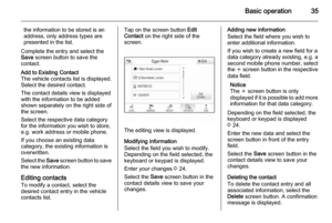 35
35 36
36 37
37 38
38 39
39 40
40 41
41 42
42 43
43 44
44 45
45 46
46 47
47 48
48 49
49 50
50 51
51 52
52 53
53 54
54 55
55 56
56 57
57 58
58 59
59 60
60 61
61 62
62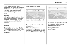 63
63 64
64 65
65 66
66 67
67 68
68 69
69 70
70 71
71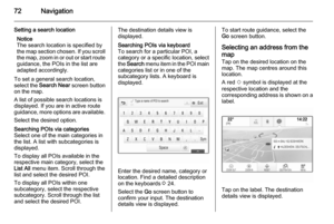 72
72 73
73 74
74 75
75 76
76 77
77 78
78 79
79 80
80 81
81 82
82 83
83 84
84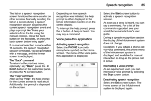 85
85 86
86 87
87 88
88 89
89 90
90 91
91 92
92 93
93 94
94 95
95 96
96 97
97 98
98 99
99 100
100 101
101 102
102 103
103 104
104 105
105 106
106 107
107 108
108 109
109 110
110 111
111 112
112 113
113 114
114 115
115 116
116 117
117 118
118 119
119 120
120 121
121 122
122 123
123 124
124 125
125 126
126 127
127 128
128 129
129 130
130 131
131 132
132 133
133 134
134 135
135 136
136 137
137 138
138 139
139 140
140 141
141 142
142