2015 MERCEDES-BENZ S-Class phone
[x] Cancel search: phonePage 78 of 298

Your COMAND equipment
These operating instructions describe all
standard and optional equipment available
for your COMAND system at the time of pur-
chase. Country-specific differences are pos-
sible. Please note that your COMAND system may not be equipped with all the features
described. This also applies to safety-relevant
systems and functions. Therefore, the equip-
ment on your COMAND system may differ
from that in the descriptions and illustrations. Should you have any questions concerning
equipment and operation, please consult an
authorized Mercedes-Benz Center. Introduction
Important safety notes
G
WARNING
If you operate information systems and com-
munication equipment integrated in the vehi- cle while driving, you will be distracted from
traffic conditions. You could also lose control of the vehicle. There is a risk of an accident.
Only operate the equipment when the traffic
situation permits. If you are not sure that this
is possible, park the vehicle paying attention
to traffic conditions and operate the equip-
ment when the vehicle is stationary.
You must observe the legal requirements for
the country in which you are currently driving when operating COMAND.
COMAND calculates the route to the destina-
tion without taking account of the following,
for example:
R traffic lights
R stop and yield signs
R merging lanes
R parking or stopping in a no parking/no
stopping zone
R other road and traffic rules and regulations
R narrow bridges COMAND can give incorrect navigation com-
mands if the actual street/traffic situation
does not correspond with the digital map's
data. Digital maps do not cover all areas nor
all routes in an area. For example, a route may
have been diverted or the direction of a one-
way street may have changed.
For this reason, you must always observe
road and traffic rules and regulations during
your journey. Road and traffic rules and reg-
ulations always have priority over the sys-
tem's driving recommendations.
Navigation announcements are intended to
direct you while driving without diverting your attention from the road and driving.
Please always use this feature instead of con-sulting the map display for directions. Look-
ing at the icons or map display can distract
you from traffic conditions and driving, and
increase the risk of an accident. General notes
Operational readiness of the navigation system The navigation system must determine the
position of the vehicle before first use or
whenever operational status is restored.
Therefore, you may have to drive for a while
before precise route guidance is possible.
GPS reception Among other things, correct functioning of
the navigation system depends on GPS recep-
tion. In certain situations, GPS reception may
be impaired, there may be interference or
there may be no reception at all, e.g. in tun-
nels or parking garages.
i Using roof carriers may impair the correct
functioning of a roof antenna (phone, sat-
ellite radio, GPS). 76
Int
roductionNavigation
Page 79 of 298

Entry restriction
In certain countries, data entry is restricted if
the vehicle is traveling at more than approx-
imately 3 mph (5 km/h). The restriction is
deactivated as soon as the vehicle speed
drops below about 2 mph (3 km/h).
When the restriction is active, certain entries cannot be made. This will be indicated by the
fact that certain menu items are grayed out
and cannot be selected.
The following entries are not possible, for
example:
R entering the destination city and street
R entering a destination via the map
R entering POIs in the vicinity of a city or via a
name search
R editing entries
R direct entry via the telephone keypad (if
available)
Other entries are possible, such as entering
points of interest in the vicinity of the desti-
nation or current position. Introduction
77Navigation Z
Page 93 of 298

Selection Instructions
Menu item
Search By
Search By
Name
Name
Search for all POIs on the
digital map or around
one of the three previ-
ously specified positions X
Call up the POI menu (Y page 89).
X To select Search By Name Search By Name: turn and press the controller.
X Select All POIs
All POIs or one of the three previously selected posi-
tions.
The point of interest list with character bar appears.
X Enter a name.
or
X To select Mercedes-Benz Service Mercedes-Benz Service: turn and press the con-
troller. Menu item
Search By
Search By
Phone Number
Phone Number
This function gives you
access to all points of
interest that have a
phone number. X
Call up the POI menu (Y page 89).
X To select Search SearchBy
ByPhone
Phone Number
Number : turn and press the con-
troller.
You will see a list of phone numbers.
X Enter the telephone number.
The telephone number consists of: R the country code (international dialing code)
R the area code
When entering the area code, omit the leading "0".
R the telephone number of the participating caller Selecting a POI category
POI categories appear after choosing the
menu items
Near Destination Near Destination, Current
Current
Position
Position and after entering another city. X
Select a POI category: turn and press the
controller.
The 0043symbol after an entry shows that
further categories are available.
X Select a sub-category.
The POI search covers a 240 mile (400 km)
radius around the selected position.
Once the search is completed, the POI list
is displayed.
The search results display the following
information:
R an arrow that shows the linear direction
to the POI (search around vehicle posi-
tion)
R the linear distance to the point of interest
R the name of the point of interest
X Select a point of interest.
The complete address of the POI is shown. Destination input
91Navigation Z
Page 94 of 298

Selecting a point of interest
Requirement for "Calling a POI": a mobile phone is connected to COMAND (Y
page 138).
Requirements for "Viewing the vicinity of the destination" and "Loading data from the Internet": mbrace must be activated for Internet access (Y page 173).The complete address of the POI is shown.
Viewing the vicinity of the destination
X To select symbol 0043: turn the controller and press to confirm.
If street images are available, the street in the vicinity of the destination address is shown.
Calling up the map
X Select Map
Map.
X Move the map, change the map scale and select the POI (Y page 93).
Calling up the POI
X Select Call
Call.
If a telephone number is available, COMAND switches to the telephone function.
Loading data from the Internet X Select www
www.
If an Internet address is available, data is loaded from the Internet.
Saving a POI
X To select Save
Save: turn and press the controller.
The POI can be saved as:
R a navigable contact in the address book
R My Address
Starting route calculation X To select Start
Start: press the controller (Y page 86).92
Destination inputNavigation
Page 97 of 298

Selection Action
Using Map
Using Map X
Enter a destination
using the map
(Y page 93). From Memory From Memory
Card Card X
Select a personal POI
(Y page 99). From From
Mercedes- Mercedes-
Benz Apps Benz Apps X
Enter a destination
from Mercedes-Benz
Apps (Y page 96). Using Geo- Using Geo-
Coordinates Coordinates X
Enter a destination
using the geo-coordi-
nates (Y page 97). X
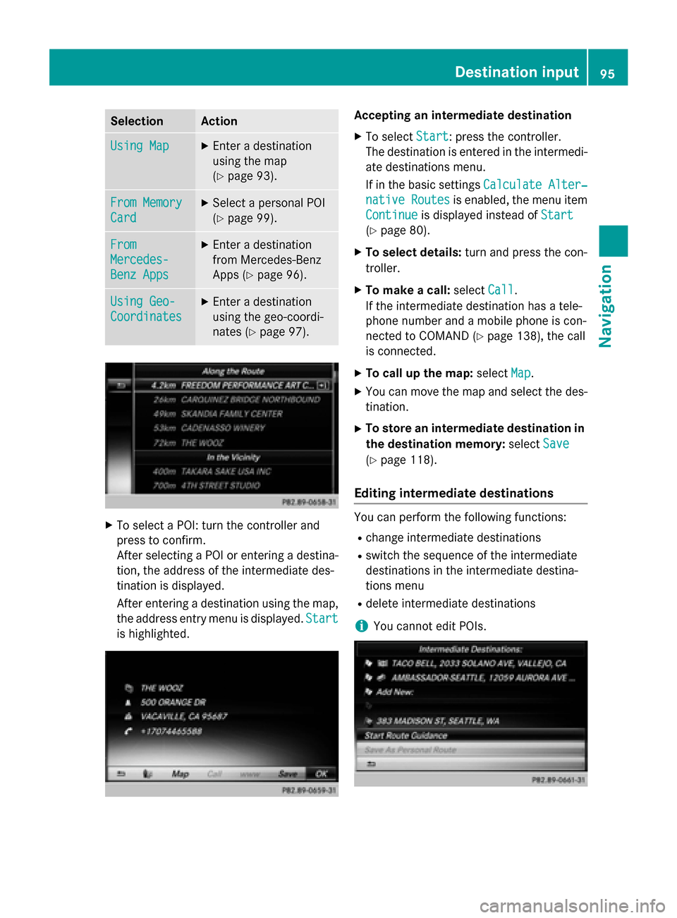
To select a POI: turn the controller and
press to confirm.
After selecting a POI or entering a destina- tion, the address of the intermediate des-
tination is displayed.
After entering a destination using the map,
the address entry menu is displayed. Start
Start
is highlighted. Accepting an intermediate destination
X To select Start
Start: press the controller.
The destination is entered in the intermedi-
ate destinations menu.
If in the basic settings Calculate Alter‐ Calculate Alter‐
native Routes
native Routes is enabled, the menu item
Continue Continue is displayed instead of Start Start
(Y page 80).
X To select details: turn and press the con-
troller.
X To make a call: selectCall
Call.
If the intermediate destination has a tele-
phone number and a mobile phone is con-
nected to COMAND (Y page 138), the call
is connected.
X To call up the map: selectMap
Map.
X You can move the map and select the des-
tination.
X To store an intermediate destination in
the destination memory: selectSave Save
(Y page 118).
Editing intermediate destinations You can perform the following functions:
R
change intermediate destinations
R switch the sequence of the intermediate
destinations in the intermediate destina-
tions menu
R delete intermediate destinations
i You cannot edit POIs. Destination input
95Navigation Z
Page 102 of 298

Selecting a register
X Slide 9the controller.
X To select a character: turn and press the
controller.
Selecting character set for sorting
X To highlight 0054, slide9the controller.
X Press the controller.
The available character sets are displayed.
The 003Bdot indicates the current setting.
X Turn and press the controller.
Editing Personal route
X Select personal POI or personal route
(Y page 99).
Exploring personal POI or route X To select Map Map: turn and press the controller.
The map with the crosshair appears and
shows the destination.
X Scroll the map (Y page 120).
X Set the map scale (Y page 120).
X To return to the menu: press the 0038but-
ton.
Placing a call to the personal POI X To select Call
Call: turn and press the control-
ler.
If a mobile phone is connected to COMAND and the telephone number is available, the
call is connected (Y page 145). Changing name and symbol
X To select Edit
Edit: turn and press the control-
ler.
X Select Change Name Change Name orEdit Icon
Edit Icon.
X To change name: enter character
(Y page 36).
X To change symbol: select a symbol.
The symbol is saved.
Deleting personal POI or route
X To select Delete Delete: turn and press the con-
troller.
A prompt will appear.
X Select Yes YesorNo
No.
If you select Yes
Yes, the personal destination
or personal route is deleted.
Selecting outward and return route
X To select Swap
Swap: turn and press the control-
ler.
The starting and destination positions of
your personal route, and thus the direction for route guidance, are switched round.
One-way streets or restricted intersections
are taken into consideration. Therefore, the outward and return routes may differ from
each other.
Saving personal POI
X To select Save
Save: turn and press the control-
ler.
X To continue saving (Y page 118).
Starting route guidance
X To select Start Start: turn and press the con-
troller. 100
Personal POIs and routesNavigation
Page 109 of 298

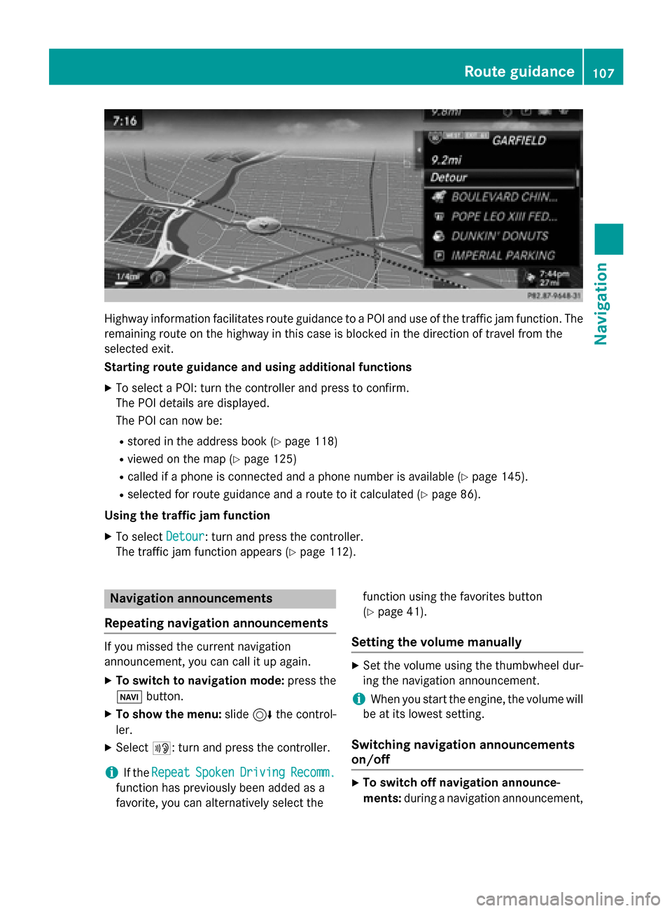
Highway information facilitates route guidance to a POI and use of the traffic jam function. The
remaining route on the highway in this case is blocked in the direction of travel from the
selected exit.
Starting route guidance and using additional functions
X To select a POI: turn the controller and press to confirm.
The POI details are displayed.
The POI can now be:
R stored in the address book (Y page 118)
R viewed on the map (Y page 125)
R called if a phone is connected and a phone number is available (Y page 145).
R selected for route guidance and a route to it calculated (Y page 86).
Using the traffic jam function X To select Detour
Detour: turn and press the controller.
The traffic jam function appears (Y page 112).Navigation announcements
Repeating navigation announcements If you missed the current navigation
announcement, you can call it up again.
X To switch to navigation mode: press the
00BE button.
X To show the menu: slide6the control-
ler.
X Select 006A: turn and press the controller.
i If the
Repeat
Repeat Spoken SpokenDriving
Driving Recomm.
Recomm.
function has previously been added as a
favorite, you can alternatively select the function using the favorites button
(Y
page 41).
Setting the volume manually X
Set the volume using the thumbwheel dur-
ing the navigation announcement.
i When you start the engine, the volume will
be at its lowest setting.
Switching navigation announcements
on/off X
To switch off navigation announce-
ments: during a navigation announcement, Route guidance
107Navigation Z
Page 112 of 298

X
To switch to navigation mode: press the00BEbutton.
X To show the menu: slide6the controller.
X To select Route
Route: turn and press the controller.
X Select Destination Information
Destination Information.
The destination and existing intermediate destinations are displayed with distances, travel
time and arrival time.
X To select destination or intermediate destination: turn and press the controller.
The address appears.
X Select Save
Save.
The destination or intermediate destination can be saved as:
R a navigable contact in the address book
R My Address
X To call up a map: select Map
Map.
X Move the map, change the map scale and select the destination or the intermediate desti-
nation (Y page 93).
X To call the destination or intermediate destination: select Call
Call.
If a phone is connected and a phone number is available, COMAND switches to the tele-
phone function.
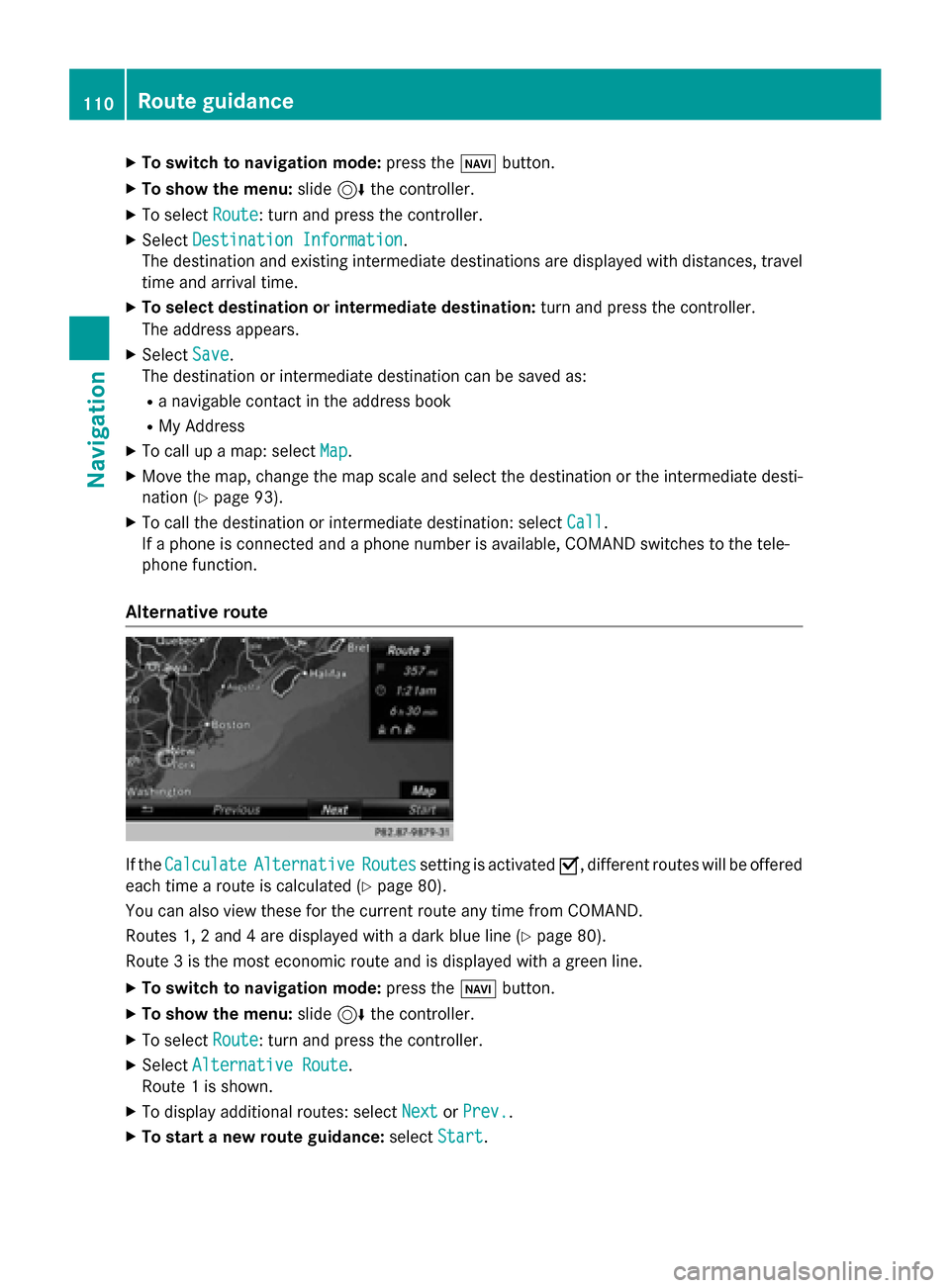
Alternative route If the
Calculate
Calculate Alternative
Alternative Routes
Routessetting is activated 0073, different routes will be offered
each time a route is calculated (Y page 80).
You can also view these for the current route any time from COMAND.
Routes 1, 2 and 4 are displayed with a dark blue line (Y page 80).
Route 3 is the most economic route and is displayed with a green line.
X To switch to navigation mode: press the00BEbutton.
X To show the menu: slide6the controller.
X To select Route
Route: turn and press the controller.
X Select Alternative Route
Alternative Route.
Route 1 is shown.
X To display additional routes: select Next
Next orPrev.
Prev..
X To start a new route guidance: selectStart
Start. 110
Route guidanceNavigation